
Oglala Lakota County is a county in southwestern South Dakota, United States. The population was 13,672 at the 2020 census. Oglala Lakota County does not have a functioning county seat; Hot Springs in neighboring Fall River County serves as its administrative center. The county was created as a part of the Dakota Territory in 1875, although it remains unorganized. Its largest community is Pine Ridge.

Minnehaha County is a county on the eastern border of the state of South Dakota. As of the 2020 census, the population was 197,214, making it the state's most populous county. It contains over 20% of the state's population. Its county seat is Sioux Falls, South Dakota's largest city. The county was created in 1862 and organized in 1868. Its name was derived from the Sioux word Mnihaha, meaning "rapid water," or "waterfall".

Miner County is a county in the U.S. state of South Dakota. As of the 2020 census, the population was 2,298. Its county seat is Howard. The county was created in 1873 and organized in 1880.

Lake County is a county in the U.S. state of South Dakota. As of the 2020 United States Census, the population was 11,059. Its county seat is Madison. The county was formed in 1873.

Dakota County is the third-most populous county in the U.S. state of Minnesota, located in the east central portion of the state. As of the 2020 census, the population was 439,882. The population of Dakota County was estimated to be 442,038 in 2021. The county seat is Hastings. Dakota County is named for the Dakota Sioux tribal bands who inhabited the area. The name is recorded as "Dahkotah" in the United States Census records until 1851. Dakota County is included in the Minneapolis–St. Paul–Bloomington, MN–WI Metropolitan Statistical Area, the sixteenth largest metropolitan area in the United States with about 3.64 million residents. The largest city in Dakota County is the city of Lakeville, the eleventh-largest city in Minnesota and sixth-largest Twin Cities suburb. The county is bordered by the Minnesota and Mississippi Rivers on the north, and the state of Wisconsin on the east.

Scouting in South Dakota has a long history, from the 1910s to the present, and serves thousands of youth in programs that suit the environment in which they live.
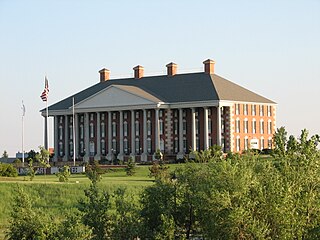
Watertown is a city in and the county seat of Codington County, South Dakota, United States. Watertown is home to the Redlin Art Center which houses many of the original art works produced by Terry Redlin, one of America's most popular wildlife artists. Watertown is located between Pelican Lake and Lake Kampeska, from which Redlin derived inspiration for his artwork.

Clear Lake is a city in and the county seat of Deuel County, South Dakota, United States. The population was 1,218 at the 2020 census.

Madison is a city in Lake County, South Dakota, United States. The population was 6,191 at the 2020 census. It is the county seat of Lake County and is home to Dakota State University.

The history of the U.S. state of Minnesota is shaped by its original Native American residents, European exploration and settlement, and the emergence of industries made possible by the state's natural resources. Early economic growth was based on fur trading, logging, milling and farming, and later through railroads and iron mining.
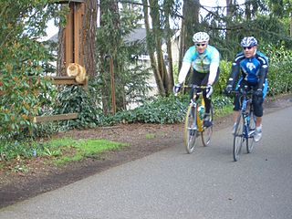
The Burke–Gilman Trail is a rail trail in King County, Washington. The 27-mile (43 km) multi-use recreational trail is part of the King County Regional Trail System and occupies an abandoned Seattle, Lake Shore and Eastern Railway (SLS&E) corridor.
The Drift Prairie is a geographic region of North Dakota and South Dakota.
The Dakota are a Native American tribe and First Nations band government in North America. They compose two of the three main subcultures of the Sioux people, and are typically divided into the Eastern Dakota and the Western Dakota.
The Red River Trails were a network of ox cart routes connecting the Red River Colony and Fort Garry in British North America with the head of navigation on the Mississippi River in the United States. These trade routes ran from the location of present-day Winnipeg in the Canadian province of Manitoba across the Canada–United States border, and thence by a variety of routes through what is now the eastern part of North Dakota and western and central Minnesota to Mendota and Saint Paul, Minnesota on the Mississippi.

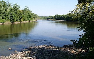
The Traverse Gap is an ancient river channel occupied by Lake Traverse, Big Stone Lake and the valley connecting them at Browns Valley, Minnesota. It is located on the border of the U.S. states of Minnesota and South Dakota. Traverse Gap has an unusual distinction for a valley: it is crossed by a continental divide, and in some floods water has flowed across that divide from one drainage basin to the other. Before the Anglo-American Convention of 1818 it marked the border between British territory in the north and U.S. – or earlier, French – territory in the south.
Traverse des Sioux is a historic site in the U.S. state of Minnesota. Once part of a pre-industrial trade route, it is preserved to commemorate that route, a busy river crossing on it, and a nineteenth-century settlement, trading post, and mission at that crossing place. It was a transshipment point for pelts in fur trading days, and the namesake for an important United States treaty that forced the Dakota people to cede part of their homeland and opened up much of southern Minnesota to European-American settlement.
Lac qui Parle Mission is a pre-territorial mission in Chippewa County, Minnesota, United States, which was founded in June 1835 by Dr. Thomas Smith Williamson and Alexander Huggins after fur trader Joseph Renville invited missionaries to the area. Lac qui Parle is a French translation of the native Dakota name, meaning "lake which speaks". In the 19th century, the first dictionary of the Dakota language was written, and part of the Bible was translated into that language for the first time at a mission on the site of the park. It was a site for Christian missionary work to the Sioux for nearly 20 years. Renville was related to and had many friends in the Native community, and after his death in 1846, the mission was taken over by the "irreligious" Martin McLeod. The relationship between the mission and the Dakota people worsened, and in 1854 the missionaries abandoned the site and relocated to the Upper Sioux Agency.

Lake Herman State Park is a South Dakota state park in Lake County, South Dakota in the United States. The park is open for year-round recreation including camping, swimming, fishing, hiking and boating on the 1,350-acre Lake Herman. There are 72 campsites which feature electric hook-ups and 4 cabins.
Roy Lake State Park is a South Dakota state park in Marshall County, South Dakota in the United States. The park is divided in two sections on Roy Lake, and is open for year-round recreation including camping, beaches, swimming, fishing, hiking and boating. The Roy Lake Resort & Lodge is located in the park. Boat ramps are available and visitors can rent boats from the resort.
