
Nassau County is a suburban county located immediately to the east of New York City. As of the 2020 United States census, Nassau County's population was 1,395,774, making it the sixth-most populous county in the State of New York, and reflecting an increase of 56,242 (+4.2%) from the 1,339,532 residents enumerated at the 2010 census. Its county seat is Mineola, while the county's largest town is Hempstead. The county is part of the Long Island region of the state, lying in its southeastern portion along with the remainder of the island.

Lyme is a town in New London County, Connecticut, United States, situated on the eastern side of the Connecticut River. The town is part of the Lower Connecticut River Valley Planning Region. The population was 2,352 at the 2020 census. Lyme is the eponym of Lyme disease.

East Hills is a village in Nassau County, on the North Shore of Long Island, in New York, United States. It is considered part of the Greater Roslyn area, which is anchored by the Incorporated Village of Roslyn. The population was 7,284 at the time of the 2020 census.

Glen Cove is a city in Nassau County, New York, United States, on the North Shore of Long Island. At the 2020 United States Census, the city population was 28,365 as of the 2020 census.

Greenvale is a hamlet and census-designated place (CDP) in the towns of North Hempstead and Oyster Bay in Nassau County, on the North Shore of Long Island, in New York, United States. It is considered part of the Greater Roslyn area, which is anchored by the Incorporated Village of Roslyn. The population was 1,069 at the time of the 2020 census.

Roslyn is a village in the Town of North Hempstead in Nassau County, on the North Shore of Long Island, in New York, United States. It is the Greater Roslyn area's anchor community. The population was 2,988 at the time of the 2020 census.

The Catawba River is a major river located in the Southeastern United States. It originates in Western North Carolina and flows into South Carolina, where it later becomes known as the Wateree River. The river is approximately 220 miles (350 km) long. It rises in the Appalachian Mountains and drains into the Piedmont, where it has been impounded through a series of reservoirs for flood control and generation of hydroelectricity. The river is named after the Catawba tribe of Native Americans, which lives on its banks. In their language, they call themselves "yeh is-WAH h’reh", meaning "people of the river."

The Assonet River is located in Bristol County, Massachusetts. It flows 7.4 miles (11.9 km) in a westerly direction through Freetown and joins the Taunton River near Assonet Neck in Berkley, Massachusetts.

Hempstead Lake State Park is a 737-acre (2.98 km2) state park located in Nassau County, New York in the United States. The park is located in West Hempstead and is one of three state parks within the Town of Hempstead. There is a quick-access entrance at exit 18 from the Southern State Parkway. The park contains the largest freshwater lake in Nassau County.

New York State Route 25A (NY 25A) is a state highway on Long Island in New York, United States. It serves as the main east–west route for most of the North Shore of Long Island, running for 73 miles (117 km) from Interstate 495 (I-495) at the Queens–Midtown Tunnel in the New York City borough of Queens to NY 25 in Calverton, Suffolk County. The highway is a northern alternate route of NY 25, which follows a more inland routing along Jericho Turnpike.

New York State Route 106 (NY 106) is a 13.28-mile (21.37 km) state highway located in Nassau County, New York, in the United States. It begins in the town of Hempstead at an intersection with NY 105 in North Bellmore and heads to the north, crossing the hamlets of East Meadow and Levittown before entering the town of Oyster Bay. In Hicksville, NY 106 becomes concurrent with NY 107, an overlap colloquially known as the "One oh Six–One oh Seven". The concurrency ends immediately after an interchange with Jericho Turnpike in the hamlet of Jericho. After breaking away from NY 107, NY 106 heads north across the villages of Brookville and Muttontown and the hamlet of East Norwich to the hamlet of Oyster Bay, where the route ends one block south of Oyster Bay Harbor.
New York State Route 107 (NY 107) is a 17.07-mile (27.47 km) state highway in Nassau County, New York, in the United States. The route begins at an intersection with Merrick Road in Massapequa, serving several communities in the town of Oyster Bay before entering the city of Glen Cove and terminating at an intersection with Pulaski Street. From here, the right-of-way continues west for a short distance as Pratt Boulevard (CR 243) to Brewster Street and Glen Cove Avenue. Route 107 is the only State Highway on Long Island to enter a city other than New York City. The route connects with several major parkways and expressways and has a concurrency with NY 106 through Hicksville and Jericho Gardens; the route is historically known as the Massapequa Glen Cove Highway.
Cedar Creek is a 53-kilometre-long (33 mi) stream in southeastern Wisconsin in the United States. The Cedar Creek watershed is a 330 km2 (127 mi2) sub-basin of the larger Milwaukee River watershed.
Glen Cove Road is a major, 11.7-mile-long (18.8 km) north–south thoroughfare running through north-central Nassau County on Long Island, New York, in the United States.
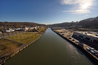
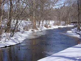
Hempstead Harbor is a bay hugging the northern coast of Long Island, New York. Located off of the Long Island Sound, it forms the northernmost portion of the political border between the Nassau County towns of Oyster Bay on the east and North Hempstead on the west, as well as the western border of the city of Glen Cove.
Peninsula Boulevard is a major, 9.1-mile-long (14.6 km) arterial road through southwestern Nassau County, on Long Island, New York. It runs southwest-to-northeast between Cedarhurst connecting the Five Towns area to the Village of Hempstead – in addition to indirectly serving The Rockaways in Queens.
Fishing Creek is a 2.19 mi (3.52 km) long 1st order tributary to Blackbird Creek in New Castle County, Delaware. This creek is entirely tidal for its course.

Strathmore is an unincorporated, Levitt & Sons-developed hamlet in the Town of North Hempstead in Nassau County, on the North Shore of Long Island, in New York, United States, within the census-designated place (CDP) of Manhasset.
The Mill River is a river in the Town of Hempstead in Nassau County, on the South Shore of Long Island, in New York, United States.

Motts Creek is a stream in the Town of Hempstead in Nassau County, on the South Shore of Long Island, in New York, United States.

