Glennville, Georgia

Last updated

Glennville, Georgia
Glennwanis Hotel, Glenview, GA, US.jpg
Glennwanis Hotel, East Barnard Street
Downtown Glennville, GA
Tattnall County Georgia Incorporated and Unincorporated areas Glennville Highlighted.svg
Location in Tattnall County and the state of Georgia
Coordinates: 31°56′13″N81°55′44″W / 31.937°N 81.929°W / 31.937; -81.929 [1]
Country United States
State Georgia
County Tattnall
Government
  MayorBernie Weaver
Area
[2]
  Total7.13 sq mi (18.47 km2)
  Land7.05 sq mi (18.26 km2)
  Water0.08 sq mi (0.21 km2)
Elevation
171 ft (52 m)
Population
 (2020)
  Total3,834
  Density543.91/sq mi (210.01/km2)
Time zone UTC-5 (Eastern (EST))
  Summer (DST) UTC-4 (EDT)
ZIP code
30427
Area code 912
FIPS code 13-33336 [3]
GNIS feature ID0331820 [4]
Website www.cityofglennville.com

Glennville is a city in southeastern Tattnall County, Georgia, United States. As of the 2020 census, the town had a population of 3,834.

Contents

Geography

Glennville lies within the coastal plain of Georgia, surrounded by farmland and forest. The Altamaha River is 10 miles (16 km) to the southwest. Less than 2 miles to the east of Glennville, Beards Creek forms the border with Long County; just east of the creek is the edge of Fort Stewart. The nearest major city is Savannah, approximately 50 miles (80 km) east of Glennville. Baxley, Georgia, is 29 miles (47 km) southwest of Glennville.

According to the United States Census Bureau, as of 2020 the city had a total area of 7.13 square miles (18.5 km2), of which 7.05 square miles (18.3 km2) was land and 0.08 square miles (0.21 km2) was water.

Major highways

There are multiple partial concurrencies among route numbers; descriptions are omitted here for simplicity:

  • US 25.svgUS 301.svg US 25  / US 301 (Main Street); travels north–south through downtown.
  • Georgia 23.svgGeorgia 57.svg SR 23  / SR 57 (Barnard Street from downtown to northwest; South Main Street from downtown southward)
  • Georgia 73.svg SR 73 (North Main Street)
  • Georgia 144.svg SR 144 (Barnard Street through downtown, and northwest to Hencart Road; Hencart Road to southwest)

Climate

Climate data for Glennville, Georgia (1991–2020 normals, extremes 1946–present)
MonthJanFebMarAprMayJunJulAugSepOctNovDecYear
Record high °F (°C)84
(29)
87
(31)
94
(34)
97
(36)
103
(39)
110
(43)
113
(45)
105
(41)
106
(41)
98
(37)
89
(32)
85
(29)
113
(45)
Mean maximum °F (°C)77.0
(25.0)
79.9
(26.6)
85.0
(29.4)
89.3
(31.8)
94.5
(34.7)
98.5
(36.9)
100.0
(37.8)
98.4
(36.9)
95.3
(35.2)
89.0
(31.7)
83.8
(28.8)
78.2
(25.7)
100.9
(38.3)
Mean daily maximum °F (°C)60.6
(15.9)
64.7
(18.2)
71.3
(21.8)
78.6
(25.9)
85.2
(29.6)
90.1
(32.3)
92.3
(33.5)
91.2
(32.9)
86.6
(30.3)
78.9
(26.1)
69.9
(21.1)
62.8
(17.1)
77.7
(25.4)
Daily mean °F (°C)49.0
(9.4)
52.5
(11.4)
58.7
(14.8)
65.5
(18.6)
72.9
(22.7)
79.3
(26.3)
81.9
(27.7)
81.1
(27.3)
76.4
(24.7)
67.1
(19.5)
57.8
(14.3)
51.4
(10.8)
66.1
(18.9)
Mean daily minimum °F (°C)37.5
(3.1)
40.4
(4.7)
46.0
(7.8)
52.4
(11.3)
60.7
(15.9)
68.5
(20.3)
71.5
(21.9)
71.0
(21.7)
66.2
(19.0)
55.2
(12.9)
45.6
(7.6)
40.1
(4.5)
54.6
(12.6)
Mean minimum °F (°C)22.7
(−5.2)
25.7
(−3.5)
30.5
(−0.8)
38.7
(3.7)
49.2
(9.6)
61.9
(16.6)
67.1
(19.5)
65.6
(18.7)
54.9
(12.7)
41.0
(5.0)
30.9
(−0.6)
25.5
(−3.6)
20.1
(−6.6)
Record low °F (°C)1
(−17)
11
(−12)
17
(−8)
28
(−2)
40
(4)
52
(11)
59
(15)
52
(11)
40
(4)
28
(−2)
13
(−11)
9
(−13)
1
(−17)
Average precipitation inches (mm)3.83
(97)
3.78
(96)
3.86
(98)
3.01
(76)
3.50
(89)
5.96
(151)
5.32
(135)
7.48
(190)
3.33
(85)
3.59
(91)
2.55
(65)
3.56
(90)
49.77
(1,264)
Average precipitation days8.47.76.56.46.49.59.810.97.15.75.67.291.2
Source: NOAA [5] [6]

Demographics

Historical population
CensusPop.Note
1900 269
1910 640137.9%
1920 1,06967.0%
1930 1,50340.6%
1940 1,67411.4%
1950 2,32739.0%
1960 2,79119.9%
1970 2,9656.2%
1980 4,14439.8%
1990 3,676−11.3%
2000 3,641−1.0%
2010 3,569−2.0%
2020 3,8347.4%
U.S. Decennial Census [7]
Glennville racial composition as of 2020 [8]
RaceNum.Perc.
White (non-Hispanic)2,03753.13%
Black or African American (non-Hispanic)1,31834.38%
Native American 80.21%
Asian 571.49%
Pacific Islander 30.08%
Other/Mixed 1273.31%
Hispanic or Latino 2847.41%

As of the 2020 United States census, there were 3,834 people residing in the city; these included 1,477 households and 1,071 families.

Economy

The Georgia Department of Corrections provides jobs for hundreds of people within Tattnall County and surrounding counties. Smith State Prison, a close-security facility, is located 2 miles north of Glennville. The facility can house 1000+ inmates at any given time.

The city is known for farming crickets to use as animal feed, as well as for pecans. [9]

Media

The Journal Sentinel of Tattnall County, with offices in the county seat of Reidsville as well as in Glennville, has been published since 1879. [10]

Glennville is the principal setting of Eternal Fire, a novel by Georgia-born author Calder Willingham.

Historic structures

Notable people

Related Research Articles

<span class="mw-page-title-main">Toombs County, Georgia</span> County in Georgia, United States

Toombs County is a county located in the east central portion of the U.S. state of Georgia. As of the 2020 census, the population was 27,030. The county seat is Lyons and the largest city is Vidalia. The county was created on August 18, 1905.

<span class="mw-page-title-main">Tattnall County, Georgia</span> County in Georgia, United States

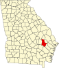
Tattnall County is a county located in the southeast portion of the U.S. state of Georgia, located within the Magnolia Midlands, a part of the Historic South region. As of the 2020 census, the population was 22,842. The county seat is Reidsville. Tattnall County was created on December 5, 1801, from part of Montgomery County, Georgia by the Georgia General Assembly.

<span class="mw-page-title-main">McIntosh County, Georgia</span> County in Georgia, United States

McIntosh County is a county located in the U.S. state of Georgia. As of the 2020 census, the population was 10,975, a drop of 23.4 percent since the 2010 census. The county seat is Darien.

<span class="mw-page-title-main">Long County, Georgia</span> County in Georgia, United States

Long County is a county located in the U.S. state of Georgia. The county seat is Ludowici. Long County is part of the Hinesville-Fort Stewart Metropolitan Statistical Area. The constitutional amendment to create the county was proposed August 14, 1920, and ratified November 2, 1920. The county is named after Crawford Long (1815–1878), an American surgeon and pharmacist who was the first to use diethyl ether as an anaesthetic.

<span class="mw-page-title-main">Evans County, Georgia</span> County in Georgia, United States

Evans County is a county in the southeastern portion of the U.S. state of Georgia. As of the 2020 census, the population was 10,774. The county seat is Claxton. A bill creating the county was passed in the Georgia General Assembly on August 11, 1914, and later, on November 3, 1914, an amendment was ratified by a vote of the people which formally created the county. Evans became part of the Statesboro micropolitan area in 2023, joining Bulloch County.

<span class="mw-page-title-main">DeKalb County, Georgia</span> County in Georgia, United states

DeKalb County is located in the north central portion of the U.S. state of Georgia. As of the 2020 census, the population was 764,382, making it Georgia's fourth-most populous county. Its county seat is Decatur.

<span class="mw-page-title-main">Baker County, Georgia</span> County in Georgia, United States

Baker County is a county in Georgia. As of the 2020 census, the population was 2,876. The county seat and only city is Newton. The county was created December 12, 1825, from the eastern portion of Early County by an act of the Georgia General Assembly and is named for Colonel John Baker, a hero of the American Revolutionary War.

<span class="mw-page-title-main">Tyrone, Georgia</span> Town in Georgia, United States

Tyrone is a town in Fayette County, Georgia, United States. The population was 6,879 at the 2010 census, up from 3,916 in 2000. The estimated population in 2018 was 7,388. It is a part of the Atlanta metropolitan area.

<span class="mw-page-title-main">Alpharetta, Georgia</span> City in Georgia, United States

Alpharetta is a city in northern Fulton County, Georgia, United States, and part of the Atlanta metropolitan area. As of the 2020 US Census, Alpharetta's population was 65,818; in 2010, the population had been 57,551.

<span class="mw-page-title-main">Wrightsville, Georgia</span> City in Georgia, United States

Wrightsville is a city in and the county seat of Johnson County, Georgia, United States. The population was 2,195 at the 2010 census, down from 2,223 at the 2000 census. By 2020, its population grew to 3,449. The city limits include Johnson State Prison on the northeast side of town. Wrightsville is part of the Dublin Micropolitan Statistical Area.

<span class="mw-page-title-main">Ludowici, Georgia</span> American city

Ludowici is a city in Long County, Georgia, United States. The population was 1,703 at the 2010 Census and an estimated 2,221 in 2018. The city is the county seat of Long County. It is a part of the Hinesville-Fort Stewart metropolitan statistical area (MSA).

<span class="mw-page-title-main">Collins, Georgia</span> City in Georgia, United States

Collins is a city in Tattnall County, Georgia, United States. The population was 540 in 2020.

<span class="mw-page-title-main">Reidsville, Georgia</span> City in Georgia, United States

Reidsville is a city in, and county seat of, Tattnall County, Georgia. The population was 2,515 in 2020. The Georgia State Prison is near Reidsville.

<span class="mw-page-title-main">Georgia State Route 144</span> State highway in Georgia, United States

State Route 144 (SR 144) is an 83.0-mile-long (133.6 km) state highway that travels in a west-to-east direction through portions of Appling, Tattnall, Long, Liberty, Bryan counties in the east-central of the U.S. state of Georgia. It connects Baxley with southeastern Bryan County.

<span class="mw-page-title-main">Georgia State Route 23</span> State highway in Georgia

State Route 23 (SR 23) is a 240.0-mile-long (386.2 km) state highway that travels south-to-north through portions of Charlton, Brantley, Wayne, Long, Tattnall, Candler, Emanuel, Jenkins, and Burke counties in the southeastern and east-central parts of the U.S. state of Georgia. The highway connects the Florida state line, south-southwest of Saint George with the southern part of the Augusta metropolitan area, via Folkston, Nahunta, Jesup, Ludowici, Glennville, Reidsville, Metter, Twin City, and Millen.

<span class="mw-page-title-main">Georgia State Route 57</span> State highway in Georgia, United States

State Route 57 (SR 57) is a 178.5-mile-long (287.3 km) state highway that travels northwest-to-southeast through portions of Bibb, Jones, Twiggs, Wilkinson, Washington, Johnson, Emanuel, Candler, Tattnall, Long, and McIntosh counties in the central and southeastern parts of the U.S. state of Georgia. The route connects the eastern part of the Macon area to the Eulonia area, via Swainsboro.

<span class="mw-page-title-main">U.S. Route 25 in Georgia</span> Highway in Georgia, United States

U.S. Highway 25 (US 25) is a United States Numbered Highway that travels from Brunswick, Georgia, to the Kentucky–Ohio state line, where Covington, Kentucky, meets Cincinnati, Ohio, at the Ohio River. In the U.S. state of Georgia, US 25 is as a 190.0-mile-long (305.8 km) highway that travels south to north in the eastern part of the state, near the Atlantic Ocean, serving Statesboro and the Brunswick and Augusta metropolitan areas on its path from Brunswick to South Carolina at the Savannah River. Its routing travels through portions of Glynn, Wayne, Long, Tattnall, Evans, Bulloch, Jenkins, Burke, and Richmond counties.

<span class="mw-page-title-main">U.S. Route 301 in Georgia</span> Section of U.S. Highway

U.S. Route 301 (US 301) is a 170-mile-long (270 km) U.S. Highway in the U.S. state of Georgia. It travels south-to-north from the St. Marys River south-southeast of Folkston to the Savannah River north-northeast of Sylvania, via Jesup, Ludowici, Glennville, Claxton, Statesboro, and Sylvania.

<span class="mw-page-title-main">Georgia State Route 178</span> State highway in Georgia, United States

State Route 178 (SR 178) is a 29.4-mile-long (47.3 km) state highway in the east-central part of the U.S. state of Georgia. It is routed northwest-to-southeast through portions of Toombs and Tattnall counties.

<span class="mw-page-title-main">McRae–Helena, Georgia</span> City in Georgia, United States

McRae–Helena is a city in the U.S. state of Georgia, formed on January 1, 2015, by the merger of the two cities of McRae and Helena. McRae–Helena is the county seat of Telfair County.

References

  1. "US Gazetteer files: 2010, 2000, and 1990". United States Census Bureau. February 12, 2011. Archived from the original on August 24, 2019. Retrieved April 23, 2011.
  2. "2020 U.S. Gazetteer Files". United States Census Bureau. Archived from the original on March 18, 2021. Retrieved December 18, 2021.
  3. "U.S. Census website". United States Census Bureau. Archived from the original on December 27, 1996. Retrieved January 31, 2008.
  4. "US Board on Geographic Names". United States Geological Survey. October 25, 2007. Archived from the original on February 2, 2001. Retrieved January 31, 2008.
  5. "NOWData NOAA Online Weather Data". National Oceanic and Atmospheric Administration. Archived from the original on June 17, 2022. Retrieved April 23, 2023.
  6. "Summary of Monthly Normals 19912020". National Oceanic and Atmospheric Administration. Archived from the original on April 28, 2023. Retrieved April 23, 2023.
  7. "Census of Population and Housing". Census.gov. Archived from the original on July 1, 2021. Retrieved June 4, 2015.
  8. "Explore Census Data". data.census.gov. Archived from the original on December 18, 2021. Retrieved December 18, 2021.
  9. "Glennville" Archived May 21, 2014, at the Wayback Machine , Explore Georgia. Retrieved 2014-5-20.
  10. The Journal Sentinel, Tattnall County Archived August 7, 2023, at the Wayback Machine , archives. Retrieved August 6, 2023.