Glidden, Iowa | |
---|---|
Coordinates: 42°03′28″N94°43′36″W / 42.05778°N 94.72667°W | |
Country | United States |
State | Iowa |
County | Carroll |
Area | |
• Total | 1.10 sq mi (2.84 km2) |
• Land | 1.10 sq mi (2.84 km2) |
• Water | 0.00 sq mi (0.00 km2) |
Elevation | 1,227 ft (374 m) |
Population (2020) | |
• Total | 1,151 |
• Density | 1,049.23/sq mi (405.13/km2) |
Time zone | UTC-6 (Central (CST)) |
• Summer (DST) | UTC-5 (CDT) |
ZIP code | 51443 |
Area code | 712 |
FIPS code | 19-31395 |
GNIS feature ID | 2394917 [2] |
Glidden is a town in Carroll County, Iowa, United States. The population was 1,151 at the time of the 2020 census. [3]
Glidden was laid out as a town in 1866. [4] It was named either for Capt. W. T. Glidden, a railroad promoter, [5] or in honor of Joseph Farwell Glidden, the inventor of barbed wire. [6]
According to the United States Census Bureau, the city has a total area of 1.11 square miles (2.87 km2), all land. [7]
Year | Pop. | ±% |
---|---|---|
1870 | 177 | — |
1880 | 584 | +229.9% |
1890 | 532 | −8.9% |
1900 | 733 | +37.8% |
1910 | 850 | +16.0% |
1920 | 867 | +2.0% |
1930 | 854 | −1.5% |
1940 | 941 | +10.2% |
1950 | 996 | +5.8% |
1960 | 993 | −0.3% |
1970 | 964 | −2.9% |
1980 | 1,076 | +11.6% |
1990 | 1,099 | +2.1% |
2000 | 1,253 | +14.0% |
2010 | 1,146 | −8.5% |
2020 | 1,151 | +0.4% |
Source: "U.S. Census website". United States Census Bureau. Archived from the original on July 9, 2021. Retrieved March 28, 2020. and Iowa Data Center Source: |
As of the census [9] of 2010, there were 1,146 people, 502 households, and 327 families living in the city. The population density was 1,032.4 inhabitants per square mile (398.6/km2). There were 523 housing units at an average density of 471.2 per square mile (181.9/km2). The racial makeup of the city was 99.0% White, 0.6% Native American, 0.1% Asian, and 0.3% from two or more races. Hispanic or Latino of any race were 0.6% of the population.
There were 502 households, of which 29.3% had children under the age of 18 living with them, 54.4% were married couples living together, 8.0% had a female householder with no husband present, 2.8% had a male householder with no wife present, and 34.9% were non-families. 30.5% of all households were made up of individuals, and 15.7% had someone living alone who was 65 years of age or older. The average household size was 2.26 and the average family size was 2.82.
The median age in the city was 44.8 years. 23.3% of residents were under the age of 18; 6.2% were between the ages of 18 and 24; 20.8% were from 25 to 44; 33.1% were from 45 to 64; and 16.5% were 65 years of age or older. The gender makeup of the city was 48.8% male and 51.2% female.
As of the census [10] of 2000, there were 1,253 people, 481 households, and 303 families living in the city. The population density was 1,231.6 inhabitants per square mile (475.5/km2). There were 517 housing units at an average density of 508.2 per square mile (196.2/km2). The racial makeup of the city was 99.20% White, 0.08% African American, 0.24% Native American, 0.16% Asian, and 0.32% from two or more races. Hispanic or Latino of any race were 0.24% of the population.
There were 481 households, out of which 30.8% had children under the age of 18 living with them, 53.4% were married couples living together, 6.9% had a female householder with no husband present, and 36.8% were non-families. 32.6% of all households were made up of individuals, and 17.7% had someone living alone who was 65 years of age or older. The average household size was 2.34 and the average family size was 3.00.
23.6% are under the age of 18, 8.0% from 18 to 24, 27.6% from 25 to 44, 24.5% from 45 to 64, and 16.3% who were 65 years of age or older. The median age was 40 years. For every 100 females, there were 87.0 males. For every 100 females age 18 and over, there were 87.6 males.
The median income for a household in the city was $35,333, and the median income for a family was $48,026. Males had a median income of $30,152 versus $21,914 for females. The per capita income for the city was $17,437. 5.7% of the population and 3.7% of families are living below the poverty line. Out of the total population, 4.9% of those under the age of 18 and 1.9% of those 65 and older are below the poverty line.
The Glidden–Ralston Community School District consists of a combined elementary, middle and high school housed in one building. The school serves students from Glidden and the neighboring city of Ralston. [11]
Carroll County is a county located in the U.S. state of Iowa. As of the 2020 census, the population was 20,760. Its county seat is Carroll. The county is named in honor of Charles Carroll of Carrollton, signer of the Declaration of Independence.
Fairbank is a city in Buchanan and Fayette counties in the U.S. state of Iowa. The population was 1,111 at the time of the 2020 census.
Allison is a city in, and the county seat of, Butler County, Iowa, United States. The population was 966 at the 2020 census. Allison is home to the Butler County Fair. The city was named for U.S. Senator William B. Allison in 1881.
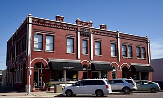
Ralston is a city in Carroll and Greene counties in the U.S. state of Iowa. The population was 81 at the time of the 2020 census.
Little Sioux is a city in Harrison County, Iowa, United States. The population was 166 at the time of the 2020 census. The city is most known for Little Sioux Scout Ranch of the Boy Scouts of America.
Mondamin is a city in Harrison County, Iowa, United States. The population was 339 at the time of the 2020 census.
Persia is a city in Harrison County, Iowa, United States. The population was 297 in the 2020 census, a decline from 363 in the 2000 census.
Woodbine is a city in Harrison County, Iowa, United States, along the Boyer River. The population was 1,625 at the time of the 2020 census.
Hayesville is a city in Keokuk County, Iowa, United States. The population was 41 at the time of the 2020 census.
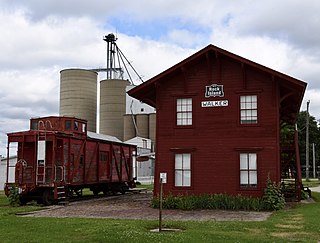
Walker is a city in Linn County, Iowa. The population was 688 at the 2020 census. It is part of the Cedar Rapids, Iowa metropolitan area.
Leighton is a city in Mahaska County, Iowa, United States. The population was 158 in the 2020 census, an increase from 153 in the 2000 census.
Emerson is a city in Mills County, Iowa, United States. The population was 403 at the time of the 2020 census.
Carson is a city in Pottawattamie County, Iowa, United States. The population was 766 at the 2020 census. Carson has a number of interesting and historic places.
Macedonia is a city in Pottawattamie County, Iowa, United States. The population was 267 at the time of the 2020 census.
Minden is a city in Pottawattamie County, Iowa, United States. The population was 600 at the time of the 2020 census.
Dixon is a city in Scott County, Iowa, United States. The population was 202 at the time of the 2020 census.
Ralston is a city in Douglas County, Nebraska, United States. The population was 6,494 at the 2020 census. A suburb of Omaha, Ralston is surrounded on three sides by the city of Omaha by 84th, 72nd, and L Streets, and by Sarpy County on the south side.
North English is a city located mainly in Iowa county with a small portion in Keokuk county in the U.S. state of Iowa. The population was 1,065 at the time of the 2020 census. It is named for the English River.
Bevington is a city in Madison and Warren Counties in the U.S. state of Iowa. The population was 57 at the 2020 census. It is part of the Des Moines–West Des Moines Metropolitan Statistical Area.
Barnes City is a city in Mahaska and Poweshiek counties in the U.S. state of Iowa. The population was 156 at the 2020 census.