Goldston, North Carolina

Last updated

Goldston, North Carolina
Goldston.jpg
Commercial buildings along North Main Street
NCMap-doton-Goldston.PNG
Location of Goldston, North Carolina
Coordinates: 35°35′32″N79°19′39″W / 35.59222°N 79.32750°W / 35.59222; -79.32750
Country United States
State North Carolina
County Chatham
Area
[1]
  Total0.83 sq mi (2.16 km2)
  Land0.83 sq mi (2.15 km2)
  Water0.01 sq mi (0.01 km2)
Elevation
[2]
417 ft (127 m)
Population
 (2020)
  Total234
  Density282.27/sq mi (109.03/km2)
Time zone UTC-5 (Eastern (EST))
  Summer (DST) UTC-4 (EDT)
ZIP code
27252
Area code 919
FIPS code 37-26920 [3]
GNIS feature ID2406585 [2]
Website www.goldstonnc.com

Goldston is a town in Chatham County, North Carolina, United States, south of Pittsboro. The population was 268 at the 2010 census. [4]

Contents

Geography

Goldston is located in southern Chatham County. U.S. Route 421, a four-lane expressway, passes northeast of the town, with access from Exit 159. US 421 leads southeast 12 miles (19 km) to Sanford and northwest 44 miles (71 km) to Greensboro. Via rural roads it is 13 miles (21 km) northeast from Goldston to Pittsboro, the Chatham County seat.

Soils at Goldston are dominantly yellowish brown, moderately well drained to somewhat poorly drained silt loams of the Cid or Lignum soil series. Brown to yellowish red, well drained silt loam of the Nanford series is also common.

According to the United States Census Bureau, Goldston has a total area of 0.81 square miles (2.1 km2), of which 0.004 square miles (0.01 km2), or 0.64%, is water. [4]

Historic features

The Goldston Commercial Historic District is registered on the National Register of Historic Places. The town is also home to several historic homes: the Paschal-Womble House and William Alston Rives House. [5] The town is named for its founders, the Goldston family.

Business and industry

The town has always been predominantly rural, and most of the business and industry over the years has been centered around the area's agricultural heritage, mainly the poultry industry. The town's location near the railroad line has helped to keep industry going in the area, although in recent years the town has seen a decline in industry. The town has a Dollar General variety store as well as two restaurants, Lizzie's and Rufus's.

Railroad

Goldston is located on a spur of the Norfolk Southern Railway that runs between Greensboro and Sanford. The railroad was historically important to the growth of the town. The rail line was once part of the now defunct Southern Railway, and prior to that the Atlantic & Yadkin Railway. [6] Until a few years ago many older Southern-marked freight gondolas could be found parked on a side track downtown and at the nearby old Pomona Clay pit.

Most of the rail traffic that comes through town is local freight between Sanford and Greensboro or freight going to the Aberdeen, Carolina and Western Railway, which connects 4 miles (6 km) to the southeast of Goldston in the village of Gulf. Most of this freight is composed of grain hopper cars going to local poultry feed mills. Norfolk Southern Right of Way Maintenance equipment and cars are also frequently parked on the side trackage in Goldston.

Demographics

Historical population
CensusPop.Note
1910 240
1920 28920.4%
1930 3128.0%
1940 41633.3%
1950 372−10.6%
1960 3740.5%
1970 364−2.7%
1980 353−3.0%
1990 299−15.3%
2000 3196.7%
2010 268−16.0%
2020 234−12.7%
U.S. Decennial Census [7]

As of the census [3] of 2010, there were 268 people, 144 households, and 121 occupied houses in the town. As of the census of 2000, the population density was 403.8 inhabitants per square mile (155.9/km2). There were 142 housing units at an average density of 179.8 per square mile (69.4/km2). The racial makeup of the town was 90.91% White, 6.58% African American, 0.31% Native American, 0.63% from other races, and 1.57% from two or more races. Hispanic or Latino of any race were 3.45% of the population.

There were 128 households, out of which 26.6% had children under the age of 18 living with them, 55.5% were married couples living together, 12.5% had a female householder with no husband present, and 27.3% were non-families. 23.4% of all households were made up of individuals, and 11.7% had someone living alone who was 65 years of age or older. The average household size was 2.49 and the average family size was 2.92.

As of the census of 2000, the median income for a household in the town was $35,000, and the median income for a family was $46,250. Males had a median income of $40,114 versus $22,188 for females. The per capita income for the town was $18,485. About 8.9% of families and 13.9% of the population were below the poverty line, including 25.4% of those under age 18 and 20.8% of those age 65 or over.

Miscellaneous

Related Research Articles

<span class="mw-page-title-main">Montgomery County, North Carolina</span> County in North Carolina, United States

Montgomery County is a rural county located in the southern Piedmont of the U.S. state of North Carolina. As of the 2020 census, the population was 25,751. Its county seat is Troy.

<span class="mw-page-title-main">Stokes County, North Carolina</span> County in North Carolina, United States

Stokes County is a county located in the U.S. state of North Carolina. As of the 2020 census, the population was 44,520. Its county seat is Danbury.

<span class="mw-page-title-main">Forsyth County, North Carolina</span> County in North Carolina, United States

Forsyth County is located in the northwest Piedmont of the U.S. state of North Carolina. As of the 2020 census, the population was 382,590, making it the fourth-most populous county in North Carolina. Its county seat is Winston-Salem. Forsyth County is part of the Winston-Salem, NC, Metropolitan Statistical Area, which is also included in the Greensboro–Winston-Salem–High Point, NC, Combined Statistical Area. Portions of Forsyth County are in the Yadkin Valley wine region.

<span class="mw-page-title-main">Davie County, North Carolina</span> County in North Carolina, United States

Davie County is a county located in the U.S. state of North Carolina. As of the 2020 census, the population was 42,712. Its county seat is Mocksville.

<span class="mw-page-title-main">Davidson County, North Carolina</span> County in North Carolina, United States

Davidson County is a county located in the U.S. state of North Carolina. As of the 2020 census, the population was 168,930. Its county seat is Lexington, and its largest community is Thomasville.

<span class="mw-page-title-main">Chatham County, North Carolina</span> County in North Carolina, United States

Chatham County is a county located in the Piedmont area of the U.S. state of North Carolina. It is also the location of the geographic center of North Carolina, northwest of Sanford. As of the 2020 census, the population was 76,285. Its county seat is Pittsboro.

<span class="mw-page-title-main">Fearrington Village, North Carolina</span> Census-designated place in North Carolina, United States

Fearrington Village is a residential development and census-designated place (CDP) in Chatham County, North Carolina, United States. The population was 2,339 at the 2010 census, up from 903 in 2000. The 2020 census counted 2,557 residents. Its name is phonetically pronounced FAIR-ington, not FEAR-ington as the spelling might indicate. The CDP occupies what was formerly the area of the unincorporated community of Farrington. It is a mixed-use community located on farmland dating back to the 18th century in Pittsboro, North Carolina. The community is located about 15 minutes from Chapel Hill, a half-hour from Durham and 45 minutes from Raleigh.

<span class="mw-page-title-main">Pittsboro, North Carolina</span> Town in North Carolina, United States

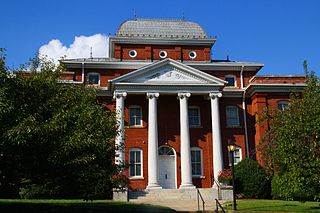
Pittsboro is a town in Chatham County, North Carolina, United States. The population was 3,743 at the 2010 census and 4,537 at the 2020 census. It is the county seat of Chatham County.

<span class="mw-page-title-main">Siler City, North Carolina</span> Town in North Carolina, United States

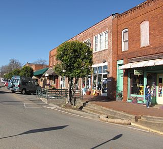
Siler City is a town in western Chatham County, North Carolina, United States. As of the 2020 census, the town's population was 7,702.

Bermuda Run is a town in Davie County, North Carolina, United States. As of the 2020 census, the population of the town was 3,120. It was incorporated in 1999 as a fully gated residential community near country clubs and golf courses like the Bermuda Run Country Club, Oak Valley Golf Club, and Tanglewood Park. In 2000, the town annexed into neighboring Hillsdale, picking up a commercial district. The town rests on the western bank of the Yadkin River along U.S. Route 158 and North Carolina Highway 801. Interstate 40 provides express access to Winston-Salem, the town's nearest urban center. In 2012, Kinderton Village was voluntarily annexed by the town of Bermuda Run. Bermuda Run is considered by the locals to be a mid-high class community and the second-most influential, behind nearby Oak Valley.

<span class="mw-page-title-main">Rural Hall, North Carolina</span> Town in North Carolina, United States

Rural Hall is a town in Forsyth County, North Carolina, United States. It is a part of the Piedmont Triad. The population was 3,360 at the 2020 census. The town has one public park: Covington Memorial Park.

<span class="mw-page-title-main">Sanford, North Carolina</span> City in North Carolina, United States

Sanford is a city in Lee County, North Carolina, United States. The population was 30,261 at the 2020 census. It is the county seat of Lee County. The geographic center of North Carolina is located northwest of the city, in Chatham County.

<span class="mw-page-title-main">Albemarle, North Carolina</span> City in North Carolina, United States

Albemarle is a city in and the county seat of Stanly County, North Carolina, United States. The population was 16,432 in the 2020 census.

<span class="mw-page-title-main">Dobson, North Carolina</span> Town in North Carolina, United States

Dobson is a town in Dobson Township, Surry County, North Carolina, United States. As of the 2020 census, the town population was 1,396. It is the county seat of Surry County. Dobson is the home of the Shelton Vineyards, the largest winery in North Carolina. It is also home to a significant Latino population due to the large number of farms in the area. The main crops in the area are corn, tobacco and soy beans.

<span class="mw-page-title-main">Pilot Mountain, North Carolina</span> Town in North Carolina, United States

Pilot Mountain is a town in Surry County, North Carolina, United States. The population was 1,443 at the 2020 census. It is named for the nearby landmark of Pilot Mountain, a distinctive geological formation.

<span class="mw-page-title-main">Jonesville, North Carolina</span> Town in North Carolina, United States

Jonesville, originally called Allen's Settlement, is the oldest town in Yadkin County, North Carolina, United States. The population was 2,285 at the 2010 census. The town grew by nearly 800 residents in 2001 when it merged with neighboring Arlington. Recognized as the Heart of the Yadkin Valley, Jonesville is a gateway to the Blue Ridge Mountains, the Yadkin Valley Heritage/Cultural Corridor and to local wineries in the Swan Creek AVA and the larger Yadkin Valley AVA, as well as offering access to the Yadkin river.

<span class="mw-page-title-main">Yadkinville, North Carolina</span> Town in North Carolina, United States

Yadkinville is a town in Yadkin County, North Carolina, United States. The population was 2,995 at the 2020 census. Located in the Piedmont Triad, it is the county seat and most populous city of Yadkin County.

<span class="mw-page-title-main">Ridgeway, Virginia</span> Town in Virginia, United States

Ridgeway is a town in Henry County, Virginia, United States. The population was 742 at the 2010 census. It is part of the Martinsville Micropolitan Statistical Area. Martinsville Speedway, a NASCAR racetrack, is located between Ridgeway and the Martinsville city limits.

<span class="mw-page-title-main">Elkin, North Carolina</span> Town in North Carolina, United States

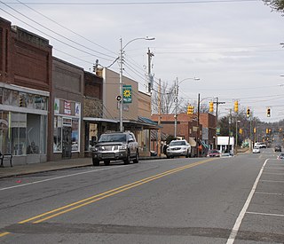
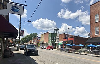
Elkin is a town in Surry and Wilkes counties in the U.S. state of North Carolina, along the Yadkin River. Elkin shares its name with the surrounding township of Elkin Township. The population was 4,122 at the time of the 2020 census.

<span class="mw-page-title-main">Gulf, North Carolina</span> Census-designated place in North Carolina, United States

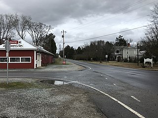
Gulf is an unincorporated community and census-designated place (CDP) in southwestern Chatham County, North Carolina, United States, southeast of the town of Goldston. As of the 2010 census, the Gulf CDP had a population of 144. The community is home to a general store and several historic homes. It received its name from its location at a wide bend in the Deep River.

References

  1. "ArcGIS REST Services Directory". United States Census Bureau. Retrieved September 20, 2022.
  2. 1 2 U.S. Geological Survey Geographic Names Information System: Goldston, North Carolina
  3. 1 2 "U.S. Census website". United States Census Bureau . Retrieved January 31, 2008.
  4. 1 2 "Geographic Identifiers: 2010 Demographic Profile Data (G001): Goldston town, North Carolina". U.S. Census Bureau, American Factfinder. Archived from the original on February 12, 2020. Retrieved December 29, 2014.
  5. "National Register Information System". National Register of Historic Places . National Park Service. July 9, 2010.
  6. Atlantic & Yadkin Railway
  7. "Census of Population and Housing". Census.gov. Retrieved June 4, 2015.
  8. Doran, Will. "Charlie Daniels coming home for Down South Music Festival". Sanford Herald.