Gower, Missouri

Last updated

Gower, Missouri
Clinton County Missouri Incorporated and Unincorporated areas Gower Highlighted.svg
Location of Gower, Missouri
Coordinates: 39°36′47″N94°35′41″W / 39.61306°N 94.59472°W / 39.61306; -94.59472
Country United States
State Missouri
Counties Clinton, Buchanan
Area
[1]
  Total1.01 sq mi (2.62 km2)
  Land1.01 sq mi (2.62 km2)
  Water0.00 sq mi (0.00 km2)
Elevation
[2]
984 ft (300 m)
Population
 (2020)
  Total1,533
  Density1,514.82/sq mi (585.05/km2)
Time zone UTC-6 (Central (CST))
  Summer (DST) UTC-5 (CDT)
ZIP code
64454
Area code 816
FIPS code 29-28036 [3]
GNIS feature ID2394938 [2]

Gower is a city in Buchanan and Clinton counties in the U.S. state of Missouri and is part of the Kansas City metropolitan area. The population was 1,533 at the 2020 census.

Contents

The Buchanan County portion of Gower is part of the St. Joseph, MO KS Metropolitan Statistical Area, while the Clinton County portion is part of the Kansas City, MOKS Metropolitan Statistical Area.

History

The city was named after A. G. Gower, a railroad official. [4] [5]

Geography

According to the United States Census Bureau, the city has a total area of 1.00 square mile (2.59 km2), all land. [6]

Demographics

Historical population
CensusPop.Note
1880 163
1890 328101.2%
1900 39219.5%
1910 370−5.6%
1920 41813.0%
1930 378−9.6%
1940 3862.1%
1950 350−9.3%
1960 40616.0%
1970 75886.7%
1980 1,27668.3%
1990 1,249−2.1%
2000 1,39912.0%
2010 1,5269.1%
2020 1,5330.5%
U.S. Decennial Census [7]

2010 census

As of the census [8] of 2010, there were 1,526 people, 561 households, and 408 families living in the city. The population density was 1,526.0 inhabitants per square mile (589.2/km2). There were 598 housing units at an average density of 598.0 per square mile (230.9/km2). The racial makeup of the city was 98.4% White, 0.4% African American, 0.1% Native American, 0.2% Asian, and 1.0% from two or more races. Hispanic or Latino of any race were 0.4% of the population.

There were 561 households, of which 38.5% had children under the age of 18 living with them, 58.3% were married couples living together, 11.6% had a female householder with no husband present, 2.9% had a male householder with no wife present, and 27.3% were non-families. 24.1% of all households were made up of individuals, and 11.3% had someone living alone who was 65 years of age or older. The average household size was 2.60 and the average family size was 3.08.

The median age in the city was 37.9 years. 26.5% of residents were under the age of 18; 7.7% were between the ages of 18 and 24; 24.6% were from 25 to 44; 24.7% were from 45 to 64; and 16.3% were 65 years of age or older. The gender makeup of the city was 48.1% male and 51.9% female.

2000 census

As of the census [3] of 2000, there were 1,399 people, 536 households, and 393 families living in the city. The population density was 1,399.9 inhabitants per square mile (540.5/km2). There were 549 housing units at an average density of 549.3 per square mile (212.1/km2). The racial makeup of the city was 99.36% White, 0.14% African American, 0.14% Native American, and 0.36% from two or more races. Hispanic or Latino of any race were 0.79% of the population.

There were 536 households, out of which 38.4% had children under the age of 18 living with them, 61.2% were married couples living together, 9.9% had a female householder with no husband present, and 26.5% were non-families. 22.8% of all households were made up of individuals, and 14.6% had someone living alone who was 65 years of age or older. The average household size was 2.61 and the average family size was 3.09.

In the city the population was spread out, with 28.2% under the age of 18, 8.4% from 18 to 24, 29.8% from 25 to 44, 20.1% from 45 to 64, and 13.6% who were 65 years of age or older. The median age was 36 years. For every 100 females, there were 88.5 males. For every 100 females age 18 and over, there were 85.8 males.

The median income for a household in the city was $48,125, and the median income for a family was $55,694. Males had a median income of $35,313 versus $24,563 for females. The per capita income for the city was $19,408. About 2.4% of families and 3.8% of the population were below the poverty line, including 4.8% of those under age 18 and 3.5% of those age 65 or over.

Schools

East Buchanan C-1 School District

The East Buchanan C-1 School District administration is headquartered in Gower. [9] The high school and elementary school are in Gower, where the middle school is located in nearby Easton. [10] The district is constructing a new middle school in Gower by 2025.

Related Research Articles

<span class="mw-page-title-main">Clinton County, Missouri</span> County in Missouri, United States

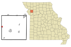
Clinton County is a county located in the U.S. state of Missouri and is part of the Kansas City metropolitan area. As of the 2020 U.S. Census, the county had a population of 21,184. Its county seat is Plattsburg. The county was organized January 2, 1833 and named for Governor DeWitt Clinton of New York. The county seat of Plattsburg derives its name from a town of a similar name that is the county seat of Clinton County, New York, which was also named for the Governor.

<span class="mw-page-title-main">Colesburg, Iowa</span> City in Iowa, United States

Colesburg is a city in Delaware County, Iowa, United States. The population was 386 at the time of the 2020 census.

<span class="mw-page-title-main">Winthrop, Minnesota</span> City in Minnesota, United States

Winthrop is a city in Sibley County, Minnesota, United States. The population was 1,399 at the 2010 census.

<span class="mw-page-title-main">Easton, Missouri</span> City in Missouri, United States

Easton is a city in Buchanan County, Missouri, United States. The population was 227 at the 2020 census. It is part of the St. Joseph, MO–KS Metropolitan Statistical Area.

<span class="mw-page-title-main">Belton, Missouri</span> City in Missouri, United States

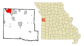
Belton is a city in northwestern Cass County, Missouri, United States. The population was 23,116 at the 2010 census.

<span class="mw-page-title-main">Smithville, Missouri</span> City in Missouri, United States

Smithville is a city in Clay and Platte counties in the U.S. state of Missouri and is part of the Kansas City metropolitan area, along the Little Platte River. The population was 10,406 at the 2020 United States Census.

<span class="mw-page-title-main">Wheatland, Missouri</span> City in Missouri, United States

Wheatland is a city in Hickory County, Missouri, United States. The population was 277 at the 2020 census.

<span class="mw-page-title-main">Cave, Missouri</span> City in Missouri, United States

Cave is a City in Lincoln County, Missouri, United States. The population was 5 at the 2010 census. However, As of the 2020 census, the population is 0, making it the smallest incorporated community in the U.S state of Missouri. It is the 939th largest city in Missouri and the 19481st largest city in the United States. Cave is currently declining at a rate of 0.00% annually and its population has decreased by 0.00% since the most recent census, which recorded a population of 5 in 2010.

<span class="mw-page-title-main">Troy, Missouri</span> City in Missouri, US

Troy is a city in Lincoln County, Missouri, United States. As of 2019, the estimated population was 12,820. It is the county seat of Lincoln County. Troy is an exurb of St. Louis, and is part of the St. Louis Metropolitan Statistical Area.

<span class="mw-page-title-main">Humansville, Missouri</span> City in Missouri, United States

Humansville is a city in Polk County, Missouri, United States. As of the 2020 census, the city population was 965. It is part of the Springfield, Missouri Metropolitan Statistical Area. Carl Long is the current mayor, sworn in on October 7, 2019.

<span class="mw-page-title-main">Benton, Missouri</span> City in Missouri, United States

Benton is a city in Scott County, Missouri, United States. The population was 863 at the 2010 census. It is the county seat of Scott County.

<span class="mw-page-title-main">Flordell Hills, Missouri</span> City in Missouri, United States

Flordell Hills is a city in St. Louis County, Missouri, United States. The population was 822 at the 2010 census.

<span class="mw-page-title-main">Hazelwood, Missouri</span> City in Missouri, United States

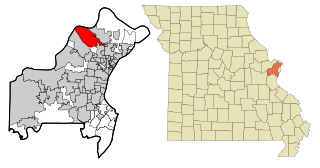
Hazelwood is a city in St. Louis County, Missouri, within Greater St. Louis. It is a second-ring northern suburb of St. Louis. Based on the 2020 United States census, the city had a total population of 25,485. It is located north of St. Louis-Lambert International Airport and is situated on Interstates 270 and 170, as well as the much-traveled Lindbergh Boulevard and Highway 370.

<span class="mw-page-title-main">Manchester, Missouri</span> City in Missouri, United States

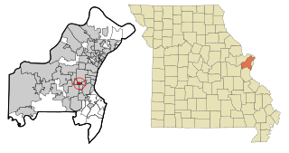
Manchester is a city in St. Louis County, Missouri, United States. The population was 18,333 at the 2020 census.

<span class="mw-page-title-main">Wildwood, Missouri</span> City in Missouri, United States

Wildwood is a city in St. Louis County, Missouri, United States. It is located in the far western portion of the county. As of the 2020 census, the population was 35,417. Wildwood is the home of the Al Foster Trail, and numerous other trails, parks, and reserves such as Rockwoods Reservation and Babler State Park.

<span class="mw-page-title-main">Winchester, Missouri</span> City in Missouri, United States

Winchester is a city in St. Louis County, Missouri, United States. The population was 1,447 at the 2020 census.

<span class="mw-page-title-main">Iatan, Missouri</span> Village in Missouri, United States

Iatan is a village in Platte County, Missouri within the United States. The population was 69 at the 2010 census. It is within the Kansas City metropolitan area.

<span class="mw-page-title-main">Warson Woods, Missouri</span> City in Missouri, United States

Warson Woods is a city in St. Louis County, Missouri, United States. The population was 1,962 at the 2010 census.

<span class="mw-page-title-main">Conewango Township, Warren County, Pennsylvania</span> Township in Pennsylvania, United States

Conewango Township is a township in Warren County, Pennsylvania, United States. The population was 3,429 at the 2020 census, down from 3,594 at the 2010 census. 3,915 at the 2000 census.

<span class="mw-page-title-main">Dearborn, Missouri</span> City in Missouri, United States

Dearborn is a city in Buchanan and Platte counties in the U.S. state of Missouri and is part of the Kansas City metropolitan area. The population was 482 at the 2020 census.

References

  1. "ArcGIS REST Services Directory". United States Census Bureau. Retrieved August 28, 2022.
  2. 1 2 U.S. Geological Survey Geographic Names Information System: Gower, Missouri
  3. 1 2 "U.S. Census website". United States Census Bureau . Retrieved January 31, 2008.
  4. "Clinton County Place Names, 1928–1945 (archived)". The State Historical Society of Missouri. Archived from the original on June 24, 2016. Retrieved September 21, 2016.{{cite web}}: CS1 maint: bot: original URL status unknown (link)
  5. Eaton, David Wolfe (1916). How Missouri Counties, Towns and Streams Were Named. The State Historical Society of Missouri. pp.  278.
  6. "US Gazetteer files 2010". United States Census Bureau. Archived from the original on January 25, 2012. Retrieved July 8, 2012.
  7. "Census of Population and Housing". Census.gov. Retrieved June 4, 2015.
  8. "U.S. Census website". United States Census Bureau . Retrieved July 8, 2012.
  9. "East Buchanan C-1 School District | Gower, Missouri". eastbuchananschools. Retrieved October 20, 2020.
  10. "East Buchanan Middle School | Home of the Bulldogs". eastbuchananschools. Retrieved October 20, 2020.