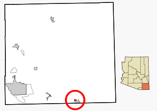
Pirtleville is a census-designated place (CDP) in Cochise County, Arizona, United States. The population was 1,744 at the 2010 census.

Thatcher is a town in Graham County, Arizona, United States. According to the 2010 Census, the population of the town is 4,865. It is part of the Safford Micropolitan Statistical Area.

Wheatland is a city in Clinton County, Iowa, United States. The population was 764 at the 2010 census.

Decatur City is a city in Decatur County, Iowa, United States. The population was 197 at the 2010 census.

Leando is a census-designated place (CDP) in Van Buren County, Iowa, United States. The population was 135 at the 2000 census.

Bethel Township is a civil township of Branch County in the U.S. state of Michigan. As of the 2010 census, the township population was 1,434.
Huron Township is a civil township of Huron County in the U.S. state of Michigan. The population was 423 at the 2000 census.
Zippel Township is a township in Lake of the Woods County, Minnesota, United States. The population was 140 at the 2000 census.

Goehner is a village in Seward County, Nebraska, United States. It is part of the Lincoln, Nebraska Metropolitan Statistical Area. The population was 154 at the 2010 census.

Kingstown is a town in Cleveland County, North Carolina, United States. The population was 681 at the 2010 census.

Ingold is a census-designated place (CDP) in Sampson County, North Carolina, United States. The population was 484 at the 2000 census.

Fort Pierre is a city in Stanley County, South Dakota, United States. It is part of the Pierre, South Dakota micropolitan area and the county seat of Stanley County. The population was 2,078 at the 2010 census. Fort Pierre is situated at the confluence of the Missouri and Bad rivers.
East Koochiching is an unorganized territory in Koochiching County, Minnesota, United States. The population was 383 at the 2000 census.
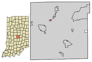
Spring Hill is a town in Marion County, Indiana, United States. The population was 98 at the 2010 census. It has existed as an "included town" since 1970, when it was incorporated into Indianapolis as part of Unigov. It is part of Indianapolis, but retains town governmental powers under IC 36-3-1-11.
Bidaurreta is a town and municipality located in the province and autonomous community of Navarre, northern Spain.

Miminegash is a municipality that holds community status in Prince Edward Island, Canada. It is located 8 miles (13 km) northwest of Alberton and 11 miles (18 km) southwest of Tignish. It is part of a small area known as either the St. Louis, Palmer Road, or Miminegash area. This area is often associated with Tignish due to the shared Acadian roots between these areas.

Sports and Fitness Center is an indoor sporting arena located in Saint Thomas, United States Virgin Islands. The capacity of the arena is 3,500 people and is home to the University of the Virgin Islands Buccaneers. It hosts the United States Virgin Islands Paradise Jam, a pre-season college basketball tournament.
The Boas is a river on Southampton Island in Nunavut, Canada. The river rises at 64°49′58″N084°23′34″W and its mouth is located at the Bay of Gods Mercy. Proceeding inland, the river becomes braided and is about 5 kilometres (3.1 mi) wide.

Antrim is an unincorporated community in Guernsey County, in the U.S. state of Ohio.


