Hanson (CDP), Massachusetts

Last updated
Hanson, Massachusetts
Town Hall, September 2012, Hanson MA.jpg
Town Hall
Plymouth County Massachusetts incorporated and unincorporated areas Hanson (CDP) highlighted.svg
Location in Plymouth County in Massachusetts
Coordinates: 42°4′3″N70°51′2″W / 42.06750°N 70.85056°W / 42.06750; -70.85056 Coordinates: 42°4′3″N70°51′2″W / 42.06750°N 70.85056°W / 42.06750; -70.85056
Country United States
State Massachusetts
County Plymouth
Area
[1]
  Total2.09 sq mi (5.42 km2)
  Land1.83 sq mi (4.75 km2)
  Water0.26 sq mi (0.67 km2)
Elevation
98 ft (30 m)
Population
 (2020)
  Total2,028
  Density1,105.18/sq mi (426.75/km2)
Time zone UTC-5 (Eastern (EST))
  Summer (DST) UTC-4 (EDT)
ZIP codes
02341, 02350
Area code(s) 781
FIPS code 25-28460
GNIS feature ID0613516

Hanson is a census-designated place (CDP) in the town of Hanson in Plymouth County, Massachusetts, United States. The population was 2,118 at the 2010 census. [2]

Contents

Geography

Hanson is located at 42°4′2″N70°51′1″W / 42.06722°N 70.85028°W / 42.06722; -70.85028 (42.067413, -70.850524). [3]

According to the United States Census Bureau, the CDP has a total area of 5.5 km2 (2.1 mi2), of which 4.8 km2 (1.9 mi2) is land and 0.6 km2 (0.2 mi2) (11.79%) is water.

Demographics

Historical population
CensusPop.
2020 2,028
U.S. Decennial Census [4]

At the 2000 census, [5] there were 2,044 people, 652 households and 560 families residing in the CDP. The population density was 422.0/km2 (1,092.8/mi2). There were 661 housing units at an average density of 136.5/km2 (353.4/mi2). The racial makeup was 97.99% White, 0.44% Black or African American, 0.29% Asian, 0.24% from other races, and 1.03% from two or more races. Hispanic or Latino of any race were 0.68% of the population.

There were 652 households, of which 40.8% had children under the age of 18 living with them, 73.2% were married couples living together, 9.7% had a female householder with no husband present, and 14.1% were non-families. 11.0% of all households were made up of individuals, and 3.7% had someone living alone who was 65 years of age or older. The average household size was 3.13 and the average family size was 3.40.

27.4% of the population were under the age of 18, 7.7% from 18 to 24, 31.1% from 25 to 44, 27.2% from 45 to 64, and 6.7% who were 65 years of age or older. The median age was 36 years. For every 100 females, there were 98.1 males. For every 100 females age 18 and over, there were 95.8 males.

The median household income was $64,896 and the median family incomewas $71,250. Males had a median income of $47,760 and females $28,098. The per capita income was $23,433. About 1.1% of families and 1.8% of the population were below the poverty line, including none of those under age 18 and 4.4% of those age 65 or over.

Related Research Articles

Taft, Florida Census-designated place in Florida, United States

Taft is a census-designated place and an unincorporated area in Orange County, Florida, United States. The population was 2,205 at the 2010 census. It is part of the Orlando–Kissimmee Metropolitan Statistical Area.

Smith Mills, Massachusetts Census-designated place in Massachusetts, United States

Smith Mills is a census-designated place (CDP) in the town of Dartmouth in Bristol County, Massachusetts, United States. The population was 4,760 at the 2010 census.

Marion Center, Massachusetts Census-designated place in Massachusetts, United States

Marion Center is a census-designated place (CDP) in the town of Marion in Plymouth County, Massachusetts, United States. The population was 1,111 at the 2010 census.

Marshfield Hills, Massachusetts Census-designated place in Massachusetts, United States

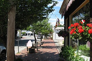
Marshfield Hills is a census-designated place (CDP) in the town of Marshfield in Plymouth County, Massachusetts, United States. The population was 2,356 at the 2010 census. The historic center of the village has been designated a historic district and listed on the National Register of Historic Places.

North Lakeville, Massachusetts Census-designated place in Massachusetts, United States

North Lakeville is a census-designated place (CDP) in the town of Lakeville in Plymouth County, Massachusetts, United States. The population was 2,630 at the 2010 census.

North Pembroke, Massachusetts Census-designated place in Massachusetts, United States

North Pembroke is a census-designated place (CDP) in the town of Pembroke in Plymouth County, Massachusetts, United States. The population was 3,292 at the 2010 census.

North Scituate, Massachusetts Census-designated place in Massachusetts, United States

North Scituate is a census-designated place (CDP) in the town of Scituate in Plymouth County, Massachusetts, United States. The population was 5,077 at the 2010 census. It was formerly known as Gannet Corner.

South Duxbury, Massachusetts Census-designated place in Massachusetts, United States

South Duxbury is a census-designated place (CDP) in the town of Duxbury in Plymouth County, Massachusetts, United States. The population was 3,360 at the 2010 census.

Wareham Center, Massachusetts Census-designated place in Massachusetts, United States

Wareham Center is a census-designated place (CDP) in the town of Wareham in Plymouth County, Massachusetts, United States. The population was 2,896 at the 2010 census.

North Boston, New York Census-designated place in New York, United States

North Boston is a hamlet and census-designated place (CDP) in the town of Boston in Erie County, New York, United States. As of the 2010 census, the CDP population was 2,521. It is part of the Buffalo–Niagara Falls Metropolitan Statistical Area.

Vinco, Pennsylvania Census-designated place in Pennsylvania, United States

Vinco is an unincorporated community and census-designated place (CDP) in Jackson Township, Cambria County, in the U.S. state of Pennsylvania. The population was 1,305 at the 2010 census.

Rowley (CDP), Massachusetts Census-designated place in Massachusetts, United States

Rowley is a census-designated place (CDP) in the town of Rowley in Essex County, Massachusetts, United States. The population was 1,416 at the 2010 census.

Duxbury (CDP), Massachusetts Census-designated place in Massachusetts, United States

Duxbury is a census-designated place (CDP) in the town of Duxbury in Plymouth County, Massachusetts, United States. The population was 1,802 at the 2010 census.

Hingham (CDP), Massachusetts Census-designated place in Massachusetts, United States

Hingham is a census-designated place (CDP) in the town of Hingham in Plymouth County, Massachusetts, United States. The population was 5,650 at the 2010 census.

Marshfield (CDP), Massachusetts Census-designated place in Massachusetts, United States

Marshfield is a census-designated place (CDP) in the town of Marshfield in Plymouth County, Massachusetts, United States. The population was 4,335 at the 2010 census.

Scituate (CDP), Massachusetts Census-designated place in Massachusetts, United States

Scituate is a census-designated place (CDP) in the town of Scituate in Plymouth County, Massachusetts, United States. The population was 5,245 at the 2010 census.

Barre (CDP), Massachusetts CDP in Massachusetts, United States

Barre is a census-designated place (CDP) in the town of Barre in Worcester County, Massachusetts, United States. The population was 1,009 at the 2010 census.

Warren (CDP), Massachusetts CDP in Massachusetts, United States

Warren is a census-designated place (CDP) in the town of Warren in Worcester County, Massachusetts, United States. The population was 1,405 at the 2010 census.

Hudson (CDP), Massachusetts Census-designated place in Massachusetts, United States

Hudson is a census-designated place (CDP) in the town of Hudson in Middlesex County, Massachusetts, United States. The population was 14,907 at the 2010 census.

Pepperell (CDP), Massachusetts Census-designated place in Massachusetts, United States

Pepperell is a census-designated place (CDP) in the town of Pepperell in Middlesex County, Massachusetts, United States. The population was 2,504 at the 2010 census.

References

  1. "2020 U.S. Gazetteer Files". United States Census Bureau. Retrieved May 21, 2022.
  2. "Profile of General Population and Housing Characteristics: 2010 Demographic Profile Data (DP-1): Hanson CDP, Massachusetts". United States Census Bureau . Retrieved March 23, 2012.
  3. "US Gazetteer files: 2010, 2000, and 1990". United States Census Bureau. February 12, 2011. Retrieved April 23, 2011.
  4. "Census of Population and Housing". Census.gov. Retrieved June 4, 2016.
  5. "U.S. Census website". United States Census Bureau . Retrieved January 31, 2008.