
Padre Island National Seashore (PINS) is a national seashore located on Padre Island off the coast of South Texas. In contrast to South Padre Island, known for its beaches and vacationing college students, PINS is located on the north end of Padre Island and consists of a long beach where nature is preserved.

Plymouth is a town and county seat of Plymouth County, Massachusetts, United States. Located in Greater Boston, the town holds a place of great prominence in American history, folklore, and culture, and is known as "America's Hometown". Plymouth was the site of the colony founded in 1620 by the Mayflower Pilgrims, where New England was first established. It is the oldest municipality in New England and one of the oldest in the United States. The town has served as the location of several prominent events, one of the more notable being the First Thanksgiving feast. Plymouth served as the capital of Plymouth Colony from its founding in 1620 until the colony's merger with the Massachusetts Bay Colony in 1691. The English explorer John Smith named the area Plymouth and the region 'New England' during his voyage of 1614. It was a later coincidence that, after an aborted attempt to make the 1620 trans-Atlantic crossing from Southampton, the Mayflower finally set sail for America from Plymouth, England.

The piping plover is a small sand-colored, sparrow-sized shorebird that nests and feeds along coastal sand and gravel beaches in North America. The adult has yellow-orange-red legs, a black band across the forehead from eye to eye, and a black stripe running along the breast line. This chest band is usually thicker in males during the breeding season, and it is the only reliable way to tell the sexes apart. The bird is difficult to see when it is standing still, as it blends well with open, sandy beach habitats. It typically runs in short, quick spurts and then stops.
Plum Island is a barrier island located off the northeastern coast of Massachusetts, north of Cape Ann, United States. It is approximately 11 miles (18 km) in length. The island is named for the wild beach plum shrubs that grow on its dunes, but is also famous for the purple sands at high tide, which derive their color from tiny crystals of pink pyrope garnet. It is located in parts of four municipalities in Essex County. From north to south they are the city of Newburyport, and the towns of Newbury, Rowley, and Ipswich.

Saco Bay is a small curved embayment of the Gulf of Maine on the Atlantic coast of Maine in the United States.

The Edwin B. Forsythe National Wildlife Refuge is a U.S. National Wildlife Refuge located in southern and south-central New Jersey, along the Atlantic coast, north of Atlantic City, in Atlantic and Ocean counties. The refuge was created in 1984 out of two existing refuge parcels created to protect tidal wetland and shallow bay habitat for migratory water birds. The Barnegat Division is located in Ocean County on the inland side of Barnegat Bay. The Brigantine Division is located approximately 10 miles (16 km) north of Atlantic City along the south bank of the mouth of the Mullica River. The two divisions are separated by approximately 20 miles (32 km). The refuge is located along most active flight paths of the Atlantic Flyway, making it an important link in the network of national wildlife refuges administered nationwide by the U.S. Fish and Wildlife Service. Forsythe Refuge is a part of the Hudson River/New York Bight Ecosystem and The New Jersey Coastal Heritage Trail Route. The refuge is named for Edwin B. Forsythe, conservationist Congressman from New Jersey. The refuge was named as a Ramsar Site of international importance in 1986.

Padre Island is the largest of the Texas barrier islands and the world's longest barrier island. The island is located along Texas's southern coast of the Gulf of Mexico and is noted for its white sandy beaches. Meaning father in Spanish, it was named after Father José Nicolás Ballí (c.1770-1829), who owned the island and served as a missionary priest and collector of finances for all the churches in the Rio Grande Valley. He also founded the first mission in present-day Cameron County.
The Stewart B. McKinney National Wildlife Refuge is a 950-acre (384.5 ha) National Wildlife Refuge in ten units across the U.S. state of Connecticut. Located in the Atlantic Flyway, the refuge spans 70 miles (110 km) of Connecticut coastline and provides important resting, feeding, and nesting habitat for many species of wading birds, shorebirds, songbirds and terns, including the endangered roseate tern. Adjacent waters serve as wintering habitat for brant, scoters, American black duck, and other waterfowl. Overall, the refuge encompasses over 900 acres (364.2 ha) of barrier beach, intertidal wetland and fragile island habitats.

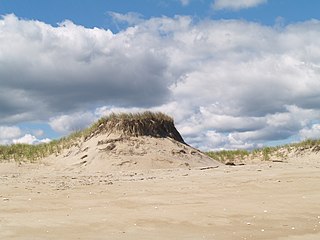
Duxbury Beach is a barrier beach in the town of Duxbury, Massachusetts. It is six miles long and is accessed by the Powder Point Bridge from Duxbury, or Gurnet Road from Marshfield. Since 1975, approximately 4.5 miles of the beach is owned by Duxbury Beach Reservation, Inc, which annually leases a substantial portion of the beach—excepting the Duxbury Beach Park area—to the town of Duxbury. Under this arrangement, the town issues beach vehicle permits, provides police protection, and provides conservation officers to patrol the beach in all seasons of the year.
Popponesset Spit is a spit between Popponesset Bay and Nantucket Sound. The barrier peninsula extends for about 1.0 mile (1.6 km) from the community of Popponesset in Mashpee on Cape Cod in Massachusetts and is part of the coastline known as Popponesset Beach. The tip of the peninsula is owned by the Massachusetts Audubon Society while the landward end is owned by Save Popponesset Bay.

Plymouth Bay is a small, well-protected bay of the Atlantic Ocean on the western shore of larger Cape Cod Bay along the coastline of the Commonwealth of Massachusetts. Plymouth Bay retains historical significance for the landing at Plymouth Rock in 1620 by the Pilgrims aboard the Mayflower who proceeded to establish the first permanent Northern European settlement in North America at Plymouth Colony.

The Eel River is a 3.9-mile (6.3 km) river mostly in the village of Chiltonville in Plymouth, Massachusetts. Its headwaters are springs and small ponds above Russell Millpond. Its watershed encompasses approximately 15 square miles (39 km2). It flows along Plimoth Plantation and Plymouth Beach for about ½ mile before emptying into Plymouth Harbor between the beach and Manters Point.

Chiltonville is a small village in Plymouth, Massachusetts, United States. It is located south of Wellingsley, northeast of South Pond, and consists of the Eel River valley and the land that stretches south of the river to the Pine Hills. Plimoth Plantation is in the northeastern part of the village. Bramhall's Corner, the center of Chiltonville, is located less than a mile north of Plimoth Plantation Highway. It includes a general store, an antiques store and Chiltonville Congregational Church.

Town Brook is a 1.5-mile (2.4 km) stream in Plymouth, Massachusetts that provided drinking water to the Pilgrims who made their homes adjacent to the brook on Leyden Street in Plymouth. Town Brook's headwaters are the Billington Sea, a 269-acre (109 ha) freshwater pond. The brook passes through numerous small ponds, including Deep Water Pond and Jenny Pond. It also passes by the Plimoth Grist Mill and the Brewster Gardens before emptying into Plymouth Harbor. A nature trail runs along the entire length of the brook.
The Oregon Coast National Wildlife Refuge Complex consists of six National Wildlife Refuges along the Oregon Coast. It provides wilderness protection to thousands of small islands, rocks, reefs, headlands, marshes, and bays totaling 371 acres spanning 320 miles (515 km) of Oregon's coastline. The areas are all managed by the United States Fish and Wildlife Service.
Cascumpec Bay is within Prince Edward Island in Canada and is adjacent to the Gulf of Saint Lawrence.
Sampsons Island is a 15-acre (6.1 ha) uninhabited, undeveloped barrier island at the mouth of Cotuit Harbor in Barnstable, Massachusetts. It is the location of the Massachusetts Audubon Society's Sampsons Island Wildlife Sanctuary, and it forms part of the Sampsons Island/Dead Neck Island barrier beach system. The island is only accessible by private boat, and is used for recreation and wildlife viewing and preservation.

Waquoit Bay National Estuarine Research Reserve (WBNERR) encompasses open waters, barrier beaches, marshlands and uplands on the south shore of Cape Cod in the towns of Falmouth and Mashpee. The park is managed by the Department of Conservation and Recreation (DCR) and the National Oceanic and Atmospheric Administration.

Nantucket National Wildlife Refuge is a 24-acre (9.7 ha) range and was established in 1973 for its "particular value in carrying out the national migratory bird management program." The refuge, which is cooperatively managed with The Trustees of Reservations, encompasses 24 acres (9.7 ha) at Great Point. Nantucket National Wildlife Refuge is an un-staffed unit of the Eastern Massachusetts National Wildlife Refuge Complex. Nantucket National Wildlife Refuge consists of the Northeast tip of Nantucket, known as Great Point. The Refuge has been managed informally by TTOR several decades. TTOR owns the land immediately adjacent to Great Point, known as the Coskata-Coatue Wildlife Refuge. Great Point is known as one of the best surfcasting locations in New England because of the rip tide which brings bluefish and striped bass to the point. The Refuge is also a destination for hundreds of visitors each year seeking to enjoy a Nantucket beach or a tour of the Great Point Lighthouse. More information about the adjacent TTOR property is available on their website.
The Target Rock National Wildlife Refuge is located just east of the village of Lloyd Harbor, New York, on the north shore of Long Island, 25 miles (40 km) east of New York City. It is managed by the U.S. Fish and Wildlife Service as part of the Long Island National Wildlife Refuge Complex.


