
Maries County is a county located in the U.S. state of Missouri. As of the 2020 census, its population was 8,432. Its county seat is Vienna. The county was organized March 2, 1855 and named for the Maries River and Little Maries River. The word "Maries" is derived from the French word marais, which means "marsh, lake, or pond".

Stanton is an unincorporated community in southern Franklin County, Missouri, United States. It lies on Interstate 44 at the junction with Missouri Supplemental Route W, which provides access to Meramec Caverns, located approximately two miles southeast along the Meramec River.

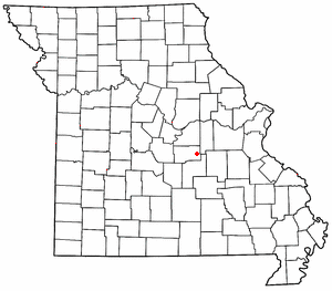
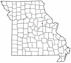
Vichy is an unincorporated community in southern Maries County, Missouri, United States. It is located on U.S. Route 63, approximately ten miles north of Rolla. The community was founded in 1880 and is named after Vichy, France. A post office called Vichy has been in operation since 1880. The Rolla National Airport, a former U.S. Army airfield owned and operated by the City of Rolla, with two 5,500 ft (1,700 m) asphalt runways, is located nearby. The ZIP Code for Vichy is 65580.
High Gate is an unincorporated community in eastern Maries County, Missouri, United States. It is at the intersection of routes H and U approximately fourteen miles east of Vienna and 1.5 miles from the Maries-Gasconade county line.
Brinktown is an unincorporated community in Maries County, Missouri, United States. It is located approximately eight miles southwest of Vienna on Route 133.
Beaufort is an unincorporated community in western Franklin County, Missouri, United States. It is located at the intersection of U.S. Route 50 and Route 185, approximately 11 miles (18 km) west of Union.
Williamsburg is an unincorporated community in eastern Callaway County, Missouri, United States. It is located on Missouri Supplemental Route D just north of Interstate 70, approximately thirteen miles northeast of Fulton. The Whetstone Creek Conservation Area along Whetstone Creek lies about one mile to the north. The ZIP Code for Williamsburg is 63388.
Bluffton is an unincorporated community in western Montgomery County, Missouri, United States. It is located on Route 94, approximately ten miles west of Hermann, near the Missouri River.

Mount Sterling is an unincorporated community in western Gasconade County, Missouri, United States.
Frankenstein is an unincorporated community in northwestern Osage County, Missouri, United States. It is located approximately 20 km (12 mi) east of Jefferson City. Frankenstein is located on Missouri Route C, about midway between Luystown to the east and Bonnots Mill to the west. Cedar Creek flows past, about one mile south of the site.

Loose Creek is an unincorporated community in Osage County, Missouri, United States. It is located north of U.S. Route 50, approximately eight miles east of Missouri's capital of Jefferson City. The ZIP Code for Loose Creek is 65054.

Rich Fountain is an unincorporated community in Osage County, Missouri, United States. It is located approximately three miles east of U.S. Route 63 and is fifteen miles southeast of Jefferson City.
Paydown is an unincorporated community in northeastern Maries County, Missouri, United States.
Argo is an unincorporated community in northwest Crawford County, in the U.S. state of Missouri. The community is on a ridge northwest of the Little Bourbeuse River. The site is located on Missouri Route C about five miles northwest of Bourbon and Interstate 44.
Bend is an unincorporated community in northeastern Maries County, in the U.S. state of Missouri.
Lanes Prairie is an unincorporated community in eastern Maries County, in the U.S. state of Missouri.
Lois is an unincorporated community in eastern Maries County, in the U.S. state of Missouri.
Safe is an unincorporated community in southeastern Maries County, in the U.S. state of Missouri. The community is located on Missouri Route H on a hill just west of and above the Bourbeuse River. The community is approximately six miles north-northeast of St. James.
Stickney is an unincorporated community in southern Maries County, in the U.S. state of Missouri. The community is on Missouri Route E, two miles east of Hayden. The location is just west of the confluence of Dry Creek and Montague Creek and two miles west of the confluence of Dry Creek with the Gasconade River. The community is about eight miles south of Vienna.
Anthonies Mill is an unincorporated community in Washington County, in the U.S. state of Missouri. The community is located at the confluence of Ashley Branch with Brazil Creek on the western border of the county. The site is at the junction of routes N and W. The old community of Vilander lies in Crawford County just 2.5 miles downstream to the west.


