Related Research Articles
Thornfield is an unincorporated community in Ozark County, Missouri, United States. It is located 15 miles (24 km) northwest of Gainesville, on Route 95 at the Little North Fork of the White River on the edge of the Mark Twain National Forest between Wasola to the northeast and Longrun to the southwest. Hammond, the site of the historic Hammond Mill, lies on the Little North Fork 2.5 miles (4.0 km) southeast of Thornfield. Thornfield has a post office with ZIP code 65762.
Foil is an unincorporated community in northern Ozark County, Missouri, United States. It is located approximately sixteen miles south of Ava on county roads 953 and 955. Wasola is about four miles northeast on Missouri Route 5 and Thornfield approximately three miles southwest on Missouri Route JJ. The community is on the banks of Little Creek, a tributary of Little North Fork White River.
Musselfork is an unincorporated community in Chariton County, in the U.S. state of Missouri.

Ann is a historic town in Douglas County, Missouri, United States. The GNIS classifies it as a populated place. The townsite is located at the junction of state routes EE and AD in the northeast corner of the county. The North Fork River lies just to the east of the site.
Arden is an unincorporated community in western Douglas County, Missouri, United States. Arden is located on a ridge along Missouri Route O between Missouri Route 14 to the north and the community of Red Bank to the south. The community is on a ridge of Keyger Mountain at an elevation of 1,362 ft (415 m).
Cheney is an unincorporated community in Douglas County, in the Ozarks of southern Missouri. The community was located on Missouri Route C, approximately one mile north of Evans on Missouri Route 14.
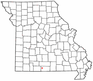
Coldspring is an unincorporated community in north central Douglas County, in the Ozarks of southern Missouri. The community is located on Missouri Route 76 and Clever Creek.
Denlow is an unincorporated community in north central Douglas County in the Ozarks of Missouri. Denlow is located on Missouri Route 76, just west of the Fox Creek bridge.
Depew is an unincorporated community in northwest Douglas County, in the U.S. state of Missouri. The community was located just north of Missouri Route 14, approximately two miles southwest of Dogwood.
Merritt is an unincorporated community in southwestern Douglas County, Missouri, United States. Merritt is located west of Goodhope on Missouri Route T in the Little Beaver Creek valley.
Omba is an historic town in eastern Douglas County, Missouri, United States. The GNIS classifies it as a populated place. The townsite is located along State Route AA between Missouri Route 181 and the North Fork River.
Prior is an unincorporated community in Douglas County, Missouri, United States. The community is located on Missouri Route 95, just north of the intersection with Missouri Route 76 and 2.5 miles north of Vanzant. The community sits on a ridge between Fox Creek to the west and Clifty Creek to the east, at an elevation of 1,243 ft (379 m).

Redbank is an unincorporated community in western Douglas County, Missouri, United States. Redbank is located on Missouri State Route O at its junction with Route NN to the west. The community of Arden is to the north and Goodhope is to the south along Route O and Merritt lies to the southwest along Route T.

Richville is an unincorporated community in southeastern Douglas County, Missouri, United States. Richville is located at the intersection of Missouri State Route 14 and State route W and a short distance west of the intersection of Route 14 and Missouri State Route 181. The site is located on a high ridge at an elevation of 1,191 ft (363 m). Sauls Knob at 1,339 ft (408 m) lies just to the southeast on the south side of Route 14.
Roy is an unincorporated community in southwestern Douglas County, Missouri, United States. Roy is located on Missouri Route 76, south of the Goodhope junction on Missouri Route T. The village site is at an elevation of 1,263 ft (385 m) about 1.5 mile west of the Beaver Creek valley.
Silverton is an historic town in Douglas County, Missouri, United States. The GNIS classifies it as a populated place. It was located along County Road 317 on Spring Creek, 1.7 miles (2.7 km) north-northeast of Wasola and 1.9 miles (3.1 km) west of the Hilo Cemetery, along Route N on Hilo Ridge. Although Hilo is listed as a variant name, the two were not at the same location.
Sweden is an unincorporated community in Douglas County, Missouri, United States. Sweden lies in the south-central part of the county. The former Sweden store is located on Missouri Route 14, one-half mile east of the intersection of Route 14 and State Route P. Sweden community church and cemetery lie one-quarter mile north of the former store location on a county road.

Topaz is an unincorporated community in northeast Douglas County, Missouri, United States. Topaz is an old mill site located on the North Fork River. Access to the community is from Missouri Route 76 via either Missouri Route EE or Missouri Route E.
Oak Mound is an unincorporated community in eastern Ozark County, in the Ozarks of south-central Missouri, United States. The community was located on Bond Ridge and the Oak Mound Cemetery lies adjacent to the south side of Missouri Route KK. The North Fork of the White River lies just over one mile west of the site.
Biggs was an unincorporated community in northeast Douglas County, Missouri, United States.
References
- ↑ U.S. Geological Survey Geographic Names Information System: Hebron, Missouri
- 1 2 Dora, Missouri, 7.5 Minute Topographic Quad, USGS, 2004
- ↑ "Post Offices". Jim Forte Postal History. Retrieved September 28, 2016.
- ↑ "Douglas County Place Names, 1928–1945 (archived)". The State Historical Society of Missouri. Archived from the original on June 24, 2016. Retrieved September 28, 2016.
{{cite web}}: CS1 maint: bot: original URL status unknown (link)
Municipalities and communities of Douglas County, Missouri, United States | ||
|---|---|---|
| City |  | |
| Townships | ||
| Unincorporated communities |
| |
| Ghost towns | ||
36°51′08″N92°09′12″W / 36.85222°N 92.15333°W
| | This Douglas County, Missouri state location article is a stub. You can help Wikipedia by expanding it. |