
The Province of the Transvaal, commonly referred to as the Transvaal, was a province of South Africa from 1910 until 1994, when a new constitution subdivided it following the end of apartheid. The name "Transvaal" refers to the province's geographical location to the north of the Vaal River. Its capital was Pretoria, which was also the country's executive capital.
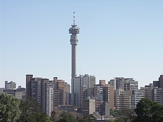
Hillbrow is an inner city residential neighbourhood of Johannesburg, Gauteng Province, South Africa. It is known for its high levels of population density, unemployment, poverty, prostitution and crime.

The Afrikaner Weerstandsbeweging, meaning "Afrikaner Resistance Movement", commonly known by its abbreviation AWB, is an Afrikaner nationalist, neo-Nazi, and white supremacist political party in South Africa. Since its founding in 1973 by Eugène Terre'Blanche and six other far-right Afrikaners, it has been dedicated to secessionist Afrikaner nationalism and the creation of an independent Boer-Afrikaner republic or "Volkstaat/Boerestaat" in part of South Africa. During bilateral negotiations to end apartheid in the early 1990s, the organisation terrorised and killed black South Africans.

Eugène Ney Terre'Blanche was an Afrikaner nationalist who founded and led the Afrikaner Weerstandsbeweging. Prior to founding the AWB, Terre'Blanche served as a South African Police officer, was a farmer, and was an unsuccessful Herstigte Nasionale Party candidate for local office in the Transvaal. He was a major figure in the right-wing backlash against the collapse of apartheid. His beliefs and philosophy have continued to be influential amongst white supremacists in South Africa and across the world.

Springs is a former independent city that is now part of the City of Ekurhuleni, based in the east of Johannesburg, in Gauteng Province, South Africa. It lies 50 km (31 mi) east of Johannesburg and 72 km (45 mi) southeast from Pretoria. Its name derives from the large number of springs in the area, and its estimated population is more than 121,610 in 2011. It is situated at 1628 m (5,340 ft) above sea level.

Alberton is a town situated on the southern part of the East Rand of the Gauteng Province in South Africa and is situated very close to the major urban centre of Johannesburg.

Kempton Park is a city in the East Rand region of Gauteng province, South Africa. It is part of the City of Ekurhuleni Metropolitan Municipality. It is situated south of Tembisa, one of the largest townships in South Africa, which is also part of Ekurhuleni. South Africa's busiest airport, O. R. Tambo International Airport is located in Kempton Park.
Westonaria is a town in the west of Gauteng province of South Africa. It is situated in the Rand West City Local Municipality, part of the West Rand District Municipality. During the apartheid era, Africans lived outside town in Bekkersdal. The town is some 45 km west of Johannesburg and 18 km south of Randfontein.

Petrus Steyn, is a small farming town between Tweeling and Kroonstad, 35 km north-east of Lindley in the Free State province of South Africa. It is at the centre of an agricultural area known for wheat, maize, sunflower, potato, cattle, hunting, sheep production and forms part of the breadbasket in the Free State. It is the highest town above sea level in the Free State.
Volksrust is a town in the Mpumalanga province of South Africa near the KwaZulu-Natal provincial border, some 240 km southeast of Johannesburg, 53 km north of Newcastle and 80 km southeast of Standerton.

Greylingstad, officially Nthorwane, is a small farming town west of Standerton in Mpumalanga, South Africa.

Ventersdorp is a town of 4,200 in Dr Kenneth Kaunda District Municipality, North West Province, South Africa. It was the seat of the defunct Ventersdorp Local Municipality until 2016.
The following lists events that happened during 1960 in South Africa.
Florida is a location in Gauteng province, South Africa. It is located about 16 kilometres west of Johannesburg. The area which is referred to as Florida was originally established as the farm Vogelstruisfontein. Today, it is a suburb of Roodepoort.

Bedfordview is an affluent suburb in western Ekurhuleni, sharing an administrative boundary with the City of Johannesburg Metropolitan Municipality, Gauteng, South Africa. Bedfordview has been part of the City of Ekurhuleni Metropolitan Municipality since 2000. The Eastgate Shopping Centre, one of the biggest in Africa when first built, is also located here.
Louis Botha Avenue is a major street in Johannesburg, South Africa. Originally part of the main road between central Johannesburg and Pretoria, it runs along through the north-eastern parts of the city from Hillbrow to Sandton, passing through numerous older suburbs, including Houghton and Orange Grove, before it becomes the Pretoria Main Road (R101) which passes the Alexandra Township and continues to Midrand and Pretoria.
White South Africans generally refers to South Africans of European descent. In linguistic, cultural, and historical terms, they are generally divided into the Afrikaans-speaking descendants of the Dutch East India Company's original settlers, known as Afrikaners, and the Anglophone descendants of predominantly British colonists of South Africa. In 2016, 57.9% were native Afrikaans speakers, 40.2% were native English speakers, and 1.9% spoke another language as their mother tongue, such as Portuguese, Greek, or German. White South Africans are by far the largest population of White Africans. White was a legally defined racial classification during apartheid.

Many people of European heritage in South Africa are descended from Huguenots. Most of these originally settled in the Cape Colony, but were absorbed into the Afrikaner and Afrikaans-speaking population, because they had religious similarities to the Dutch colonists.

Hoërskool Voortrekker is a public Afrikaans medium co-educational high school situated in the municipality of Boksburg in the city of Ekurhuleni in the Gauteng province of South Africa. The academic school was established in 1920.
Denver is an industrial suburb in eastern Johannesburg, South Africa, on the railway to Germiston and Hoofrif Road, around 6 km east of City Hall. It borders Benrose to the west, Jeppestown and Malvern to the north, Cleveland to the east, and the François Oberholzer Freeway to the south. Just a small portion of the suburb in the northwest has residential zoning; otherwise, Denver consists of industrial land and squatter camps both in the west and up north, the latter largely on Hoofrif Road.


