Holden, West Virginia

Last updated
Holden, West Virginia
Holden, West Virginia.jpg
Trace Avenue in Holden
USA West Virginia location map.svg
Red pog.svg
Holden
Usa edcp location map.svg
Red pog.svg
Holden
Coordinates: 37°49′7″N82°3′42″W / 37.81861°N 82.06167°W / 37.81861; -82.06167 Coordinates: 37°49′7″N82°3′42″W / 37.81861°N 82.06167°W / 37.81861; -82.06167
Country United States
State West Virginia
County Logan
Area
[1]
  Total3.73 sq mi (9.67 km2)
  Land3.73 sq mi (9.67 km2)
  Water0.0 sq mi (0.0 km2)
Elevation
735 ft (224 m)
Population
 (2010) [2]
  Total876
  Density230/sq mi (91/km2)
Time zone UTC-5 (Eastern (EST))
  Summer (DST) UTC-4 (EDT)
ZIP code
25625
Area code 304
FIPS code 54-37948 [3]
GNIS feature ID1540381 [4]

Holden is a census-designated place (CDP) in Logan County, West Virginia, United States. The population was 876 at the 2010 census, [2] down from 1,105 in 2000. The CDP contains the unincorporated communities of Holden, Beebe, Frogtown, Sycamore, Diamond, and Davis, all in the valley of Copperas Mine Fork.

Contents

Geography

Holden is located in western Logan County along Copperas Mine Fork, a tributary of Island Creek and part of the Guyandotte River watershed. [5] It is 4 miles (6 km) southwest of Logan, the county seat. U.S. Route 119, a four-lane freeway, passes just east of Holden village, leading north 56 miles (90 km) to Charleston, the state capital, and southwest 51 miles (82 km) to Pikeville, Kentucky.

According to the United States Census Bureau, the Holden CDP has a total area of 3.7 square miles (9.7 km2), of which 0.1 acres (534 m2), or less than 0.01%, are water. [1]

Demographics

At the 2000 census there were 1,105 people, 436 households, and 324 families living in the CDP. The population density was 113.1 people per square mile (43.7/km2). There were 488 housing units at an average density of 49.9/sq mi (19.3/km2). The racial makeup of the CDP was 90.23% White, 8.87% African American, 0.18% Asian, 0.09% from other races, and 0.63% from two or more races. Hispanic or Latino of any race were 0.27%. [3]

Of the 436 households 27.5% had children under the age of 18 living with them, 53.2% were married couples living together, 17.7% had a female householder with no husband present, and 25.5% were non-families. 23.4% of households were one person and 12.6% were one person aged 65 or older. The average household size was 2.51 and the average family size was 2.95.

The age distribution was 23.1% under the age of 18, 9.3% from 18 to 24, 26.8% from 25 to 44, 26.0% from 45 to 64, and 14.8% 65 or older. The median age was 40 years. For every 100 females, there were 85.7 males. For every 100 females age 18 and over, there were 79.3 males.

The median household income was $23,510 and the median family income was $30,750. Males had a median income of $24,653 versus $21,316 for females. The per capita income for the CDP was $11,615. About 19.4% of families and 20.9% of the population were below the poverty line, including 30.1% of those under age 18 and 23.9% of those age 65 or over.

History

The settlement was built between 1902 and 1915, by mining engineer Albert F. "Bert" Holden, who wanted to build a model mining town. [6] [7] Located along Copperas Mine Fork, the settlement had a band mill and a brick-making plant to meet the building needs of the community, and all structures were made from local materials including stones from a nearby quarry. [8] In 1907, a mining engineer wrote:

The town of Holden is most attractive and most worthy of praise and approval. All houses are provided with electric lights, open grates and porches, water from driven wells and tastefully painted. A more orderly, more attractive, or more wisely planned and managed community does not exist in the state of West Virginia. [8] :16

By 1909, 400 buildings had been constructed including houses, stores, barns, a machine shop, a carpenter shop, a blacksmith shop, and a power plant. [8] The center of the community was described as "Main Holden". [8]

Notable people

Related Research Articles

<span class="mw-page-title-main">Wyoming County, West Virginia</span> County in West Virginia, United States

Wyoming County is a county in the U.S. state of West Virginia. As of the 2010 census, the population was 23,796. Its county seat is Pineville. The county was created in 1850 from Logan County and named for the Lenape word meaning "large plains".

<span class="mw-page-title-main">Logan County, West Virginia</span> County in West Virginia, United States

Logan County is a county in the U.S. state of West Virginia. As of the 2010 census, the population was 36,743. Its county seat is Logan. Logan County comprises the Logan, WV Micropolitan Statistical Area, which is also included in the Charleston–Huntington–Ashland, WV–OH–KY Combined Statistical Area.

<span class="mw-page-title-main">Boone County, West Virginia</span> County in West Virginia, United States

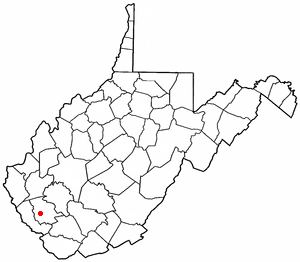
Boone County is a county in the U.S. state of West Virginia. As of the 2020 census, the population was 21,809. Its county seat is Madison. Boone County is part of the Charleston, WV Metropolitan Statistical Area. Leading industries and chief agricultural products in Boone County include coal, lumber, natural gas, tobacco, and strawberries.

<span class="mw-page-title-main">Healy, Alaska</span> Census-designated place in Alaska, United States

Healy is a census-designated place (CDP) and the borough seat of Denali Borough in the U.S. state of Alaska. The population was 966 at the time of the 2020 census, down from 1,021 in 2010.

<span class="mw-page-title-main">Sutton-Alpine, Alaska</span> Census-designated place in Alaska, United States

Sutton is a census-designated place (CDP) in the Matanuska-Susitna Borough in the U.S. state of Alaska. At the 2020 census the population was 1,038, down from 1,447 in 2010. The CDP includes the former coal mining community and road construction camp of Sutton, as well as the former mining camps of Eska and Jonesville.

<span class="mw-page-title-main">Hungry Horse, Montana</span> Unincorporated community in Montana, United States

Hungry Horse is an unincorporated community and census-designated place (CDP) in Flathead County, Montana, United States. The population was 828 at the 2020 census. The ZIP code for Hungry Horse is 59919.

<span class="mw-page-title-main">Church Rock, New Mexico</span> Human settlement in New Mexico, United States

Church Rock is a census-designated place (CDP) in McKinley County, New Mexico, United States. The population was 1,128 at the 2010 census. Church Rock is named for Church Rock, a prominent natural landmark with the same name.

<span class="mw-page-title-main">Neffs, Ohio</span> Census-designated place in Ohio, United States

Neffs is a census-designated place (CDP) in Belmont County, Ohio, United States. It is part of the Wheeling, West Virginia Metropolitan Statistical Area. The population was 993 at the 2010 census.

<span class="mw-page-title-main">Ewing, Virginia</span> Census-designated place in Virginia, United States

Ewing is an unincorporated community and census-designated place (CDP) in Lee County, Virginia. The population was 439 at the 2010 U.S. Census. Ewing is one of the westernmost settlements in the Commonwealth of Virginia, before reaching the Cumberland Gap and the borders with Kentucky and Tennessee.

<span class="mw-page-title-main">Keokee, Virginia</span> Census-designated place in Virginia, United States

Keokee is an unincorporated community and census-designated place (CDP) in Lee County, Virginia, United States. The population was 416 at the 2010 census.

<span class="mw-page-title-main">Ravensdale, Washington</span> Census-designated place in Washington, United States

Ravensdale is a census-designated place (CDP) in King County, Washington, United States. The population was 555 at the 2020 census.

<span class="mw-page-title-main">Madison, West Virginia</span> City in West Virginia, United States

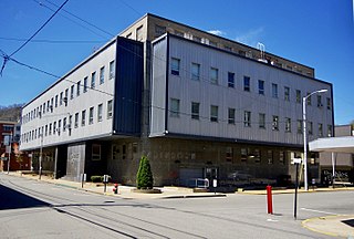
Madison is a city and former coal town in Boone County, West Virginia, United States. The population was 2,911 at the 2020 census. It is the county seat of Boone County.

<span class="mw-page-title-main">Powellton, West Virginia</span> CDP in West Virginia, United States

Powellton is a census-designated place (CDP) in Fayette County, West Virginia, United States. The population was 619 at the 2010 census.

<span class="mw-page-title-main">Coal Fork, West Virginia</span> Census-designated place in West Virginia, United States

Coal Fork is an unincorporated census-designated place (CDP) in Kanawha County, West Virginia, United States. It is part of a larger unincorporated community known as Campbells Creek, approximately 10 minutes east of Charleston. The population was 1,233 at the 2010 census.

<span class="mw-page-title-main">Alum Creek, West Virginia</span> Census-designated place in West Virginia, United States

Alum Creek is a census-designated place (CDP) in Kanawha and Lincoln counties along the Coal River in the U.S. state of West Virginia. It includes the unincorporated communities of Alum Creek, Forks of Coal, and Priestley. The CDP had a population of 1,749 at the 2010 census, down from 1,839 at the 2000 census.

<span class="mw-page-title-main">Harts, West Virginia</span> Census-designated place in West Virginia, United States

Harts is a census-designated place (CDP) at the mouth of Big Harts Creek in Lincoln County, West Virginia, United States, situated along the Guyandotte River. As of the 2010 census, its population was 656. Harts is a part of the Huntington-Ashland, WV-KY-OH, Metropolitan Statistical Area (MSA). The Harts CDP includes the unincorporated communities of Harts, Atenville, Ferrellsburg, and Sand Creek.

<span class="mw-page-title-main">Mallory, West Virginia</span> Census-designated place in West Virginia, United States

Mallory is a census-designated place (CDP) in Logan County, West Virginia, United States. The population was 1,654 at the 2010 census. The CDP contains the unincorporated communities, from west to east, of Huff Junction, Mallory, Davin, Mineral City, Claypool, Combs Addition, and Gillman Bottom.

<span class="mw-page-title-main">Mount Gay-Shamrock, West Virginia</span> Census-designated place in West Virginia, United States

Mount Gay-Shamrock is a census-designated place (CDP) in Logan County, West Virginia, United States.

<span class="mw-page-title-main">Switzer, West Virginia</span> Census-designated place in West Virginia, United States

Switzer is an unincorporated community and census-designated place (CDP) in Logan County, West Virginia, United States. The CDP includes the neighboring unincorporated community of Micco. The total CDP population was 595 at the 2010 census.

<span class="mw-page-title-main">Monongah, West Virginia</span> Town in West Virginia, United States

Monongah is a town in Marion County, West Virginia, United States, situated where Booths Creek flows into the West Fork River. The population was 972 at the 2020 census. Monongah was chartered in 1891, based on Chapter 47 of West Virginia code. Its name is derived from the nearby Monongahela River.

References

  1. 1 2 "2020 U.S. Gazetteer Files – West Virginia". United States Census Bureau. Retrieved March 11, 2021.
  2. 1 2 "Total Population: 2010 Census DEC Summary File 1 (P1), Holden CDP, West Virginia". data.census.gov. U.S. Census Bureau. Retrieved March 11, 2021.
  3. 1 2 "U.S. Census website". United States Census Bureau . Retrieved 2008-01-31.
  4. "US Board on Geographic Names". United States Geological Survey. 2007-10-25. Retrieved 2008-01-31.
  5. West Virginia Atlas & Gazetteer. Yarmouth, Me.: DeLorme. 1997. p. 57. ISBN   0-89933-246-3.
  6. . Logan (WV) Democrat. May 22, 1913.{{cite news}}: Missing or empty |title= (help)
  7. ""Albert Holden: Founder of the World's 2nd Largest Mining and Smelting Trust". The Village of Bratenahl. Retrieved October 16, 2022.
  8. 1 2 3 4 Carpenter, Helena (August 15, 1978). Holden, West Virginia: The Story of a Company Town. p. 3,16.