Holsworthy, New South Wales

Last updated

Holsworthy
Sydney,  New South Wales
Holsworthy High School.JPG
Holsworthy High School
Holsworthy, New South Wales
Population5,476 (2016 census) [1]
Established1835
Postcode(s) 2173
Elevation19 m (62 ft)
Location31 km (19 mi) SW of Sydney CBD
LGA(s) City of Liverpool
State electorate(s)
Federal division(s)
Suburbs around Holsworthy:
Moorebank Wattle Grove Hammondville
Glenfield Holsworthy Chipping Norton
Macquarie Fields Wedderburn Liverpool

Holsworthy is a suburb in south-western Sydney, in the state of New South Wales, Australia 31 kilometres south-west of the Sydney central business district, in the local government area of the City of Liverpool.

Contents

Holsworthy is most notable for a large Australian Army reserve, Holsworthy Barracks, where training exercises are frequently carried out. The reserve is adjacent to Heathcote Road, which connects to Bankstown, Liverpool, Lucas Heights, Engadine and Heathcote. Signs on the perimeter warn potential trespassers of the use of laser-guided and conventional gunfire.

The residential area is located north of the railway station. Anzac Village is a locality in the northern part of the suburb and the adjacent suburb of Wattle Grove. A new development called 'Mornington' has recently been built in this region. A shopping centre has also been built in this area.

History

The area was named after Holsworthy, Devon, England, where Governor Lachlan Macquarie married Elizabeth Campbell, on 3 November 1807. It was originally spelt as Holdsworthy until after World War II, when the 'd' was dropped. [2]

This land was occupied by the Tharawal people. With the arrival of the First Fleet, indigenous people were pushed back from their traditional lands in the area surrounding Sydney. In 1795, explorers George Bass and Matthew Flinders explored the Georges River and in 1798, grants of land for farming were made in the area. The soil was good and crops of corn, wheat and vegetables were soon being harvested. [3]

However, tensions developed with the Tharawal. In 1801, Governor King ordered soldiers to fire on the aborigines to keep them from settler's properties. By 1815, Governor Macquarie declared a state of open warfare against aborigines in the Georges River area and forbade them carrying weapons within a mile of any British settlement. Ultimately, the British prevailed. [4]

A settlement named Eckersley was established in 1835 on what is now military land. By the 1880s a number of vineyards were established in the area. The land was acquired by the army in 1913. During World War I it was home to a large internment camp for civilians of German or Austro-Hungarian background, the camp absorbed prisoners from the infamous Torrens Island Concentration Camp in 1915. The modern village of Holsworthy evolved after World War II to the north, with the barracks to the south. The streets are named with a military theme, such as Tarakan, Bardia, Wewak, Lae, Brunei, Finschhafen, Madang, Gona, Anzac, Light Horse, Infantry, Cavalry, Sabre, Gunners Row and Trooper Row. In Anzac Village, Australian Generals are remembered with Birdwood, Monash, Bridges and Blamey.

The Holsworthy bushland retains many indigenous sites and has been referred to as "Sydney's Kakadu". There are more than 500 significant Tharawal sites in the area including campsites, tool making sites and rock art. The art is mostly engravings of hands, boomerangs, animals, birds and fish. [4]

Climate

Holsworthy has a humid subtropical climate (Cfa), like most of Sydney, with warm summers and cool to mild winters, and precipitation spread throughout the year. Thunderstorms are common in the summer months, and provide most of the precipitation in that season. Winters are pleasantly cool and sunny, although east coast lows can bring large amounts of rainfall. Snow has never occurred, although frost is a fairly common occurrence in winter. Being inland from the coast, and away from Sydney City, Holsworthy receives up to 500mm (20 in) less precipitation than coastal areas, just 25 km (16 mi) away.

Climate data for Holsworthy Control Range
MonthJanFebMarAprMayJunJulAugSepOctNovDecYear
Record high °C (°F)45.7
(114.3)
41.7
(107.1)
38.5
(101.3)
33.6
(92.5)
27.7
(81.9)
24.9
(76.8)
24.8
(76.6)
28.9
(84.0)
35.0
(95.0)
37.1
(98.8)
42.0
(107.6)
42.0
(107.6)
45.7
(114.3)
Mean daily maximum °C (°F)29.1
(84.4)
28.3
(82.9)
26.3
(79.3)
23.5
(74.3)
20.5
(68.9)
17.8
(64.0)
17.3
(63.1)
19.1
(66.4)
22.3
(72.1)
24.1
(75.4)
25.5
(77.9)
27.4
(81.3)
23.4
(74.1)
Mean daily minimum °C (°F)17.5
(63.5)
17.5
(63.5)
15.5
(59.9)
12.1
(53.8)
8.1
(46.6)
6.2
(43.2)
4.9
(40.8)
5.4
(41.7)
8.4
(47.1)
10.8
(51.4)
13.8
(56.8)
15.7
(60.3)
11.3
(52.3)
Record low °C (°F)9.2
(48.6)
10.8
(51.4)
6.6
(43.9)
2.8
(37.0)
−2.0
(28.4)
−2.6
(27.3)
−4.0
(24.8)
−2.0
(28.4)
0.8
(33.4)
3.7
(38.7)
5.0
(41.0)
7.0
(44.6)
−4.0
(24.8)
Average precipitation mm (inches)59.5
(2.34)
113.7
(4.48)
67.4
(2.65)
54.8
(2.16)
53.8
(2.12)
69.1
(2.72)
43.1
(1.70)
37.6
(1.48)
32.6
(1.28)
52.2
(2.06)
73.7
(2.90)
56.6
(2.23)
709.4
(27.93)
Average precipitation days (≥ 0.1mm)8.710.311.111.210.010.610.17.47.59.511.910.5118.8
Average relative humidity (%)50565553525349444348515050
Source: [5]

Population

According to the 2016 census, Holsworthy had a population of 5,476. There were a high number of families with children (76.2%) and the median age of Holsworthy residents (30) was eight years younger than the national median. Not surprisingly, defence was the major industry of employment, covering 16.8% of the suburb's residents. The median family income ($2,179 per week) was substantially higher than the national median ($1,734).

60.4% of people were born in Australia. The next most common countries of birth were India 7.3%, Philippines 3.0%, Indonesia 2.5%, New Zealand 2.2% and China 2.1%. 59.1% of people only spoke English at home. Other languages spoken at home included Hindi 3.0%, Mandarin 2.9%, Indonesian 2.9%, Bengali 2.7% and Arabic 2.4%. The most common responses for religion were Catholic 23.4%, No Religion 22.4%, Anglican 12.6% and Hinduism 10.8% [1]

Transport

Pop culture

Churches

A congregation of Lifegate Community Church (Holsworthy & Wattle Grove) meets weekly in the Wattle Grove Primary Public School Hall on Cressbrook Drive (Holsworthy Church on google maps).

St Christophers Catholic Church at Holsworthy also services the Holsworthy and Wattle Grove area.

Related Research Articles

<span class="mw-page-title-main">Heathcote National Park</span> Protected area in New South Wales, Australia

Heathcote National Park is a protected national park that is located in the southern area of Sydney, New South Wales in eastern Australia, and is situated on Dharawal country. The 2,679-hectare (6,620-acre) national park is situated approximately 35 kilometres (22 mi) southwest of the Sydney central business district, west of the Illawarra railway line, the Princes Highway and Motorway, and the suburbs of Heathcote and Waterfall.

<span class="mw-page-title-main">Liverpool, New South Wales</span> Suburb of City of Liverpool, New South Wales, Australia

Liverpool is a suburb of South Western Sydney, in the state of New South Wales, Australia. It is located approximately 31 kilometres (19 mi) south-west of the Sydney CBD. Liverpool is the administrative seat of the local government area of the City of Liverpool and is situated in the Cumberland Plain.

<span class="mw-page-title-main">Georges River</span> River in Sydney, New South Wales, Australia

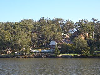
The Georges River, also known as Tucoerah River, is an intermediate tide-dominated drowned valley estuary, that is located in Sydney in the state of New South Wales, Australia. The Georges River is located south and south-west from the Sydney CBD, with the mouth of the river being at Botany Bay.

<span class="mw-page-title-main">Campbelltown, New South Wales</span> City in New South Wales, Australia

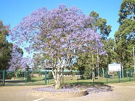
Campbelltown is a suburb located on the outskirts of the metropolitan area of Sydney, New South Wales, Australia. It is located in Greater Western Sydney 53 kilometres (33 mi) south-west of the Sydney central business district by road. Campbelltown is the administrative seat of the local government area of the City of Campbelltown. It is also acknowledged on the register of the Geographical Names Board of New South Wales as one of only four cities within the Sydney metropolitan area.

<span class="mw-page-title-main">Voyager Point, New South Wales</span> Suburb of Sydney, New South Wales, Australia

Voyager Point is a small suburb, in South Western Sydney in the state of New South Wales, Australia. Voyager Point is located 25 kilometres south of the Sydney central business district, in the local government area of the City of Liverpool. The only adjacent suburbs are Sandy Point, Holsworthy and Pleasure Point. Milperra, Panania and East Hills are located on the opposite bank of the Georges River. In the 2016 census, Voyager Point recorded a population of 1668 people.

Casula is a suburb of Sydney, in the state of New South Wales, Australia. It is 34 kilometres south-west of the Sydney central business district, in the local government area of the City of Liverpool.

<span class="mw-page-title-main">Macquarie Fields, New South Wales</span> Suburb of Sydney, New South Wales, Australia

Macquarie Fields is a suburb of Sydney, in the state of New South Wales, Australia. Macquarie Fields is located 38 kilometres south-west of the Sydney central business district, in the local government area of the City of Campbelltown and is part of the Macarthur region.

<span class="mw-page-title-main">Marsfield, New South Wales</span> Suburb of Sydney, New South Wales, Australia

Marsfield is a suburb in the Northern Sydney region of Sydney, in the state of New South Wales, Australia. Marsfield is located 16 kilometres north-west of the Sydney central business district in the local government area of the City of Ryde.

<span class="mw-page-title-main">Illawong</span> Suburb of Sydney, New South Wales, Australia

Illawong is a suburb in southern Sydney, in the state of New South Wales, Australia. Illawong is located 27 kilometres south of the Sydney Central Business District, in the local government area of the Sutherland Shire in the area commonly called Menai. The post code is 2234, which is also assigned to the contiguous suburbs of Menai, Bangor Barden Ridge and Alfords Point.

Wattle Grove is a suburb of Sydney, in the state of New South Wales, Australia. Wattle Grove is located 30 kilometres south-west of the Sydney central business district in the local government area of the City of Liverpool.

<span class="mw-page-title-main">Sandy Point, New South Wales</span> Suburb of Sydney, New South Wales, Australia

Sandy Point is a suburb in south-western Sydney, in the state of New South Wales, Australia 28 km south of the Sydney central business district, in the local government area of the Sutherland Shire.

<span class="mw-page-title-main">Ingleburn, New South Wales</span> Suburb of Sydney, New South Wales, Australia

Ingleburn is a suburb of Sydney, in the state of New South Wales, Australia 45 kilometres south-west of the Sydney central business district, in the local government area of City of Campbelltown. It is part of the Macarthur region. Ingleburn is located approximately halfway between the two commercial centres of Liverpool and Campbelltown.

<span class="mw-page-title-main">City of Liverpool (New South Wales)</span> Local government area in New South Wales, Australia

The City of Liverpool is a local government area, administered by Liverpool City Council, located in the south-west of Sydney, in the state of New South Wales, Australia. The area encompasses 305.5 square kilometres (118.0 sq mi) and its administrative centre is located in the suburb of Liverpool.

<span class="mw-page-title-main">East Hills, New South Wales</span> Suburb of Sydney, New South Wales, Australia

East Hills, a suburb of local government area City of Canterbury-Bankstown, is located 26 kilometres south-west of the Sydney central business district, in the state of New South Wales, Australia, and is a part of the South-western Sydney region, near larger areas like Revesby and Bankstown.

<span class="mw-page-title-main">Greenacre, New South Wales</span> Suburb of Sydney, New South Wales, Australia

Greenacre is a suburb in South-western Sydney, located 20 kilometres south-west of the Sydney central business district in the state of New South Wales, Australia. Most of Greenacre is in the local government area of the City of Canterbury-Bankstown, while a part in the east is in the Municipality of Strathfield.

<span class="mw-page-title-main">Campsie, New South Wales</span> Suburb of Sydney, New South Wales, Australia

Campsie is a suburb in the state of New South Wales, Australia. Campsie is 11 kilometres south west of the Sydney central business district, on the southern bank of the Cooks River. Campsie is one of the administrative centres of the City of Canterbury-Bankstown.

<span class="mw-page-title-main">Engadine, New South Wales</span> Suburb of Sydney, New South Wales, Australia

Engadine is a suburb in southern Sydney, in the state of New South Wales, Australia. Engadine is located 33 kilometres (21 mi) south of the Sydney central business district, in the local government area of the Sutherland Shire.

<span class="mw-page-title-main">Heathcote, New South Wales</span> Suburb of Sydney, New South Wales, Australia

Heathcote is a suburb of Sydney in the state of New South Wales, Australia. The suburb is located 36 km south of the Sydney central business district in the Sutherland Shire of Southern Sydney. Heathcote is bordered by Engadine to the north and Waterfall to the south. It is bounded by The Royal National Park to the east, and Heathcote National Park to the west.

<span class="mw-page-title-main">The Oaks, New South Wales</span> Town in New South Wales, Australia

The Oaks is a town in the Macarthur Region of Sydney in New South Wales, Australia in Wollondilly Shire on the south western edge of the Sydney Basin. The Oaks is located 82 kilometres (51 mi) south-west of Sydney via the Hume Highway, 13 kilometres (8 mi) west of Camden and 290m above sea-level. At the 2016 census, The Oaks and the surrounding area had a population of 2,525.

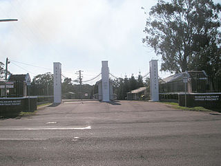
The Holsworthy railway line was located in South-western Sydney. It was constructed during World War I, mainly using labour from the Holsworthy Internment Camp. Its purpose was to service the Holsworthy army facilities opening on 21 January 1918.

References

  1. 1 2 Australian Bureau of Statistics (27 June 2017). "Holsworthy (State Suburb)". 2016 Census QuickStats. Retrieved 14 March 2018. OOjs UI icon edit-ltr-progressive.svg
  2. The Book of Sydney Suburbs, Compiled by Frances Pollon, Angus & Robertson 1990 ISBN   0-207-14495-8, page 123
  3. "History of our suburbs: Holsworthy's European Heritage". Liverpool City Council. Archived from the original on 14 October 2007. Retrieved 31 December 2007.
  4. 1 2 "History of our suburbs: Holsworthy's Aboriginal Heritage". Liverpool City Council. Archived from the original on 14 October 2007. Retrieved 31 December 2007.
  5. "Climate statistics for Holsworthy Control Range". Bureau of Meteorology . Retrieved 10 November 2013.

33°57′45″S150°57′16″E / 33.96261°S 150.95455°E / -33.96261; 150.95455