Hurst, Illinois

Last updated
Hurst, Illinois
Hurst-Bush-Ave-il.jpg
Bush Avenue
Williamson County Illinois Incorporated and Unincorporated areas Hurst Highlighted.svg
Location of Hurst in Williamson County, Illinois.
Illinois in United States (US48).svg
Location of Illinois in the United States
Coordinates: 37°49′57″N89°8′40″W / 37.83250°N 89.14444°W / 37.83250; -89.14444 Coordinates: 37°49′57″N89°8′40″W / 37.83250°N 89.14444°W / 37.83250; -89.14444
CountryUnited States
StateIllinois
County Williamson
Founded1903
Government
  MayorDuke Woolsey
Area
[1]
  Total0.89 sq mi (2.31 km2)
  Land0.89 sq mi (2.30 km2)
  Water0.01 sq mi (0.02 km2)
Elevation
[2]
394 ft (120 m)
Population
 (2020)
  Total764
  Density861.33/sq mi (332.72/km2)
Time zone UTC-6 (CST)
  Summer (DST) UTC-5 (CDT)
ZIP Code
62949
Area code 618
FIPS code 17-36815
GNIS feature ID2394459 [2]
Wikimedia CommonsHurst, Illinois

Hurst is a city in Williamson County, Illinois, United States. The population was 795 at the 2010 census.

Contents

History

Hurst was founded in 1903 as a stop along the St. Louis, Iron Mountain and Southern Railway, which had extended a line to the area from De Soto. Thomas Philip Russell, who donated some of the land for the new city, initially sought to name it after his family, but the name "Russell" was already in use elsewhere in Illinois. He then agreed to name it after his friend, William Charles Hurst, a railroad official who had stayed at his house during visits to the area. [3]

Geography

Hurst is located at 37°49′57″N89°8′40″W / 37.83250°N 89.14444°W / 37.83250; -89.14444 (37.832366, -89.144475). [4]

According to the 2010 census, Hurst has a total area of 0.862 square miles (2.23 km2), of which 0.86 square miles (2.23 km2) (or 99.77%) is land and 0.002 square miles (0.01 km2) (or 0.23%) is water. [5]

Demographics

Historical population
CensusPop.
1910 325
1920 1,222276.0%
1930 1,123−8.1%
1940 1,012−9.9%
1950 858−15.2%
1960 8630.6%
1970 9348.2%
1980 9380.4%
1990 842−10.2%
2000 805−4.4%
2010 795−1.2%
2020 764−3.9%
U.S. Census [6]

As of the census [7] of 2000, there were 805 people, 360 households, and 217 families residing in the city. The population density was 935.1 inhabitants per square mile (361.0/km2). There were 386 housing units at an average density of 448.4 per square mile (173.1/km2). The racial makeup of the city was 97.27% White, 0.99% African American, 0.12% Native American, 0.87% from other races, and 0.75% from two or more races. Hispanic or Latino of any race were 1.24% of the population.

There were 360 households, out of which 29.2% had children under the age of 18 living with them, 41.9% were married couples living together, 12.5% had a female householder with no husband present, and 39.7% were non-families. 36.1% of all households were made up of individuals, and 17.5% had someone living alone who was 65 years of age or older. The average household size was 2.24 and the average family size was 2.89.

In the city, the population was spread out, with 24.1% under the age of 18, 8.9% from 18 to 24, 29.1% from 25 to 44, 23.9% from 45 to 64, and 14.0% who were 65 years of age or older. The median age was 36 years. For every 100 females, there were 88.5 males. For every 100 females age 18 and over, there were 80.8 males.

The median income for a household in the city was $21,765, and the median income for a family was $30,250. Males had a median income of $24,659 versus $18,393 for females. The per capita income for the city was $12,583. About 18.7% of families and 24.8% of the population were below the poverty line, including 38.9% of those under age 18 and 14.8% of those age 65 or over.

Emergency services

The Hurst Fire Chief is Tom Gottschalk and the ambulance director is Gregory Parker. The fire and ambulance services are both fully volunteer organizations.

Education and religion

Hurst has 1 church in the community: a Christian church located on Russell Street. After the closing of the Hurst-Bush Community Grade School in 1996 and the community high school in 1966, Hurst citizens attend Herrin Unit 4 schools.[ citation needed ]

Related Research Articles

<span class="mw-page-title-main">Cokedale, Colorado</span> Town in Colorado, United States

The Town of Cokedale is a Statutory Town located in Las Animas County, Colorado, United States. The town population was 127 at the 2020 United States Census.

<span class="mw-page-title-main">McCook, Illinois</span> Village in Illinois, United States

McCook is a village in Cook County, Illinois, United States, and is an industrial suburb of Chicago. As of the 2020 census, the village population was 249, which is the lowest population of all municipalities in the county.

<span class="mw-page-title-main">North City, Illinois</span> Village in Illinois, United States

North City is a village in Franklin County, Illinois, United States. As of the 2020 census, the population was 509. North City is also known as "Coello". The current mayor is Curtis Overton.

<span class="mw-page-title-main">Orient, Illinois</span> City in Illinois, United States

Orient is a city in Franklin County, Illinois, United States. As of the 2010 census, the city population was 358, up from 296 at the 2000 census.

<span class="mw-page-title-main">Royalton, Illinois</span> Village in Illinois, United States

Royalton is a village in Franklin County, Illinois, United States. The population was 1,151 at the 2010 census.

<span class="mw-page-title-main">Zeigler, Illinois</span> City in Illinois, United States

Zeigler is a city in Franklin County, Illinois, United States. The population was 1,801 at the 2010 census. The current mayor is Dennis Mitchell.

<span class="mw-page-title-main">Ava, Illinois</span> City in Illinois, United States

Ava is a city in northwest Jackson County, Illinois, United States. The population was 654 at the 2010 census.

<span class="mw-page-title-main">Campbell Hill, Illinois</span> Village in Illinois, United States

Campbell Hill is a village in Jackson County, Illinois, United States. The population was 309 at the 2020 census.

<span class="mw-page-title-main">De Soto, Illinois</span> Village in Illinois, United States

De Soto is a village in Jackson County, Illinois, United States. The population was 1,590 at the 2010 census, down from 1,653 at the 2000 census. It is named for Hernando de Soto, the discoverer of the Mississippi River.

<span class="mw-page-title-main">Vergennes, Illinois</span> Village in Illinois, United States

Vergennes is a village in Jackson County, Illinois, United States. The population was 298 at the 2010 census, down from 491 at the 2000 census.

<span class="mw-page-title-main">Mount Olive, Illinois</span> City in Illinois, United States

Mount Olive is a city in Macoupin County, Illinois, United States. The population was 2,099 at the 2010 census and is part of the metro east in the St. Louis metropolitan area

<span class="mw-page-title-main">Mounds, Illinois</span> City in Illinois, United States

Mounds is a city in Pulaski County, Illinois, United States. The population was 810 in the 2010 census, a decline from 1,117 in 2000.

<span class="mw-page-title-main">Olmsted, Illinois</span> Village in Illinois, United States

Olmsted is a village in Pulaski County, Illinois, along the Ohio River. The population was 299 at the 2000 census.

<span class="mw-page-title-main">Jonesboro, Illinois</span> City in Illinois, United States

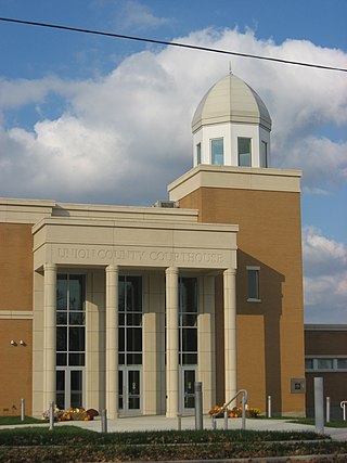
Jonesboro is a city in Union County, Illinois, United States. The population was 1,821 at the 2010 census, a decline from 1,853 in 2000. It is the county seat of Union County. The city is known for being tied to its close neighbor Anna, together known as Anna-Jonesboro.

<span class="mw-page-title-main">Bush, Illinois</span> Village in Illinois, United States

Bush is a village in Williamson County, Illinois, United States. As of the 2000 census, the village population was 257.

<span class="mw-page-title-main">Crainville, Illinois</span> Village in Illinois, United States

Crainville is a village in Williamson County, Illinois, United States. The population was 1,254 at the 2010 census.

<span class="mw-page-title-main">North Middletown, Kentucky</span> City in Kentucky, United States

North Middletown is a home rule-class city in Bourbon County, Kentucky, in the United States. The population was 643 as of the 2010 census. North Middletown is part of the Lexington-Fayette Metropolitan Statistical Area.

Marble City Community is a census-designated place (CDP) in Sequoyah County, Oklahoma, United States. It is part of the Fort Smith, Arkansas-Oklahoma Metropolitan Statistical Area. The population was 420 at the 2000 census.

<span class="mw-page-title-main">South Manheim Township, Schuylkill County, Pennsylvania</span> Township in Pennsylvania, United States

South Manheim Township is a township in Schuylkill County, Pennsylvania, United States. The population was 2,751 at the 2020 census. It was created in 1845 by dividing Manheim Township into South Manheim and North Manheim Townships.

Ironton is a town in Sauk County, Wisconsin, United States. The population was 650 at the 2000 census. The town was named from deposits of iron ore in the area. The Village of Ironton is located within the town.

References

  1. "2020 U.S. Gazetteer Files". United States Census Bureau. Retrieved March 15, 2022.
  2. 1 2 U.S. Geological Survey Geographic Names Information System: Hurst, Illinois
  3. Barbara Barr Hubbs, "Hurst History," Williamson County Illinois Historical Society website. Accessed 13 June 2021.
  4. "US Gazetteer files: 2010, 2000, and 1990". United States Census Bureau. 2011-02-12. Retrieved 2011-04-23.
  5. "G001 - Geographic Identifiers - 2010 Census Summary File 1". United States Census Bureau. Archived from the original on 2020-02-13. Retrieved 2015-12-27.
  6. Census of Population and Housing, U.S. Census Bureau
  7. "U.S. Census website". United States Census Bureau . Retrieved 2008-01-31.