
A ZIP Code is a system of postal codes used by the United States Postal Service (USPS). The term ZIP was chosen to suggest that the mail travels more efficiently and quickly when senders use the code in the postal address.

Rock Island County is a county located in the U.S. state of Illinois, bounded on the west by the Mississippi River. According to the 2020 census, it had a population of 144,672. Its county seat is Rock Island; its largest city is neighboring Moline. Rock Island County is one of the four counties that make up the Davenport-Moline-Rock Island, IA-IL Metropolitan Statistical Area.

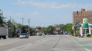
East Moline is a city in Rock Island County, Illinois, United States. The population was 21,374 at the 2020 census. East Moline is part of the Quad Cities, along with the cities of Rock Island, Moline, and the Iowa city of Davenport. As of 2011, the Quad Cities has a population estimate of 381,342.

St. James Township is a civil township of Charlevoix County in the U.S. state of Michigan. The population was 365 at the 2010 census.
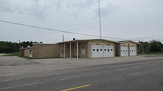
Garfield Township is a civil township of Mackinac County in the U.S. state of Michigan. The population was 1,146 at the 2010 census, and 1,166 in 2020.
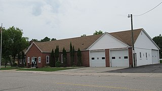
Newton Township is a civil township of Mackinac County in the U.S. state of Michigan. As of 2020, its population was 430.
River Rouge is a city in Wayne County in the U.S. state of Michigan. The population was 7,224 at the 2020 census.

An unincorporated area is a region that is not governed by a local municipal corporation. There are many unincorporated communities and areas in the United States and Canada. Most other countries have very few or no unincorporated areas.
A minor civil division (MCD) is a term used by the United States Census Bureau for primary governmental and/or administrative divisions of a county or county-equivalent, typically a municipal government such as a city, town, or civil township. MCDs are used for statistical purposes by the Census Bureau, and do not necessarily represent the primary form of local government. They range from non-governing geographical survey areas to municipalities with weak or strong powers of self-government. Some states with large unincorporated areas give substantial powers to counties; others have smaller or larger incorporated entities with governmental powers that are smaller than the MCD level chosen by the Census.
A civil township is a widely used unit of local government in the United States that is subordinate to a county, most often in the northern and midwestern parts of the country. The term town is used in New England, New York, as well as Wisconsin to refer to the equivalent of the civil township in these states; Minnesota uses "town" officially but often uses it and "township" interchangeably. Specific responsibilities and the degree of autonomy vary in each state. Civil townships are distinct from survey townships, but in states that have both, the boundaries often coincide and may completely geographically subdivide a county. The U.S. Census Bureau classifies civil townships as minor civil divisions. Currently, there are 20 states with civil townships.
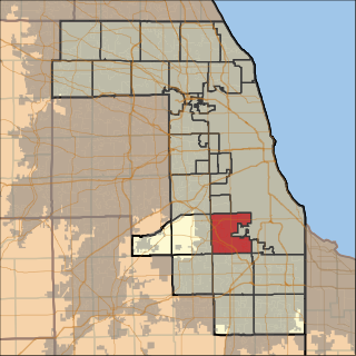
Worth Township is one of 29 townships in Cook County, Illinois. As of the 2020 census, its population was 152,934, with its most populous municipalities including Oak Lawn, Evergreen Park (19,943), Alsip, and Chicago Ridge. It was founded in 1849, when the county voted to subdivide itself into townships.

Ocean View is an unincorporated community and census-designated place (CDP) located within Dennis Township in Cape May County, in the U.S. state of New Jersey. The area is served as United States Postal Service ZIP Code 08230. The post office was established in 1872, with William Doolittle as the first postmaster.
Solon Mills is an unincorporated community and census-designated place in McHenry County, Illinois, United States. Solon Mills is located on U.S. Route 12, 2 miles (3.2 km) southwest of Spring Grove. Solon Mills is part of ZIP code 60071; it once had its own post office with ZIP code 60080 before it closed on September 28, 2002. It was named a CDP before the 2020 census, at which time it had a population of 133.
Buffalo Prairie is a Census-designated place in Rock Island County, Illinois, United States. Buffalo Prairie is 10 miles (16 km) west of Reynolds. Buffalo Prairie has a post office with ZIP code 61237.
Taylor Ridge is a census-designated place (CDP) in Rock Island County, Illinois, United States. Taylor Ridge is located at the junction of Illinois Route 94 and Illinois Route 192, 4 miles (6.4 km) north of Reynolds. Taylor Ridge has a post office with ZIP code 61284.

Preemption is an unincorporated community and census-designated place in Preemption Township, Mercer County, Illinois, United States. As of the 2020 census, it had a population of 254. Preemption is 4 miles (6 km) west of Sherrard and has a post office with ZIP code 61276.
Lakewood is an unincorporated community and Census Designated Place in Lakewood Township, Shelby County, Illinois, United States. Lakewood is located on County Highway 12, 8 miles (13 km) southwest of Shelbyville. Lakewood had a post office, which opened on July 26, 1872, and closed on November 2, 2002.

Laughlintown is an unincorporated community that is located in Ligonier Township, Westmoreland County, Pennsylvania, United States. It is located on U.S. Route 30, 3 miles (4.8 km) southeast of Ligonier.
Maxatawny is an unincorporated community and census-designated place located on U.S. Route 222 in Maxatawny Township, Berks County, Pennsylvania, United States, five miles east of Kutztown. It is in the Lehigh watershed and Schaefer Run flows through it to the Little Lehigh Creek. Maxatawny has a post office, with the ZIP code of 19538. Traffic speed on US 222 is reduced to 35 miles-per-hour passing through the village, which borders Lehigh County.
South Seaville is an unincorporated community located within Dennis Township in Cape May County, in the U.S. state of New Jersey. South Seaville is 4 miles (6.4 km) northwest of Sea Isle City. South Seaville has a post office with ZIP Code 08246.


