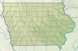
The Mississippi River is the primary river, and second-longest river, of the largest drainage basin in the United States. From its traditional source of Lake Itasca in northern Minnesota, it flows generally south for 2,340 miles (3,766 km) to the Mississippi River Delta in the Gulf of Mexico. With its many tributaries, the Mississippi's watershed drains all or parts of 32 U.S. states and two Canadian provinces between the Rocky and Appalachian mountains. The main stem is entirely within the United States; the total drainage basin is 1,151,000 sq mi (2,980,000 km2), of which only about one percent is in Canada. The Mississippi ranks as the thirteenth-largest river by discharge in the world. The river either borders or passes through the states of Minnesota, Wisconsin, Iowa, Illinois, Missouri, Kentucky, Tennessee, Arkansas, Mississippi, and Louisiana.

Nobles County is a county in the U.S. state of Minnesota. As of the 2020 census, the population was 22,290. Its county seat is Worthington. Nobles County comprises the Worthington, MN Micropolitan Statistical Area.

Mower County is a county in the U.S. state of Minnesota. As of the 2020 census, the population was 40,029. The county seat is Austin. Mower County comprises the Austin Micropolitan Statistical Area and is included in the Rochester-Austin Combined Statistical Area. Lake Louise State Park is in southeastern Mower County, near Le Roy.

Martin County is a county in Minnesota, United States. As of the 2020 census, the population was 20,025. Its county seat is Fairmont.
Jackson County is a county in the U.S. state of Minnesota. As of the 2020 census, the population was 9,989. Its county seat is Jackson.

Freeborn County is a county in the state of Minnesota. As of the 2020 census, the population was 30,895. Its county seat is Albert Lea. Freeborn County comprises the Albert Lea Micropolitan Statistical Area.

Faribault County is a county in the U.S. state of Minnesota. As of the 2020 census, the population was 13,921. Its county seat is Blue Earth.

The Des Moines River is a tributary of the Mississippi River in the upper Midwestern United States that is approximately 525 miles (845 km) long from its farther headwaters. The largest river flowing across the state of Iowa, it rises in southern Minnesota and flows across Iowa from northwest to southeast, passing from the glaciated plains into the unglaciated hills near the capital city of Des Moines, named after the river, in the center of the state. The river continues to flow to a southeastern direction away from Des Moines, later flowing directly into the Mississippi River.

The Iowa Great Lakes, often referred to as Okoboji, is a group of natural lakes in northwestern Iowa in the United States. There are seven lakes in the region totaling 12,687 acres (5,134 ha) with the three principal lakes of the group being Big Spirit Lake, West Okoboji Lake, and East Okoboji Lake. They are the largest natural lakes in the state of Iowa. The largest, Spirit Lake, is 5,684 acres (2,300 ha). The lake area extends to the north into Jackson County, Minnesota. The headwaters of Little Sioux River flow past the west side of the lake area.

Big Spirit Lake is a natural body of water, approximately 5,684 acres (2,300 ha) in area, in Dickinson County in northwest Iowa in the United States. It is part of the chain of lakes known as the Iowa Great Lakes, the northern shore of the lake straddles the border with Minnesota. It is the largest natural lake in Iowa. The Dakotah Indian name for the lake was Minnewaukon. Early French traders named it Lac D' Esprit after the Indian legends of an evil spirit who dwelled in the lake.
The Little Sioux River is a river in the United States. It rises in southwestern Minnesota near the Iowa border, and continues to flow southwest for 258 miles (415 km) across northwest Iowa into the Missouri River at Little Sioux. The Little Sioux River was known as Eaneah-waudepon or "Stone River" to the Sioux Indians. Its tributaries include the Ocheyedan River, Maple River and the West Fork of the Little Sioux River. The Little Sioux River is integral to the Nepper Watershed Project, a major Iowa flood control and soil conservation program that was introduced in 1947.

Okamanpeedan Lake, partially located in Martin County, Minnesota, and Emmet County, Iowa, is also known as Tuttle Lake. Okamanpeedan Lake is a roughly 2,300-acre (9.3 km²) riverine lake located on the East Fork of the Des Moines River. It has an average depth of about four to six feet. The lake has a contributing watershed of approximately 120,056 acres (486 km²) and watershed:lake ratio on the order of about 50:1. The lake is situated in a glacial till plain and is generally in an area dominated by loamy, poorly drained soils. The area is primarily level but does have some rolling hills.

Lake Louise State Park is a Minnesota state park just north of the Iowa border near the small town of Le Roy in Mower County, Minnesota, directly south of Rochester. It has a 25 acre man-made lake and 1,168 acres (5 km2) of mixed prairie and deciduous forest. It is used for picnics, swimming, camping, hiking, horseback riding, and other outdoor recreation. It is noted for butterfly watching, as some rare species have been seen. It features a picnic shelter which dates to the Public Works Administration era.

The Blue Earth River is a tributary of the Minnesota River, 108 miles (174 km) long, in southern Minnesota in the United States. Two of its headwaters tributaries, the Middle Branch Blue Earth River and the West Branch Blue Earth River, also flow for short distances in northern Iowa. By volume, it is the Minnesota River's largest tributary, accounting for 46% of the Minnesota's flow at the rivers' confluence in Mankato. Via the Minnesota River, the Blue Earth River is part of the watershed of the Mississippi River, draining an area of 3,486 square miles (9,030 km2) in an agricultural region. Ninety percent of the river's watershed is in Minnesota. It is a Minnesota Department of Natural Resources designated Water Trail.
The Shell Rock River is a 113-mile-long (182 km) tributary of the West Fork Cedar River in southern Minnesota and northern Iowa in the United States. Via the Cedar and Iowa rivers, it is part of the Mississippi River watershed.

The Ocheyedan River is a tributary of the Little Sioux River, 58 mi (93 km) long, in southwestern Minnesota and northwestern Iowa in the United States. Via the Little Sioux and Missouri Rivers, it is part of the watershed of the Mississippi River. The river has been channelized for much of its length.

The Rock River is a tributary of the Big Sioux River, about 144 miles (232 km) long, in southwestern Minnesota and northwestern Iowa in the United States. Via the Big Sioux and Missouri rivers, it is part of the watershed of the Mississippi River. The river's name comes from a prominent rocky outcrop about 175 feet high of reddish-gray Sioux Quartzite, about 3 miles (5 km) north of Luverne. The outcrop of quartzite is contained in Minnesota's Blue Mounds State Park.