
Cattaraugus County is a county in Western New York, with one side bordering Pennsylvania. As of the United States 2020 census, the population was 77,042. The county seat is Little Valley. The county was created in 1808 and later organized in 1817.

Erie County is a county along the shore of Lake Erie in western New York State. As of the 2020 census, the population was 954,236. The county seat is Buffalo, which makes up about 28% of the county's population. Both the county and Lake Erie were named for the regional Iroquoian language-speaking Erie tribe of Native Americans, who lived in the area before 1654. They were later pushed out by the more powerful Iroquoian nations tribes.

Carrollton is a town in Cattaraugus County, New York, United States. The population was 1,214 at the 2020 census. The town was named after Guy Carrollton Irvine, an early settler of the region.
Red House is a town in Cattaraugus County, New York, United States. As of the 2020 census, the town population was 30, making it the least populous town in the state. The town is on the south edge of Cattaraugus County, south of the city of Salamanca.
South Valley is a town in Cattaraugus County, New York, United States. The population was 250 at the 2020 census. The name is derived from the town's geographical attributes.

Hanover is a town in Chautauqua County, New York, United States. The population was 6,893 at the 2020 census. The town lies in the northeast corner of Chautauqua County.

Allegany Reservation is a Seneca Nation of Indians reservation in Cattaraugus County, New York, U.S. In the 2000 census, 58 percent of the population within the reservation boundaries were Native Americans. Some 42% were European Americans; they occupy properties under leases from the Seneca Nation, a federally recognized tribe. The population outside of the rented towns was 1,020 at the 2010 census. The reservation's Native American residents are primarily members of the Seneca, but a smaller number of Cayuga, another Iroquois nation, also reside there, and at least one family is known to have descended from the Neutral Nation. Prior to the 17th century, this area was occupied by the Iroquoian-speaking Wenrohronon and Eriehronon. The more powerful Seneca eliminated these competing groups during the Beaver Wars beginning in 1638, as the Iroquois Confederacy sought to control the lucrative fur trade with the French and Dutch colonists.

Gowanda is a village in western New York, United States. It lies partly in Erie County and partly in Cattaraugus County. The population was 2,512 at the 2020 census. The name is derived from a local Seneca language term meaning "almost surrounded by hills" or "a valley among the hills". The Erie County portion of Gowanda is part of the Buffalo–Niagara Falls metropolitan statistical area, while the Cattaraugus County portion is part of the Olean micropolitan statistical area.
Cattaraugus Reservation is an Indian reservation located partly in Cattaraugus County, New York, United States. The population was 314 at the 2010 census. The majority of the residents are of the federally recognized Seneca Nation, one of the original Five Nations of the Iroquois Confederacy.
Cattaraugus Reservation is an Indian reservation of the Seneca Nation of New York, located partly in Chautauqua County, New York, United States. The population of this portion of the reservation was 38 at the 2010 census. Most of the inhabitants are of the Seneca tribe.

Cattaraugus Reservation is an Indian reservation located partly in Erie County, New York, United States. The population was 1,833 at the 2010 census.

Cattaraugus Reservation is an Indian reservation of the federally recognized Seneca Nation of Indians, formerly part of the Iroquois Confederacy located in New York. As of the 2000 census, the Indian reservation had a total population of 2,412. Its total area is about 34.4 mi² (89.1 km²). The reservation stretches from Lake Erie inward along Cattaraugus Creek, along either side of NY 438. It is divided among three counties for census purposes:
Perrysburg is a town in Cattaraugus County, New York, United States. The population was 1,515 at the 2020 census. The town is named after Commodore Oliver Hazard Perry and is located in the northwest corner of the county. The town contains the census-designated place also named Perrysburg, formerly an incorporated village.

Salamanca is a city in Cattaraugus County, New York, United States, inside the Allegany Indian Reservation, one of two governed by the Seneca Nation of New York. The population was 5,929 at the 2020 census. It was named after José de Salamanca, a Spanish nobleman and cabinet minister of the mid-19th century. Salamanca invested in railroads around the globe, including the Atlantic and Great Western Railroad in New York State, Pennsylvania, and Ohio.

Cattaraugus Creek is a stream, approximately 68 miles (109 km) long, in western New York in the United States. The creek drains a wooded rural portion of western New York southwest of Buffalo into Lake Erie. In its lower course it flows primarily through the Cattaraugus Reservation of the Seneca tribe. William Beauchamp identifies the name Cattaraugus as deriving from the Seneca word Gah-ta-ra-ke-ras, meaning "stinking shore" or "foul-smelling river bank." This in turn is likely a loanword from an extinct Attiwandiron, Erie, Wenro, or Wendat (Huron) language, combining the verb root -i'tar-, referring to clay or mud, and -akera(n)-, describing a bad or strong odor: hence, tke'tarakeras, place of strong-smelling mud or clay. This name is a result of the natural gas that oozes from the river mud.

New York State Route 438 (NY 438) is a north–south state highway located entirely in Erie County, New York, in the United States. Though signed as north–south, the route runs in an almost east–west direction for 11.78 miles (18.96 km) between Gowanda and Irving through the Cattaraugus Indian Reservation. The southern terminus of the route is at an intersection with U.S. Route 62 (US 62) and NY 39 in Gowanda. Its northern terminus is at a junction with US 20 and NY 5 in Irving. The route was assigned in the mid-1940s. Although it is signed as a state route, the state does not maintain any of the route.
Steamburg is a hamlet in the Town of Coldspring in Cattaraugus County, in western New York, United States.
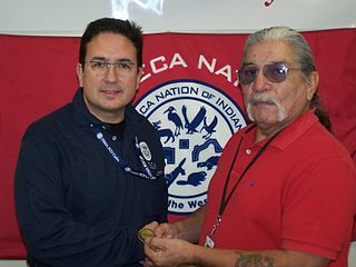
The Seneca Nation of Indians is a federally recognized Seneca tribe based in western New York. They are one of three federally recognized Seneca entities in the United States, the others being the Tonawanda Band of Seneca and the Seneca-Cayuga Nation of Oklahoma. Some Seneca also live with other Iroquois peoples on the Six Nations of the Grand River in Ontario.
Sunset Bay is a hamlet and census-designated place (CDP) in the town of Hanover in Chautauqua County, New York, United States. The population was 660 at the 2010 census.
