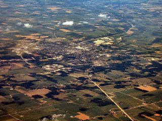
Silver Springs State Fish and Wildlife Area is an Illinois state park on 1,350 acres (550 ha) in Kendall County, Illinois, United States. The park was established in the late 1960s and is named for the natural spring within its boundaries. The park has two artificial lakes and the Fox River flows through the northern end of the park. Silver Springs hosts a variety of activities including fishing, hunting, boating and hiking. The park has areas of native prairie restoration, a sledding hill and a seven-mile (11 km) equestrian trail. The prairie restoration areas hold many species of plants including lead plant, and purple coneflower.

Bear Rock Lakes Wildlife Management Area is a 242-acre (98 ha) protected area located in Ohio County, West Virginia, about 8 miles (13 km) east of Wheeling. The terrain at Bear Rock Lakes is rolling hills covered by a combination of hardwood forest and open fields.

Hidden Valley Wildlife Management Area is a 6,400-acre (26 km2) Wildlife Management Area in Washington County, Virginia, along its border with Russell County. The area is typified by mountainous mature hardwood forests that have regenerated on land logged in the early twentieth century; a number of small openings which are also maintained as habitat for local wildlife. Its elevation ranges from 2,000 to 4,000 feet above sea level. At the head of the valley is the 60-acre (24 ha) Hidden Valley Lake, which serves as the source of Brumley Creek.
Chief Cornstalk Wildlife Management Area is located on 11,772 acres (4,764 ha) in Mason County near Southside, West Virginia. Second growth oak-hickory and mixed hardwoods forests cover much of the rolling and moderately steep slopes. Chief Cornstalk WMA can be reached either on Nine Mile Creek Road off US 35 near Southside, or by Crab Creek Road from State Route 2, south of Gallipolis Ferry.

Conaway Run Lake Wildlife Management Area is located on 630 acres (250 ha) in Tyler County near Middlebourne, West Virginia. Mixed hardwoods forests and brush cover much of the hillsides surrounding the 30-acre Conaway Run Lake. Conaway Run Lake WMA can be reached on Conaway Run Road off West Virginia Route 18, about 10 miles (16 km) south of Middlebourne.

Frozen Camp Wildlife Management Area is located on 2,587 acres (1,047 ha) in Jackson County near Ripley, West Virginia. The hilly terrain is mostly covered with second-growth mixed hardwoods, with some open creek bottoms and ridgetops.

Horse Creek Wildlife Management Area is located in Wyoming County near Pineville, West Virginia. Located on 47.9 acres (19.4 ha) that includes a small lake, the open fields of the WMA are bordered by steep hardwood forest.

Pleasant Creek Wildlife Management Area is located near Philippi, West Virginia in Barbour and Taylor counties. Located on 3,030 acres (1,230 ha) land that varies from wetlands to steeply forested woodlands, the Pleasant Creek WMA rises to an elevation of 1,600 feet (490 m).

Sleepy Creek Wildlife Management Area is located in Morgan and Berkeley Counties in West Virginia's Eastern Panhandle. It encompasses 22,928 acres (92.79 km2), mostly covered with mixed oak and pine forest, although about 3,500 acres (14 km2) are covered with mixed hardwoods. The 205-acre (83 ha) Sleepy Creek Lake is located entirely within the WMA.

Teter Creek Lake Wildlife Management Area is located about 6 miles (9.7 km) northeast of Belington in Barbour County, West Virginia. It is located on 137 acres (55 ha) of sloping terrain along the shores of Teter Creek Lake.

Tug Fork Wildlife Management Area (WMA) is located about 10 miles northwest of Welch, West Virginia in McDowell County. Tug Fork WMA is located on 2,165 acres (876 ha) of steep terrain along hills above the Tug Fork River. The WMA is heavily forested, primarily with mixed hardwoods and yellow poplar/black cherry forests in the coves. The WMA is accessed from U.S. Route 52 at Premier. Several tracks and jeep trails provide walking access into the Tug Fork WMA from U.S. Route 52.

Woodrum Lake Wildlife Management Area, is located about 3 miles (4.8 km) east of Romance, West Virginia in Jackson County. Woodrum Lake WMA is located on 1,696 acres (686 ha) of hilly oak-hickory hardwood lots mixed with abandoned farmland.
Willow Slough Fish and Wildlife Area is an area dedicated to providing hunting and fishing opportunities while maintaining 9,956 acres (40.29 km2), 1,800 of which are open water, marshes, and flooded crop land. It is located at 2042 S. 500 W., Morocco, Indiana.

J. Edward Roush Lake is a reservoir in Huntington, Indiana. The lake is found at an elevation of 748 feet (228 m).

Lake Charles State Park is a 140-acre (57 ha) Arkansas state park in Lawrence County, Arkansas in the United States. Situated in The Ozarks along the Black River, the park features the 645-acre (261 ha) artificial Lake Charles. The lake is a result of a partnership of four agencies to construct a multipurpose lake just north of Shirey Bay Rainey Brake Wildlife Management Area in an effort to control flooding and preserve the watershed. Construction on the lake began in 1964, and the park was dedicated in 1967.

Winamac Fish and Wildlife Area is a protected area dedicated to providing hunting and fishing opportunities while maintaining 4,770 acres (1,930 ha) of oak forest and upland fields. It is located on U.S. Route 35, north of Winamac, Indiana.
Kingsbury Fish and Wildlife Area is a protected area that covers 7,120 acres (2,880 ha) of grasslands, wetlands, and crop fields dedicated to providing hunting and fishing opportunities. It is located south on County Road 650W, near Kingsbury, Indiana.
LaSalle Fish and Wildlife Area is a protected area that covers 3,797 acres (1,537 ha) dedicated to providing hunting and fishing opportunities. It is located south on County Road 650W, near Lake Village, Indiana on the Kankakee River.
Tri-County Fish and Wildlife Area is a protected area that covers 3,569 acres (1,444 ha) and is dedicated to providing hunting and fishing opportunities for the public. It is located between Indiana State Road 13 and State Route 5, northeast of Warsaw, IN.
Pigeon River Fish and Wildlife Area is a protected area that covers 12,134 acres (4,910 ha) and is dedicated to providing hunting and fishing opportunities. The area includes 529 acres (214 ha) of lakes and 17 miles (27 km) along the Pigeon River. It is located on Indiana State Road 3, near Mongo in Lagrange County, Indiana. The Fish and Wildlife Area contains Tamarack Bog Nature Preserve, a 150-acre (61 ha) wetland parcel that has been designated as a National Natural Landmark.