Queens is a borough of New York City, coextensive with Queens County, in the U.S. state of New York. Located on Long Island, it is the largest New York City borough by area. It is bordered by the borough of Brooklyn at the western tip of Long Island, with Nassau County to its east. Queens shares water borders with the boroughs of Manhattan, the Bronx, and Staten Island and with New Jersey.

The Bronx Kill is a narrow strait in New York City delineating the southernmost extent of the Bronx. It separates the Bronx from Randalls Island. It connects the Harlem River to the East River.

Dunwoodie is a neighborhood in Yonkers, New York, noted for being the home of St. Joseph's Seminary and College on Valentine Hill. Dunwoodie (proper) is located north of the Seminary, while Dunwoodie Heights includes the seminary and what is south of it. Dunwoodie also includes Yonkers' "Little Italy" and a public golf course.

Manhattan Valley is a neighborhood in the northern part of Upper West Side in Manhattan, New York City. It is bounded by West 110th Street to the north, Central Park West to the east, West 96th Street to the south, and Broadway to the west.
Thomas A. Edison Career and Technical Education High School is a public secondary school in Queens's Jamaica Hills community in New York City. It is one of the few public high schools in New York City to offer vocational training programs as well as traditional college preparatory tracks and well known for its largely male population. The school is operated by the New York City Department of Education.

Ocean Hill is a subsection of Bedford–Stuyvesant in the New York City borough of Brooklyn. The neighborhood is part of Brooklyn Community Board 16 and was founded in 1890. The ZIP code for the neighborhood is 11233. Ocean Hill's boundaries start from Broadway and the neighborhood of Bushwick in the north, Ralph Avenue and the neighborhoods of Bedford-Stuyvesant proper and Crown Heights to the west, East New York Avenue and the neighborhood of Brownsville to the south, and Van Sinderen Avenue and the neighborhood of East New York to the east.

The Outer Barrier, also known as the Long Island and New York City barrier islands, refers to the string of barrier islands that divide the lagoons south of Long Island, New York from the Atlantic Ocean. These islands include Long Beach Barrier Island, Barnum Island, Jones Beach Island, Fire Island and Westhampton Island. The outer barrier extends 75 miles (121 km) along the South Shore of Long Island, from the Rockaway Peninsula in New York City to the east end of Shinnecock Bay in Suffolk County.

Rochdale Village is a housing cooperative and neighborhood in the southeastern corner of the New York City borough of Queens. Located in Community District 12, Rochdale Village is grouped as part of Greater Jamaica, corresponding to the former Town of Jamaica. It is adjacent to four other Queens neighborhoods: St. Albans to the east, South Jamaica to the west, Locust Manor to the north, and Springfield Gardens to the south across the Belt Parkway. Rochdale is about 2 miles (3.2 km) from the Queens/Nassau border and about 1 mile (1.6 km) north of John F. Kennedy International Airport.

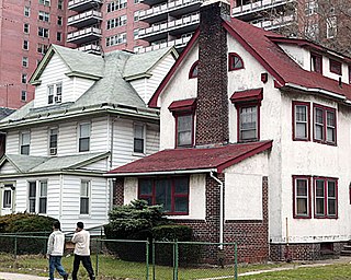
Jamaica Estates is a neighborhood in the New York City borough of Queens. Jamaica Estates is part of Queens Community District 8 and located in the northern portion of Jamaica. It is bounded by Union Turnpike to the north, Hillside Avenue to the south, Utopia Parkway and Homelawn Street to the west, and 188th Street to the east. The main road through the neighborhood is Midland Parkway.
Locust Manor is a neighborhood in the New York City borough of Queens. It is bordered on the north by Baisley Boulevard to Irwin Place to Roe Road to 120th Avenue, on the east by the tracks of the Long Island Rail Road to 121st Avenue to Farmers Boulevard, on the south by North Conduit Boulevard, and on the west by Guy R. Brewer Boulevard to 137th Avenue to 173rd Street to 134th Road to Bedell Street. Nearby neighborhoods include Jamaica, South Jamaica, and Rochdale Village. Locust Manor, which was named after a 1906 residential development in the area, was formerly the location of the Jamaica Race Course, which operated from 1903 to 1959, and was torn down in 1960 in order to construct Rochdale Village.

Union Turnpike is a thoroughfare stretching across part of Long Island in southern New York state, mostly within central and eastern Queens in New York City. It runs from Myrtle Avenue in Glendale, Queens, to Marcus Avenue in North New Hyde Park, Nassau County, about 1 mile (1.6 km) outside New York City border.

The East Bronx is the part of the New York City borough of the Bronx which lies east of the Bronx River; this roughly corresponds to the eastern half of the borough. Neighborhoods include: Baychester, Castle Hill, City Island, Co-op City, Country Club, Eastchester, Edenwald, Edgewater Park, Harding Park, Morris Park, Parkchester, Pelham Bay, Pelham Parkway, Soundview, Throggs Neck, Van Nest, Wakefield, Westchester Square, and Williamsbridge.
The West Side of Manhattan refers to the side of Manhattan Island that abuts the Hudson River and faces the U.S. state of New Jersey. The West Side is home to several famed New York City locations, including Fifth Avenue, Central Park, and lower Broadway. The major neighborhoods on the West Side are Inwood, Hudson Heights, Washington Heights, West Harlem, Morningside Heights, Manhattan Valley, Upper West Side, Hell's Kitchen, Chelsea, West Village, SoHo, and Tribeca. The 8th Avenue and West Side subway lines connect all parts of the West Side.

Since its founding in 1625 by Dutch traders as New Amsterdam, New York City has been a major destination for immigrants of many nationalities who have formed ethnic enclaves, neighborhoods dominated by one ethnicity. Freed African American slaves also moved to New York City in the Great Migration and the later Second Great Migration and formed ethnic enclaves. These neighborhoods are set apart from the main city by differences such as food, goods for sale, or even language. Ethnic enclaves provide inhabitants security in work and social opportunities, but limit economic opportunities, do not encourage the development of English speaking, and keep immigrants in their own culture.

Gun Hill Road is a major thoroughfare in the New York City borough of the Bronx. The road stretches for 3.5 miles (5.6 km) from Mosholu Parkway in Norwood to Stillwell Avenue in Baychester, near an exit for the Hutchinson River Parkway. Van Cortlandt Park and the Mosholu Golf Course are both located at the western terminus of Gun Hill Road.

White Plains Road is a major north-south thoroughfare which runs the length of the New York City borough of the Bronx. It runs from Castle Hill and Clason Point in the south to Wakefield in the north, where it crosses the city line and becomes West 1st Street of Mount Vernon, New York. The Bronx River Parkway lies to its west and parallels much of its route. Between Magenta Street & 217th Street, White Plains Road is very wide due to the presence of the Gun Hill Road station house in the road's median.

The Heights of Guan is a historical name given to a series of hills extending in a ridge along western Long Island in New York State. The ridge extends in an east-northeast direction across the modern-day New York City boroughs of Brooklyn and Queens, with hills varying in height from 100 to 150 feet. The southern slope of the ridge has a relatively steep drop and the northern slope is more gradual. Further to the south is an outwash plain bordered by the Atlantic Ocean. Geologically, the ridge is part of the Harbor Hill Moraine formed 13,000 to 12,000 years ago during the Wisconsin glaciation.

Midtown South is a macro-neighborhood of the borough of Manhattan in New York City, generally characterized as constituting the southern portion of Midtown Manhattan. Midtown Manhattan hosts over 700,000 daily employees as a busy hub for workers, residents, and tourists. The Empire State Building, the Flatiron Building, Pennsylvania Station, Madison Square Garden, the Macy's Herald Square flagship store, Koreatown, and NYU Langone Medical Center are all located in Midtown South.
Foch Sitting Area is a 0.051-acre (210 m2) green public space in the South Jamaica neighborhood of Queens, New York, at the southeast corner of Foch Boulevard and the northbound service road of the Van Wyck Expressway. Like the adjacent Foch Boulevard, it is named after Ferdinand Foch, Marshal of France in World War I. The road, running between South Ozone Park and South Jamaica, was named following its completion in 1919.