
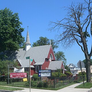
Jamaica is a neighborhood in the New York City borough of Queens. It is mainly composed of a large commercial and retail area, though part of the neighborhood is also residential. Jamaica is bordered by Hollis to the east; St. Albans, Springfield Gardens, Rochdale Village to the southeast; South Jamaica to the south; Richmond Hill and South Ozone Park to the west; Briarwood to the northwest; and Kew Gardens Hills, Jamaica Hills, and Jamaica Estates to the north.

The Belt Parkway is the name given to a series of controlled-access parkways that form a belt-like circle around the New York City boroughs of Brooklyn and Queens. The Belt Parkway comprises three of the four parkways in what is known as the Belt System: the Shore Parkway, the Southern Parkway, and the Laurelton Parkway. The three parkways in the Belt Parkway are a combined 25.29 miles (40.70 km) in length. The Cross Island Parkway makes up the fourth parkway in the system, but is signed separately.
Queens Village is a mostly residential middle class neighborhood in the eastern part of the New York City borough of Queens. It is bound by Hollis to the west, Cambria Heights to the south, Bellerose to the east, and Oakland Gardens to the north.

The Cross Island Parkway is a controlled-access parkway in New York City, part of the Belt System of parkways running along the perimeter of the boroughs of Queens and Brooklyn. The Cross Island Parkway runs 10.6 miles (17.1 km) from the Whitestone Expressway in Whitestone past the Throgs Neck Bridge, along and across the border of Queens and Nassau County to meet up with the Southern State Parkway, acting as a sort of separation point which designates the limits of New York City. The road is designated as New York State Route 907A (NY 907A), an unsigned reference route, and bears the honorary name 100th Infantry Division Parkway.

Rosedale is a neighborhood in New York City in the southeastern portion of the borough of Queens. The neighborhood, located along the southern part of Queens, borders Nassau County.
The IND Queens Boulevard Line, sometimes abbreviated as QBL, is a line of the B Division of the New York City Subway in Manhattan and Queens, New York City, United States. The line, which is underground throughout its entire route, contains 23 stations. The core section between 50th Street in Hell's Kitchen, Manhattan, and 169th Street in Jamaica, Queens, was built by the Independent Subway System (IND) in stages between 1933 and 1940, with the Jamaica–179th Street terminus opening in 1950. As of 2015, it is among the system's busiest lines, with a weekday ridership of over 460,000 people.
South Jamaica is a residential neighborhood in the borough of Queens in New York City, located south of downtown Jamaica. Although a proper border has not been established, the neighborhood is a subsection of greater Jamaica bounded by the Long Island Rail Road Main Line tracks, Jamaica Avenue, or Liberty Avenue to the north; the Van Wyck Expressway on the west; Rockaway Boulevard on the south; and Merrick Boulevard on the east, adjoining the neighboring community of St. Albans. Other primary thoroughfares of South Jamaica include Baisley, Foch, Linden, Guy R. Brewer, and Sutphin Boulevards. The 180th Street Business Improvement District is responsible for the development of the area.
Springfield Gardens is a neighborhood in the southeastern area of the New York City borough of Queens, bounded to the north by St. Albans, to the east by Laurelton and Rosedale, to the south by John F. Kennedy International Airport, and to the west by Farmers Boulevard. The neighborhood is served by Queens Community Board 12. The area, particularly east of Springfield Boulevard, is sometimes also referred to as Brookville.

The Jamaica–179th Street station is an express terminal station on the IND Queens Boulevard Line of the New York City Subway. Located under Hillside Avenue at 179th Street in Jamaica, Queens, it is served by the F train at all times and the <F> train during rush hours in the reverse peak direction. The station has 15 entrances, including two at Midland Parkway in Jamaica Estates.

Union Turnpike is a thoroughfare stretching across part of Long Island in southern New York state, mostly within central and eastern Queens in New York City. It runs from Myrtle Avenue in Glendale, Queens, to Marcus Avenue in North New Hyde Park, Nassau County, about 1 mile (1.6 km) outside New York City border.

Francis Lewis Boulevard is a boulevard in the New York City borough of Queens. The roadway is named for Francis Lewis, a Queens resident who was a signer of the United States Declaration of Independence. The boulevard zigzags across Queens by including segments of several other roadways that were renamed to become parts of the boulevard.

The Q27 bus route constitutes a public transit line in Queens, New York City, running primarily along 46th Avenue, Rocky Hill Road and Springfield Boulevard between a major bus-subway hub in Flushing and Cambria Heights. The route is operated by MTA Regional Bus Operations under the New York City Transit brand.

Springfield Boulevard is a major north/south roadway that runs through the eastern section of Queens, New York. It is 7.8 miles (12.6 km) long and goes from Northern Boulevard in Bayside, to 147th Avenue in Springfield Gardens. Springfield Boulevard runs through Bayside, Oakland Gardens, Queens Village, Cambria Heights, Laurelton, Springfield Gardens and along the eastern border of St. Albans. The name "Springfield," derived from the Springfield Armory, is one of several firearms-oriented street names in the area. This is the result of the National Rifle Range having been situated on the grounds of what is now Creedmoor State Hospital during the 19th and early 20th centuries.
The Queens Community Board 8 is a local government in the New York City borough of Queens, encompassing the neighborhoods of Briarwood, Cunningham Heights, Flushing South, Fresh Meadows, Hillcrest, Hilltop Village, Holliswood, Jamaica Estates, Jamaica Hills, Kew Gardens Hills, Pomonok, and Utopia. It is delimited by the Long Island Expressway to Hillside Avenue and from the Van Wyck Expressway to the Clearview Expressway.
The Queens Community Board 13 is a local government in the New York City borough of Queens, encompassing the neighborhoods of Queens Village, Glen Oaks, Bellerose, Cambria Heights, Laurelton, Rosedale, Meadowmere, Floral Park and Brookville. It is bounded to the north by the Grand Central Parkway, to the east by the Nassau County border, to the south by Nassau County and John F. Kennedy International Airport and to the west by Francis Lewis Boulevard. The area has a population of 196,284, which is made up of roughly 60% Black, 10% Caucasian, 12% Asian and 12% Hispanic residents.
Conduit Avenue is an arterial road in New York City, the vast majority of which is in Queens. The divided highway runs from Atlantic Avenue in Cypress Hills, Brooklyn to Hook Creek Boulevard in Rosedale, Queens at the Nassau County border. The thoroughfare is named after an aqueduct in its right-of-way.
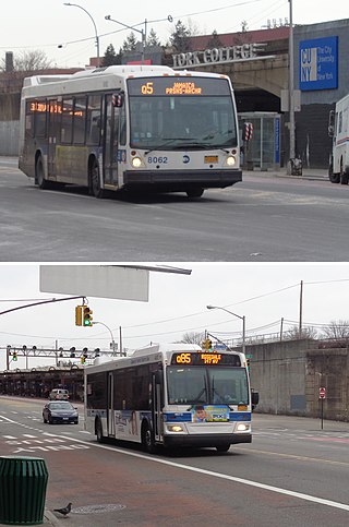
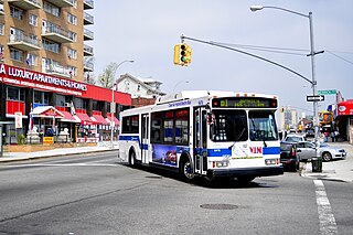
The Q5 and Q85 bus routes constitute a public transit corridor running along Merrick Boulevard in southeastern Queens, New York City. The routes run from the Jamaica Center transit hub and business district to Rosedale, with continued service to Green Acres Mall in Valley Stream, Nassau County. The Q4 and Q84 buses also serve the northern portion of the corridor, before diverging east along Linden Boulevard and 120th Avenue respectively. The Q4, Q5, and Q85 also provide limited-stop service along the corridor. The routes on the corridor mainly serve as feeder routes to New York City Subway services at Jamaica Center–Parsons/Archer station.

Spring Creek Park is a public park along the Jamaica Bay shoreline between the neighborhoods of Howard Beach, Queens, and Spring Creek, Brooklyn, in New York City. Created on landfilled former marshland, the park is mostly an undeveloped nature preserve, with only small portions accessible to the public for recreation.
The Q1, Q36, and Q43 bus routes constitute a public transit line in Queens, New York City. The routes run primarily along Hillside Avenue from the Jamaica, Queens commercial and transportation hub towards several eastern Queens neighborhoods on the city border with Nassau County. Originally operated by the North Shore Bus Company until 1947, all three routes are now operated by MTA Regional Bus Operations under the New York City Transit brand.
Holliswood is an affluent residential neighborhood located on the Harbor Hill Moraine in the east-central portion of the borough of Queens, New York City. Bounded to the north by the Grand Central Parkway, to the west by 188th Street to the south by Hillside Avenue and to the east by Francis Lewis Boulevard.

