| Jarretts, Indiana | |
|---|---|
| Unincorporated community | |
 Jarretts  Jarretts | |
| Coordinates: 38°07′16″N87°21′29″W / 38.12111°N 87.35806°W Coordinates: 38°07′16″N87°21′29″W / 38.12111°N 87.35806°W | |
| Country | United States |
| State | Indiana |
| County | Warrick |
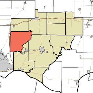
| Township | Campbell |
| Elevation [1] | 459 ft (140 m) |
| Time zone | Central (CST) (UTC-6) |
| • Summer (DST) | CDT (UTC-5) |
| ZIP code | 47613 |
| Area code(s) | 812, 930 |
| GNIS feature ID | 452124 |
Jarretts is an unincorporated community in Campbell Township, Warrick County, in the U.S. state of Indiana. [2]
Campbell Township is one of ten townships in Warrick County, Indiana, United States. As of the 2010 census, its population was 906 and it contained 353 housing units.

Warrick County is a county located in the U.S. state of Indiana. As of 2010, the population was 59,689. The county seat is Boonville. It was organized in 1813 and was named for Captain Jacob Warrick, an Indiana militia company commander killed in the Battle of Tippecanoe in 1811. It is one of the ten fastest-growing counties in Indiana.

In the United States, a state is a constituent political entity, of which there are currently 50. Bound together in a political union, each state holds governmental jurisdiction over a separate and defined geographic territory and shares its sovereignty with the federal government. Due to this shared sovereignty, Americans are citizens both of the federal republic and of the state in which they reside. State citizenship and residency are flexible, and no government approval is required to move between states, except for persons restricted by certain types of court orders. Four states use the term commonwealth rather than state in their full official names.


