Leavenworth is the county seat and largest city of Leavenworth County, Kansas, United States. As of the 2010 census, the city population was 35,251. Located on the west bank of the Missouri River. The site of Fort Leavenworth, built in 1827, the city became known in American history for its role as a key supply base in the settlement of the American West. It is important in nineteenth-century African-American history. During the American Civil War, many volunteers joined the Union Army from Leavenworth. In 1866, the 10th Regiment of Cavalry, an all-black unit within the U.S. Army, was stood up at Fort Leavenworth. The city has been notable as the location of several prisons, particularly the United States Disciplinary Barracks and United States Penitentiary, Leavenworth.

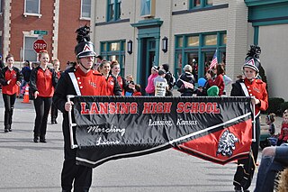
Lansing is a city in Leavenworth County, Kansas, United States. It is situated along the west side of the Missouri River and Kansas-Missouri state border. As of the 2010 census, the city population was 11,265. It is the second most populous city of Leavenworth County and is a part of the Kansas City metropolitan area.

Kansas City is the third-largest city in the State of Kansas, the county seat of Wyandotte County, and the third-largest city of the Kansas City metropolitan area. Kansas City, Kansas is abbreviated as "KCK" to differentiate it from Kansas City, Missouri, after which it is named. It is part of a consolidated city-county government known as the "Unified Government". Wyandotte County also includes the independent cities of Bonner Springs and Edwardsville. As of the 2010 census, the city had a population of 145,786 residents. It is situated at Kaw Point, which is the junction of the Missouri and Kansas rivers.

Argentine is a community of Kansas City, Kansas, located in the southern part of Wyandotte County. It is bordered on the west by the Turner community, on the east by the Rosedale community, on the south by Johnson County, and on the north by Armourdale community and by the Kansas River.

The Crossroads is a neighborhood within Greater Downtown. It is centered at approximately 19th Street and Baltimore Avenue, directly south of the Downtown Loop and north of Crown Center. It is the city's main art gallery district and center for the visual arts. Dozens of galleries are located in its renovated warehouses and industrial buildings. It is also home to numerous restaurants, housewares shops, architects, designers, an advertising agency, and other visual artists. The district also has several live music venues.
Stilwell is an unincorporated community in Johnson County, Kansas, United States, and part of the Kansas City Metropolitan Area.
State Line Road is a major north–south street in the Kansas City Metropolitan Area that runs along the Kansas–Missouri state line. It runs 12.5 miles (20 km) from Chester Avenue in the north, crossing U.S. Highway 56 a couple of miles from the northern end and continuing south to the intersection of 135th St. in Kansas, Missouri Route 150 in the South. It continues north as Eaton St. and continues south as Kenneth Rd., both in Kansas. Its northernmost point is roughly 3/4 mile (1.25 km) south of Interstate 35. It is the dividing line between Kansas and Missouri for most of the Kansas City metro area south of the confluence of the Kansas and Missouri rivers. Cities along the road include Kansas City, Missouri, Kansas City, Kansas, and several smaller communities in Kansas such as Leawood, Mission Hills, Prairie Village, and Westwood Hills.
The Women's Eastern Reception, Diagnostic and Correctional Center (WERDCC) is a prison in Vandalia, Missouri, in the United States. It is a part of the Missouri Department of Corrections.
Piper is a neighborhood within Kansas City, Kansas, United States. It was formerly an unincorporated semi-rural area, similar to Turner, before Piper was annexed.

Swope Park is an 1,805-acre city park in Kansas City, Missouri. It is the 51st-largest municipal park in the United States, and the largest park in Kansas City. It is named in honor of Colonel Thomas H. Swope, a philanthropist who donated the land to the city in 1896.

Ward Parkway is a boulevard in Kansas City, Missouri, United States, near the Kansas-Missouri state line. Ward Parkway begins at Brookside Boulevard on the eastern edge of the Country Club Plaza and continues westward along Brush Creek as U.S. Route 56 until it turns southward across the creek just before the Kansas-Missouri state line. It then continues south for four miles, terminating at Wornall Road near West 95th Street.

Legends Outlets Kansas City, formerly The Legends at Village West, is a super-regional shopping mall located in the Village West development near Kansas City, Kansas, located in the latent township Kansas City, Kansas. The mall has a gross leasable area of 1,200,000 square feet (110,000 m2).
The Kansas City Irish Center, formerly known as the Irish Center of Kansas City, is a non-profit organization currently transitioning to a new location in historic Drexel Hall, 3301 Baltimore, KCMO. The Center opened in Union Station on March 17, 2007. The Center's mission encourages knowledge and appreciation of the Irish and Irish-American community, culture, history, and heritage in the greater Kansas City area and region.
The Silverstein Eye Centers Arena is a 5,800-seat multi-purpose arena in Independence, Missouri, United States. It was opened in November 2009. It currently hosts the home games of the Kansas City Mavericks in the ECHL and the Kansas City Comets of the Major Arena Soccer League. The center will host more than 100 events every year, with a very large spectrum of its events including: trade shows, professional sporting events, festivals, community events, concerts and its primary tenant, Kansas City Mavericks.

Rosedale, Kansas is a community of Kansas City, Kansas, in the southeast corner of Wyandotte County and bordered on the north by the Kansas River and the Armourdale neighborhood, on the south by Johnson County, on the west by the Argentine neighborhood, and on the east by the state of Missouri. It is home to the Rosedale World War I Memorial Arch and the University of Kansas Medical Center.
The 1995 Kansas City Royals season was a season in American baseball. During this season, the Royals finished second in the American League Central, with a record of 70 wins and 74 losses. This was the first of 17 losing seasons the Royals would suffer through 2012.
Volker is a historic neighborhood in Kansas City, MO that lies just northwest of the Westport historic and entertainment district. The 39th Street West District and the Old Westport Shopping Center lie within the Volker neighborhood. The boundaries of the Volker Neighborhood are 31st Street on the north and Westport Road/43rd Street on the south. The western boundary is State Line Road. On the east, the boundaries are Roanoke Road on the north side of 39th and Southwest Trafficway south of 39th.
Village West is a $1,200,000,000, 1,500-acre (6.1 km2) retail, dining and entertainment development that opened in 2002 in Kansas City, Kansas. It is located at the intersection of Interstates 70 and 435. Village West is the most popular tourist destination in the state, and has significantly fueled growth in KCK and Wyandotte County.
Fairmount is an unincorporated community in Leavenworth County, Kansas, USA.
Delaware City is a ghost town in Leavenworth County, in the U.S. state of Kansas.


