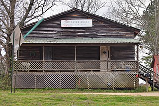
Fort Morgan, also known as Fort Bowyer, is an unincorporated community in Baldwin County, Alabama, United States. It is west of Gulf Shores on Mobile Point. Mobile Point extends from Gulf Shores to the west, towards historic Fort Morgan at the tip of the peninsula.

Dixons Mills is an unincorporated community in Marengo County, Alabama, United States. The community was named for a group of mills operated by Joel B. Dixon in the 19th century. Dixons Mills has a post office utilizing the 36736 ZIP code.

Alberta is an unincorporated community in Wilcox County, Alabama, United States.
Maysville, also known as Mayville, is an unincorporated community in eastern Madison County, Alabama, United States. Maysville borders Ryland to the West, and is close to the Town of Gurley to the East
Clopton is an unincorporated community and census-designated place (CDP) in Dale County, Alabama, United States. Clopton is located on Alabama State Route 105, 10.9 miles (17.5 km) west-northwest of Abbeville.
Skipperville is an unincorporated community in Dale County, Alabama, United States. Skipperville is located on Alabama State Route 105, 8.8 miles (14.2 km) northeast of Ozark. Skipperville has a post office with ZIP code 36374, which opened on November 10, 1853.This community also consists of G.W. Long School, which has won a 2a state championship for baseball in many previous years. This school also has other sports teams with state wide victories.
Veto is an unincorporated community in northern Limestone County, Alabama, United States.

Stroud is an unincorporated community in Chambers County, Alabama, United States, located along U.S. Route 431. Stroud was home to James Wyly Grady, who served in the Alabama Legislature. A post office operated under the name Stroud from 1882 to 1957.
Ada is an unincorporated community in Montgomery County, Alabama, United States. Ada is located at the intersection of U.S. Route 331 and Alabama State Route 94, 20 miles (32 km) south of Montgomery.
Stewart, also known as Stewart's Station, is an unincorporated community in Hale County, Alabama, United States.
Hamburg, also known as Hamburgh or Hamburg Station, is an unincorporated community in Perry County, Alabama, United States. A post office operated under the name Hamburg from 1833 to 1941.
Landersville is an unincorporated community in Lawrence County, Alabama, United States, located 6.2 miles (10.0 km) west of Moulton.
Dundee is an unincorporated community in Geneva County, Alabama, United States. It is located on Alabama State Route 123, and is now included in the city limits of Hartford.
Antioch, also known as Hilton, is an unincorporated community in Covington County, Alabama, United States.

Falco, also spelled Falko, is an unincorporated community in Covington County, Alabama, United States. The community lies entirely within the Conecuh National Forest.
Ardilla is an unincorporated community in Houston County, Alabama, United States. Ardilla is located along Alabama State Route 53, 1 mile southeast of Ross Clark Circle in Dothan.
Arguta is an unincorporated community in Dale County, Alabama, United States.
Asbury is an unincorporated community in Dale County, Alabama, United States.
Echo, also known as Marshalls Cross Roads, is an unincorporated community in Dale County, Alabama, United States. Echo is located on Alabama State Route 27, 10.4 miles (16.7 km) east of Ozark.
Ewell is an unincorporated community in Dale County, Alabama, United States. Ewell is located on Alabama State Route 27, 3.0 miles (4.8 km) southeast of Ozark.


