
Dhule is a city located in the Dhule District in the northwestern part of Maharashtra state, India known as West Khandesh. Situated on the banks of Panzara River, Dhule is the regional headquarters of MIDC, RTO, and MTDC.

Ratnagiri District is a district in the state of Maharashtra, India. The administrative headquarter of the district is located in the town of Ratnagiri. The district is 11.33% urban. The district is bounded by the Arabian Sea to the west, Sindhudurg district to the south, Raigad district to the north and Satara, Sangli and Kolhapur districts to the east. This district is part of Konkan division.

Nandurbar district is an administrative district in the northwest corner of Maharashtra state in India. On 1 July 1998 Dhule was bifurcated as two separate districts now known as Dhule and Nandurbar. Nandurbar is a tribal-dominated district, The district headquarters are located at Nandurbar city. The district occupies an area of 5,955 square kilometres (2,299 sq mi) and has a population of 1,648,295 of which 16.71% were urban.

Shahada is a town in Nandurbar district of the Indian state of Maharashtra. It is a Municipal council.

Bhusawal is a city in Jalgaon district of Maharashtra in India. It is the seat of its eponymous, Bhusawal taluka.
Jalgaon district is a district in Maharashtra, India. Its headquarters is the Jalgaon city.
Nashik Division is one of the six divisions of India's Maharashtra state and four of its five districts form Uttar Maharashtra. The three northernmost districts of Uttar Maharashtra form most of the historic Khandesh region which covers the northern part of the division in the valley of the Tapti River. Nashik Division is bound by Konkan Division and the state of Gujarat to the west, Madhya Pradesh state to the north, Amravati Division and Marathwada to the east, and Desh to the south.
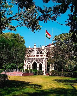
Dhule district is a district of Maharashtra, India. The city of Dhule is the administrative headquarters of the district. It is part of North Maharashtra.
Muktainagar is a town in Jalgaon district, Maharashtra, India. It is the administrative headquarter of its eponymous taluka. It is located in North Maharashtra region.
Dondaicha-Warwade is a town and consists of a municipal council in Sindkheda Taluka in the Dhule District of Khandesh Region in the state of Maharashtra in India.
Nandurbar is a city and a municipal council in Nandurbar district in the Indian state of Maharashtra. Nandurbar municipal corporation is the first municipal corporation. The District Nandurbar was formed from the district Dhule on July 1, 1998. Nandurbar is an administrative district in the northwest corner of of Maharashtra. On 1 July 1998 Dhule was bifurcated as two separate districts now known as Dhule and Nandurbar. The district headquarters is located at Nandurbar city. The district occupies an area of 5034 km2 and has a population of 1,311,709 of which 15.45% is urban. Nandurbar district is bounded to the south and south-east by Dhule district, to the west and north is the state of Gujarat, to the north and north-east is the state of Madhya Pradesh. The northern boundary of the district is defined by the great Narmada river. It came into limelight during February 2006 bird flu crisis which struck many of its poultry farms. Thousand of chickens from the farms had to be killed and buried in nearby grounds to stop the virus spreading.
Yawal is a taluka, city and a municipal council in Jalgaon, Maharashtra, India.
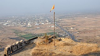
Parola is a city and a municipal council in Jalgaon district in the Indian state of Maharashtra. It is located on the Hajira (Surat)–Dhule–Kolkata national highway 6. The municipal council was established by the British government before the independence of India. This City is centuries old known for the two main features such as the Shree Balaji Temple and The Parola fort Also known as the native of Rani Laxmibai of Jhansi. City and Fort Build by Jahagirdar Sadashiv Rao Damodar Newalkar the great grandfather in law of Rani Lakshmibai Jhansi.
The Farooqi dynasty or the Farooq Shahi was the ruling dynasty of the Khandesh Sultanate from its inception in 1382 till its annexation by the Mughal emperor Akbar in 1601. The founder of the dynasty, Malik Ahmad participated in a rebellion against the Bahmani ruler Muhmmad Shah I in his early years. When he was compelled to flee from Deccan, he established in Thalner on the Tapti River. After receiving the grant of the fiefdoms of Thalner and Karanda from Firuz Shah Tughluq in 1370, he conquered the region around Thalner, which later became known as Khandesh. By 1382, he started ruling independently.

Bhusawal railway division is one of the five railway divisions of the Central Railway (India) zone of Indian Railways, located at Bhusawal in the Jalgaon district of Maharashtra state in western India. The other railway divisions are: Mumbai CSMT, Nagpur, Solapur and Pune. There are 115 railway stations in the Bhusawal railway division.

Khandesh is a geographic region in Maharashtra, India. It was made up of present Jalgaon, Dhule and Nandurbar districts. It also said that Burhanpur District of Madhya Pradesh was also its part.
Ghodasgaon is a village in Muktainagar taluka of Jalgaon district in Maharashtra. It is located near the Purna River in Muktainagar.
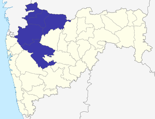
North Maharashtra is a geographical region of Maharashtra State, India. The region is composed of Nashik, Dhule, Nandurbar, and Jalgaon districts. It borders the state of Gujarat to the northwest, Paschim Maharashtra to the south, Konkan to the west, and the Vidarbha and Marathwada regions of Maharashtra to the east.
Bhusawal taluka is a taluka in the Jalgaon district of Maharashtra, India. It is situated in North Maharashtra. Named after its largest city, Bhusawal, it has 50 villages and four towns.
