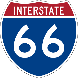
Interstate 66 (I-66) is an east–west Interstate Highway in the eastern United States. The highway runs from an interchange with I-81 near Middletown, Virginia, on its western end to an interchange with U.S. Route 29 (US 29) in Washington, D.C., at the eastern terminus. Much of the route parallels US 29 or State Route 55 (SR 55) in Virginia. I-66 has no physical or historical connection to the famous US 66, which was located in a different region of the United States.

The Elizabeth River is a 6-mile-long (10 km) tidal estuary forming an arm of Hampton Roads harbor at the southern end of Chesapeake Bay in southeast Virginia in the United States. It is located along the southern side of the mouth of the James River, between the cities of Portsmouth, Norfolk, and Chesapeake. Forming the core of the Hampton Roads harbor, it is heavily supported by its tributaries which depend upon it.

Suffolk is an independent city in Virginia, United States. As of the 2020 census, the population was 94,324. It is the 10th-most populous city in Virginia, the largest city in Virginia by boundary land area as well as the 14th-largest in the country.

The Governor Harry W. Nice Memorial/Senator Thomas "Mac" Middleton Bridge, also known as the Potomac River Bridge, is a 1.7-mile (2.7 km), two-lane continuous truss bridge that spans the Potomac River between Newburg in Charles County, Maryland and Dahlgren in King George County, Virginia, United States. It is one of eight toll facilities operated by the Maryland Transportation Authority, and is one of two toll bridges over the Potomac River. The other, the privately owned Oldtown Low Water Toll Bridge, connects Maryland and West Virginia, far upstream. The new Nice Bridge opened to traffic in October 2022. Demolition of the original bridge began on March 21, 2023.

The Hampton Roads Bridge–Tunnel (HRBT) is a 3.5-mile (5.6 km)-long Hampton Roads crossing for Interstate 64 and U.S. Route 60. It is a four-lane facility comprising bridges, trestles, man-made islands, and tunnels under the main shipping channels for Hampton Roads harbor in the southeastern portion of Virginia in the United States.

The James River Bridge (JRB) is a four-lane divided highway lift bridge across the James River in the Commonwealth of Virginia. Owned and operated by the Virginia Department of Transportation, it carries U.S. Route 17 (US 17), US 258, and State Route 32 across the river near its mouth at Hampton Roads. The bridge connects Newport News on the Virginia Peninsula with Isle of Wight County in the South Hampton Roads region, and is the easternmost such crossing without a tunnel component.
The Virginia Department of Transportation (VDOT) is the agency of the state government responsible for transportation in the state of Virginia in the United States. VDOT is headquartered at the Virginia Department of Highways Building in downtown Richmond. VDOT is responsible for building, maintaining, and operating the roads, bridges, and tunnels in the commonwealth. It is overseen by the Commonwealth Transportation Board, which has the power to fund airports, seaports, rail, and public transportation.

The Benjamin Harrison Memorial Bridge is a vertical-lift bridge that spans the James River between Jordan's Point in Prince George County and Charles City County near Hopewell, Virginia. The bridge carries vehicle traffic of State Route 106 and State Route 156, and is owned by the Virginia Department of Transportation (VDOT). It is named after Benjamin Harrison V, a signer of the Declaration of Independence and a Governor of Virginia, who lived nearby at Berkeley Plantation.

The Jamestown Ferry is a free automobile and bus ferry service across a navigable portion of the James River in Virginia. It carries State Route 31, connecting Jamestown in James City County with Scotland Wharf in Surry County.

The Midtown Tunnel carries U.S. Highway 58 across the Southern Branch of the Elizabeth River in the South Hampton Roads area of Virginia, US. It links the cities of Portsmouth and Norfolk. Owned by the Virginia Department of Transportation (VDOT), it is operated and maintained by Elizabeth River Crossings under a 58-year public–private partnership concession agreement. Formerly a toll-free facility, open road tolling was implemented on February 1, 2014 by VDOT to help finance repairs and expansion to the tunnel.

The state highway system of the U.S. state of Virginia is a network of roads maintained by the Virginia Department of Transportation (VDOT). As of 2006, the VDOT maintains 57,867 miles (93,128 km) of state highways, making it the third-largest system in the United States.

Transportation in the Commonwealth of Virginia is by land, sea and air. Virginia's extensive network of highways and railroads were developed and built over a period almost 400 years, beginning almost immediately after the founding of Jamestown in 1607, and often incorporating old established trails of the Native Americans.
The Gilmerton Bridge, originally a twin bascule drawbridge, is now a vertical-lift bridge which spans the Southern Branch Elizabeth River in the City of Chesapeake in South Hampton Roads in southeastern Virginia. Completed in 1938, it carries U.S. Route 13 and US 460 and is part of Military Highway. The Gilmerton Bridge is operated by the City of Chesapeake.
The Lesner Bridge in Virginia Beach, Virginia connects the bay area to the Virginia Beach shore via Shore Drive — crossing the Lynnhaven Inlet at the mouth the Chesapeake Bay. The bridge lies approximately three miles from the southern terminus of the Chesapeake Bay Bridge-Tunnel. The first bridge in the same location, a draw-bridge, had been constructed in 1928, replaced in 1958 by what are now the eastbound lanes of a dual span. Westbound lanes were constructed as a parallel span in 1967.
The Barrett's Ferry Bridge, officially known as the Judith Stewart Dresser Bridge, is a fixed-span bridge which carries State Route 5 across the Chickahominy River between Charles City County and James City County in eastern Virginia. It connects popular tourism destinations of the James River Plantations with Colonial Williamsburg and Jamestown. The current bridge, which opened on January 24, 2009, replaced the deteriorating 70-year-old bridge.

U.S. Route 29 is a major north–south route in the Commonwealth of Virginia. It covers 248 miles (399 km) from the North Carolina border at the city of Danville to the Key Bridge in Washington, D.C. US 29 roughly bisects Virginia into eastern and western halves, and along with I-81 and US 11 in western Virginia, and I-85/95 as well as US 1 farther east, provides one of the major north–south routes through the Commonwealth.

State Route 125 is a primary state highway in the U.S. state of Virginia. Known as Kings Highway, the state highway has two sections that run a total of 5.73 miles (9.22 km) from SR 10 and SR 32 at Chuckatuck east to SR 337 at Driver within the independent city of Suffolk. SR 125 consists of a 2.69-mile (4.33 km) western section and a 3.04-mile (4.89 km) eastern section separated by a gap at the Nansemond River. This gap arose when the Kings Highway Bridge across the river was removed in 2008.

Interstate 64 (I-64) in the US state of Virginia runs east–west through the middle of the state from West Virginia to the Hampton Roads region, for a total of 299 miles (481 km). From the West Virginia state line to Chesapeake, it passes through the major cities of Lexington, Staunton, Charlottesville, the state capital of Richmond, Newport News, Hampton, and Norfolk. It is notable for crossing the mouth of the harbor of Hampton Roads on the Hampton Roads Bridge–Tunnel (HRBT), the first bridge–tunnel to incorporate artificial islands, concurrent with U.S. Route 60 (US 60). Also noteworthy is a section through Rockfish Gap, a wind gap in the Blue Ridge Mountains, which was equipped with an innovative system of airport-style runway lighting embedded into the pavement to aid motorists during periods of poor visibility due to fog or other conditions.

Driver is a neighborhood in the independent city of Suffolk, Virginia, United States. It is located at the junction of State Route 337, State Route 125, and State Route 627.
The Byrd Road Act was an Act of Assembly passed in February 1932 by the Virginia General Assembly. Named for former Governor Harry F. Byrd, the legislation was originally presented as measure to relieve the financial pressures of the Great Depression upon the counties, as the state offered to take over responsibility and control of most county roads, creating the Virginia Secondary Roads System.

