Virginia Department of Transportation

Last updated
Virginia Department of Transportation (VDOT)
Virginia Department of Transportation (logo).svg
Agency overview
Formed1906;117 years ago (1906)
Preceding agencies
  • Virginia Department of Highways (VDH) (1927-1974)
  • Virginia Department of Highways and Transportation (VDHT) (1974-1986)
TypeDepartment
JurisdictionCommonwealth of Virginia
Headquarters1401 E. Broad Street, Richmond, Virginia, 23219 [1]
37°32′16″N77°25′48″W / 37.53778°N 77.43000°W / 37.53778; -77.43000
MottoWe Keep Virginia Moving
Employees7500
Annual budget$7.5 b USD (FY2022)
Agency executives
  • Stephen C. Brich, P.E., Commissioner
  • Cathy McGhee, P.E., Chief Deputy Commissioner
  • Lisa M. Pride, Chief of Administration
  • Barton A. Thrasher, P.E., Chief Engineer
  • Laura Farmer, Chief Financial Officer
  • Angel Deem, Chief of Policy
  • Kevin Gregg, Chief of Maintenance and Operations
Parent department Virginia Secretary of Transportation
Parent agency Commonwealth Transportation Board
Website virginiadot.org OOjs UI icon edit-ltr-progressive.svg

The Virginia Department of Transportation (VDOT) is the agency of the state government responsible for transportation in the state of Virginia in the United States. VDOT is headquartered at the Virginia Department of Highways Building in downtown Richmond. [1] VDOT is responsible for building, maintaining, and operating the roads, bridges, and tunnels in the commonwealth. It is overseen by the Commonwealth Transportation Board, which has the power to fund airports, seaports, rail, and public transportation.

Contents

VDOT's revised annual budget for fiscal year 2019 is $5.4 billion. [2]

VDOT has a workforce of about 7,500 full-time employees. [3]

Responsibilities

Virginia has the nation's third largest system of state-maintained highways, after North Carolina and Texas. The Virginia highway system totals approximately 58,000 miles of interstate, primary, frontage, and secondary roads. The system includes about 20,000 bridges and structures. In addition, independent cities and towns, as well as the counties of Henrico and Arlington, maintain approximately 12,000 miles of local streets, and receive funds from the state for that purpose.

VDOT operates and maintains:

  1. 1 2 Elizabeth River Crossings operates these facilities

Budget

Highway maintenance and operations represent 41% of the total budget, followed by 32% for highway systems construction. Smaller portions of the budget are directed to address the needs and requirements of debt service, support to other agencies, administration, and earmarks and special financing. [2]

Sources

(in millions)

Fiscal YearMotor Fuels TaxVehicle Sales and Use TaxVehicle License TaxRetail Sales and Use TaxSpecial General FundsToll revenue and Other SourcesFederalTotal
2010 [11] $793$363$235$376$766$844$3,378
2009 [12] $809$398$235$405$687$915$3,448
2008 [13] $843$561$216$422$325$738$910$4,014

Expenditures

(in millions)

Fiscal YearDebt ServiceOther Agencies & TransfersMaintenance & OperationsTolls, Administration, & Other ProgramsPublic Transportation & RailEarmarks & Special FinancingHighway Systems Construction
2010 [11] $257$45$1,631$396$19$362$669
2009 [12] $260$45$1,525$441$20$258$899
2008 [13] $263$51$1,583$471$15$583$1,048

Districts

Virginia is divided into nine districts:

District Notes

  1. Henrico county maintains its own county roads
  2. Cities in the Hampton Roads district maintain their own roads, but VDOT has jurisdiction for interstates and tunnels.
  3. The town of Smithfield maintains its own roads
  4. Arlington county maintains its own county roads

511

Many US states, as well as several US local governments and Canadian provinces, provide 511 systems. VDOT provides the Virginia 511 service, which may be accessed by the 511 telephone number, the https://www.511virginia.org/ website, and Twitter. In May 2012, VDOT introduced the Virginia 511 smartphone apps for Apple and Android devices. The Virginia 511 system provides traffic cameras, real-time road and traffic conditions, trip planning, weather information, and alternatives to traveling by car.

Controversies

Closing of rest areas

In July 2009, VDOT closed 19 of its rest areas around the state, leaving some stretches of highway, such as I-81 which is a popular route for trucks, or the heavily traveled and often congested I-95 northbound between Washington, D.C. and Richmond, a distance of 106 miles (171 km), without a rest stop. Drivers complained that people who needed to use the restroom would have nowhere to go. VDOT countered that the I-95 corridor is highly developed, and many businesses have restrooms, and that closing the rest stops would save VDOT 9 million dollars toward its 2.6 billion dollar budget deficit. [14]

In January 2010, governor Bob McDonnell announced that he would reopen all of the closed rest areas as part of his campaign promises. The state is using an "adopt a rest stop" program, pulling 3 million dollars from the reserve maintenance fund, and employing non-violent inmates to help reopen the rest stops. They all reopened on April 17, 2010. [15]

Roadside memorials

VDOT roadside memorial sign Roadside Memorial.JPG
VDOT roadside memorial sign

Spontaneous roadside memorials, often in the form of white crosses, Stars of David, bouquets of flowers, and photos of the dead, have been placed along roads at the scenes of fatal accidents. As of July 1, 2003, Virginia law has banned these memorials. Transportation officials have deemed them a threat to the safety of motorists. [16]

Virginia law §33.2-216 prohibits any person from installing a memorial on any highway controlled by the VDOT without a permit. VDOT will install a roadside memorial sign, normally for a period of two years. The sign may not deviate from the standard roadside memorial sign specifications. The cost must by paid by the person requesting the sign. [17]

Not everyone agreed with the new program. Vowing to ignore the program, Del. Robert G. Marshall (R-Prince William), whose son was killed in an auto accident along Interstate 81 in November 2001, said:

This is the bureaucratization of love. I don't like it one bit. I intend to put a cross up for my son. Period. [16]

By marking an accident site, survivors create "a living memory of this person's life," said Donna Schuurman, president of Association for Death Education and Counseling. Americans have swept the grieving process under the rug, and now it's popping up in public ways that few expected—and that some don't like, according to Ms. Schuurman. [18]

HOT lanes

In 1995, Virginia passed the Public-Private Transportation Act (PPTA), which allows the state to enter into agreements with private entities to construct, improve, maintain and operate transportation facilities. [19] Since then, Virginia has proposed or awarded several PPTA contracts, including:

High-occupancy toll lanes (HOT lanes) are toll lanes operating alongside existing highway lanes. They provided drivers with a faster and more reliable travel option. Buses, carpools, motorcycles and emergency vehicles will be able to use the HOT lanes for free while drivers with fewer than three occupants can use the HOT lanes by paying a toll. The HOT lanes will use dynamic or congestion pricing to manage the number vehicles, and to keep them free-flowing. On average, vehicles are expected to be traveling 55 miles per hour, even during peak travel times. [22]

The first HOT Lanes in the nation to open was the 91 Express Lanes project in Orange County, California, opening in December 1995. A computer adjusts the toll every six minutes, raising it if too many cars are on the highway, lowering it if the highway is underutilized. Even drivers who will not pay the toll appreciate the HOT lanes diverting traffic form the regular highway. [23]

But many people are not happy about the proposed HOT lanes in Northern Virginia. In 2001, Maryland governor Parris N. Glendening (D) stopped a state study of similar proposals for the Maryland side of the Capital Beltway. The governor believed it would be unfair to low-income residents to allow affluent drivers to buy their way out of traffic. [24]

In 2003, Virginia Department of Transportation Commissioner Philip A. Shucet stated that "[s]ingle drivers could pay $1 to $4 to get off of the congested regular lanes." [25] By 2009, transportation planners in Washington estimated the projected rush-hour toll need to be $1.60 a mile. [26] According to VDOT's web site:

There will be no toll cap, as tolls must be able to increase to the level necessary to manage real-time traffic demand and keep the lanes congestion free. [22]

Those who own property along the path of the Capital Beltway HOT Lanes are growing increasingly agitated with the project. Supervisor Sharon Bulova (D-Braddock), who represents a number of neighborhoods affected by the construction, said:

Once the project is truly underway, eventually pretty much all the trees in the VDOT right of way are going to be cleared ... I know I didn't have an appreciation of the extent of the clearing that was going to be done ... Do they really need to clear every teeny piece of vegetation in their right of way? [27]

History

The Virginia General Assembly established the first State Highway Commission in 1906.

In 1927, the Virginia Department of Highways (VDH) was established as a state agency.

VDH became the Virginia Department of Highways and Transportation (VDHT) in 1974, adding railroads and public transportation to its portfolio.

In 1986, the General Assembly authorized expanded revenue sources for transportation, including airports and seaports. Also during that same special session, the General Assembly formally renamed the agency the Virginia Department of Transportation (VDOT).

The General Assembly spun off VDOT's rail and public transportation into a new department, the Department of Rail and Public Transportation (DPRT). DPRT reports directly to the Virginia Secretary of Transportation. [28]

Related Research Articles

<span class="mw-page-title-main">Interstate 95</span> U.S. East Coast Interstate Highway

Interstate 95 (I-95) is the main north–south Interstate Highway on the East Coast of the United States, running from U.S. Route 1 (US 1) in Miami, Florida, north to the Houlton–Woodstock Border Crossing between Maine and the Canadian province of New Brunswick. The highway largely parallels the Atlantic coast and US 1, except for the portion between Savannah, Georgia, and Washington, D.C., and the portion between Portland and Houlton in Maine, both of which follow a more direct inland route.

<span class="mw-page-title-main">Interstate 66</span> Interstate in Virginia and DC

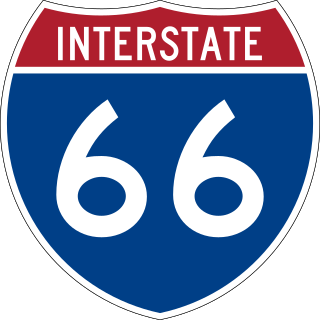
Interstate 66 (I-66) is a 76.32 mile east–west Interstate Highway in the eastern United States. The highway runs from an interchange with I-81 near Middletown, Virginia, on its western end to an interchange with U.S. Route 29 (US 29) in Washington, D.C., at the eastern terminus. Much of the route parallels US 29 or State Route 55 (SR 55) in Virginia. I-66 has no physical or historical connection to the famous US 66, which was located in a different region of the United States.

<span class="mw-page-title-main">Virginia State Route 267</span> Highway in Virginia

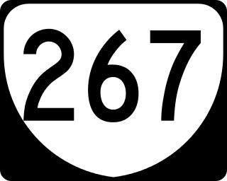
State Route 267 is a primary state highway in the US state of Virginia. It consists of two end-to-end toll roads – the Dulles Toll Road and Dulles Greenway – as well as the non-tolled Dulles Access Road, which lies in the median of Dulles Toll Road and then extends east to Falls Church. The combined roadway provides a toll road for commuting and a free road for access to Washington Dulles International Airport. The three sections are operated and maintained by separate agencies: Dulles Toll Road and Dulles Access Road are maintained by the Metropolitan Washington Airports Authority (MWAA); the Dulles Greenway is owned by TRIP II, a limited partnership, but is maintained by Atlas Arteria, an Australian company which owns the majority stake in the partnership. The Dulles Access Road's median hosts the Silver Line of the Washington Metro between the airport and Tysons.

E-ZPass is an electronic toll collection system used on toll roads, toll bridges, and toll tunnels in the Eastern United States, Midwestern United States, and Southern United States. The E-ZPass Interagency Group (IAG) consists of member agencies in several states, which use the same technology and allow travelers to use the same transponder on toll roads throughout the network.

<span class="mw-page-title-main">Capital Beltway</span> Highway in the Washington metropolitan area

The Capital Beltway is a 64-mile (103 km) auxiliary Interstate Highway in the Washington metropolitan area that surrounds Washington, D.C., the capital of the United States, and its inner suburbs in adjacent Maryland and Virginia. It is the basis of the phrase "inside the Beltway", used when referring to issues dealing with US federal government and politics. The highway is signed as Interstate 495 (I-495) for its entire length, and its southern and eastern half runs concurrently with I-95.

<span class="mw-page-title-main">Hampton Roads Bridge–Tunnel</span> Bridge–tunnel connecting Virginia cities Norfolk and Hampton

The Hampton Roads Bridge–Tunnel (HRBT) is a 3.5-mile-long (5.6 km) Hampton Roads crossing for Interstate 64 (I-64) and US Route 60 (US 60). It is a four-lane facility comprising bridges, trestles, artificial islands, and tunnels under the main shipping channels for Hampton Roads harbor in the southeastern portion of Virginia in the United States.

The Hampton Roads Beltway is a loop of Interstate 64 and Interstate 664, which links the communities of the Virginia Peninsula and South Hampton Roads which surround the body of water known as Hampton Roads and comprise much of the region of the same name in the southeastern portion of Virginia in the United States. It crosses the harbor of Hampton Roads at two locations on large four-laned bridge-tunnel facilities: the eastern half carries Interstate 64 and uses the Hampton Roads Bridge-Tunnel and the western half carries Interstate 664 and uses the Monitor-Merrimac Memorial Bridge-Tunnel. The beltway has the clockwise direction signed as the Inner Loop, and the counter-clockwise direction signed as the Outer Loop. The entire beltway, including the bridge-tunnels, is owned and operated by the Virginia Department of Transportation.

<span class="mw-page-title-main">James River Bridge</span> Bridge in VA to Newport News, VA

The James River Bridge (JRB) is a four-lane divided highway lift bridge across the James River in the Commonwealth of Virginia. Owned and operated by the Virginia Department of Transportation, it carries U.S. Route 17 (US 17), US 258, and State Route 32 across the river near its mouth at Hampton Roads. The bridge connects Newport News on the Virginia Peninsula with Isle of Wight County in the South Hampton Roads region, and is the easternmost such crossing without a tunnel component.

<span class="mw-page-title-main">Interstate 395 (Virginia–District of Columbia)</span> Interstate Highway in the DC area

Interstate 395 (I-395) in Washington, D.C., and Virginia is a 13.79-mile-long (22.19 km) spur route of I-95 that begins at an interchange with I-95 in Springfield and ends at an interchange with US Route 50 (US 50) in Northwest Washington, D.C. It passes underneath the National Mall near the US Capitol and ends at a junction with US 50 at New York Avenue, roughly one mile (1.6 km) north of the 3rd Street Tunnel. Despite its proximity to I-395 in Maryland, the route is unrelated and unconnected.

<span class="mw-page-title-main">Interstate 264 (Virginia)</span> Highway in Virginia

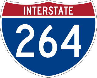
Interstate 264 (I-264) is an Interstate Highway in the US state of Virginia. It serves as the primary east–west highway through the South Hampton Roads region in southeastern Virginia. The route connects the central business districts of Chesapeake, Portsmouth, Norfolk, and Virginia Beach and serves as the most direct link between those cities and the resort beaches along Virginia's Atlantic coast.

<span class="mw-page-title-main">Downtown Tunnel</span> Tunnel across Southern Branch Elizabeth River in Virginia

The Downtown Tunnel on Interstate 264 (I-264) and U.S. Route 460 Alternate crosses the Southern Branch of the Elizabeth River in the South Hampton Roads area of Virginia, US. It links the independent City of Portsmouth with the independent City of Norfolk. In conjunction with the Berkley Bridge, the Downtown Tunnel connects to Interstate 464 to the City of Chesapeake and a continuation I-264 to the downtown and Waterside areas of Norfolk, and on to Virginia Beach. Owned by the Virginia Department of Transportation (VDOT), it is operated and maintained by Elizabeth River Crossings under a 58-year public–private partnership concession agreement. Formerly a toll-free facility, open road tolling was implemented on February 1, 2014 by VDOT to help finance repairs and expansion to the tunnel.

<span class="mw-page-title-main">Interstate 564</span>

Interstate 564 (I-564) is an Interstate Highway in the US state of Virginia. Known as Admiral Taussig Boulevard, after US Navy Rear Admiral Edward D. Taussig, the Interstate runs 3.03 miles (4.88 km) from State Route 337 (SR 337) east to I-64 within the city of Norfolk. I-564 is the primary access highway to Naval Station Norfolk, the world's largest naval base. The Interstate also links I-64 with Norfolk International Terminals via SR 406 and the Wards Corner area of Norfolk through connections with U.S. Route 460 (US 460) and SR 165.

<span class="mw-page-title-main">Transportation in Virginia</span> Overview of land sea and air transport systems in Virginia

Transportation in the Commonwealth of Virginia is by land, sea and air. Virginia's extensive network of highways and railroads were developed and built over a period almost 400 years, beginning almost immediately after the founding of Jamestown in 1607, and often incorporating old established trails of the Native Americans.

<span class="mw-page-title-main">Transportation in Richmond, Virginia</span>

Transportation in Richmond, Virginia and its immediate surroundings include land, sea and air modes. This article includes the independent city and portions of the contiguous counties of Henrico and Chesterfield. While almost all of Henrico County would be considered part of the Richmond area, southern and eastern portions of Chesterfield adjoin the three smaller independent cities of Petersburg, Hopewell, and Colonial Heights, collectively commonly called the Tri-Cities area. A largely rural section of southwestern Chesterfield may be considered not a portion of either suburban area.

<span class="mw-page-title-main">Interstate 95 in Virginia</span> Interstate Highway in Virginia

Interstate 95 (I-95) runs 179 miles (288 km) within the commonwealth of Virginia between its borders with North Carolina and Maryland. I-95 meets the northern terminus of I-85 in Petersburg and is concurrent with I-64 for three miles (4.8 km) in Richmond. Although I-95 was originally planned as a highway through Washington, D.C., it was rerouted along the eastern portion of the Capital Beltway concurrent with I-495. From Petersburg to Richmond, I-95 utilized most of the Richmond–Petersburg Turnpike, a former toll road. In addition to Richmond, the route also runs through the medium-sized cities of Emporia, Petersburg, Colonial Heights, Fredericksburg, and Alexandria.

<span class="mw-page-title-main">Interstate 95 in Maryland</span> Interstate Highway in Maryland

Interstate 95 (I-95) is an Interstate Highway running along the East Coast of the United States from Miami, Florida, north to the Canada–United States border at Houlton, Maine. In Maryland, the route is a major highway that runs 110.01 miles (177.04 km) diagonally from southwest to northeast, entering from the District of Columbia and Virginia at the Woodrow Wilson Bridge over the Potomac River, northeast to Maryland's border with Delaware near Elkton. It is the longest Interstate Highway within Maryland and is one of the most traveled Interstate Highways in the state, especially between Baltimore and Washington, D.C., despite alternate routes along the corridor, such as the Baltimore–Washington Parkway, U.S. Route 1 (US 1), and US 29. I-95 also has eight auxiliary routes in the state, the most of any state along the I-95 corridor. Portions of the highway, including the Fort McHenry Tunnel and the Millard E. Tydings Memorial Bridge, are tolled.

<span class="mw-page-title-main">Interstate 64 in Virginia</span> Highway in Virginia

Interstate 64 (I-64) in the US state of Virginia runs east–west through the middle of the state from West Virginia to the Hampton Roads region, for a total of 299 miles (481 km). From the West Virginia state line to Chesapeake, it passes through the major cities of Lexington, Staunton, Charlottesville, the state capital of Richmond, Newport News, Hampton, and Norfolk. It is notable for crossing the mouth of the harbor of Hampton Roads on the Hampton Roads Bridge–Tunnel (HRBT), the first bridge–tunnel to incorporate artificial islands, concurrent with U.S. Route 60 (US 60). Also noteworthy is a section through Rockfish Gap, a wind gap in the Blue Ridge Mountains, which was equipped with an innovative system of airport-style runway lighting embedded into the pavement to aid motorists during periods of poor visibility due to fog or other conditions.

Located in the southeastern corner of the state, Norfolk is economically and culturally important to Virginia. A variety of transportation modes have developed around the city's importance and somewhat unusual geography.

<span class="mw-page-title-main">Transportation in Hampton Roads</span>

Historically, the harbor was the key to the Hampton Roads area's growth, both on land and in water-related activities and events. Ironically, the harbor and its tributary waterways were both important transportation conduits and obstacles to other land-based commerce and travel. For hundreds of years, state and community leaders have worked to develop solutions to accommodate both.

Virginia HOT lanes refers to six separate projects in the U.S. state of Virginia. The first project, completed in November 2012, added high-occupancy/toll (HO/T) lanes to the Capital Beltway (I-495) in Fairfax County. The second project, opened to the public in December 2014, involved converting and extending the existing reversible high-occupancy vehicle (HOV) lanes on I-95 and a portion of I-395 to HO/T lanes from Stafford to near Alexandria. The third project converted all lanes on I-66 inside the Beltway to peak-direction HO/T lanes, opening on December 4, 2017. The fourth project reconstructed approximately 21 miles (34 km) of I-66 outside the Beltway, making it a 10-lane corridor. The fifth project, which was completed in November 2019, essentially extended the aforementioned I-95/I-395 project several miles to the north, converting the existing reversible HOV lanes on I-395 to HO/T lanes from near Alexandria to Washington, DC. The sixth project will convert the existing reversible HOV lanes to HO/T Lanes on Interstate 64 from Interstate 564 in Norfolk to Interstate 264 in Virginia Beach, and also propose to expand the I-64 express lanes before and after the HO/T Lanes.

References

  1. 1 2 "Contact Us". Virginia Department of Transportation. Retrieved December 2, 2018. Virginia Department of Transportation
    1401 E. Broad St.
    Richmond, Virginia 23219
  2. 1 2 "VDOT's Budget". Virginia Department of Transportation. Retrieved December 2, 2018.
  3. "VDOT's Organization". Virginia Department of Transportation. Retrieved December 2, 2018.
  4. "Services". Virginia DOT. Retrieved December 2, 2018.
  5. "Bridges in Virginia". Virginia DOT. Retrieved December 2, 2018.
  6. "Snow Removal". Fairfax County. Retrieved December 2, 2018.
  7. "Safety Rest Areas and Welcome Centers". Virginia DOT. Retrieved December 2, 2018.
  8. "Virginia Toll Facilities". Virginia DOT. Retrieved December 2, 2018.
  9. "Hampton Roads Tunnels and Bridges". Virginia DOT. Retrieved December 2, 2018.
  10. "Ferry Information". Virginia DOT. Retrieved December 2, 2018.
  11. 1 2 "Fiscal Year 2009-2010 VDOT Annual Budget" (PDF). Retrieved December 2, 2018.
  12. 1 2 "Fiscal Year 2008-2009 VDOT Annual Budget" (PDF). Retrieved December 2, 2018.
  13. 1 2 "Fiscal Year 2007-2008" (PDF). Retrieved December 2, 2018.
  14. Halsey III, Ashley (July 8, 2009). "Virginia Prepares to Close Highway Rest Areas". The Washington Post. Retrieved December 2, 2018.
  15. Kumar, Anita (January 21, 2010). "Virginia to reopen 19 highway rest stops". The Washington Post. Retrieved December 2, 2018.
  16. 1 2 Shear, Michael D. (February 21, 2003). "Roadside Memorials Banned VDOT; Agency Calls Shrines Hazardous to Safety". The Washington Post. Archived from the original on December 3, 2018. Retrieved December 2, 2018.
  17. "§ 33.2-216. Roadside memorials; penalty". Virginia Law Library. Retrieved December 2, 2018.
  18. Shaffrey, Ted (September 22, 2002). "Roadside Memorials Stir Debate; States Weigh Remembrance Vs. Safety". The Washington Post. Archived from the original on December 3, 2018. Retrieved December 2, 2018.
  19. "Public-Private Transportation Act of 1995, (as Amended): Implementation Guidelines" (PDF). Retrieved December 1, 2018.
  20. "I-495 HOT Lanes Overview". Archived from the original on 2010-02-13. Retrieved 2011-08-20.
  21. I-95 / 395 HOT Lanes Overview
  22. 1 2 HOT Lanes FAQs
  23. The New York Times, September 26, 2004, John Tierney, "The Way We Drive Now; The Autonomist Manifesto 20 Years of growing", New York, NY, page 57
  24. The Washington Post, July 13, 2002, Michael D. Shear, "Toll Plan Proposed To Widen Beltway - Virginia Considers Private Firm's Offer", Washington, DC, page B1
  25. Shear, Michael D. (July 12, 2003). "Beltway Toll Lanes Endorsed; Va. Transportation Chief Wants Plan Considered". The Washington Post. Washington, DC. Archived from the original on December 3, 2018. Retrieved December 2, 2018.
  26. Hannon, Kelly (August 19, 2009). "Funding delays HOT lanes". The Free Lance-Star. Retrieved December 2, 2018.
  27. The Washington Post, June 24, 2008, Amy Gardner, ""Tree Cutting Shocks HOT Lane Neighbors - Public Will Still Have Voice, VDOT Says"", Washington D.C., page B1
  28. Virginia Department of Transportation (October 6, 2022). "VDOT History Highlights". About VDOT. Retrieved January 9, 2023.