Interstate 790 (I-790) is an auxiliary Interstate Highway in the city of Utica, New York, in the United States. It runs for 2.41 miles (3.88 km) from an interchange with New York State Route 5A (NY 5A) and NY 5S in downtown Utica to a pair of interchanges with Genesee Street east of the city. All of I-790 is concurrent with NY 5, and the portion south of NY 49 is also concurrent with NY 8 and NY 12. I-790 connects to exit 31 of the New York State Thruway (I-90) by way of an interchange near its east end. According to the New York State Department of Transportation (NYSDOT), I-790 follows NY 5 to Genesee Street while the highway leading to Thruway exit 31 is merely a pair of ramps connecting I-790 to its parent. The north–south portion of I-790 between its western terminus and NY 49 is named the North–South Arterial Highway.
The New York State Thruway Authority (NYSTA) is a public benefit corporation in New York State, United States. The NYSTA was formed in 1950 with the responsibility of constructing, maintaining, and operating the New York State Thruway, a system of limited-access highways within the state.

Interstate 86 (I-86) is an Interstate Highway that extends for 223.39 miles (359.51 km) through northwestern Pennsylvania and the Southern Tier region of New York, in the United States. The highway has two segments: the longer of the two begins at an interchange with I-90 east of Erie, Pennsylvania, and ends just beyond the Chemung-Tioga county line at the Pennsylvania border, while the second extends from I-81 east of Binghamton to New York State Route 79 (NY 79) in Windsor. When projects to upgrade the existing NY 17 to Interstate Highway standards are completed, I-86 will extend from I-90 near Erie to the New York State Thruway (I-87) in Woodbury. The portion in Erie County, Pennsylvania, is known as the Hopkins-Bowser Highway and is signed as such at each end. In New York, the current and future alignment of I-86 is known as the Southern Tier Expressway west of I-81 in Binghamton and the Quickway east of I-81.

New York State Route 895 (NY 895), known locally as Sheridan Boulevard, is an urban boulevard in the New York City borough of The Bronx. Its south end is at a merge with the Bruckner Expressway (I-278) in the Hunts Point neighborhood, and its north end is at the Cross Bronx Expressway (I-95), where the road connects with local streets in the West Farms neighborhood.

New York State Route 149 (NY 149) is an east–west state highway that runs for 32.20 miles (51.82 km) through the Capital District of New York in the United States. It begins at exit 20 on the Adirondack Northway in the Warren County town of Queensbury and intersects U.S. Route 9 (US 9), US 4, and NY 22, among other routes, as it progresses eastward to its eastern end at the Vermont state line in the Washington County village of Granville. Here, the highway becomes Vermont Route 149 (VT 149) and continues for an additional 1.302 miles (2.095 km) to an intersection with VT 30 in Rutland County. Both NY 149 and VT 149 traverse mostly rural areas.

The New York City Department of Transportation (NYCDOT) is the agency of the government of New York City responsible for the management of much of New York City's transportation infrastructure. Ydanis Rodriguez is the Commissioner of the Department of Transportation, and was appointed by Mayor Eric Adams on January 1, 2022. Former Commissioners have included Polly Trottenberg, Janette Sadik-Khan, and Iris Weinshall. Their Training Center is located at 140 General R W Berry Dr, Queens, NY 11359, off of Exit 32 of the Cross Island Parkway.

New York State Route 73 (NY 73) is a 27.55-mile-long (44.34 km) state highway located entirely within Essex County, New York, in the United States. The highway begins at an intersection with NY 86 in the village of Lake Placid and ends at a junction with U.S. Route 9 (US 9) north of the hamlet of Underwood in the extreme southwestern corner of the town of Elizabethtown. NY 73 meanders through a mountainous region of Adirondack Park and passes by several named peaks, including Porter Mountain and Lower Wolfjaw Mountain. Along the way, the route has a short concurrency with NY 9N in the town of Keene.

New York State Route 531 (NY 531) is a limited-access, east–west state highway located in Monroe County, New York, United States. The route extends for 8.02 miles (12.91 km) from the far northwestern suburbs of Rochester to the town of Gates located just west of the city. The western terminus of the route is at an intersection with NY 31 and NY 36 west of the village of Spencerport in the town of Ogden, while the eastern terminus of NY 531 is at Interstate 490 (I-490) exit 8 2 miles (3.2 km) west of the Rochester city limits. NY 531 is the primary route between Rochester and the village of Brockport, located 5 miles (8 km) northwest of NY 531's west end.

New York State Route 31F (NY 31F) is an east–west state highway located in the vicinity of Rochester, New York, in the United States. The western terminus of the route is at an intersection with NY 96 north of the Monroe County village of Pittsford. Its eastern terminus is at a junction with NY 31 in the Wayne County hamlet of Macedon. Along the way, NY 31F serves the villages of East Rochester and Fairport and connects to Interstate 490 (I-490) in the town of Pittsford. From Fairport eastward, NY 31F roughly parallels the Erie Canal, which the route crosses over twice: once west of Fairport and again north of Macedon.

New York State Route 31E (NY 31E) is a 5.29-mile (8.51 km) state highway located in western New York in the United States. It serves as a northerly alternate route of NY 31 between the village of Middleport in eastern Niagara County and the nearby village of Medina in Orleans County. NY 31E connects to NY 31 at each end by way of a short overlap with NY 271 in Middleport. Most of NY 31E parallels the Erie Canal, and parts of the route run adjacent to the waterway. Outside of the two villages at each end, NY 31E traverses mostly rural areas of the towns of Royalton and Ridgeway.

New York State Route 88 (NY 88) is a north–south state highway in the Finger Lakes region of New York in the United States. It extends for 20.62 miles (33.18 km) from an intersection with NY 96 in the Ontario County village of Phelps to a junction with NY 104 in the Wayne County town of Sodus. In between, NY 88 passes through the Village of Newark, where it intersects NY 31 and crosses over the Erie Canal. NY 88 originally extended south to the city of Canandaigua when it was assigned as part of the 1930 renumbering of state highways in New York. It was truncated to its current length in August 1972. According to the New York State Department of Transportation (NYSDOT), the NY 382 designation is reserved for the NY 88 alignment. No timetable exists for the redesignation of NY 88 to NY 382.

New York State Route 370 (NY 370) is an east–west state highway in Central New York in the United States. It extends for about 35 miles (56.33 km) from an intersection with NY 104 and NY 104A south of the Wayne County village of Red Creek to a junction with U.S. Route 11 (US 11) in the Onondaga County city of Syracuse. The western and central portions of the route pass through mostly rural areas; however, the eastern section serves densely populated areas of Onondaga County, including the villages of Baldwinsville and Liverpool. NY 370 also passes through Cayuga County, where it connects to NY 34, a major north–south highway in Central New York.

The New York State Department of Environmental Conservation is a department of New York state government. The department guides and regulates the conservation, improvement, and protection of New York's natural resources; manages Forest Preserve lands in the Adirondack and Catskill parks, state forest lands, and wildlife management areas; regulates sport fishing, hunting and trapping; and enforces the state's environmental laws and regulations. Its regulations are compiled in Title 6 of the New York Codes, Rules and Regulations. It was founded in 1970, replacing the Conservation Department, and is headed by Basil Seggos.
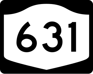
New York State Route 631 (NY 631) is a north–south state highway in Onondaga County, New York, in the United States. It serves as a bypass around the village of Baldwinsville, extending for just over 5 miles (8.0 km) from an intersection with NY 370 in the southeastern part of the village to a junction with NY 48 and NY 690 just north of Baldwinsville in the town of Lysander. The route has a short overlap with NY 31 east of the village. Most of the route is two lanes wide and passes through rural areas around the edge of Baldwinsville, while a part near the Lysander community of Radisson is four lanes wide and serves residential and commercial neighborhoods.
The office of Superintendent of Public Works was created by an 1876 amendment to the New York State Constitution. It abolished the canal commissioners and established that the Department of Public Works execute all laws relating to canal maintenance and navigation except for those functions performed by the New York State Engineer and Surveyor who continued to prepare maps, plans and estimates for canal construction and improvement. The Canal Board continued to handle hiring of employees and other personnel matters. The Barge Canal Law of 1903 directed the Canal Board to oversee the enlargement of and improvements to the Erie Canal, the Champlain Canal and the Oswego Canal. In 1967, the Department of Public Works was merged with other departments into the new New York State Department of Transportation.

Blue Ridge Road is a 19.2-mile (30.9 km) long roadway in Essex County, New York, in the United States. The road is designated as County Route 84 (CR 84) from NY 28N in Newcomb to Interstate 87 (I-87) in North Hudson, and as New York State Route 910K (NY 910K) between I-87 and U.S. Route 9 (US 9) in North Hudson. The CR 84 portion is an 18-mile (29 km), two-lane stretch of rural highway maintained by the Essex County Department of Public Works' Highway Division while NY 910K is a 1 mile (1.6 km) highway maintained by the New York State Department of Transportation (NYSDOT). All of Blue Ridge Road has been designated as the "Blue Ridge Road Scenic Byway" by NYSDOT.
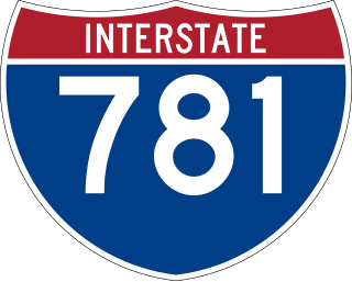
Interstate 781 (I-781) is an auxiliary Interstate Highway north of Watertown in Jefferson County, New York. The route extends for 4.3 miles (6.9 km) from an interchange with I-81 in Pamelia to the main entrance of Fort Drum in Le Ray. It also has one intermediate interchange with US Route 11 (US 11) just west of Fort Drum. I-781 is four lanes wide and serves as the principal travel corridor into and out of the post. The freeway is ceremoniously designated as the Paul Cerjan Memorial Highway in honor of Paul G. Cerjan, a late US Army lieutenant general who oversaw a $1.2-billion expansion of Fort Drum in the 1980s.
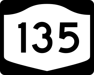
New York State Route 135 (NY 135) is a 10.8-mile (17.4 km) freeway in eastern Nassau County, New York, in the United States. The route connects Seaford with Syosset. The highway runs from Merrick Road in Seaford to NY 25 in Syosset. In between, NY 135 passes through Bethpage and Plainview and serves Bethpage State Park. The highway is ceremoniously designated as the Ralph J. Marino Expressway; however, it is more commonly known as the Seaford–Oyster Bay Expressway.

Edward Burton Hughes was Acting Commissioner of New York State Department of Transportation in 1969, Executive Deputy Commissioner of New York State Department of Transportation from 1967 to 1970, and Deputy Superintendent of New York State Department of Public Works from 1952 to 1967. Hughes worked over 45 years in public service at the DOT. Upon his retirement in 1970, he founded the E. Burton Hughes Achievement Award.