
Long Island City (LIC) is a residential and commercial neighborhood on the western tip of Queens, a borough in New York City in the United States. It is bordered by Astoria to the north; the East River to the west; New Calvary Cemetery in Sunnyside to the east; and Newtown Creek, which separates Queens from Greenpoint, Brooklyn, to the south.

Greenpoint is the northernmost neighborhood in the New York City borough of Brooklyn, in the U.S. state of New York. It is bordered on the southwest by Williamsburg at Bushwick Inlet Park and McCarren Park; on the southeast by the Brooklyn–Queens Expressway and East Williamsburg; on the north by Newtown Creek and the neighborhood of Long Island City in Queens; and on the west by the East River. The neighborhood has a large Polish immigrant and Polish-American community, containing many Polish restaurants, markets, and businesses, and it is often referred to as Little Poland.

The Belt Parkway is the name given to a series of controlled-access parkways that form a belt-like circle around the New York City boroughs of Brooklyn and Queens. The Belt Parkway comprises three of the four parkways in what is known as the Belt System: the Shore Parkway, the Southern Parkway, and the Laurelton Parkway. The three parkways in the Belt Parkway are a combined 25.29 miles (40.70 km) in length. The Cross Island Parkway makes up the fourth parkway in the system, but is signed separately.

East Williamsburg is a name for the area in the northwestern portion of Brooklyn, New York City, United States. East Williamsburg consists roughly of what was the 3rd District of the Village of Williamsburgh and what is now called the East Williamsburg In-Place Industrial Park (EWIPIP), bounded by the neighborhoods of Northside and Southside Williamsburg to the west, Greenpoint to the north, Bushwick to the south and southeast, and both Maspeth and Ridgewood in Queens to the east. Much of this area is still referred to as either Bushwick, Williamsburg, or Greenpoint with the term East Williamsburg falling out of use since the 1990s.

The Pulaski Bridge in New York City connects Long Island City in Queens to Greenpoint in Brooklyn over Newtown Creek. It was named after Polish military commander and American Revolutionary War fighter Casimir Pulaski in homage to the large Polish-American population in Greenpoint. It connects 11th Street in Queens to McGuinness Boulevard in Brooklyn.

Newtown Creek, a 3.5-mile (6-kilometer) long tributary of the East River, is an estuary that forms part of the border between the boroughs of Brooklyn and Queens, in New York City. Channelization made it one of the most heavily-used bodies of water in the Port of New York and New Jersey and thus one of the most polluted industrial sites in the United States, containing years of discarded toxins, an estimated 30,000,000 US gallons of spilled oil, including the Greenpoint oil spill, raw sewage from New York City's sewer system, and other accumulation from a total of 1,491 sites.
The IND Crosstown Line or Brooklyn–Queens Crosstown Line is a rapid transit line of the B Division of the New York City Subway in Brooklyn and Queens, New York City, United States. It provides crosstown service between western Brooklyn and northwestern Queens and is the only subway line that does not carry trains to and from Manhattan.

The Kosciuszko Bridge, originally known as the Meeker Avenue Bridge, is a cable-stayed bridge over Newtown Creek in New York City, connecting Greenpoint in Brooklyn to Maspeth in Queens. The bridge consists of a pair of cable-stayed bridge spans: the eastbound span opened in April 2017, while the westbound span opened in August 2019. An older bridge, a truss bridge of the same name that was located on the site of the westbound cable-stayed span, was originally opened in 1939 and was closed and demolished in 2017. The crossing is part of the Brooklyn–Queens Expressway (BQE), which carries Interstate 278.

Iris Weinshall is the chief operating officer of The New York Public Library, former vice chancellor at the City University of New York and a former commissioner of the New York City Department of Transportation. Weinshall was appointed Chief Operating Officer by the Library in July 2014, and she began her tenure on September 1, 2014. She is the wife of U.S. Senator and Senate Majority leader Chuck Schumer.
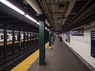
The Greenpoint Avenue station is a station on the IND Crosstown Line of the New York City Subway. Located at the intersection of Greenpoint and Manhattan Avenues in Greenpoint, Brooklyn, it is served by the G train at all times.

The Grand Street Line is a public transit line in Brooklyn and Queens, New York City, running mostly along the continuous Grand Street and Grand Avenue between Williamsburg, Brooklyn and Maspeth, Queens. It then continues down Queens Boulevard to the 63rd Drive–Rego Park station. Originally a streetcar line, it is now the Q59 bus route, operated by the New York City Transit Authority between Williamsburg and Rego Park, Queens.

The Crosstown Line is a public transit line in Brooklyn, New York City, running along Van Brunt Street and Manhattan Avenue between Red Hook and Long Island City, Queens. Originally a streetcar line, it is now the B61 and the B62 bus routes. The northern section, the B62, is operated by MTA New York City Bus' Grand Avenue Depot in Maspeth, Queens, and the southern section is the B61, operated by MTA New York City Bus' Jackie Gleason Depot in Sunset Park. The entire route was a single line, the B61, until January 3, 2010; the B62 was previously a separate, parallel route between Downtown Brooklyn and Greenpoint, now part of the B43 route. The streetcar line, B61 and the original B62 previously operated from the now-closed Crosstown Depot in Greenpoint.
The Union Avenue Line was a public transit line in Brooklyn, New York City, United States, running mostly along Myrtle Avenue, Knickerbocker Avenue, Flushing Avenue, Throop Avenue, and Union Avenue from Ridgewood, Queens northwest to Greenpoint, Brooklyn.
Bedford Avenue is the longest street in Brooklyn, New York City, stretching 10.2 miles (16.4 km) and 132 blocks, from Manhattan Avenue in Greenpoint south to Emmons Avenue in Sheepshead Bay, and passing through the neighborhoods of Williamsburg, Bedford-Stuyvesant, Crown Heights, Flatbush, Midwood, Marine Park, and Sheepshead Bay.

Roosevelt Avenue and Greenpoint Avenue are main thoroughfares in the New York City boroughs of Queens and Brooklyn. Roosevelt Avenue begins at 48th Street and Queens Boulevard in the neighborhood of Sunnyside. West of Queens Boulevard, the road is named Greenpoint Avenue and continues through Sunnyside and Long Island City across the Greenpoint Avenue Bridge into the borough of Brooklyn, terminating at WNYC Transmitter Park on the East River in the neighborhood of Greenpoint. Roosevelt Avenue goes through Woodside, Jackson Heights, Elmhurst, Corona, Flushing Meadows–Corona Park and Flushing. In Flushing, Roosevelt Avenue ends at 156th Street and Northern Boulevard.

Grand Street Bridge is a through-truss swing bridge over Newtown Creek in New York City. The current crossing was completed in 1902, and links Grand Street and Grand Avenue via a two-lane, height-restricted roadway. It is a main connection between the boroughs of Brooklyn and Queens, carrying an average of 10,200 vehicles per day.

McGuinness Boulevard is a boulevard in Greenpoint, a neighborhood in the New York City borough of Brooklyn. It runs between Interstate 278 in the south and the Pulaski Bridge in the north, which connects Greenpoint to Long Island City, Queens and Jackson Avenue. South of Driggs Avenue, it is called McGuinness Boulevard South.

The Brooklyn–Queens Connector, abbreviated the BQX, was a proposed streetcar line in New York City. It is planned to operate on a north–south corridor along the East River between the boroughs of Queens and Brooklyn. A previous plan bearing similarities to the BQX was initially proposed in 1989 as part of a Brooklyn waterfront streetcar line connecting Red Hook with Downtown Brooklyn. A study by the city, published in 2011, found the proposal to be infeasible. A later proposal by the nonprofit Friends of the Brooklyn Queens Connector, made public in January 2016, found backing from Mayor Bill de Blasio. A director for Friends of the Brooklyn Queens Connector was appointed in May 2016, and a list of possible routings was released in November 2016.

The Borden Avenue Bridge is a retractable bridge in New York City, in the Long Island City neighborhood of Queens. It carries vehicular and pedestrian traffic across Dutch Kills, a tidal waterway that is a tributary of Newtown Creek. The main span is 84 feet long, and it retracts by sliding on rails. It was last retracted to allow marine traffic to pass in 2005. It was designed by Edward Abraham Byrne and opened on March 25, 1908.


