Michigan Department of Transportation

Last updated

Michigan Department of Transportation
MichiganDOT.svg
MDOT Logo
Department overview
FormedJuly 1, 1905;118 years ago (1905-07-01)
Preceding department
  • Michigan Department of State Highways
Superseding agency
  • Incumbent
Jurisdiction State of Michigan
Headquarters425 West Ottawa Street
Lansing, Michigan 48909
42°44′04″N84°33′30″W / 42.73444°N 84.55833°W / 42.73444; -84.55833
Annual budget$4.7 Billion [1] [lower-alpha 1]
Department executives
  • Brad Wieferich, Director
  • Michael Hayes, Transportation Commission Vice-Chair
Key document
Website www.michigan.gov/mdot

The Michigan Department of Transportation (MDOT) is a constitutional government principal department of the US state of Michigan. The primary purpose of MDOT is to maintain the Michigan State Trunkline Highway System which includes all Interstate, US and state highways in Michigan with the exception of the Mackinac Bridge. [lower-alpha 2] Other responsibilities that fall under MDOT's mandate include airports, shipping and rail in Michigan.

Contents

The predecessor to today's MDOT was the Michigan State Highway Department (MSHD) that was formed on July 1, 1905 after a constitutional amendment was approved that year. The first activities of the department were to distribute rewards payments to local units of government for road construction and maintenance. In 1913, the state legislature authorized the creation of the state trunkline highway system, and the MSHD paid double rewards for those roads. These trunklines were signed in 1919, making Michigan the second state to post numbers on its highways. The department continued to improve roadways under its control through the Great Depression and into World War II. During the war, the state built its first freeways. These freeways became the start of Michigan's section of the Interstate Highway System. Since the mid-1960s, the department was reorganized. It was renamed the Michigan Department of State Highways for a time. Further changes culminated in adding all modes of transportation to the department's portfolio. In August 1973, the department was once again renamed to the Michigan Department of State Highways and Transportation by executive order. The name was later simplified and shortened to that of today.

History

Early history

The first State Highway Department was created on July 1, 1905. [3] The department was born out of the Good Roads Movement at the turn of the century. Bicycle enthusiasts as a part of the League of American Wheelmen pushed for better roads and streets. They also wanted to ensure that bicyclists could use these streets and roads free from interference from horsedrawn vehicles. This movement persuaded the Michigan State Legislature to form a State Highway Commission in 1892. Another law in 1893 allowed voters in each county to establish county road commissions. [4] The attention of Michigan residents was turned to the good-roads movement by Horatio S. Earle, the first state highway commission. In 1900 he organized the first International Road Congress in Port Huron and even put together a tour of a 1 mi (1.6 km) macadam road. He even ran for the state senate in 1900 at the urging of the Detroit Wheelmen bicycle club. [5] The legislature set up a state reward system for highways and created the State Highway Department with an office of Highway Commissioner. Earle was appointed by Governor Aaron Bliss. This appointment and department were voided when the attorney general ruled the law unconstitutional. A constitutional amendment was passed in 1905 to reverse this decision. The department was formed, and Earle was appointed commissioner by Governor Fred M. Warner on July 1, 1905. [3]

At first the department administered rewards to the counties and townships for building roads to state minimum specifications. In 1905 there were 68,000 mi (110,000 km) of roads in Michigan. Of these roads, only 7,700 mi (12,000 km) were improved with gravel and 245 mi (394 km) were macadam. The state's "statute labor system" was abolished in 1907. Under that system, a farmer and a team of horses could work on road improvements in place of paying road taxes. Instead a property tax system was instituted with the funding only for permanent improvements, not maintenance. The nation's first mile of concrete roadway was laid along Woodward Avenue between Six Mile and Seven Mile roads in Detroit. This section of street was 17 feet 8 inches (5.38 m) wide. Work began by the Wayne County Road Commission on April 2, 1909 and finished on July 4, 1909, at a cost of $13,354 (equivalent to $323,967 in 2023 [6] ). [7]

Dead Man's Curve along the Marquette-Negaunee Road shown in 1917 with its hand-painted centerline, the first in the nation Thefirstruralhighwaycenterline.png
Dead Man's Curve along the Marquette–Negaunee Road shown in 1917 with its hand-painted centerline, the first in the nation

In 1913 voters elected Frank Rogers to the post of highway commissioner. This election was the first after the legislature made it an elective post. Automobile registrations surged to 20 times the level at the department's formation, to 60,438, and there were 1,754 mi (2,823 km) of roads built under the rewards system. Passage of the "State Trunkline Act" provided for 3,000 mi (4,828 km) of roadways with double rewards payments. [8] Further legislation during the Rogers administration allowed for special assessment taxing districts for road improvements, taxation of automobiles based on weight and horsepower and tree-planting along highway roadsides. Another law allowed the commissioner to name all unnamed state roads. It also allowed for the posting of signage with the names and distances to towns. [9] The centerline was first invented in 1911 in Wayne County by Edward N. Hines, and saw its first implementation on a state highway in 1917 along the Marquette-Negaunee Road, then M-15 and now County Road 492 in Marquette County. That same year, the first stop sign was put in place and the country's first "crow's nest" traffic signal tower was installed in Detroit. This traffic light using red-yellow-green was developed by William Potts, a Detroit police officer. [10] Michigan is also home to the first snowplow. [11] This winter maintenance started during World War I to keep 590 mi (950 km) of strategic highways clear. [10] In 1919 Michigan first signed the trunklines, the second state after Wisconsin to do so. [12]

The first ferry service was started on July 1, 1923, linking Michigan's Upper and Lower peninsulas. The first gasoline tax was enacted in 1923 at the rate of $0.02/gal (equivalent to $0.36/gal in 2023 [13] ), but vetoed by Governor Alex Groesbeck. [14] It was later enacted effective in 1926. The highway commissioner was also given complete control over the planning and maintenance of the state trunklines. Construction switched to concrete or asphalt only instead of gravel and macadam with an increase in the gas tax in 1927. Highway construction in the 1920s earned Michigan national attention. The first trunklline completed in concrete was M-16 (later part of US 16). The road was built to a standard of 20 ft (6.1 m) and between 7–9 in (17.8–22.9 cm) thick. The current standard at the time was 16 ft (4.9 m) wide and 6 in (15.2 cm) thick. [15] The 1920s were also busy for Michigan highways as Michigan developed the yellow-line center line to indicate no-passing zones for sight-restricted hills and curves. Roadside picnic tables, soil testing and aerial surveying of highways also debuted at this time. As MDOT historians put it, "the age of mud was over; the age of concrete was moving in. [16]

Later history

During the Great Depression, highway construction slowed down with decreased gas tax and property tax revenues. License plate fees were sent to the counties for road funding starting in 1932 and road crews made of "reliefers". The federal aid money was split between the highway department and the welfare department. The county welfare agencies supplied workers on road construction projects across the state. [17] Roadside parks and travel information centers debuted in the 1930s as well. [18] During World War II the department built the Willow Run Expressway and the Detroit Industrial Expressway in 11 months so workers could get to the Ford Motor Company's bomber plant at Willow Run. [19] When the Interstate Highway System was created in the late 1950s, Michigan modified existing freeway plans to fit the Interstate standards. In the 1960s nearly 1,000 mi (2,000 km) of freeways were built at an average pace of one new mile every three to four days. Michigan was also the first state to complete a border to border Interstate, I-94 from New Buffalo to Detroit running 205 mi (330 km). [20] The 1950s and 60s also brought the completion of several major bridges in Michigan, the Mackinac Bridge in 1957, the Portage Lake Lift Bridge in 1959 and the International Bridge in 1962. The biggest bridge designed by the department spanned the River Rouge carrying the Fisher Freeway (I-75). This bridge was 8,367 ft (2,550 m) long and 115 ft (35 m) high. [21]

MDOT logo 1978 MDOT logo 1978.png
MDOT logo 1978

The adoption of the 1963 Constitution reorganized the department. No longer would the highway commissioner be elected. Instead, a six-member commission appointed by the governor and headed day to day by a department director initial appointed by the commission. The new commission would also have jurisdiction over "such other public works of the state as provided by law. [22] At the time, the name was rearranged to the Michigan Department of State Highways. The legislative authorization led to 1970s reorganization of the department. An executive order by Governor William G. Milliken gave the department authority over all transportation programs in Michigan. The department was renamed on August 23, 1973, to the Michigan Department of State Highways and Transportation giving it responsibility for aviation, railroads, buses, ships, ports and non-motorized pathways and trails. [23] In 1976, the department acquired the Ann Arbor Railroad. The acquisition included right-of-way from Ashley to Cadillac and from Ann Arbor to Toledo, Ohio. At the time, the department gained the rolling stock of the railroad in the first such purchase by the department. [24] The name of the department was later shortened to the current form in 1978. [25]

In November 1978, Michigan voters approved Proposal M, which, in addition to allocating gas tax revenues, replaced the Michigan State Highway Commission with the Michigan State Transportation Commission. [26] By 1983, the department director became appointed by the state governor.

Leadership

State Highway Commissioners

Department Directors

Transportation Commission

The Michigan State Transportation Commission establishes policy for the Michigan Department of Transportation as they relate to transportation programs, facilities, and developments. [27] The Michigan State Transportation Commission is composed of six members, serving three-year terms, appointed by the Governor of Michigan with the advice and consent of the Michigan Senate. [28] [27]

Membership

The Constitution of Michigan requires that no more than three members be from the same political party.

NameHometownStartEnd
Michael Hayes Midland March 5, 2021December 21, 2023
Rita Brown Birmingham April 2023December 21, 2025
Gregory C. Johnson Wixom August 7, 2020December 21, 2024
Heath E. Salisbury Gaines April 8, 2022December 21, 2024
Richard W. Turner Monroe March 5, 2021December 21, 2023
Rhonda Welburn Detroit April 2023December 21, 2025
Vice-Chair

Michigan Aeronautics Commission

The Michigan Aeronautics Commission is charged with creating rules regarding airports, related facilities and pilot training. It is composed of five gubernatorial appointees and 4 department head representatives. [29]

NameHometownStartEnd
Russell Kavalhuna Dearborn May 26, 2021May 27, 2025
Kelly Burris Pleasant Ridge July 14, 2019May 27, 2023
Benjamin R. Carter Farmington Hills May 26, 2021May 27, 2024
Rick J. Fiddler Ada May 28, 2021May 27, 2024
Brian R. Smith Grand Ledge 2019May 27, 2023
F/LT. Brian BahlauRepresentative for the Michigan State Police
Brig. Gen. Bryan J. TeffRepresentative for the Michigan Department of Military and Veterans Affairs
Kevin JacobsRepresentative for the Michigan Department of Natural Resources
Laura J. MesterRepresentative of the MDOT Director
Mike TroutEx-officio director of the Michigan Aeronautics Commission as the Director of the Bureau of Aeronautics and Freight Services of MDOT
Chair, Vice-Chair
Information from the Bureau of Aeronautics [30]

Department organization

MDOT Regions
Bay Grand Metro North
Southwest Superior University Michigan DOT Regions.svg
MDOT Regions
     Bay     Grand     Metro     North
     Southwest     Superior     University

MDOT is organized into seven regions statewide and a series of divisions and bureaus that report through two chief officers to the department director. The chief administrative officer oversees the sections of the department related to aviation and aeronautics, finances, transportation planning and human resources. The chief operations officers supervises the seven regional offices, and the divisions devoted to highway research, design and construction.

The offices devoted to communications, passenger transportation and business and economic affairs report to director of the department. [31] The Mackinac Bridge Authority coordinates its activities to maintain the Mackinac Bridge as an independent agency through the department director. [2] The International Bridge Administration (IBA) is the arm of the department responsible to the Sault Ste. Marie Bridge Authority. That authority maintains the International Bridge. [32] The IBA reports to the chief administrative officer. [31]

Bureau of Aeronautics and Freight Services

The Bureau of Aeronautics and Freight Services carries out the enforcement of the Commission's rules. It has three divisions: Airports Division, Aviation Services, and Freight Services. The bureau, along with the Passenger Transportation Bureau, was formed out of the Multi-Modal Transportation Services Bureau in 2006. [33] The Airports Division runs development programs for airports which includes planning, design safety evaluation and construction. Additionally, this division licenses airports, flight schools, aircraft, and aircraft dealers and inspects airports. Seminars for pilots are run to keep license pilots up to date on current procedures. [29] Mike Trout oversees the Aeronautics. [33] The Aviation Services Division assists airports in bring in and retaining airline services. Through the Airport Preservation Program, this division aids at risk airports to find ways to stay open. [29]

Railroad subsidies

The department provides subsidies to Amtrak Michigan Services operations in the state for the Blue Water , Wolverine and the Pere Marquette lines. [34] [35]

See also

Notes

  1. For Fiscal Year 2019.
  2. The Mackinac Bridge Authority (MBA) is an independent state agency responsible for the Mackinac Bridge and thus maintains that section of the overall highway system. The MBA works with MDOT but does not report to it. The executive secretary of the MBA is appointed by MDOT with MBA approval. [2]

Related Research Articles

<span class="mw-page-title-main">Interstate 96</span> Interstate Highway in Michigan, United States

Interstate 96 (I-96) is an east–west Interstate Highway that runs for approximately 192 miles (309 km) entirely within the Lower Peninsula of the US state of Michigan. The western terminus is at an interchange with US Highway 31 (US 31) and Business US 31 on the eastern boundary of Norton Shores southeast of Muskegon, and the eastern terminus is at I-75 near the Ambassador Bridge in Detroit. From Grand Rapids through Lansing to Detroit, the freeway parallels Grand River Avenue, never straying more than a few miles from the decommissioned US 16. The Wayne County section of I-96 is named the Jeffries Freeway from its eastern terminus to the junction with I-275 and M-14. Though maps still refer to the freeway as the Jeffries, the portion within the city of Detroit was renamed by the state legislature as the Rosa Parks Memorial Highway in December 2005 in honor of the late civil rights pioneer. There are four auxiliary Interstates as well as two current and four former business routes associated with I-96.

<span class="mw-page-title-main">M-185 (Michigan highway)</span> State highway on Mackinac Island in Mackinac County, Michigan, United States

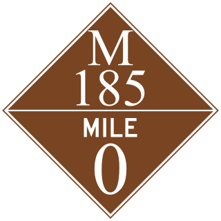
M-185 is a state trunkline highway in the U.S. state of Michigan that circles Mackinac Island, a popular tourist destination on the Lake Huron side of the Straits of Mackinac, along the island's shoreline. A narrow paved road of 8.004 miles (12.881 km), it offers scenic views of the straits that divide the Upper and the Lower peninsulas of Michigan and Lakes Huron and Michigan. It has no connection to any other Michigan state trunkline highways—as it is on an island—and is accessible only by passenger ferry. The City of Mackinac Island, which shares jurisdiction over the island with the Mackinac Island State Park Commission (MISPC), calls the highway Main Street within the built-up area on the island's southeast quadrant, and Lake Shore Road elsewhere. M-185 passes by several important sites within Mackinac Island State Park, including Fort Mackinac, Arch Rock, British Landing, and Devil's Kitchen. Lake Shore Road carries the highway next to the Lake Huron shoreline, running between the water's edge and woodlands outside the downtown area.

<span class="mw-page-title-main">M-3 (Michigan highway)</span> State highway in Michigan, United States

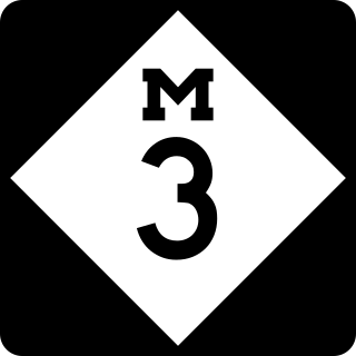
M-3, known for most of its length as Gratiot Avenue, is a north–south state trunkline highway in the Detroit metropolitan area of the US state of Michigan. The trunkline starts in Downtown Detroit and runs through the city in a northeasterly direction along one of Detroit's five major avenues. The highway passes several historic landmarks and through a historic district. It also connects residential neighborhoods on the city's east side with suburbs in Macomb County and downtown.

<span class="mw-page-title-main">M-8 (Michigan highway)</span> State highway in Wayne County, Michigan, United States

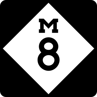
M-8 is a 5.5-mile (8.9 km) state trunkline highway in the U.S. state of Michigan lying within the cities of Detroit and Highland Park. Much of it is the Davison Freeway, the nation's first urban depressed freeway, which became a connector between the Lodge (M-10) and the Chrysler freeways.

<span class="mw-page-title-main">M-6 (Michigan highway)</span> State highway in Michigan, United States

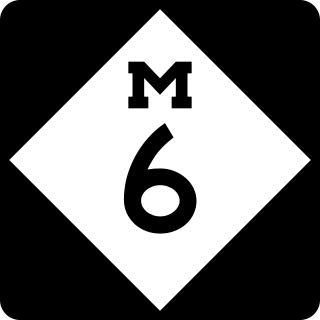
M-6, or the Paul B. Henry Freeway, is a 19.7-mile-long (31.7 km) east–west freeway and state trunkline highway in the United States that serves portions of southern Kent and eastern Ottawa counties south of Grand Rapids, Michigan. Although the freeway is named for Paul B. Henry, local residents and the press continue to use the original name, South Beltline as well on occasion. The freeway connects Interstate 196 (I-196) on the west with I-96 on the east. M-6 also provides a connection to U.S. Highway 131 (US 131) in the middle of its corridor while running through several townships on the south side of the Grand Rapids metropolitan area in Western Michigan. Each end is in a rural area while the central section has suburban development along the trunkline.

<span class="mw-page-title-main">Interstate 275 (Michigan)</span> Interstate Highway in Michigan, United States

Interstate 275 (I-275) is an auxiliary Interstate Highway in the US state of Michigan that acts as a western bypass of the Detroit metropolitan area. The Michigan Department of Transportation (MDOT) maintains the highway as part of the larger State Trunkline Highway System. The freeway runs through the western suburbs near Detroit Metropolitan Wayne County Airport, and crosses several rivers and rail lines in the area. The southern terminus is the interchange with I-75 near Newport, northeast of Monroe. MDOT considers the Interstate to run to an interchange with I-96, I-696 and M-5 on the Farmington Hills–Novi city line, running concurrently with I-96 for about five miles (8.0 km). This gives a total length of about 35.03 miles (56.38 km), which is backed up by official signage. According to the Federal Highway Administration (FHWA), the length is 29.97 miles (48.23 km) because that agency considers I-275 to end at the junction with I-96 and M-14 along the boundary between Livonia and Plymouth Township. All other map makers, like the American Automobile Association, Rand McNally and Google Maps follow MDOT's practice.

<span class="mw-page-title-main">M-39 (Michigan highway)</span> State highway in Michigan, United States

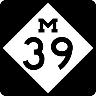
M-39 is a 16-mile-long (26 km) north–south state trunkline highway in Metro Detroit area of the US state of Michigan that runs from Lincoln Park, on the south end, to Southfield on the north. The official southern terminus of M-39 is at the corner of Southfield Road and Lafayette Boulevard in Lincoln Park, one block southeast of the junction of Interstate 75 and two blocks northwest of M-85. From there the highway heads northward. The first 2.3 miles (3.7 km) of the highway follows Southfield Road, a divided highway in the Downriver area. It then transitions into the Southfield Freeway, which is a 13.7-mile-long (22.0 km) freeway that runs from I-94 in Allen Park north through Dearborn, and then the west side of Detroit, to Southfield. The northern terminus is at M-10 in Southfield.

<span class="mw-page-title-main">U.S. Route 27 in Michigan</span> Former U.S. Highway in Michigan

US Highway 27 (US 27) is a part of the US Highway System that now runs from Miami, Florida, to Fort Wayne, Indiana. In the US state of Michigan, it was a north–south state trunkline highway that entered the state south of Kinderhook and ended south of Grayling. Its route consisted of a freeway concurrency with Interstate 69 (I-69) from the state line north to the Lansing area before it followed its own freeway facility northward to St. Johns. From there north to Ithaca, US 27 was an expressway before continuing as a freeway to a terminus south of Grayling.

<span class="mw-page-title-main">U.S. Route 131</span> US Highway in Indiana and Michigan

US Highway 131 (US 131) is a north–south United States Highway, of which all but 0.64 of its 269.96 miles are within the state of Michigan. The highway starts in rural Indiana south of the state line as a state road connection to the Indiana Toll Road. As the road crosses into Michigan it becomes a state trunkline highway that connects to the metropolitan areas of Kalamazoo and Grand Rapids before continuing north to its terminus at Petoskey. US 131 runs as a freeway from south of Portage through to Manton in the north. Part of this freeway runs concurrently with Interstate 296 (I-296) as an unsigned designation through Grand Rapids. US 131 forms an important corridor along the western side of the Lower Peninsula of Michigan, running through rural farm and forest lands as well as urban cityscapes. Various names have been applied to the roadway over the years. The oldest, the Mackinaw Trail, originated from an Indian trail in the area while other names honored politicians. An attempt to dedicate the highway to poet James Whitcomb Riley failed to gain official support in Michigan.

<span class="mw-page-title-main">Interstate 75 in Michigan</span> Interstate Highway in Michigan, United States

Interstate 75 (I-75) is a part of the Interstate Highway System that runs north–south from Miami, Florida, to Sault Ste. Marie in the Upper Peninsula of the US state of Michigan. I-75 enters the state from Ohio in the south, north of Toledo, and runs generally northward through Detroit, Pontiac and Bay City, crosses the Mackinac Bridge, and ends at the Canadian border in Sault Ste. Marie. The freeway runs for approximately 396 miles (637 km) on both of Michigan's major peninsulas. The landscapes traversed by I-75 include Southern Michigan farmland, northern forests, suburban bedroom communities, and the urban core of Detroit. The freeway also uses three of the state's monumental bridges to cross major bodies of water. There are four auxiliary Interstates in the state related to I-75, as well as nine current or former business routes, with either Business Loop I-75 or Business Spur I-75 designations.

<span class="mw-page-title-main">M-140 (Michigan highway)</span> State highway in Berrien and Van Buren counties in Michigan, United States

M-140 is a north–south state trunkline highway in Berrien and Van Buren counties of the US state of Michigan. The highway starts in the Niles area at M-139 and runs north through Watervliet to South Haven, ending at Interstate 196/US Highway 31 (I-196/US 31). In between, it runs through farm fields and past lakes in the southwestern part of the Lower Peninsula. The trunkline is used, on average, by between 1,500 and 10,200 vehicles.

<span class="mw-page-title-main">Interstate 94 in Michigan</span> Interstate Highway in Michigan, United States

Interstate 94 (I-94) is a part of the Interstate Highway System that runs from Billings, Montana, to the Lower Peninsula of the US state of Michigan. In Michigan, it is a state trunkline highway that enters the state south of New Buffalo and runs eastward through several metropolitan areas in the southern section of the state. The highway serves Benton Harbor–St. Joseph near Lake Michigan before turning inland toward Kalamazoo and Battle Creek on the west side of the peninsula. Heading farther east, I-94 passes through rural areas in the middle of the southern Lower Peninsula, crossing I-69 in the process. I-94 then runs through Jackson, Ann Arbor, and portions of Metro Detroit, connecting Michigan's largest city to its main airport. Past the east side of Detroit, the Interstate angles northeasterly through farmlands in The Thumb to Port Huron, where the designation terminates on the Blue Water Bridge at the Canada–United States border.

<span class="mw-page-title-main">U.S. Route 31 in Michigan</span> U.S. Highway in Michigan

US Highway 31 (US 31) is a part of the United States Numbered Highway System that runs from Alabama to the Lower Peninsula of the US state of Michigan. In Michigan, it is a state trunkline highway that runs from the Indiana–Michigan state line at Bertrand Township north to its terminus at Interstate 75 (I-75) south of Mackinaw City. Along its 355.2-mile-long (571.6 km) route, US 31 follows the Michigan section of the St. Joseph Valley Parkway as well as other freeways and divided highways northward to Ludington. North of there, the trunkline is a rural undivided highway through the Northern Michigan tourist destinations of Traverse City and Petoskey before terminating south of Mackinaw City. Along its route, US 31 has been dedicated in memory of a few different organizations, and sections of it carry the Lake Michigan Circle Tour (LMCT) moniker. Four bridges used by the highway have been recognized for their historic character as well.

<span class="mw-page-title-main">U.S. Route 23 in Michigan</span> U.S. Highway in Michigan

US Highway 23 (US 23) is a north–south United States Numbered Highway that runs from Jacksonville, Florida, to Mackinaw City, Michigan. In the US state of Michigan, it is a major, 362-mile-long (583 km), north–south state trunkline highway that runs through the Lower Peninsula. The trunkline is a freeway from the Michigan–Ohio state line near Lambertville to the city of Standish, and it follows the Lake Huron shoreline from there to its northern terminus. Serving the cities of Ann Arbor and Flint, US 23 acts as a freeway bypass of the Metro Detroit area. Overall, the highway runs through rural areas of the state dominated by farm fields or woodlands; some segments are urban in character in the Ann Arbor, Flint and Tri-Cities areas. The section from Flint north to Standish also carries Interstate 75 (I-75) along a concurrency that includes a segment that carries almost 70,000 vehicles on a daily basis.

<span class="mw-page-title-main">Interstate 69 in Michigan</span> Interstate Highway in Michigan, United States

Interstate 69 (I-69) is a part of the Interstate Highway System that will eventually run from the Mexican border in Texas to the Canadian border at Port Huron, Michigan. In Michigan, it is a state trunkline highway that enters the state south of Coldwater and passes the cities of Lansing and Flint in the Lower Peninsula. A north–south freeway from the Indiana–Michigan border to the Lansing area, it changes direction to east–west after running concurrently with I-96. The freeway continues to Port Huron before terminating in the middle of the twin-span Blue Water Bridge while running concurrently with I-94 at the border. There are four related business loops for I-69 in the state, connecting the freeway to adjacent cities.

<span class="mw-page-title-main">U.S. Route 2 in Michigan</span> U.S. Highway in Michigan

US Highway 2 (US 2) is a component of the United States Numbered Highway System that connects Everett, Washington, to the Upper Peninsula (UP) of the US state of Michigan, with a separate segment that runs from Rouses Point, New York, to Houlton, Maine. In Michigan, the highway runs through the UP in two segments as a part of the state trunkline highway system, entering the state at Ironwood and ending at St. Ignace; in between, US 2 briefly traverses the state of Wisconsin. As one of the major transportation arteries in the UP, US 2 is a major conduit for traffic through the state and neighboring northern Midwest states. Two sections of the roadway are included as part of the Great Lakes Circle Tours, and other segments are listed as state-designated Pure Michigan Byways. There are several memorial highway designations and historic bridges along US 2 that date to the 1910s and 1920s. The highway runs through rural sections of the UP, passing through two national and two state forests in the process.

<span class="mw-page-title-main">U.S. Route 127 in Michigan</span> U.S. Highway in Michigan

US Highway 127 (US 127) is a part of the United States Numbered Highway System that runs from Chattanooga, Tennessee, to the Lower Peninsula of Michigan. In Michigan, it is a state trunkline highway that runs for 212.2 miles (341.5 km), entering from Ohio south of Hudson and ending at a partial interchange with Interstate 75 (I-75) south of Grayling. US 127 is the primary route connecting Lansing and Central Michigan to Northern Michigan and the Mackinac Bridge. From the south side of Jackson northerly, it is mostly a four-lane freeway. A notable exception is a 16-mile (26 km) stretch from north of St. Johns to just south of Ithaca, where the highway is built as an expressway and speed limits are lower. South of Jackson to the state line, the trunkline is a two-lane, undivided highway with access from adjacent properties.

<span class="mw-page-title-main">Michigan State Trunkline Highway System</span> Highway system in Michigan

The State Trunkline Highway System consists of all the state highways in Michigan, including those designated as Interstate, United States Numbered, or State Trunkline highways. In their abbreviated format, these classifications are applied to highway numbers with an I-, US, or M- prefix, respectively. The system is maintained by the Michigan Department of Transportation (MDOT) and comprises 9,669 miles (15,561 km) of trunklines in all 83 counties of the state on both the Upper and Lower peninsulas, which are linked by the Mackinac Bridge. Components of the system range in scale from 10-lane urban freeways with local-express lanes to two-lane rural undivided highways to a non-motorized highway on Mackinac Island where cars are forbidden. The longest highway is nearly 400 miles (640 km) long, while the shortest is about three-quarters of a mile. Some roads are unsigned highways, lacking signage to indicate their maintenance by MDOT; these may be remnants of highways that are still under state control whose designations were decommissioned or roadway segments left over from realignment projects.

References

  1. Michigan Department of Management and Budget (February 7, 2018). "FY19 Executive Budget" (PDF). State of Michigan. Retrieved November 26, 2018.
  2. 1 2 Mackinac Bridge Authority (September 20, 2005). "Granholm Approves MDOT, Bridge Authority Agreement Securing Bridge's Future" (Press release). Mackinac Bridge Authority. Retrieved November 29, 2010.
  3. 1 2
    • Kulsea, Bill & Shawver, Tom (1980). Making Michigan Move: A History of Michigan Highways and the Michigan Department of Transportation. Lansing: Michigan Department of Transportation. p. 3. OCLC   8169232.
  4. Kulsea & Shawver (1980) , p. 1.
  5. Kulsea & Shawver (1980) , p. 2.
  6. Johnston, Louis & Williamson, Samuel H. (2023). "What Was the U.S. GDP Then?". MeasuringWorth . Retrieved November 30, 2023. United States Gross Domestic Product deflator figures follow the MeasuringWorth series.
  7. Kulsea & Shawver (1980) , p. 5.
  8. Kulsea & Shawver (1980) , p. 7.
  9. Kulsea & Shawver (1980) , p. 9.
  10. 1 2 Kulsea & Shawver (1980) , p. 10.
  11. Michigan Department of Transportation (n.d.). "Transportation Timeline". Michigan Department of Transportation. Retrieved April 18, 2008.
  12. Michigan State Highway Department (July 1, 1919). State of Michigan (Map). Scale not given. Lansing: Michigan State Highway Department. Upper Peninsula and Lower Peninsula sheets. OCLC   15607244.
  13. 1634–1699: McCusker, J. J. (1997). How Much Is That in Real Money? A Historical Price Index for Use as a Deflator of Money Values in the Economy of the United States: Addenda et Corrigenda (PDF). American Antiquarian Society. 1700–1799: McCusker, J. J. (1992). How Much Is That in Real Money? A Historical Price Index for Use as a Deflator of Money Values in the Economy of the United States (PDF). American Antiquarian Society. 1800–present: Federal Reserve Bank of Minneapolis. "Consumer Price Index (estimate) 1800–" . Retrieved February 29, 2024.
  14. Kulsea & Shawver (1980) , p. 11.
  15. Kulsea & Shawver (1980) , p. 12.
  16. Kulsea & Shawver (1980) , p. 13.
  17. Kulsea & Shawver (1980) , p. 15.
  18. Kulsea & Shawver (1980) , p. 17.
  19. Kulsea & Shawver (1980) , p. 18.
  20. Kulsea & Shawver (1980) , p. 20.
  21. Kulsea & Shawver (1980) , pp. 22–23.
  22. Kulsea & Shawver (1980) , p. 24.
  23. Kulsea & Shawver (1980) , p. 27.
  24. Michigan Department of Transportation (2014). Michigan's Railroad History 1825–2014 (PDF). Michigan Department of Transportation. p. 24. Retrieved April 29, 2024.
  25. Kulsea & Shawver (1980) , pp. 30–31.
  26. Michigan Secretary of State (December 5, 2008). "Initiatives and Referendums under the Constitution of the State of Michigan of 1963" (PDF). Michigan Secretary of State. Retrieved March 23, 2016.
  27. 1 2 Michigan Department of Transportation (n.d.). "About the State Transportation Commission". Michigan Department of Transportation. Retrieved March 23, 2016.
  28. Michigan Department of Transportation (n.d.). "Michigan State Transportation Commission". Michigan Department of Transportation. Retrieved April 27, 2023.
  29. 1 2 3 Michigan Department of Transportation (2007). "A Citizen's Guide to MDOT" (PDF). Michigan Department of Transportation. Retrieved August 22, 2008.
  30. Bureau of Aeronautics. "Michigan Aeronautics Commission". Michigan Department of Transportation. Retrieved April 27, 2023.
  31. 1 2 Michigan Department of Transportation (August 2010). "MDOT Organizational Chart" (PDF). Michigan Department of Transportation. Retrieved November 29, 2010.
  32. International Bridge Administration (September 24, 2009). "Welcome to the International Bridge". Michigan Department of Transportation. Retrieved November 29, 2010.
  33. 1 2 Michigan Aeronautics Commission (October 24, 2006). "Rob Abent". Michigan Aeronautics Commission. Retrieved August 22, 2008.
  34. Michigan Services (n.d.). "Routes: Midwest". Amtrak . Retrieved November 23, 2013.
  35. Amtrak (n.d.). "Amtrak Fact Sheet, Fiscal Year 2005" (PDF). Amtrak. Retrieved October 30, 2006.