Related Research Articles
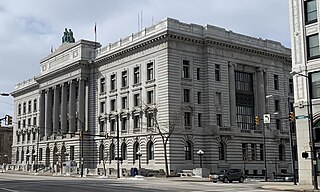
Mahoning County is a county in the U.S. state of Ohio. As of the 2020 census, the population was 228,614. Its county seat and largest city is Youngstown. The county is named after the Mahoning River and was formed on March 1, 1846; the 83rd county in Ohio. Until 1846, the area that is now Mahoning County was part of Trumbull and Columbiana counties, when the counties in the area were redefined and Mahoning County emerged as a new county. Mahoning County is part of the Youngstown–Warren, OH Metropolitan Statistical Area.
Bloomingdale is a village in central Jefferson County, Ohio, United States. The population was 145 at the 2020 census. It is part of the Weirton–Steubenville metropolitan area.

Austintown is an unincorporated community and census-designated place within Austintown Township, Mahoning County, Ohio, United States. The population was 29,594 at the 2020 census. Located directly west of Youngstown, it is a suburb of the Youngstown–Warren metropolitan area.
The Purchase Line is the name commonly given to the line dividing Indian from British Colonial lands established in the Treaty of Fort Stanwix of 1768 in western Pennsylvania. In New York State documents, it is referred to as the Line of Property. That article contains the treaty text and other sections.

The Youngstown–Warren, OH Metropolitan Statistical Area, typically known as the Mahoning Valley, is a metropolitan area in Northeast Ohio with Youngstown, Ohio, at its center. According to the U.S. Census Bureau, the metropolitan statistical area (MSA) includes Mahoning and Trumbull counties. As of the 2020 census, the region had a population of 541,243, making it the 107th largest metro area in the country.
Steamtown is an unincorporated community in Noble County, in the U.S. state of Ohio.
Blanco is an unincorporated community in Mahoning County, in the U.S. state of Ohio.
Calla is an unincorporated community in Mahoning County, in the U.S. state of Ohio. The community lies about 4 miles (6.5 km) south of Canfield.
Coitsville Center is an unincorporated community in Mahoning County, in the U.S. state of Ohio.
East Lewistown is an unincorporated community in Mahoning County, in the U.S. state of Ohio.
Fredericksburg is an unincorporated community in Mahoning County, in the U.S. state of Ohio.
Garfield is an unincorporated community in Mahoning County, in the U.S. state of Ohio.
Hickory Corners is an unincorporated community in Mahoning County, in the U.S. state of Ohio.
New Albany is an unincorporated community in Mahoning County, in the U.S. state of Ohio.
Patmos is an unincorporated community in Mahoning County, in the U.S. state of Ohio.
Poland Center is an unincorporated community in Mahoning County, in the U.S. state of Ohio.
Rosemont is an unincorporated community in Mahoning County, in the U.S. state of Ohio.
Snodes is an unincorporated community in Mahoning County, in the U.S. state of Ohio.
West Austintown is an unincorporated community in Mahoning County, in the U.S. state of Ohio.
Sippo is an unincorporated community in Stark County, in the U.S. state of Ohio.
References
- ↑ U.S. Geological Survey Geographic Names Information System: Knaufville, Ohio
- ↑ "Mahoning County". Jim Forte Postal History. Retrieved January 18, 2016.
- ↑ Sanderson, Thomas W. (1907). 20th Century History of Youngstown and Mahoning County, Ohio, and Representative Citizens. Biographical Publishing Company. p. 755.
Municipalities and communities of Mahoning County, Ohio, United States | ||
|---|---|---|
| Cities |  | |
| Villages | ||
| Townships | ||
| CDPs | ||
| Other communities | ||
| Footnotes | ‡This populated place also has portions in an adjacent county or counties | |
40°59′40″N80°48′59″W / 40.99444°N 80.81639°W
| | This Mahoning County, Ohio state location article is a stub. You can help Wikipedia by expanding it. |