Mahoning County is a county in the U.S. state of Ohio. As of the 2020 census, the population was 228,614. Its county seat and largest city is Youngstown. The county is named after the Mahoning River and was formed on March 1, 1846; the 83rd county in Ohio. Until 1846, the area that is now Mahoning County was part of Trumbull and Columbiana counties, when the counties in the area were redefined and Mahoning County emerged as a new county. Mahoning County is part of the Youngstown–Warren, OH Metropolitan Statistical Area.

Canfield is a city in central Mahoning County, Ohio, United States. The population was 7,699 as of the 2020 census. A suburb about 8 miles (13 km) southwest of Youngstown, the city lies at the intersection of U.S. Routes 62 and 224 and is part of the Youngstown–Warren metropolitan area. In 2005, Canfield was rated the 82nd best place to live in the United States by Money magazine.

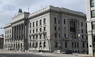
Youngstown is the largest city in and county seat of Mahoning County, Ohio, United States. At the 2020 census, it had a population of 60,068, making it the 11th-largest city in Ohio. It is a principal city of the Youngstown–Warren metropolitan area, which had a population of 430,591 in 2020, making it the seventh-largest metro area in Ohio and 125th-largest in the United States. Youngstown is situated on the Mahoning River in Northeast Ohio, 58 miles (93 km) southeast of Cleveland and 61 miles (100 km) northwest of Pittsburgh.
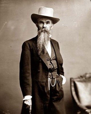
William Mahone was an Confederate States Army General, civil engineer, railroad executive, prominent Virginia Readjuster and ardent supporter of former slaves.

Beaver Township is one of the fourteen townships of Mahoning County, Ohio, United States. The 2020 census found 6,756 people in the township.

The Youngstown–Warren, OH Metropolitan Statistical Area, typically known as the Mahoning Valley, is a metropolitan area in Northeast Ohio with Youngstown, Ohio, at its center. According to the U.S. Census Bureau, the metropolitan statistical area (MSA) includes Mahoning and Trumbull counties. As of the 2020 census, the region had a population of 541,243, making it the 107th largest metro area in the country.

Goshen Township is one of the fourteen townships of Mahoning County, Ohio, United States. The 2020 census recorded 3,101 people in the township.

Smith Township is one of the fourteen townships of Mahoning County, Ohio, United States. The 2020 census found 4,097 people in the township.

Springfield Township is one of the fourteen townships of Mahoning County, Ohio, United States. The 2020 census found 6,800 people in the township.
Fairfield Township is one of the eighteen townships of Columbiana County, Ohio, United States, extending into southern Mahoning County. The 2020 census reported 9,769 people living in the township.

Coitsville Township is one of the fourteen townships of Mahoning County, Ohio, United States. The 2020 census found 1,264 people in the township.

Green Township is one of the fourteen townships of Mahoning County, Ohio, United States. The 2020 census found 3,414 people in the township.

Jackson Township is one of the fourteen townships of Mahoning County, Ohio, United States. The 2020 census found 2,124 people in the township.

North Benton is an unincorporated community in northern Smith Township, Mahoning County, Ohio, United States. It has a post office with the ZIP code 44449. It lies along State Route 14 between Salem and Ravenna.

Lake Milton is a census-designated place in central Milton Township, Mahoning County, Ohio, United States. The population was 637 at the 2020 census. Located in northwestern Mahoning County, it sits along the shore of the Lake Milton reservoir, along with the village of Craig Beach. It is part of the Youngstown–Warren metropolitan area.

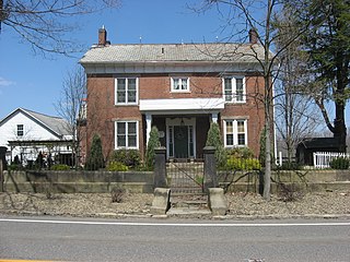
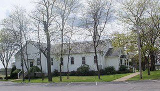
This is a list of the National Register of Historic Places listings in Mahoning County, Ohio.
Locust Grove is an unincorporated community in Mahoning County, Ohio, United States. Locust Grove is located on Ohio State Route 165, 12.3 miles (19.8 km) south-southwest of Youngstown.

The 1972 United States presidential election in Ohio took place on November 7, 1972. All 50 states and the District of Columbia were part of the 1972 United States presidential election. State voters chose 25 electors to the Electoral College, who voted for president and vice president.
The Pennsylvania State Game Lands Number 287 are Pennsylvania State Game Lands in Armstrong County in Pennsylvania in the United States providing hunting, bird watching, and other activities.

East Alliance is an unincorporated community and census-designated place (CDP) in Mahoning County, Ohio, United States. It was first listed as a CDP prior to the 2020 census.
