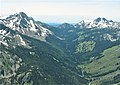
Sacajawea Peak is a peak in the Wallowa Mountains, in the U.S. state of Oregon. It is in the Eagle Cap Wilderness and the Wallowa–Whitman National Forest.

Seven Gables is a 13,080-foot-elevation (3,990-meter) mountain summit located in the Sierra Nevada mountain range in Fresno County of northern California, United States. It is situated between the east and south forks of Bear Creek in the John Muir Wilderness, on land managed by Sierra National Forest. It is set 9 miles (14 km) southeast of Lake Thomas A Edison, 1.2 miles (1.9 km) northwest of Gemini, and 3.2 miles (5.1 km) west-southwest of Feather Peak, the nearest higher neighbor. Topographic relief is significant as it rises nearly 3,500 feet above Upper Bear Creek Meadows in approximately two miles. Seven Gables ranks as the 133rd highest summit in California.

Highland Peak is a prominent 10,936-foot-elevation mountain summit located in the Sierra Nevada mountain range, in Alpine County of northern California, United States. It is situated 3.5 miles east of Ebbetts Pass in the Carson-Iceberg Wilderness, on land managed by Humboldt–Toiyabe National Forest. Although it ranks as the 680th highest summit in California, it ranks 36th highest of those with at least 500 meters of topographic prominence. Also, there is no higher peak than Highland Peak to the north within the Sierra Nevada. Highland Peak has a subsidiary South Peak, with one-half mile separation between summits. The Pacific Crest Trail traverses the western foot of this mountain, providing an approach option.
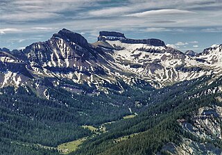
Coxcomb Peak is a 13,656-foot-elevation (4,162-meter) mountain summit located on the common boundary of Hinsdale County and Ouray County, in Colorado, United States. It is situated nine miles northeast of the community of Ouray, in the Uncompahgre Wilderness, on land managed by Uncompahgre National Forest. It is part of the San Juan Mountains which are a subset of the Rocky Mountains, and is situated west of the Continental Divide. Coxcomb ranks as the 171st-highest peak in Colorado, and topographic relief is significant as the south aspect rises 2,000 feet above Wetterhorn Basin in approximately one mile, and 4,400 feet above Cow Creek in three miles. Neighbors include Precipice Peak 2.7 miles to the north, Redcliff one-half mile north, Matterhorn Peak 2.3 miles to the east-southeast, and nearest higher neighbor Wetterhorn Peak 1.8 mile to the southeast. The mountain's descriptive name, which has been officially adopted by the United States Board on Geographic Names, was in use since at least 1906 when Henry Gannett published it in the Gazetteer of Colorado.

Ostler Peak is a 12,718-foot elevation (3,876 m) mountain summit located in Summit County, Utah, United States.

Mount Lovenia is a 13,219-foot elevation (4,029 m) mountain summit located on the common border that Duchesne County shares with Summit County in the U.S. state of Utah.

Explorer Peak is a 12,708-foot elevation (3,873 m) mountain summit located in Duchesne County, Utah, United States.

Dead Horse Peak is a 12,642-foot elevation (3,853 m) mountain summit located on the common border that Duchesne County shares with Summit County in the U.S. state of Utah.

Wasatch Peak is a 13,156-foot elevation (4,010 m) mountain summit located in Summit County, Utah, United States.
Sawtooth Peak is a 9,179-foot elevation (2,798 m) mountain summit located in Wallowa County, Oregon, US.

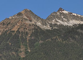
Chief Joseph Mountain is a 9,616-foot elevation (2,931 m) mountain summit located in Wallowa County, Oregon, US.

Matterhorn is a 9,835-foot elevation (2,998 m) mountain summit located in Wallowa County, Oregon, US.

Craig Mountain is a 9,204-foot elevation (2,805 m) mountain summit located in Wallowa County, Oregon, US.
Bonneville Mountain is an 8,140-foot elevation (2,481 m) mountain summit located in Wallowa County, Oregon, US.

Glacier Peak is a 9,495-foot elevation (2,894 m) mountain summit located in Union County, Oregon, US.

Cusick Mountain is a summit located in Wallowa County, Oregon, US.

Needle Point is a mountain summit located in Union County, Oregon, US.

Cornucopia Peak is a mountain summit located in Baker County, Oregon, US.

Twining Peak is a 13,711-foot (4,179 m) mountain summit on the shared border of Pitkin County and Lake County, in Colorado, United States.

Mount Tweto is a 13,672-foot (4,167 m) mountain summit on the boundary shared by Lake County and Park County, in Colorado, United States.