
Interstate 12 (I-12) is an intrastate Interstate Highway located entirely within the US state of Louisiana. It spans a total of 85.59 miles (137.74 km) in an east–west direction from I-10 in Baton Rouge to an interchange with both I-10 and I-59 in Slidell. Along the way, it passes through the city of Hammond, where it intersects I-55 and US Route 51 (US 51). It also serves the cities of Ponchatoula and Denham Springs, as well as the St. Tammany Parish cities of Covington and Mandeville.

St. Tammany Parish is a parish located in the U.S. state of Louisiana named after Tamanend, the legendary Lenape Chief of Chiefs and the "Patron Saint of America." At the 2020 census, the population was 264,570, making it the fourth-most populous parish in Louisiana. The parish seat is Covington. The parish was founded in 1810.

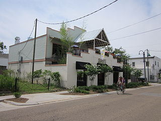
Covington is a city in, and the parish seat of, St. Tammany Parish, Louisiana, United States. The population was 11,564 at the 2020 United States census. It is located at a fork of the Bogue Falaya and the Tchefuncte River. Covington is part of the Slidell metropolitan area. Covington has played a large role in movie making over the past 20 years, featuring in over 30 films.
Eden Isle is a census-designated place (CDP) in St. Tammany Parish, Louisiana, United States, on the northeast shore of Lake Pontchartrain. The population was 7,041 at the 2010 census, and 7,782 in 2020. It is part of the New Orleans–Metairie–Kenner metropolitan statistical area. The area is a residential community with homes built on a system of canals connecting to eastern Lake Pontchartrain, which also includes businesses along the Interstate-10 corridor as well as restaurants and marina services within the residential section.

Madisonville is a town in St. Tammany Parish in the U.S. state of Louisiana. The population was 748 at the 2010 U.S. census, and 850 at the 2020 U.S. census. It is part of the New Orleans–Metairie–Kenner metropolitan statistical area. The ZIP code is 70447.
Mandeville is a city in St. Tammany Parish, Louisiana, United States. Its population was 11,560 at the 2010 U.S. census, and 13,192 at the 2020 United States census. Mandeville is located on the north shore of Lake Pontchartrain, south of Interstate 12. It is across the lake from the city of New Orleans and its southshore suburbs. It is part of the New Orleans–Metairie–Kenner metropolitan area.

Pearl River is a town in St. Tammany Parish in the U.S. state of Louisiana. The population was 2,506 at the 2010 U.S. census, and 2,618 at the 2020 population estimates program. It is part of the New Orleans–Metairie–Kenner metropolitan statistical area.

Slidell is a city on the northeast shore of Lake Pontchartrain in St. Tammany Parish, Louisiana, United States. The population was 28,781 at the 2020 census. It is part of the New Orleans−Metairie−Kenner metropolitan statistical area.
Bush is an unincorporated community in northeastern St. Tammany Parish, Louisiana, United States. Bush is on Louisiana Highway 21 south of Sun connecting to Bogalusa. It is part of the New Orleans–Metairie–Kenner Metropolitan Statistical Area. Highway 21 crosses the Bogue Chitto River approximately 1.45 miles (2.33 km) north of town.

The Florida Parishes, on the east side of the Mississippi River—an area also known as the Northshore or Northlake region—are eight parishes in the southeastern portion of the U.S. state of Louisiana.
Fontainebleau High School is a public high school located in unincorporated St. Tammany Parish, Louisiana, United States, north of Mandeville. The school is a part of the St. Tammany Parish Public Schools.
Northshore High School in Slidell, Louisiana, United States, serves a population of approximately 14,000 in its district. Northshore, which serves small portions of northern and eastern Slidell, is a part of the St. Tammany Parish Public Schools.

Salmen High School is a public high school in Slidell, Louisiana, United States, under the St. Tammany Parish School Board.

WYLK, also known as Lake 94.7, is a hot adult contemporary radio station serving the St. Tammany Parish area. Owned by former Mississippi congressman C. Wayne Dowdy under the company name North Shore Broadcasting Co., Inc., the station is licensed to Lacombe, Louisiana, and broadcasts at 94.7 MHz with an ERP of 2,900 watts.

St. Genevieve Church is a parish of the Roman Catholic Archdiocese of New Orleans located along the northeastern edge of Lake Pontchartrain in Slidell, Louisiana, United States. St. Genevieve is one of eight parishes which belongs to Deanery XII - East St. Tammany - Washington Deanery, an ecclesiastical division of the archdiocese.

Mandeville High School is a public high school located in Mandeville, Louisiana, United States, a suburban city located thirty miles north of New Orleans. It is part of the St. Tammany Parish Public Schools system.

St. Tammany Parish Public Schools is a public school district serving the children of St. Tammany Parish, located along the Northshore banks of Lake Pontchartrain in southeast Louisiana, United States. The district's Central Office is located in downtown Covington, on the site of the original Covington High School and the former sites of the Covington Grammar School and C.J. Schoen Middle School. The district also has an annex location in Slidell, Louisiana, to serve the east side of St. Tammany Parish.
Slidell High School is a public school for grades nine through twelve located in Slidell, Louisiana, United States. It is part of the St. Tammany Parish Public School District and serves portions of west and central Slidell as well as a section of Lacombe.
Lakeshore High School is a public high school located in unincorporated St. Tammany Parish, Louisiana, United States, north of Mandeville. Lakeshore High School receives the students from Monteleone Junior High School. The school is operated by the St. Tammany Parish Public Schools district.
Lewisburg is an unincorporated community and census-designated place in St. Tammany Parish, Louisiana, United States. The community is located 7 miles south of Covington, Louisiana. It was first listed as a CDP in the 2020 census with a population of 420.


