Lake Argyle

Last updated

Lake Argyle
Lake argyle.jpg
Lake Argyle seen from space, August 1985. The main channel of the Ord River (dark, meandering feature) north of the lake is visible as it drains northward, eventually emptying into the Joseph Bonaparte Gulf. Low, folded mountains can be identified east and west of this river valley.
Australia Western Australia relief location map.png
Red pog.svg
Lake Argyle
Location in Western Australia
Locationnear Kununurra
East Kimberley, Western Australia
Coordinates 16°20′08″S128°44′37″E / 16.3355°S 128.7435°E / -16.3355; 128.7435 (Lake Argyle) OOjs UI icon edit-ltr-progressive.svg
Type Freshwater reservoir
Primary inflows Ord River, Bow River
Primary outflows Ord River
Catchment area 46,100 km2 (17,800 sq mi)
Basin  countriesAustralia
First flooded1971
Max. length67 kilometres (42 mi)
Max. width10 kilometres (6.2 mi)
Surface area703 km2 (271 sq mi)
Water volume10,763 gigalitres (8.726×10^6 acre⋅ft; 2.582 cu mi) [1]
Website www.lakeargyle.com OOjs UI icon edit-ltr-progressive.svg
ReferencesWater Corporation [1]
Lake Argyle
Official nameLakes Argyle and Kununurra
Designated7 June 1990
Reference no.478 [2]

Lake Argyle is Western Australia's largest and Australia's second largest [3] freshwater man-made reservoir by volume. The reservoir is part of the Ord River Irrigation Scheme and is located near the East Kimberley town of Kununurra. The lake flooded large parts of the Shire of Wyndham-East Kimberley on the Kimberley Plateau about 80 kilometres (50 mi) inland from the Joseph Bonaparte Gulf, close to the border with the Northern Territory.

Contents

The primary inflow is the Ord River, while the Bow River and many other smaller creeks also flow into the dam. [4] The lake is a DIWA-listed wetland. [5] Lake Argyle and Lake Kununurra were listed in 1990 as Ramsar Convention protected wetlands. [6]

History and construction

The construction of the Ord River Dam was completed in 1971 by Dravo Corporation. [7] The dam was officially opened the following year. The dam wall is 335 metres (1,099 ft) long, and 98 metres (322 ft) high. The earth-fill only dam wall at Lake Argyle is the most efficient dam in Australia in terms of the ratio of the size of the dam wall to the amount of water stored. The lake was named after the property it partly submerged, Argyle Downs. [7]

Ord River Dam post office opened on 1 March 1969 and closed on 15 November 1971 demonstrating the approximate duration of the construction camp. [8]

In 1996, the spillway wall was raised by 6 metres (20 ft), which doubled the dam's capacity. [9] Sediment flowing into the dam caused concerns in the mid-1990s that the dam's capacity could be dramatically reduced. By 2006 continual regeneration of the upper Ord catchment appeared to have reduced the amount of sediment inflow. [10]

The dam received a Historic Engineering Marker from Engineers Australia as part of its Engineering Heritage Recognition Program. [11]

Geography

Dam wall Lake Arglye Dam Wall DSC03854.JPG
Dam wall

Lake Argyle normally has a surface area of about 1,000 square kilometres (390 sq mi). The storage capacity, to the top of the spillway is 10,763 gigalitres (3.801×10¹¹ cu ft). The lake filled to capacity in 1973, and the spillway flowed until 1984.[ citation needed ] Lake Argyle's usual storage volume is 5,797 gigalitres (2.047×10¹¹ cu ft), [12] making it the largest reservoir in Australia. The combined Lake Gordon/Lake Pedder system in Tasmania is larger but is two dams connected by a canal. At maximum flood level, Lake Argyle would hold 35,000 gigalitres (1.2×10¹² cu ft) of water and cover a surface area of 2,072 square kilometres (800 sq mi). [7]

Higher areas have become permanent islands within the lake's area.

Irrigation

Lake Argyle, together with Lake Kununurra, is part of the Ord River Irrigation Scheme. There are currently some 150 square kilometres (58 sq mi) of farmland under irrigation in the East Kimberly region. The original plan was for dam water to irrigate rice crop for export to China. [7] However these plans were scuppered as waterfowl, particularly magpie geese ate rice shoots more quickly than they could be planted. Other crops are now grown, but Lake Argyle still remains Australia's most under-utilised lake. [7]

Flora and fauna

View from downstream viewing the Ord River after it leaves Lake Argyle Lake Argyle Western Australia DSC03731.jpg
View from downstream viewing the Ord River after it leaves Lake Argyle

The damming of the Ord River has caused major changes to the environment.[ citation needed ] Flows to the Ord River have been severely reduced. Within Lake Argyle itself a thriving new eco-system has developed. The lake is recognised as an important wetland area under the Ramsar Convention; with Lake Kununurra it forms the Lakes Argyle and Kununurra Ramsar Site. [13]

The lake is now home to 26 species of native fish and a population of freshwater crocodiles currently estimated at some 25,000. [14] Fish species that are present in Lake Argyle include barramundi, southern saratoga, archer fish, forktail cat fish, mouth almighty, long tom, bony bream and sleepy cod. [7] While the official website states that only incidentally a saltwater crocodile is found, [15] other experts disagree. [16]

Cane toads reached the dam in late 2008, mostly via traveling along the Victoria Highway, with numbers rising significantly during the 2009 summer. [13]

Birds

Aerial view at southern end Southern end of Lake Argyle from the air.jpg
Aerial view at southern end

The lake, with its surrounding mudflats and grasslands, has been identified by BirdLife International as an Important Bird Area (IBA) because it supports about 150,000 waterbirds with twelve species being represented in large enough numbers to be considered internationally significant. The mud flats and grasslands are the natural habitat of eight wader species also represented in internationally significant numbers, along with a healthy population of Australian bustards which are considered a "near threatened" species. Birds for which the lake has global importance include magpie geese, wandering whistling-ducks, green pygmy-geese, Pacific black ducks, hardheads, black-necked storks, white-headed stilts, red-capped plovers, Oriental plovers, black-fronted dotterels, long-toed stints and sharp-tailed sandpipers. [17]

Common larger-bodied bird species found at the lake include the Australian pelican, black swan, eastern great egret, royal spoonbill, osprey and wedge-tailed eagle. Common smaller-bodied bird species include the spinifex pigeon, peaceful dove, common sandpiper, white-winged tern and budgerigar, while mid-sized bird species include the red-winged parrot, blue-winged kookaburra and barking owl. [17]

Some threats identified by the IBA include invasive weed and animal species, such as the cane toad, as well as agricultural uses, free range cattle and feral ungulates that may be over-grazing in the shallow areas around the lake. The IBA recommends that a fence be installed in the important shallows in the south and east to prevent all ungulates from entering those lake areas. [17]

See also

Related Research Articles

<span class="mw-page-title-main">Kununurra, Western Australia</span> Town in the Kimberley region of Western Australia

Kununurra is a town in far northern Western Australia located at the eastern extremity of the Kimberley approximately 45 kilometres (28 mi) from the border with the Northern Territory. Kununurra was initiated to service the Ord River Irrigation Scheme. Its language is Miriwoong.

The Kimberley is the northernmost of the nine regions of Western Australia. It is bordered on the west by the Indian Ocean, on the north by the Timor Sea, on the south by the Great Sandy and Tanami deserts in the region of the Pilbara, and on the east by the Northern Territory.

<span class="mw-page-title-main">Murray–Darling basin</span> Largest Australian river catchment

The Murray–Darling Basin is a large geographical area in the interior of southeastern Australia, encompassing the drainage basin of the tributaries of the Murray River, Australia's longest river, and the Darling River, a right tributary of the Murray and Australia's third-longest river. The Basin, which includes six of Australia's seven longest rivers and covers around one-seventh of the Australian landmass, is one of the country's most significant agricultural areas providing one-third of Australia's food supply. Located west of the Great Dividing Range, it drains southwest into the Great Australian Bight and spans most of the states of New South Wales and Victoria, the Australian Capital Territory, and parts of the states of Queensland and South Australia.

<span class="mw-page-title-main">Ord River</span> River in Kimberley region of Western Australia

The Ord River is a 651-kilometre long (405 mi) river in the Kimberley region of Western Australia. The river's catchment covers 55,100 square kilometres (21,274 sq mi).

<span class="mw-page-title-main">Shire of Wyndham–East Kimberley</span> Local government area in Western Australia

The Shire of Wyndham East Kimberley is one of the four local government areas in the Kimberley region of northern Western Australia, covering an area of 117,514 square kilometres (45,372 sq mi) at Western Australia's northeastern corner. The Shire's seat of government was originally in Wyndham but now in the town of Kununurra, which is home to over half of the Shire's permanent population of around 7,000, while a council office is located at Wyndham.

<span class="mw-page-title-main">Burdekin Falls Dam</span> Dam in North Queensland

The Burdekin Falls Dam, also known as the Burdekin Dam, is a concrete gravity dam with an uncontrolled spillway across the Burdekin River, located south west of Ayr, and Home Hill in the Shire of Burdekin, North Queensland, Australia. Built for the purpose of irrigation, the reservoir is called Lake Dalrymple. Burdekin Falls Dam is managed by SunWater. Water from the reservoir is also used to replenish downstream aquifers.

<span class="mw-page-title-main">Maharana Pratap Sagar</span> Reservoir in India

Maharana Pratap Sagar, also known as Pong Reservoir or Pong Dam Lake is a large reservoir in Fatehpur, Jawali and Dehra tehsil of Kangra district of the state of Himachal Pradesh in India. It was created in 1975, by building the highest earthfill dam in India on the Beas River in the wetland zone of the Siwalik Hills. Named in the honour of Maharana Pratap (1540–1597), the reservoir or the lake is a well-known wildlife sanctuary and one of the 75 international wetland sites declared in India by the Ramsar Convention. The reservoir covers an area of 24,529 hectares, and the wetlands portion is 15,662 hectares.

<span class="mw-page-title-main">Mornington Sanctuary</span>

Mornington Sanctuary, formerly Mornington Station, is a 3,582 km2 (1,383 sq mi) nature reserve in the Kimberley region of north-west Western Australia. It contains the Mornington Wilderness Camp and is owned and managed by the Australian Wildlife Conservancy (AWC). It lies in the Pentecost subregion of the Central Kimberley Bioregion.

The Orielton Lagoon is a shallow dystrophic lagoon located west of Sorell in south east Tasmania, Australia.

<span class="mw-page-title-main">Chaffey Dam</span> Dam in New South Wales, Australia

Chaffey Dam is a minor ungated rock fill with clay core embankment dam with an uncontrolled morning glory spillway across the Peel River, located upstream of the city of Tamworth, in the New England region of New South Wales, Australia. The dam's purpose includes flood mitigation, irrigation, water supply, and water conservation.

Lake Gore is a seasonal and semi-permanent freshwater lake in the Goldfields-Esperance region of Western Australia located approximately 24 km (15 mi) west of Esperance. It is an important site for waterbirds.

<span class="mw-page-title-main">Lake Kununurra</span> Freshwater reservoir in Kununurra, Western Australia

Lake Kununurra is a freshwater man-made reservoir located in the Ord River valley. The lake was formed in 1963 by the construction of the Ord Diversion Dam in Kununurra, northern Western Australia, which was built to supply water to the Ord River Irrigation Area. Prior to the diversion dam construction a natural permanent waterhole held back by the Bandicoot Bar was known as "Carlton Reach", which was reputed to be the largest waterhole in the Kimberley.

<span class="mw-page-title-main">Lakes Argyle and Kununurra Ramsar Site</span> Protected area in Western Australia

The Lakes Argyle and Kununurra Ramsar Site comprises an extensive system of artificial freshwater reservoirs, with their associated permanent wetlands, formed by damming the Ord River in the eastern part of the Kimberley region of northern Western Australia. The reservoirs include Lake Argyle and Lake Kununurra. There are numerous endemic plants and a rich fauna. The 1,500 km2 (580 sq mi) site was designated a wetland of international importance under the Ramsar Convention on 7 June 1990, making it Ramsar Site 478.

<span class="mw-page-title-main">Ord River Floodplain</span>

The Ord River floodplain is the floodplain of the lower Ord River in the Shire of Wyndham-East Kimberley, in the Kimberley region of northern Western Australia. It lies within the Victoria Bonaparte IBRA bioregion and contains river, seasonal creek, tidal mudflat and floodplain wetlands, with extensive stands of mangroves, that support saltwater crocodiles and many waterbirds. It is recognised as an internationally important wetland area, with 1,384 square kilometres (534 sq mi) of it designated on 7 June 1990 as Ramsar Site 477 under the Ramsar Convention on Wetlands.

<span class="mw-page-title-main">Saskatchewan River Delta</span> Inland river delta in Western Canada

Ivanhoe or Ivanhoe Station is a pastoral lease and cattle station located just north of Kununurra in the Kimberley region of Western Australia. Founded in 1893 by the Durack brothers, station is presently owned by the Consolidated Pastoral Company.

<span class="mw-page-title-main">Menindee Lakes</span> Shallow freshwater lakes in New South Wales

The Menindee Lakes is a system of 9 large, but relatively shallow lakes, located in south-west New South Wales on the Darling (Barka) River, about 200 km upstream of the Darling River's junction with the River Murray. The Darling River is fed by nine major tributary river systems flowing from south-east Queensland and north and central NSW. The town of Menindee is close to the lakes and the nearest city is Broken Hill.

<span class="mw-page-title-main">North Victorian Wetlands</span> Wetlands in Victoria, Australia

The North Victorian Wetlands, also known as the Kerang Wetlands, comprise an extensive series of over 100 freshwater, brackish and saline lakes and swamps on the floodplain of the Loddon River where it enters the Murray valley, in the vicinity of the town of Kerang, in northern Victoria, south-eastern Australia. They are important for a variety, and sometimes large numbers, of waterbirds.

<span class="mw-page-title-main">Ord Irrigation Area Important Bird Area</span>

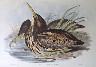
The Ord Irrigation Area Important Bird Area is an area of land used for irrigated agriculture along the Ord River in the vicinity of the town of Kununurra in the Kimberley region of north-western Australia. It has been identified by BirdLife International as a 220 km2 Important Bird Area (IBA) for its significance for birds, especially estrildid finches.

The Gajirrawoong people, also written Gadjerong, Gajerrong and other variations, are an Aboriginal Australian people of the Northern Territory, most of whom now live in north-eastern Western Australia.

References

  1. 1 2 "Statewide Dam Storage – Argyle Dam (Ord River)". Water Corporation. 28 January 2008. Archived from the original on 4 February 2008. Retrieved 16 October 2022.
  2. "Lakes Argyle and Kununurra". Ramsar Sites Information Service. Retrieved 25 April 2018.
  3. "Largest Waterbodies". Geoscience Australia. 27 June 2014. Retrieved 15 March 2015.
  4. Public Works Department (1982). Lake Argyle (PDF) (Map). 1:30,000. Department of Transport, Government of Western Australia. Archived (PDF) from the original on 26 March 2022. Retrieved 16 October 2022.
  5. "Search for a Nationally Important Wetland". 2010. Retrieved 6 June 2010.
  6. "Australian Ramsar Sites - Lake Argyle and Kununurra". 2010. Retrieved 6 June 2010.
  7. 1 2 3 4 5 6 Harrison, Rod; Ernie James; Chris Sully; Bill Classon; Joy Eckermann (2008). Queensland Dams. Bayswater, Victoria: Australian Fishing Network. pp. 60–61. ISBN   978-1-86513-134-4.
  8. Premier Postal History, Post Office List , retrieved 21 January 2016
  9. Willacy, Marck (12 November 2006). "Fears for second stage of Ord Irrigation Scheme". Landline . Australian Broadcasting Corporation . Retrieved 28 December 2018.
  10. "Dept hopes sediment flow into Lake Argyle will decrease". ABC News online. Australian Broadcasting Corporation. 11 December 2006. Retrieved 15 May 2009.
  11. "Ord River Dam, 1972-". Engineers Australia. Retrieved 6 May 2020.
  12. Australian Govt. Pub. Service Ord River Irrigation Area review. a joint Commonwealth and Western Australian review. 1979
  13. 1 2 Narelle Towie (11 May 2009). "Cane toads thrive in Lake Argyle". PerthNow. The Sunday Times. Retrieved 15 May 2009.
  14. Claudia Bertorello-Kell (3 June 2007). "Argyle racers shrug off crocs". PerthNow. The Sunday Times. Retrieved 15 May 2009.
  15. "Freshwater Crocodiles (Crocodyllus Johnstoni)". Lake Argyle. Archived from the original on 19 August 2010. Retrieved 31 March 2010.
  16. Bennett, Michael (27 March 2010). "Fatal crocodile attack 'inevitable'". The West Australian . Retrieved 22 May 2021.
  17. 1 2 3 "IBA: Lake Argyle". Birdata. Birds Australia. Archived from the original on 6 July 2011. Retrieved 18 July 2011.