Related Research Articles

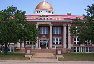
Tillman County is a county located in the southwestern part of Oklahoma, United States. As of the 2020 census, the population was 6,968. The county seat is Frederick.

Kiowa County is a county located in the southwestern part of the U.S. state of Oklahoma. As of the 2020 census, the population was 8,509. Its county seat is Hobart. The county was created in 1901 as part of Oklahoma Territory. It was named for the Kiowa people.

Ellis County is a county located on the western border of the U.S. state of Oklahoma. As of the 2020 census, the population was 3,749, making it the fifth-least populous county in Oklahoma. Its county seat is Arnett.

Cotton County is a county located in the U.S. state of Oklahoma. As of the 2020 census, the population was 5,527. Its county seat is Walters. When Oklahoma achieved statehood in 1907, the area which is now Cotton County fell within the boundaries of Comanche County. It was split off in 1912, becoming the last county created in Oklahoma; it was named for the county's primary crop.

Comanche County is a county located in the U.S. state of Oklahoma. As of the 2020 census, the population was 121,125, making it the fifth-most populous county in Oklahoma. Its county seat is Lawton. The county was created in 1901 as part of Oklahoma Territory. It was named for the Comanche tribal nation.
Lawton is a city in and the county seat of Comanche County, in the U.S. state of Oklahoma. Located in southwestern Oklahoma, approximately 87 mi (140 km) southwest of Oklahoma City, it is the principal city of the Lawton, Oklahoma, metropolitan statistical area. According to the 2020 census, Lawton's population was 90,381, making it the sixth-largest city in the state, and the largest in Western Oklahoma.

State Highway 36 is a state highway in Oklahoma. It runs for 44.4 miles (71.5 km), forming a western loop route from Interstate 44, which it connects to at both ends. It passes through Cotton Co., Tillman Co., and Comanche Co. It currently has no lettered spur routes. State Highway 36 was first added to the highway system around 1926.

State Highway 54 is a state highway in western Oklahoma. Running north–south, it exists in two parts, which lie at approximately the same longitude. The southern section's length is 9.96 miles (16.03 km), while the northern section runs for 85.5 miles (137.6 km), for a combined length of 95.5 miles (153.7 km). The northern section has two lettered spur routes.

State Highway 115 is a 57.2 mile (92 km) long state highway in western Oklahoma, passing through Comanche, Kiowa, and Washita Counties as well as the Wichita Mountains Wildlife Refuge. The highway has no lettered spur routes.

U.S. Route 70 is a transcontinental U.S. highway extending from Globe, Arizona to Atlantic, North Carolina. Along the way, 289.81 miles (466.40 km) of its route passes through the state of Oklahoma. Entering the state south of Davidson, the highway serves Oklahoma's southern tier before exiting the state east of Broken Bow. It serves the cities of Ardmore, Durant, Hugo, and Idabel, as well as Tillman, Cotton, Jefferson, Carter, Marshall, Bryan, Choctaw, and McCurtain counties.
Kiowa Creek is a watercourse in Texas and Oklahoma that becomes a tributary of the Beaver River. It originates southwest of Huntoon and east of Perryton in northeastern Ochiltree County, Texas. It travels generally east until southwest of Darrouzett in Lipscomb County, then turns northeast and passes just south and east of that town. It continues generally northeasterly into Beaver County, Oklahoma, where it is joined by Camp Creek. The stream enters Harper County west of Laverne, Oklahoma, and continues to its joinder with the Beaver River north-northwest of Laverne.

The North Fork Red River, sometimes called simply the "North Fork", is a tributary of the Red River of the South about 271 mi (436 km) long, heading along the eastern Caprock Escarpment of the Llano Estacado about 11.4 mi (18.3 km) southwest of Pampa, Texas. Rising in Gray County, Texas, it terminates at the confluence with Prairie Dog Town Fork of the Red River at the Texas-Oklahoma border.
Cache Creek is a small creek in Cotton County, Oklahoma and a tributary of the Red River. Cache Creek has a distance of 5.5 miles (8.9 km) from the Red River to the East Cache Creek and West Cache Creek basin. The East Cache Creek and West Cache Creek confluence is located 6 miles (9.7 km) southwest of Temple, Oklahoma.
Chickasha Lake, also known as Lake Chickasha, is a man-made reservoir in the central part of the state of Oklahoma. Located in Caddo County, Oklahoma, it was completed in 1958. The main purposes were supplying water and for recreation. The lake is about 9 miles (14 km) west of Chickasha, and is owned and operated by that city.
Dead Warrior Lake, sometimes known by its prior name of Dead Indian Lake, is located about 3 miles south of Roll, Oklahoma and 11 miles north of Cheyenne in Roger Mills County, Oklahoma on US Route 283. The lake and the adjacent Black Kettle Recreation Area are all part of the Black Kettle National Grassland, which is managed by the Cibola National Forest.
Spring Creek Lake is located on Spring Creek in Roger Mills County about 14 miles north of Cheyenne on US Route 283 and 8 miles west on SH-33, in the State of Oklahoma. It is inside the Black Kettle National Grassland, which is managed by the Cibola National Forest. It is 60 acres in size.
Red Rock Creek rises in the middle of Garfield County in Oklahoma, and proceeds generally east through Garfield and Noble counties on a 45-to-50 mile course taking it just past the Noble-Pawnee county line to drain into the Arkansas River. Specifically, the creek originates northeast of Breckenridge, Oklahoma and south of Hunter, Oklahoma, and continues east past the northern limit of Red Rock, Oklahoma before emptying into the Arkansas River just northeast of Sooner Lake.
Sugar Creek rises west of Hinton in Caddo County, Oklahoma. It travels generally south-southeast directly through Lookeba and the northeast corner of Binger. It flows along the west boundary of Gracemont before turning more southeasterly and joining the Washita River to the east of Anadarko, Oklahoma.
Cobb Creek, also known as Pond Creek, is a watercourse in Washita and Caddo counties in Oklahoma. It originates in Washita County just south of the Custer-Washita county line, being south of Weatherford, Oklahoma. It flows generally south-southeast, feeding into the 157-acre Crowder Lake, also known as the Cobb Creek Watershed Dam No. 1. It continues below the lake, passing through Colony, Oklahoma, after which it turns more southeasterly and crosses into Caddo County. It joins Fort Cobb Lake from the west. Cobb Creek continues south-southeast below that lake, and ends when it becomes a tributary of the Washita River just southeast of Fort Cobb, Oklahoma.
Kiowa Creek is a stream in Comanche County, Kansas. Its watershed includes multiple other streams. West Kiowa Creek forms in northeast Clark County, Kansas, and flows generally southeast, passing through the southwestern corner of Kiowa County, Kansas, where it is joined by Turkey Creek and Little Turkey Creek. It continues into Comanche County, where it is joined by Middle Kiowa Creek, a southerly-flowing stream originating in Kiowa County to the north. The combined stream flows generally south, and becomes simply Kiowa Creek at some point. It is later joined by East Kiowa Creek, also a southerly-flowing stream originating in Kiowa County to the north, and one having its own tributary, Wiggins Creek. Kiowa Creek continues generally south, and travels along the eastern border of the town of Protection, Kansas, before becoming a tributary of Cavalry Creek to the southeast of Protection. Cavalry Creeks feeds into Bluff Creek, which eventually becomes a tributary of the Cimarron River before that watercourse enters Oklahoma.
References
- ↑ "Tillman County, Oklahoma". Google Maps. Retrieved August 24, 2021.
- ↑ "Lake Frederick, OK". Google Maps. Retrieved August 24, 2021.
- ↑ "Lake Frederick, Oklahoma to Frederick, Oklahoma". Google Maps. Retrieved August 24, 2021.
- 1 2 3 4 5 "Lake Frederick Diagnostic and Bathymetric Mapping Study" (PDF). Oklahoma Water Resources Board. Retrieved August 24, 2021.
- 1 2 "Lake Frederick". TravelOK.com. Retrieved August 24, 2021.
- ↑ "Lake Frederick". Lake-Link. Retrieved August 24, 2021.
- ↑ "Comanche County, OK". Google Maps. Retrieved August 24, 2021.
- ↑ "Kiowa County, Oklahoma". Google Maps. Retrieved August 24, 2021.
- ↑ "Tillman County, Oklahoma". Google Maps. Retrieved August 24, 2021.
- ↑ "Deep Red Creek, Oklahoma". Google Maps. Retrieved August 24, 2021.
| | This Oklahoma state location article is a stub. You can help Wikipedia by expanding it. |
| | This article related to a lake in the United States is a stub. You can help Wikipedia by expanding it. |