Manitou, Oklahoma

Last updated

Manitou, Oklahoma
OKMap-doton-Manitou.PNG
Location of Manitou, Oklahoma
Coordinates: 34°30′26″N98°58′52″W / 34.50722°N 98.98111°W / 34.50722; -98.98111
Country United States
State Oklahoma
County Tillman
Area
[1]
  Total0.31 sq mi (0.81 km2)
  Land0.31 sq mi (0.81 km2)
  Water0.00 sq mi (0.00 km2)
Elevation
[2]
1,250 ft (380 m)
Population
 (2020)
  Total171
  Density544.59/sq mi (210.10/km2)
Time zone UTC-6 (Central (CST))
  Summer (DST) UTC-5 (CDT)
ZIP code
73555
Area code 580
FIPS code 40-46150 [3]
GNIS feature ID2412943 [2]

Manitou is a town in Tillman County, Oklahoma, United States. The population was 171 as of the 2020 United States census. [4] It includes the former town of Siboney, absorbed on January 28, 1907. [5]

Contents

Geography

According to the United States Census Bureau, the town has a total area of 0.3 square miles (0.78 km2), all land.

Lake Frederick is approximately seven miles east. [6]

Demographics

Historical population
CensusPop.Note
1910 267
1920 33525.5%
1930 323−3.6%
1940 258−20.1%
1950 29313.6%
1960 269−8.2%
1970 30814.5%
1980 3224.5%
1990 244−24.2%
2000 27813.9%
2010 181−34.9%
2020 171−5.5%
U.S. Decennial Census [7]

As of the census [3] of 2000, there were 278 people, 84 households, and 57 families residing in the town. The population density was 883.0 inhabitants per square mile (340.9/km2). There were 111 housing units at an average density of 352.6 per square mile (136.1/km2). The racial makeup of the town was 81.29% White, 8.99% African American, 3.60% Native American, 0.36% Asian, 0.36% Pacific Islander, 1.08% from other races, and 4.32% from two or more races. Hispanic or Latino of any race were 7.91% of the population.

There were 84 households, out of which 31.0% had children under the age of 18 living with them, 56.0% were married couples living together, 8.3% had a female householder with no husband present, and 32.1% were non-families. 31.0% of all households were made up of individuals, and 17.9% had someone living alone who was 65 years of age or older. The average household size was 2.52 and the average family size was 3.21.

In the town, the population was spread out, with 44.2% under the age of 18, 5.8% from 18 to 24, 19.1% from 25 to 44, 18.7% from 45 to 64, and 12.2% who were 65 years of age or older. The median age was 25 years. For every 100 females, there were 167.3 males. For every 100 females age 18 and over, there were 93.8 males.

EF0 tornado in Manitou Tornado in southwestern Oklahoma on November 7, 2011.jpg
EF0 tornado in Manitou

The median income for a household in the town was $33,036, and the median income for a family was $35,750. Males had a median income of $23,750 versus $12,321 for females. The per capita income for the town was $9,177. About 13.8% of families and 25.9% of the population were below the poverty line, including 47.8% of those under the age of eighteen and 16.0% of those 65 or over.

Old Manutou Jail Manitou Oklahoma.jpg
Old Manutou Jail

Transportation

Manitou is served by U.S. Route 183, and is the eastern terminus of State Highway 5C. [8]

Frederick Regional Airport (KFDR; FAA ID: FDR), with a 6099 x 150 ft. paved runway, is approximately 11 miles south of town. [9]

Commercial air transportation is available out of Lawton-Fort Sill Regional Airport, about 38 miles to the east, [10] or the larger Will Rogers World Airport in Oklahoma City, about 121 miles northeast. [11]

Government and infrastructure

The Southwest Oklahoma Juvenile Center of the Oklahoma Office of Juvenile Affairs is located in Manitou. [12]

Related Research Articles

<span class="mw-page-title-main">Tillman County, Oklahoma</span> County in Oklahoma, United States

Tillman County is a county located in the southwestern part of Oklahoma, United States. As of the 2020 census, the population was 6,968. The county seat is Frederick.

<span class="mw-page-title-main">Lockesburg, Arkansas</span> City in Arkansas, United States

Lockesburg is a city in Sevier County, Arkansas, United States. The population was 739 at the 2010 census.

<span class="mw-page-title-main">Keyes, Oklahoma</span> Town in Oklahoma, United States

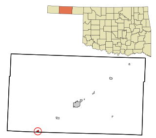
Keyes is a town in Cimarron County, Oklahoma, United States. As of the 2020 census, the town’s population was 276.

<span class="mw-page-title-main">Elgin, Oklahoma</span> City in Oklahoma, United States

Elgin is a city in northeastern Comanche County, Oklahoma, United States. The population was 2,156 at the 2010 census, a 78 percent increase from 1,210 at the 2000 census. It is included in the Lawton, Oklahoma Metropolitan Statistical Area. It is the site of Fort Sill National Cemetery.

<span class="mw-page-title-main">Faxon, Oklahoma</span> Town in Oklahoma, United States

Faxon is a town in Comanche County, Oklahoma, United States. It is located on Oklahoma State Highway 36 about 18.3 driving miles southwest of Lawton. The population was 136 at the 2010 census. It is included in the Lawton, Oklahoma Metropolitan Statistical Area.

<span class="mw-page-title-main">Indiahoma, Oklahoma</span> Town in Oklahoma, United States

Indiahoma is a town in Comanche County, Oklahoma, United States. It is located just south of US Route 62, about 24.4 driving miles west of Lawton.

<span class="mw-page-title-main">Medicine Park, Oklahoma</span> Town in Oklahoma, United States

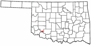
Medicine Park is a town in Comanche County, Oklahoma, United States, situated in the Wichita Mountains near the entrance to the 60,000-acre (240 km2) Wichita Mountain Wildlife Refuge. Medicine Park has a long history as a vintage cobblestone resort town. Medicine Park is located near the city of Lawton and Fort Sill. It is an exurb, part of the Lawton Metropolitan Statistical Area. Many of the original structures are constructed of naturally formed cobblestones—these red granite cobblestones are unique to the Wichita Mountains. The population was 382 at the 2010 census.

<span class="mw-page-title-main">West Siloam Springs, Oklahoma</span> Town in Oklahoma, United States

West Siloam Springs is a town in Delaware County, Oklahoma, United States. The population was 1,000 at the 2020 census, an 18.2 percent increase from the figure of 846 recorded in 2010. A bedroom community for Siloam Springs, Arkansas, it is notable for its Cherokee casino, and is the closest town to Natural Falls State Park.

<span class="mw-page-title-main">Mangum, Oklahoma</span> City in Oklahoma, United States

Mangum is a city in and county seat of Greer County, Oklahoma, United States. The population was 2,762 as of the 2020 United States census. Mangum was originally part of Old Greer County in the Texas panhandle. The community was named for A. S. Mangum, who owned the land on which the town was founded in 1882. It became part of the Oklahoma Territory in 1896, and thus part of the state of Oklahoma on November 16, 1907.

<span class="mw-page-title-main">Altus, Oklahoma</span> City in Oklahoma, United States

Altus is a city in and the county seat of Jackson County, Oklahoma, United States. The population was 18,729 at the 2020 census.

<span class="mw-page-title-main">Braman, Oklahoma</span> Town in Oklahoma, United States

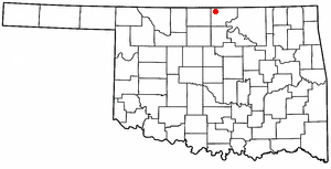
Braman is a town in Kay County, Oklahoma, United States. The population was 217 at the 2010 census, a decline of 11.1 percent from the figure of 244 in 2000.

<span class="mw-page-title-main">Hobart, Oklahoma</span> City in Oklahoma, United States

Hobart is a city in, and the county seat of, Kiowa County, Oklahoma, United States. It is west-southwest of Oklahoma City, and northwest of Lawton. It was named for Garret Hobart, the 24th Vice President of the United States. The population was 3,413 at the 2020 Census. It is served by Hobart Regional Airport. It also has two museums: the General Tommy Franks Museum and the Kiowa County Museum.

<span class="mw-page-title-main">Snyder, Oklahoma</span> City in Oklahoma, United States

Snyder is a city in Kiowa County, Oklahoma, United States. The population was 1,394 at the 2010 census. This figure represented a decline of 7.6 percent from 1,509 persons in 2000.

<span class="mw-page-title-main">Pocola, Oklahoma</span> Town in Oklahoma, United States

Pocola is a town in Le Flore County, Oklahoma, United States. It is part of the Fort Smith, Arkansas-Oklahoma metropolitan area. The population was 4,056 in 2010, a gain of 1.6 percent over the figure of 3,994 recorded in 2000. Pocola is a Choctaw word meaning "ten", the approximate distance in miles from Fort Smith, Arkansas.

<span class="mw-page-title-main">North Miami, Oklahoma</span> Town in Oklahoma, United States

North Miami is a town in Ottawa County, Oklahoma, United States. The population was 290 at the 2020 census. The town is primarily a bedroom community for several larger towns in the county.

<span class="mw-page-title-main">Hooker, Oklahoma</span> City in Oklahoma, United States

Hooker is a city in Texas County, Oklahoma, United States. As of the 2020 census, the city’s population was 1,802. It is located approximately 20 miles northeast of Guymon on US Route 54 highway.

<span class="mw-page-title-main">Texhoma, Oklahoma</span> Town in Oklahoma Texas, United States

Texhoma is a town in Texas County, Oklahoma, United States. The population was 596 at the 2020 census. Texhoma is a divided city with the Texas–Oklahoma state border separating the town from Texhoma, Texas. The name of the town is a portmanteau of Texas and Oklahoma. Founded around the Rock Island Railroad laying tracks through the area, much of the town's local economy is from ranching and livestock.

<span class="mw-page-title-main">Tyrone, Oklahoma</span> Town in Oklahoma, United States

Tyrone is a town in northeastern Texas County, Oklahoma, United States. The population was 729 at the 2020 census.

<span class="mw-page-title-main">Loveland, Oklahoma</span> Town in Oklahoma, United States

Loveland is a town in Tillman County, Oklahoma, United States. It is located about 38 miles southwest of Lawton, Oklahoma. The population was 13 at the 2020 Census. Loveland once had a post office that has since closed. The post office was popular around Valentine's Day, when people often drove many miles to have their valentines postmarked "Loveland".

<span class="mw-page-title-main">Chattanooga, Oklahoma</span> Town in Oklahoma, United States

Chattanooga is a town in Comanche and Tillman counties in the U.S. state of Oklahoma. It is located on Oklahoma State Highway 36 about 23.7 driving miles southwest of Lawton. The population was 400 at the 2020 census. The Comanche County portion of Chattanooga is included in the Lawton, Oklahoma Metropolitan Statistical Area.

References

  1. "ArcGIS REST Services Directory". United States Census Bureau. Retrieved September 20, 2022.
  2. 1 2 U.S. Geological Survey Geographic Names Information System: Manitou, Oklahoma
  3. 1 2 "U.S. Census website". United States Census Bureau . Retrieved January 31, 2008.
  4. "Manitou (town), Oklahoma". United States Census Bureau. Retrieved March 16, 2024.
  5. "The Oklahoma Almanac and Industrial Record, 1908 (accessed on Rootsweb.com)" . Retrieved March 17, 2024.
  6. "Lake Frederick to Manitou, Oklahoma". Google Maps. Retrieved September 15, 2020.
  7. "Census of Population and Housing". Census.gov. Retrieved June 4, 2015.
  8. "Manitou, Oklahoma". Google Maps. Retrieved September 15, 2020.
  9. "Frederick Regional Airport to Manitou, Oklahoma". Google Maps. Retrieved September 15, 2020.
  10. "Lawton-Fort Sill Regional Airport to Manitou, Oklahoma". Google Maps. Retrieved September 15, 2020.
  11. "Will Rogers World Airport to Manitou, Oklahoma". Google Maps. Retrieved September 15, 2020.
  12. "Southwest Oklahoma Juvenile Center." Oklahoma Office of Juvenile Affairs. Retrieved on December 16, 2015.