Lake Mary Ronan, Montana

Last updated
Lake Mary Ronan, Montana
USA Montana location map.svg
Red pog.svg
Lake Mary Ronan
Usa edcp location map.svg
Red pog.svg
Lake Mary Ronan
Coordinates: 47°55′28″N114°22′47″W / 47.92444°N 114.37972°W / 47.92444; -114.37972 Coordinates: 47°55′28″N114°22′47″W / 47.92444°N 114.37972°W / 47.92444; -114.37972
Country United States
State Montana
County Lake
Area
[1]
  Total1.05 sq mi (2.72 km2)
  Land1.05 sq mi (2.72 km2)
  Water0.00 sq mi (0.00 km2)
Elevation
3,789 ft (1,155 m)
Population
 (2020)
  Total53
  Density50.52/sq mi (19.50/km2)
Time zone UTC-7 (Mountain (MST))
  Summer (DST) UTC-6 (MDT)
Area code 406
FIPS code 30-41910
GNIS feature ID2583821 [2]

Lake Mary Ronan is a census-designated place (CDP) in Lake County, Montana, United States. The population was 65 at the 2010 census. [3] The CDP is in northwestern Lake County, along the northern and eastern shores of Lake Mary Ronan, and includes the populated places of Lake Mary Ronan, Melton, and Sipes, as well as Lake Mary Ronan State Park. It is 8 miles (13 km) northwest of U.S. Route 93 at Dayton, and 30 miles (48 km) northwest of Polson, the Lake county seat.

According to the U.S. Census Bureau, the CDP has an area of 1.0 square mile (2.7 km2), of which 0.44 acres (1,796 m2), or 0.07%, are water. [4]

Demographics

Historical population
CensusPop.
2020 53
U.S. Decennial Census [5]

Related Research Articles

<span class="mw-page-title-main">Big Arm, Montana</span> Census-designated place in Montana, United States

Big Arm is a census-designated place (CDP) in Lake County, Montana, United States. The population was 177 at the 2010 census, up from 131 in 2000.

<span class="mw-page-title-main">Elmo, Montana</span> Census-designated place in Montana, United States

Elmo is a census-designated place (CDP) in Lake County, Montana, United States. The population was 180 at the 2010 census, up from 143 in 2000.

<span class="mw-page-title-main">Finley Point, Montana</span> Census-designated place in Montana, United States

Finley Point is a census-designated place (CDP) in Lake County, Montana, United States. As of the 2010 census the population was 480.

<span class="mw-page-title-main">Kerr, Montana</span> Census-designated place in Montana, United States

Kerr is a census-designated place (CDP) in Lake County, Montana, United States. The population was 251 at the 2010 census, up from 17 in 2000.

<span class="mw-page-title-main">Kicking Horse, Montana</span> Census-designated place in Montana, United States

Kicking Horse is a census-designated place (CDP) in Lake County, Montana, United States. The population was 286 at the 2010 census, up from 80 in 2000.

<span class="mw-page-title-main">Ravalli, Montana</span> Census-designated place in Montana, United States

Ravalli is an unincorporated community and census-designated place (CDP) in Lake County, Montana, United States. The population was 76 at the 2010 census, down from 119 in 2000. At one time Charlie Allard, the country's leading expert on breeding bison, owned the country's largest herd of buffalo in Ravalli.

<span class="mw-page-title-main">Rocky Point, Montana</span> Census-designated place in Montana, United States

Rocky Point is a census-designated place (CDP) in Lake County, Montana, United States. The population was 97 at the 2010 census.

<span class="mw-page-title-main">Turtle Lake, Montana</span> Census-designated place in Montana, United States

Turtle Lake is a census-designated place (CDP) in Lake County, Montana, United States. The population was 209 at the 2010 census.

<span class="mw-page-title-main">Woods Bay, Montana</span> Census-designated place in Montana, United States

Woods Bay is a census-designated place (CDP) in Lake County, Montana, United States. The population was 661 at the 2010 census, down from 748 at the 2000 census.

<span class="mw-page-title-main">Helena Valley Northeast, Montana</span> Census-designated place in Montana, United States

Helena Valley Northeast is a census-designated place (CDP) in Lewis and Clark County, Montana, United States. The population was 2,995 at the 2010 census. It is part of the Helena Micropolitan Statistical Area.

<span class="mw-page-title-main">Fortine, Montana</span> Census-designated place in Montana, United States

Fortine is a census-designated place (CDP) in Lincoln County, Montana, United States. The population was 206 at the 2021 census.

<span class="mw-page-title-main">Dayton, Montana</span> Census-designated place in Montana, United States

Dayton is an unincorporated community and census-designated place (CDP) in Lake County, Montana, United States. The population was 84 at the 2010 census.

<span class="mw-page-title-main">Jette, Montana</span> Census-designated place in Montana, United States

Jette is a census-designated place (CDP) in Lake County, Montana, United States. The population was 253 at the 2010 census.

<span class="mw-page-title-main">Pablo, Montana</span> Census-designated place in Montana, United States

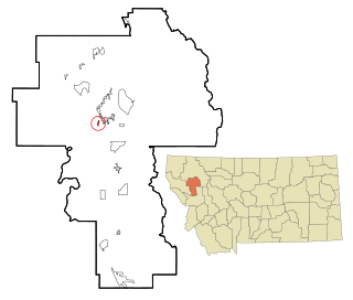
Pablo is a census-designated place (CDP) in Lake County, Montana, United States. The population was 2,254 at the 2010 census, up from 1,814 in 2000. It is the home of Salish Kootenai College and the seat of government of the Flathead Indian Reservation.

<span class="mw-page-title-main">Niarada, Montana</span> Unincorporated community in Montana, United States

Niarada is a census-designated place (CDP) in Flathead and Sanders counties in Montana, United States. The population was 27 at the 2010 census, down from 50 in 2000.

<span class="mw-page-title-main">Marysville, Montana</span> Census-designated place in Montana, United States

Marysville is an unincorporated community and census-designated place (CDP) in Lewis and Clark County, Montana, United States. Elevation is 5,413 ft.

<span class="mw-page-title-main">Stryker, Montana</span> Census-designated place in Montana, United States

Stryker is an unincorporated community and census-designated place (CDP) in Lincoln County, Montana, United States. As of the 2010 census it had a population of 26. Stryker has the 59933 ZIP code.

Swan Lake is a census-designated place and unincorporated community in Lake County, Montana, United States. Its population was 113 as of the 2010 census.

West Kootenai is a census-designated place (CDP) in Lincoln County, Montana, United States. The population was 365 at the 2010 census.

Websters Crossing is a hamlet and census-designated place (CDP) in the town of Springwater, Livingston County, New York, United States. Its population was 69 as of the 2010 census. New York State Route 15 passes through the community.

References

  1. "ArcGIS REST Services Directory". United States Census Bureau. Retrieved September 5, 2022.
  2. U.S. Geological Survey Geographic Names Information System: Lake Mary Ronan, Montana
  3. "Total Population: 2010 Census DEC Summary File 1 (P1), Lake Mary Ronan CDP, Montana". data.census.gov. U.S. Census Bureau. Retrieved April 20, 2020.
  4. "U.S. Gazetteer Files: 2019: Places: Montana". U.S. Census Bureau Geography Division. Retrieved April 20, 2020.
  5. "Census of Population and Housing". Census.gov. Retrieved June 4, 2016.