Lake Panasoffkee, Florida

Last updated

Lake Panasoffkee, Florida
CDP
Lake Panasofkee Rec Park Sign.JPG
Lake Panasoffkee's Recreational Park off of CR 470
Sumter County Florida Incorporated and Unincorporated areas Lake Panasoffkee Highlighted.svg
Location in Sumter County and the state of Florida
Coordinates: 28°47′26″N82°7′48″W / 28.79056°N 82.13000°W / 28.79056; -82.13000
Country Flag of the United States.svg  United States
State Flag of Florida.svg  Florida
County   Sumter
Area
[1]
  Total6.60 sq mi (17.10 km2)
  Land4.30 sq mi (11.14 km2)
  Water2.30 sq mi (5.96 km2)
Elevation
59 ft (18 m)
Population
 (2020)
  Total4,072
  Density946.98/sq mi (365.65/km2)
Time zone UTC-5 (Eastern (EST))
  Summer (DST) UTC-4 (EDT)
ZIP code
33538
Area code 352
FIPS code 12-38575 [2]
GNIS feature ID0285267 [3]

Lake Panasoffkee is a census-designated place (CDP) in Sumter County, Florida, United States. The population was 3,551 at the 2010 census.

Contents

History

Early inhabitants

Boggy Island was an autonomous black Seminole village that was settled by Central African slaves from Kongo. [4] Black Seminoles settled near the Boggy Island area of Lake Panasoffkee around 1813 and named it Sitarkey's Village after Sitarkey, an Alachua Seminole who had settled in the area. Nearby laid the areas of Gum Slough and Indian Mound Springs. [5] The Seminoles used the Lake Panasoffkee area to hold councils and Green Corn Dances. [6]

The black Seminoles raised corn, rice, and sugar cane which Dexter gave them in 1822. [5] In addition, residents in Sitarkey's Village raised livestock, including cattle, horses, and hogs. [7] They also possibly planted one of the oldest orange groves in Florida. [8]

Second Seminole War

Generally, the Sitakey's Village area was untouched during the Second Seminole War, [7] allowing black Seminole families to use the area as a refuge from the war. [5] The United States Army, however, did search the village twice. Looking for Seminole warriors, the Second and Eighth Infantry divisions, led by Colonel Bennet Riley and Colonel W. J. Worth, traveled from Fort McClure to the Lake Panasoffkee area on June 10, 1840. On the morning of June 11, the troops found an empty village. [6]

After the battle of Wahoo Swamp, Osceola, possibly suffering from the effects of malaria that he contracted during the Seminole occupation of Fort Drane moved to the Panasoffkee Swamp to live with the black Seminoles who regarded him with devotion. [9]

On January 10, 1837, General Thomas Sidney Jesup, looking for Osceola, raided the village. Osceola and three warriors fled. Jesup captured 16 black Seminoles while the rest of the village escaped. In all, Osceola, 50 warriors, and their families left for the headwaters of the Ocklawaha River. Twelve days later, Jesup led his troops from Fort Armstrong to the Ocklawaha River. [10]

Modern town

According to Broward Mill, the past president of the Sumter County Historical Society, Lake Panasoffkee from the time that Sumter County was settled by whites until damaging freezes which wiped out the area's citrus industry in the 1880s and 1890s. [11]

Charles G. King, a Cleveland entrepreneur, bought 2,500 acres (square kilometers) in Lake Panasoffkee and developed 737 acres (square kilometers) into Monarch Grove in 1908. An oak hammock on the property was left undisturbed. King and his employees used the sour oranges planted by the Seminoles for orange stock. In 1926, the grove produced about 40,000 boxes of oranges. [8]

Among the evidence was a group of house foundations and chimneys located in places where there were no known white settlers. County officials later believed that the cemetery was a family cemetery as the newer marked graves listed the names of the few people known to be buried there. [12]

Lake Panasoffkee dredging

According to Florida Fish and Wildlife Conservation commissioners Bob Wattendorf and Marty Hale, Lake Panasoffkee had 15 fish camps and was considered to be one of the state's best places to fish. [13]

In 1981, water levels in Lake Panasoffkee dropped to levels that had not been seen since 1962, the year the Wysong Dam was built. Southwest Florida Water Management District officials discussed the construction of a temporary dam to elevate water levels. Lake Panasoffkee residents believed that the Wysong Dam contributed to the destruction of the Withlacoochee River. [14]

Geography

According to the United States Census Bureau, the CDP has a total area of 4.1 square miles (11 km2), of which 4.0 square miles (10 km2) is land and 0.25% is water.

Demographics

Historical population
CensusPop.Note
2020 4,072
U.S. Decennial Census [15]

As of the census [2] of 2000, there were 3,413 people, 1,644 households, and 1,045 families residing in the CDP. The population density was 846.6 inhabitants per square mile (326.9/km2). There were 2,348 housing units at an average density of 582.4 per square mile (224.9/km2). The racial makeup of the CDP was 97.01% White, 0.64% African American, 0.73% Native American, 0.47% Asian, 0.15% from other races, and 1.00% from two or more races. Hispanic or Latino of any race were 0.91% of the population.

There were 1,644 households, out of which 16.8% had children under the age of 18 living with them, 52.7% were married couples living together, 7.6% had a female householder with no husband present, and 36.4% were non-families. 30.8% of all households were made up of individuals, and 18.7% had someone living alone who was 65 years of age or older. The average household size was 2.08 and the average family size was 2.52.

In the CDP, the population was spread out, with 15.4% under the age of 18, 5.6% from 18 to 24, 20.1% from 25 to 44, 25.5% from 45 to 64, and 33.5% who were 65 years of age or older. The median age was 53 years. For every 100 females, there were 94.1 males. For every 100 females age 18 and over, there were 92.0 males.

The median income for a household in the CDP was $25,930, and the median income for a family was $31,897. Males had a median income of $26,483 versus $17,985 for females. The per capita income for the CDP was $18,149. About 8.1% of families and 12.0% of the population were below the poverty line, including 17.6% of those under age 18 and 8.8% of those age 65 or over.

Famous events

Little Miss Lake Panasoffkee case

Two hitchhikers from Illinois discovered the partially decomposed body of an unidentified woman between the ages of 17 and 24 years old under the northbound lane of Lake Panasoffkee's Interstate 75 overpass on February 19, 1971. [16] [17] She was found with a man's belt around her neck. [18]

The sheriff's department made several attempts to identify the woman. [16] In 1986, the Sumter County Sheriff's Department, under the leadership of Sheriff Jamie Adams [16] and lead investigating officer William O. Farmer, exhumed her body. A forensic anthropologist rendered composite sketches of the woman both at the time of her death and as a child, and the investigator also determined the woman's weight and height. In the early 1990s, the American television series Unsolved Mysteries featured the case in an episode. Each attempt to identify the woman was unsuccessful. [16]

In 2012, the Sumter County Sheriff's Department asked the University of South Florida's Tampa Bay Cold Case Project to reexamine the remains of "Little Miss Lake Panasoffkee". An isotope analysis performed by the project indicated she could have been an immigrant from Greece, [19] possibly hailing from the town of Lavrion (located 60 miles (96 kilometers) southeast of Athens). [17] [20] The victim is believed to have moved to the United States between one and three months prior to her murder. [19] [21] The new information contradicted the Sumter County Sheriff's Department's initial assumption that the Jane Doe was either white or Native American; they had created composite sketches reflecting those ethnicities. Sumter County authorities determined, based on the time of her death, that she was visiting the Tarpon Springs area for the celebration of Epiphany on January 6, 1971. Based on the information from the forensic analysis, the Sumter County Sheriff's Department contacted the Tarpon Springs Police Department and the Greek Orthodox Church about the case and mailed 6,000 flyers to Tarpon Springs businesses and residents. [16] As of 2016, the case is still unsolved. [17]

Long nose gar

On April 14, 1985, Evan Merritt caught a 41-pound long nose gar in Lake Panasoffkee. This is the largest long nose gar caught in the state of Florida.[ citation needed ]

Preserves

The Lake Panasoffkee park and preserve protects 9,911 acres (40.11 km2) and offers birdwatching, biking, camping, horseback riding, fishing, hiking and hunting. It is accessed from the south side of State Route 44 two miles (3 km) west of Interstate 75. [22] Similar recreational opportunities (except no biking) are also offered at the 1,118-acre (4.52 km2) Panasoffkee Outlet park and preserve. Both areas are protected by the Southwest Florida Water Management District. [23]

Related Research Articles

<span class="mw-page-title-main">Celebration, Florida</span> CDP in Florida, United States

Celebration is a master-planned community (MPC) and census-designated place (CDP) in Osceola County, Florida, United States. A suburb of Orlando, Celebration is located near Walt Disney World Resort and was originally developed by The Walt Disney Company. Its population was recorded as 11,178 in the 2020 census.

<span class="mw-page-title-main">Baker County, Florida</span> County in Florida, United States

Baker County is a county in the U.S. state of Florida. As of the 2020 census, the population was 28,259. Its county seat is Macclenny. The county was founded in 1861 and is named for James McNair Baker, a judge and Confederate Senator.

<span class="mw-page-title-main">Glades County, Florida</span> County in Florida, United States

Glades County is a county located in the Florida Heartland region of the U.S. state of Florida. As of the 2020 census, the population was 12,126, making it the fourth-least populous county in Florida. Its county seat is Moore Haven.

<span class="mw-page-title-main">Lake County, Florida</span> County in Florida, United States

Lake County is a county in the central portion of the U.S. state of Florida. As of the 2020 census, the population was 383,956. Its county seat is Tavares, and its largest city is Clermont. Lake County is included in the Orlando–Kissimmee–Sanford Metropolitan Statistical Area.

<span class="mw-page-title-main">Osceola County, Florida</span> County in Florida, United States

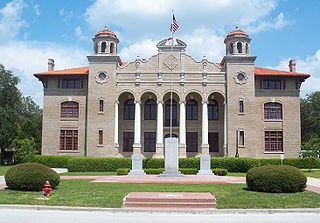
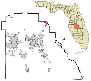
Osceola County is a county located in the central portion of the U.S. state of Florida. As of the 2020 census, the population was 388,656. Its county seat is Kissimmee. Osceola County is included in the Orlando–Kissimmee–Sanford, Fla. Metropolitan Statistical Area.

<span class="mw-page-title-main">Pinellas County, Florida</span> County in Florida, United States

Pinellas County is a county located on the west central coast of the U.S. state of Florida. As of the 2020 census, the population was 959,107, which makes it the seventh-most populous county in the state. It is also the most densely populated county in Florida, with 3,491 residents per square mile. The county is part of the Tampa–St. Petersburg–Clearwater Metropolitan Statistical Area. Clearwater is the county seat. St. Petersburg is the largest city in the county, as well as the largest city in Florida that is not a county seat.

<span class="mw-page-title-main">Seminole County, Florida</span> County in Florida, United States

Seminole County is a county located in the central portion of the U.S. state of Florida. As of the 2020 census, the population was 470,856, making it the 13th-most populated county in Florida. Its county seat and largest city is Sanford. Seminole County is part of the Orlando-Kissimmee-Sanford, Florida Metropolitan Statistical Area.

<span class="mw-page-title-main">Sumter County, Florida</span> County in Florida, United States

Sumter County is a county located in the central portion of the U.S. state of Florida. As of the 2020 census, the population is 129,752. It has the oldest median age of any US county and the highest percentage of residents aged 65 and older—at 55.6% in 2014-2018. Its county seat is Bushnell, and the largest community is The Villages.

<span class="mw-page-title-main">Homosassa, Florida</span> Census-designated place in Florida, United States

Homosassa is a census-designated place (CDP) in Citrus County, Florida, United States. The population was 2,578 at the 2010 census.

<span class="mw-page-title-main">Thonotosassa, Florida</span> Census-designated place in Florida, United States

Thonotosassa is a census-designated place (CDP) in Hillsborough County, Florida, United States. The population was 15,238 at the 2020 census, up from 13,014 at the 2010 census.

<span class="mw-page-title-main">Four Corners, Florida</span> Census-designated place in Florida, United States

Four Corners, also known as Citrus Ridge, is an unincorporated suburban community and census-designated place (CDP) in the U.S. state of Florida, located at the borders of Lake, Orange, Osceola, and Polk counties. Its population was 56,381 at the 2020 census, up from 26,116 at the 2010 census.

<span class="mw-page-title-main">Punta Rassa, Florida</span> Census-designated place in Florida, United States

Punta Rassa is an unincorporated community and census-designated place (CDP) in Lee County, Florida, United States. The population was 1,620 at the 2020 census. It is part of the Cape Coral-Fort Myers, Florida Metropolitan Statistical Area.

<span class="mw-page-title-main">Palm City, Florida</span> Census-designated place in Florida, United States

Palm City is an unincorporated area and census-designated place (CDP) in Martin County, Florida, United States. The population was 25,883 at the 2020 census. It is part of the Port St. Lucie Metropolitan Statistical Area.

<span class="mw-page-title-main">Winter Garden, Florida</span> City in Florida, United States

Winter Garden is a city in western Orange County, Florida, United States. Located 14 miles (23 km) west of Downtown Orlando, it is part of the Orlando metropolitan area. The population was 46,964 as of the 2020 census.

<span class="mw-page-title-main">East Lake, Pinellas County, Florida</span> Census-designated place in Florida, United States

East Lake is a census-designated place (CDP) in Pinellas County, Florida, United States. The population was 30,962 at the 2010 census. It was one of the last areas in the densely populated county to develop. It is often confused with East Lake in neighboring Hillsborough County.

<span class="mw-page-title-main">Loughman, Florida</span> Census-designated place in Florida, United States

Loughman (LOFF-mǝn) is a census-designated place (CDP) in the northeast corner of Polk County, Florida, United States, near the Osceola county line. The population was 1,385 at the 2000 census. It is part of the Lakeland–Winter Haven Metropolitan Statistical Area. This area has grown rapidly since 2000 due, in large part, to its proximity to Walt Disney World and the Orlando, Florida area.

<span class="mw-page-title-main">Center Hill, Florida</span> City in Florida, United States

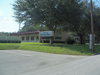
Center Hill is a city in Sumter County, Florida, United States. The population was 988 at the 2010 census. According to the U.S Census estimates of 2018, the city had a population of 1,409.

<span class="mw-page-title-main">Coleman, Florida</span> City in Florida, United States

Coleman is a city in Sumter County, Florida, United States. The population was 703 at the 2010 census. According to the U.S. Census estimates of 2018, the city had a population of 877.

Poinciana is a settlement and census-designated place (CDP) in Osceola and Polk counties in the U.S. state of Florida. It lies southwest of Kissimmee and approximately 14 miles (23 km) east of Haines City. As of the 2010 United States Census, the CDP had a population of 53,193.

<span class="mw-page-title-main">Fort Denaud, Florida</span> Census-designated place in Florida, United States

Fort Denaud is a census-designated place (CDP) and former fort in Hendry County, Florida, United States. As of the 2020 census, the population of the CDP was 2,049.

References

  1. "2020 U.S. Gazetteer Files". United States Census Bureau. Retrieved October 31, 2021.
  2. 1 2 "U.S. Census website". United States Census Bureau . Retrieved January 31, 2008.
  3. "US Board on Geographic Names". United States Geological Survey. October 25, 2007. Retrieved January 31, 2008.
  4. Landers, Jane (September 26, 2006). "Slavery in Colonial North America" (PDF). Race, Development and Social Inequality Lectures. Vanderbilt University . Retrieved May 6, 2014.
  5. 1 2 3 Mitchem, Jeffery M.; Weisman, Brent R. (June 1987). "Changing Settlement Patterns and Pottery Types in the Withlacoochee Cove". The Florida Anthropologist. Jacksonville, Florida: Florida Anthropological Society. 40 (2): 154–156, 160–163. Retrieved April 25, 2014.
  6. 1 2 Thomas Foreman, Carolyn (September 1941). "General Bennet Riley—Commandant at Fort Gibson and Governor of California". Chronicles of Oklahoma. Oklahoma State University. 19 (3): 241. Retrieved April 4, 2014.
  7. 1 2 Carrier, Toni (April 14, 2005). Trade and Plunder Networks in the Second Seminole War in Florida, 1835-1842 (MA thesis). Tampa, Florida: University of South Florida. p. 30. Retrieved December 15, 2022.
  8. 1 2 Coll, Aloysius (May 23, 1926). "Sumter County Citizens Want to Show Goods". St. Petersburg Times. St. Petersburg, Florida . Retrieved May 8, 2014.
  9. Hatch, Thom (2012). Osceola and the Great Seminole War: A Struggle for Justice and Freedom. St. Martin's Press. pp. 163, 176. ISBN   978-0-312-35591-3.
  10. Hatch 2012, p. 180–181.
  11. United States Department of Agriculture (1988). Soil Survey of Sumter County, Florida. Washington, D.C.: Soil Conservation Service. pp. 2–3. Retrieved April 20, 2014.
  12. Mims, Amanda (September 27, 2009). "Pondering grave issue". Citrus County Chronicle. Crystal River, Florida. pp. A3. Retrieved April 25, 2014.
  13. Wattendorf, Bob; Hale, Marty (September 2009). "It's about the habitat – Lake Panasoffkee". Florida LakeWATCH. Gainesville, Florida: University of Florida. 46 (Sep): 4–5.
  14. Henderson, Jane (May 7, 1981). "Group Discusses Low Level of Lake Panasoffkee". Ocala Star-Banner. Ocala, Florida. pp. 1A, 8A. Retrieved May 8, 2014.
  15. "Census of Population and Housing". Census.gov. Retrieved June 4, 2016.
  16. 1 2 3 4 5 Reichman, Bob (June 28, 2012). "New leads in 1971 murder". Sumter County Times. Bushnell, Florida. pp. 1–2. Retrieved May 8, 2014.
  17. 1 2 3 Sumter County Sheriff's Office (2013). "Cold Case File: Little Miss Lake Panasoffkee (1971-0291)". Get Involved—Cold Cases. Sumter County Sheriff's Office. Archived from the original on April 8, 2014. Retrieved May 8, 2014.
  18. "Little miss Panasoffkee," by Dan Sullivan (The Villages Daily Sun; Saturday, October 7, 2006) [ permanent dead link ]
  19. 1 2 Gorman, James (November 12, 2012). "A Jane Doe Gets a Back Story". New York Times . New York City, New York. pp. D1. Retrieved May 8, 2014.
  20. Jamison, Peter. "Clues emerge in cold case murder that may be tied to Tarpon Springs". www.tampabay.com. Retrieved June 20, 2013.
  21. The Doe Network Case File 470
  22. Lake Panasoffkee Archived 2010-12-05 at the Wayback Machine Southwest Florida Water Management District
  23. Panasoffkee Outlet Archived 2010-06-11 at the Wayback Machine Southwest Florida Water Management District