Lakeline, Ohio

Last updated

Lakeline, Ohio
OHMap-doton-Lakeline.png
Location of Lakeline, Ohio
Map of Lake County Ohio Highlighting Lakeline Village.png
Location of Lakeline in Lake County
Coordinates: 41°39′31″N81°27′14″W / 41.65861°N 81.45389°W / 41.65861; -81.45389
Country United States
State Ohio
County Lake
Area
[1]
  Total0.09 sq mi (0.23 km2)
  Land0.09 sq mi (0.23 km2)
  Water0.00 sq mi (0.00 km2)
Elevation
[2]
620 ft (189 m)
Population
 (2020)
  Total216
  Density2,454.55/sq mi (951.41/km2)
Time zone UTC-5 (Eastern (EST))
  Summer (DST) UTC-4 (EDT)
ZIP code
44095
Area code 440
FIPS code 39-41398 [3]
GNIS feature ID1042388 [2]

Lakeline is a village in Lake County, Ohio, United States. The population was 216 at the 2020 census.

Contents

Geography

Lakeline is located at 41°39′31″N81°27′14″W / 41.65861°N 81.45389°W / 41.65861; -81.45389 (41.658646, -81.453818). [4]

According to the United States Census Bureau, the village has a total area of 0.09 square miles (0.23 km2), all land. [5]

Demographics

Historical population
CensusPop.Note
1930 75
1940 772.7%
1950 183137.7%
1960 26947.0%
1970 223−17.1%
1980 25815.7%
1990 210−18.6%
2000 165−21.4%
2010 22637.0%
2020 216−4.4%
U.S. Decennial Census [6]

2010 census

As of the census [7] of 2010, there were 226 people, 95 households, and 67 families living in the village. The population density was 2,511.1 inhabitants per square mile (969.5/km2). There were 104 housing units at an average density of 1,155.6 per square mile (446.2/km2). The racial makeup of the village was 97.8% White, 0.9% African American, and 1.3% from two or more races. Hispanic or Latino of any race were 0.9% of the population.

There were 95 households, of which 29.5% had children under the age of 18 living with them, 51.6% were married couples living together, 10.5% had a female householder with no husband present, 8.4% had a male householder with no wife present, and 29.5% were non-families. 27.4% of all households were made up of individuals, and 10.6% had someone living alone who was 65 years of age or older. The average household size was 2.38 and the average family size was 2.82.

The median age in the village was 45.1 years. 19.5% of residents were under the age of 18; 7.9% were between the ages of 18 and 24; 22.2% were from 25 to 44; 33.6% were from 45 to 64; and 16.8% were 65 years of age or older. The gender makeup of the village was 51.3% male and 48.7% female.

2000 census

As of the census [3] of 2000, there were 165 people, 66 households, and 41 families living in the village. The population density was 2,173.9 inhabitants per square mile (839.3/km2). There were 70 housing units at an average density of 922.2 per square mile (356.1/km2). The racial makeup of the village was 100.00% White. 24.6% were of Irish, 20.3% German, 9.4% Italian, 8.0% English and 5.1% Slovene ancestry according to Census 2000.

There were 66 households, out of which 27.3% had children under the age of 18 living with them, 48.5% were married couples living together, 7.6% had a female householder with no husband present, and 36.4% were non-families. 28.8% of all households were made up of individuals, and 12.1% had someone living alone who was 65 years of age or older. The average household size was 2.50 and the average family size was 3.12.

In the village, the population was spread out, with 23.6% under the age of 18, 4.8% from 18 to 24, 30.3% from 25 to 44, 22.4% from 45 to 64, and 18.8% who were 65 years of age or older. The median age was 41 years. For every 100 females there were 111.5 males. For every 100 females age 18 and over, there were 100.0 males.

The median income for a household in the village was $46,250, and the median income for a family was $50,000. Males had a median income of $35,833 versus $22,083 for females. The per capita income for the village was $17,218. None of the families and 5.0% of the population were living below the poverty line, including no under eighteens and 10.3% of those over 64.

Related Research Articles

<span class="mw-page-title-main">Dot Lake, Alaska</span> CDP in Alaska, United States

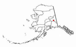
Dot Lake is a census-designated place (CDP) in Southeast Fairbanks Census Area, Alaska, United States. It is located on the Alaska Highway between Delta Junction and Tok. The population was 13 at the 2010 census, down from 19 in 2000.

<span class="mw-page-title-main">LeRoy, Michigan</span> Village in Michigan, United States

LeRoy is a village in Osceola County of the U.S. state of Michigan. The population was 256 at the 2010 census. The village is located within LeRoy Township.

Spooner Township is a township in Lake of the Woods County, Minnesota, United States. The population was 281 at the 2000 census.

<span class="mw-page-title-main">Country Life Acres, Missouri</span> Village in Missouri, United States

Country Life Acres is a village in St. Louis County, Missouri, United States. The population was 72 at the 2020 census.

<span class="mw-page-title-main">South Bend, Nebraska</span> Village in Nebraska, United States

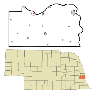
South Bend is a village in Cass County, Nebraska, United States. The population was 92 at the 2020 census. The main landmark is a pedestrian bridge across the Platte River which leads to Schramm Park State Recreation Area. It was built in 2004 on the pillars of the abandoned Rock Island Railroad bridge. Thirty-five trains a day—most of them coal trains—still pass through the area on the BNSF Railway main.

<span class="mw-page-title-main">Roaming Shores, Ohio</span> Village in Ohio, United States

Roaming Shores is a village in Ashtabula County, Ohio, United States. The population was 1,586 at the 2020 census.

<span class="mw-page-title-main">Walton Hills, Ohio</span> Village in Ohio, United States

Walton Hills is a village in Cuyahoga County, Ohio, United States. The population was 2,033 at the 2020 census. A suburb of Cleveland, it is a part of the Cleveland metropolitan area.

<span class="mw-page-title-main">Woodmere, Ohio</span> Village in Ohio, United States

Woodmere is a village in Cuyahoga County, Ohio, United States. As of the 2020 census, Woodmere had a population of 641 residents. An eastern suburb of Cleveland, it is part of the Cleveland metropolitan area.

<span class="mw-page-title-main">Yorkshire, Ohio</span> Village in Ohio, United States

Yorkshire is a village in Darke County, Ohio, United States. The population was 95 at the 2020 census.

<span class="mw-page-title-main">North Perry, Ohio</span> Village in Ohio, United States

North Perry is a village in Lake County, Ohio, United States. The population was 915 at the 2020 census.

<span class="mw-page-title-main">Timberlake, Ohio</span> Village in Ohio, United States

Timberlake is a village in Lake County, Ohio, United States. The population was 629 at the 2020 census.

<span class="mw-page-title-main">Rochester, Ohio</span> Village in Ohio

Rochester is a village in Lorain County, Ohio, United States, along the West Branch of the Black River. The population was 159 at the 2020 census.

<span class="mw-page-title-main">Berkey, Ohio</span> Village in Ohio, United States

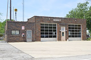
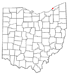
Berkey is a village in Lucas County, Ohio, United States. The population was 275 at the 2020 census.

<span class="mw-page-title-main">Broughton, Ohio</span> Village in Ohio, United States

Broughton is a village in Paulding County, Ohio, United States. The population was 116 at the 2020 census.

<span class="mw-page-title-main">Darbyville, Ohio</span> Village in Ohio, United States

Darbyville is a village in Pickaway County, Ohio, United States. The population was 186 at the 2020 census.

<span class="mw-page-title-main">Orangeville, Ohio</span> Village in Ohio, United States

Orangeville is a village in eastern Trumbull County, Ohio, United States, along the state line with Pennsylvania. The population was 174 at the 2020 census. It is part of the Youngstown–Warren metropolitan area.

<span class="mw-page-title-main">Haskins, Ohio</span> Village in Ohio, United States

Haskins is a village in Wood County, Ohio, United States. The population was 1,245 at the 2020 census.

<span class="mw-page-title-main">Dawson, Pennsylvania</span> Borough in Pennsylvania, United States

Dawson is a borough in Fayette County, Pennsylvania, United States. The population was 352 at the 2020 census, a decline from the figure of 367 tabulated in 2010.

<span class="mw-page-title-main">Terrace Heights, Washington</span> CDP in Washington, United States

Terrace Heights is a census-designated place (CDP) in Yakima County, Washington, United States. The population was 9,244 at the 2020 census. It is essentially a suburb of the city of Yakima.

<span class="mw-page-title-main">Summersville, Missouri</span> City in Missouri, United States

Summersville is a city in Shannon and Texas counties in the U.S. state of Missouri. The population was 453 at the 2020 census.

References

  1. "ArcGIS REST Services Directory". United States Census Bureau. Retrieved September 20, 2022.
  2. 1 2 "US Board on Geographic Names". United States Geological Survey. October 25, 2007. Retrieved January 31, 2008.
  3. 1 2 "U.S. Census website". United States Census Bureau . Retrieved January 31, 2008.
  4. "US Gazetteer files: 2010, 2000, and 1990". United States Census Bureau. February 12, 2011. Retrieved April 23, 2011.
  5. "US Gazetteer files 2010". United States Census Bureau. Archived from the original on July 2, 2012. Retrieved January 6, 2013.
  6. "Census of Population and Housing". Census.gov. Retrieved June 4, 2015.
  7. "U.S. Census website". United States Census Bureau . Retrieved January 6, 2013.