Lincoln, Wood County, Wisconsin

Last updated

Lincoln, Wisconsin
Lincoln Wood County Wisconsin terrain.jpg
From the moraine near Bakerville, looking northwest across Lincoln
WIMap-doton-Lincoln l.png
Location of Lincoln, Wood County, Wisconsin
Coordinates: 44°38′43″N90°14′43″W / 44.64528°N 90.24528°W / 44.64528; -90.24528
Country Flag of the United States.svg  United States
State Flag of Wisconsin.svg  Wisconsin
County Wood
Area
  Total34.2 sq mi (88.7 km2)
  Land34.2 sq mi (88.6 km2)
  Water0.0 sq mi (0.0 km2)
Elevation
[1]
1,191 ft (363 m)
Population
 (2000)
  Total1,554
  Density45.4/sq mi (17.5/km2)
Time zone UTC-6 (Central (CST))
  Summer (DST) UTC-5 (CDT)
Area code(s) 715 & 534
FIPS code 55-44550 [2]
GNIS feature ID1583571 [1]
PLSS townshipT25N R2E
Website http://www.townoflincolnwc.com

Lincoln is a town in Wood County, Wisconsin, United States. The population was 1,554 at the 2000 census. The unincorporated community of Bakerville is located in the town.

Contents

Geography

According to the United States Census Bureau, the town has a total area of 34.2 square miles (88.7 km2), of which, 34.2 square miles (88.6 km2) of it is land and 0.03% is water.

Geologists call the prominent range of hills running from Marshfield to Bakerville through Nasonville the Marshfield moraine. It is probably a terminal moraine left where a continental glacier stopped advancing long ago. The rest of the town is flatter. The section northwest of the moraine is heavy clay soil on the till plain left by that glacier, with sandstone and granite beneath. [3] [4]

History

The six mile square that would become Lincoln was first surveyed in the summer of 1851 by a crew working for the U.S. government. In November and December 1853 another crew marked its section corners, walking through the woods and wading the streams, measuring with chain and compass. [5] [6] When done, the deputy surveyor filed this general description:

This Township contains much good land and is clear from swamp The greater part of it is Rolling and good 2d Rate land. It is well watered and some of the streams are of sufficient size for Milling purposes The streams are all lined with good W P(?) which is the prevailing Timber. The upland is mostly Sugar & Lind. [7]

Lincoln Township was originally called "Johnson Township", and under the latter name was established in March 1868. A few months later, in June 1868, the township was renamed, after President Abraham Lincoln. [8]

Demographics

As of the census [2] of 2000, there were 1,554 people, 539 households, and 433 families residing in the town. The population density was 45.4 people per square mile (17.5/km2). There were 551 housing units at an average density of 16.1 per square mile (6.2/km2). The racial makeup of the town was 98.71% White, 0.06% African American, 0.77% Asian, 0.06% from other races, and 0.39% from two or more races. Hispanic or Latino of any race were 0.32% of the population.

There were 539 households, out of which 40.6% had children under the age of 18 living with them, 74.6% were married couples living together, 3.0% had a female householder with no husband present, and 19.5% were non-families. 15.2% of all households were made up of individuals, and 6.7% had someone living alone who was 65 years of age or older. The average household size was 2.88 and the average family size was 3.24.

In the town, the population was spread out, with 30.2% under the age of 18, 6.6% from 18 to 24, 28.3% from 25 to 44, 24.8% from 45 to 64, and 10.0% who were 65 years of age or older. The median age was 38 years. For every 100 females, there were 112.0 males. For every 100 females age 18 and over, there were 106.5 males.

The median income for a household in the town was $53,194, and the median income for a family was $59,904. Males had a median income of $37,019 versus $23,750 for females. The per capita income for the town was $27,617. About 2.3% of families and 3.8% of the population were below the poverty line, including 3.1% of those under age 18 and 7.9% of those age 65 or over.

Related Research Articles

<span class="mw-page-title-main">Wood County, Wisconsin</span> County in Wisconsin, United States

Wood County is a county located in the U.S. state of Wisconsin. As of the 2020 census, the population was 74,207. Its county seat is Wisconsin Rapids. The county is named after Joseph Wood, a member of the Wisconsin State Assembly. Wood County comprises the Wisconsin Rapids-Marshfield, WI Micropolitan Statistical Area and is included in the Wausau-Stevens Point-Wisconsin Rapids, WI Combined Statistical Area.

<span class="mw-page-title-main">Edson, Wisconsin</span> Town in Wisconsin, United States

The Town of Edson is located in Chippewa County in the U.S. state of Wisconsin. The population was 1,089 at the 2010 census, up from 966 at the 2000 census.

<span class="mw-page-title-main">Sampson, Wisconsin</span> Town in Wisconsin, United States

Sampson is a town in Chippewa County in the U.S. state of Wisconsin. The population was 892 at the 2010 census.

<span class="mw-page-title-main">Deer Creek, Taylor County, Wisconsin</span> Town in Wisconsin, United States

Deer Creek is a town in Taylor County, Wisconsin, United States. The village of Stetsonville lies partly in the town, straddling its west border with Little Black. The population was 733 at the 2000 census.

<span class="mw-page-title-main">Greenwood, Taylor County, Wisconsin</span> Town in Wisconsin, United States

Greenwood is a town in Taylor County, Wisconsin, United States. The population was 642 at the 2000 census. The unincorporated community of Interwald is located in the town.

<span class="mw-page-title-main">Holway, Wisconsin</span> Town in Wisconsin, United States

Holway is a town in Taylor County, Wisconsin, United States. The population was 854 at the 2000 census.

<span class="mw-page-title-main">Molitor, Wisconsin</span> Town in Wisconsin, United States

Molitor is a town in Taylor County, Wisconsin, United States. The population was 324 at the 2010 census.

<span class="mw-page-title-main">Taft, Wisconsin</span> Town in Wisconsin, United States

Taft is a town in the southwest corner of Taylor County, Wisconsin, United States. The population was 361 at the 2000 census. The unincorporated community of Bellinger is located partially in the town.

Cameron is a town in Wood County, Wisconsin, United States. The population was 510 at the 2000 census.

<span class="mw-page-title-main">Cary, Wisconsin</span> Town in Wisconsin, United States

The Town of Cary is located in Wood County, Wisconsin. The population was 398 at the time of the 2000 census.

<span class="mw-page-title-main">Cranmoor, Wisconsin</span> Town in Wisconsin, United States

Cranmoor is a town in Wood County, Wisconsin, United States. The population was 175 at the 2000 census. The unincorporated communities of Cranmoor and Walker are located in the town.

<span class="mw-page-title-main">Hiles, Wood County, Wisconsin</span> Town in Wisconsin, United States

The Town of Hiles is in Wood County, Wisconsin, United States. Its population was 188 at the 2000 census.

Marshfield is a town in Wood County, Wisconsin, United States. The population was 811 at the 2000 census. Marshfield is also the name of a neighboring city: Marshfield, Wisconsin

<span class="mw-page-title-main">Remington, Wisconsin</span> Town in Wisconsin, United States

The Town of Remington is located in Wood County, Wisconsin, United States. The population was 305 at the 2000 census. The unincorporated community of Babcock is located in the town.

<span class="mw-page-title-main">Richfield, Wood County, Wisconsin</span> Town in Wisconsin, United States

The Town of Richfield is located in Wood County, Wisconsin, United States. The population was 1,523 at the 2000 census. The unincorporated community of Bethel is located within the town.

<span class="mw-page-title-main">Saratoga, Wisconsin</span> Town in Wisconsin, United States

Saratoga is a town in Wood County, Wisconsin, United States. As of the 2015 census, the population of the town is 5,023 people.

<span class="mw-page-title-main">Sigel, Wood County, Wisconsin</span> Town in Wisconsin, United States

Th Town of Sigel is located in Wood County, Wisconsin, United States. The population was 1,130 at the 2000 census. The unincorporated community of Eight Corners is located in the town.

<span class="mw-page-title-main">Wood, Wisconsin</span> Town in Wisconsin, United States

The Town of Wood is located in Wood County, Wisconsin, United States. The population was 786 at the 2000 census.

<span class="mw-page-title-main">Marshfield, Wisconsin</span> City in Wisconsin, United States

Marshfield is in Wood and Marathon counties in the state of Wisconsin. It is located at the intersection of U.S. Highway 10, Highway 13 and Highway 97. The largest city in Wood County, its population was 18,929 at the 2020 census. Of this, 18,119 were in Wood County, and 810 were in Marathon County. The city is part of the United States Census Bureau's Marshfield-Wisconsin Rapids Micropolitan Statistical Area, which includes all of Wood County. The portion of the city in Marathon County is part of the Wausau Metropolitan Statistical Area.

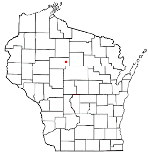
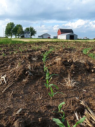
Auburndale is a town in Wood County, Wisconsin, United States. The population was 829 at the 2000 census. The Village of Auburndale is located within the town.

References

  1. 1 2 "US Board on Geographic Names". United States Geological Survey. October 25, 2007. Retrieved January 31, 2008.
  2. 1 2 "U.S. Census website". United States Census Bureau . Retrieved January 31, 2008.
  3. Clayton, Lee (1991). "Pleistocene Geology of Wood County, Wisconsin" (PDF). Information Circular 68. Madison, Wisconsin: Wisconsin Geological and Natural History Survey: 7–8. ISSN   0512-0640 . Retrieved May 28, 2024.
  4. Brown, B.A.; Greenberg, J.K. (1986). Bedrock Geology of Wood County, Wisconsin (PDF). Madison: Wisconsin Geological and Natural History Survey, UW-Extension. Retrieved May 28, 2024.
  5. "Land Survey Information". Board of Commissioners of Public Lands. Retrieved March 26, 2011.
  6. "Field Notes for T25N R2W". Original Field Notes and Plat Maps, 1833-1866. Board of Commissioners of Public Lands. Retrieved May 1, 2013.
  7. Wright, O. J. "Interior Field Notes (Nov. 1853-Dec. 1853)". Board of Commissioners of Public Lands. Retrieved May 1, 2013.
  8. Rudolph, Robert S. (1970). Wood County Place Names (PDF). The University of Wisconsin Press. p. 44.