Spencer, Wisconsin

Last updated

Spencer, Wisconsin
Spencer Wisconsin.jpg
Looking west at the downtown from intersection of WIS13 and WIS98
Motto: 
A friendly small town with a future.
Marathon County Wisconsin Incorporated and Unincorporated areas Spencer Highlighted.svg
Location of Spencer in Marathon County, Wisconsin.
Coordinates: 44°43′53″N90°16′13″W / 44.73139°N 90.27028°W / 44.73139; -90.27028
Country Flag of the United States.svg  United States
State Flag of Wisconsin.svg  Wisconsin
County Marathon
Area
[1]
  Total1.96 sq mi (5.09 km2)
  Land1.96 sq mi (5.08 km2)
  Water0.00 sq mi (0.00 km2)
Elevation
[2]
1,312 ft (400 m)
Population
 (2010) [3]
  Total1,925
  Estimate 
(2019) [4]
1,878
  Density957.19/sq mi (369.52/km2)
Time zone UTC-6 (Central (CST))
  Summer (DST) UTC-5 (CDT)
Area code(s) 715 & 534
FIPS code 55-75425 [5]
GNIS feature ID1574525 [2]
Website vil.spencer.wi.us

Spencer is a village in Marathon County, Wisconsin. It is part of the Wausau, Wisconsin Metropolitan Statistical Area. The population was 1,925 at the 2010 census. [6]

Contents

The village, which lies between two marshes (Spencer Marsh to the northwest and McMillan Marsh to the southeast) was founded in 1874 at a branch on the Wisconsin Central Railway. Today it sits at the crossroads of Wisconsin Highway 13 (WIS 13) and WIS 98 and serves as the terminus of several Marathon County Trunk Highways. Spencer lies about 8 miles (13 km) northwest of Marshfield, along WIS 13.

History

Spencer was known by the name Waltham. Then the name was changed to Irene, after the wife of James L. Robinson, a settler who had built a sawmill there. Later the town was named Spencer, after Spencer, Massachusetts. [7]

Geography

Spencer is located at 44°45′23″N90°17′53″W / 44.756406°N 90.298178°W / 44.756406; -90.298178 (44.756406, -90.298178). [8]

According to the United States Census Bureau, the village has a total area of 2.01 square miles (5.21 km2), all of it land. [9]

Demographics

Historical population
CensusPop.Note
1890 526
1910 362
1920 48233.1%
1930 456−5.4%
1940 50611.0%
1950 75749.6%
1960 89718.5%
1970 1,18131.7%
1980 1,75448.5%
1990 1,7570.2%
2000 1,93210.0%
2010 1,925−0.4%
2019 (est.)1,878 [4] −2.4%
U.S. Decennial Census [10]

2010 census

As of the census [3] of 2010, there were 1,925 people, 816 households, and 540 families living in the village. The population density was 957.7 inhabitants per square mile (369.8/km2). There were 875 housing units at an average density of 435.3 per square mile (168.1/km2). The racial makeup of the village was 97.4% White, 0.4% Native American, 0.1% Pacific Islander, 1.1% from other races, and 1.1% from two or more races. Hispanic or Latino of any race were 2.0% of the population.

There were 816 households, of which 31.7% had children under the age of 18 living with them, 50.5% were married couples living together, 11.0% had a female householder with no husband present, 4.7% had a male householder with no wife present, and 33.8% were non-families. 27.8% of all households were made up of individuals, and 12.4% had someone living alone who was 65 years of age or older. The average household size was 2.36 and the average family size was 2.86.

The median age in the village was 38.1 years. 24.7% of residents were under the age of 18; 7% were between the ages of 18 and 24; 27.3% were from 25 to 44; 26.7% were from 45 to 64; and 14.4% were 65 years of age or older. The gender makeup of the village was 47.6% male and 52.4% female.

2000 census

As of the census [5] of 2000, there were 1,932 people, 800 households, and 530 families living in the village. The population density was 971.6 people per square mile (374.8/km2). There were 852 housing units at an average density of 428.5 per square mile (165.3/km2). The racial makeup of the village was 99.17% White, 0.05% Black or African American, 0.26% Native American, 0.05% Asian, 0.26% from other races, and 0.21% from two or more races. 0.93% of the population were Hispanic or Latino of any race, or gender.

There were 800 households, out of which 31.8% had children under the age of 18 living with them, 54.4% were married couples living together, 8.9% had a female householder with no husband present, and 33.8% were non-families. 28.9% of all households were made up of individuals, and 13.8% had someone living alone who was 65 years of age or older. The average household size was 2.42 and the average family size was 2.99.

In the village, the population was spread out, with 25.6% under the age of 18, 9.9% from 18 to 24, 29.7% from 25 to 44, 20.0% from 45 to 64, and 14.9% who were 65 years of age or older. The median age was 37 years. For every 100 females, there were 95.0 males. For every 100 females age 18 and over, there were 89.6 males.

The median income for a household in the village was $40,665, and the median income for a family was $45,268. Males had a median income of $31,250 versus $25,000 for females. The per capita income for the village was $17,665. About 1.9% of families and 4.1% of the population were below the poverty line, including 3.7% of those under age 18 and 11.3% of those age 65 or over.

Education

Spencer Branch Library

In 1875, a library was formed in Spencer. In 1973, the library became a branch of the newly formed Marathon County Public Library.

Notable people

Images

Related Research Articles

<span class="mw-page-title-main">Allouez, Wisconsin</span> Village in Wisconsin, United States

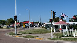
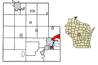
Allouez is a village in Brown County in the U.S. state of Wisconsin. The population was 14,156 at the 2020 census. It is part of the Green Bay Metropolitan Statistical Area.

<span class="mw-page-title-main">Sherwood, Wisconsin</span> Village in Wisconsin, United States

Sherwood is a village in Calumet County, Wisconsin, United States. The population was 2,713 at the 2010 census. The former historical unincorporated community of High Cliff is located within present-day Sherwood.

<span class="mw-page-title-main">Cadott, Wisconsin</span> Village in Wisconsin, United States

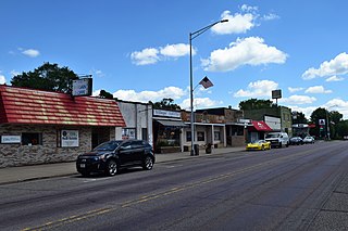
Cadott is a village in Chippewa County in the U.S. state of Wisconsin. The population was 1,437 at the 2010 census.

<span class="mw-page-title-main">Pardeeville, Wisconsin</span> Village in Wisconsin, United States

Pardeeville is a village in Columbia County, Wisconsin, United States. The population was 2,115 at the 2010 census. It is part of the Madison Metropolitan Statistical Area.

<span class="mw-page-title-main">Shiocton, Wisconsin</span> Village in Wisconsin, United States

Shiocton is a village in Outagamie County, Wisconsin, United States. The population was 921 at the 2010 census. It is wholly surrounded by the Town of Bovina.

<span class="mw-page-title-main">Boaz, Wisconsin</span> Village in Wisconsin, United States

Boaz is a village in Richland County, Wisconsin, United States. According to the 2010 census, the population of the village was 156.

<span class="mw-page-title-main">Cecil, Wisconsin</span> Village in Wisconsin, United States

Cecil is a village in Shawano County, Wisconsin, United States. The population was 570 at the 2010 census.

<span class="mw-page-title-main">Cascade, Wisconsin</span> Village in Wisconsin, United States

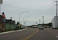
Cascade is a village in Sheboygan County, Wisconsin, United States. The population was 709 at the 2010 census. It is included in the Sheboygan, Wisconsin Metropolitan Statistical Area. Wisconsin Highway 28 passes through Cascade.

<span class="mw-page-title-main">Woodville, Wisconsin</span> Village in Wisconsin, United States

Woodville is a village in St. Croix County, Wisconsin, United States. The population was 1,344 at the 2010 census.

<span class="mw-page-title-main">Stoddard, Wisconsin</span> Village in Wisconsin, United States

Stoddard is a village in Vernon County, Wisconsin, United States. The population was 840 at the 2020 census.

<span class="mw-page-title-main">Ogdensburg, Wisconsin</span> Village in Wisconsin, United States

Ogdensburg is a village in Waupaca County, Wisconsin, United States. The population was 185 at the 2010 census.

<span class="mw-page-title-main">Biron, Wisconsin</span> Village in Wisconsin, United States

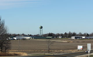
Biron is a village in Wood County, Wisconsin, United States. The population was 839 at the 2010 census. It is the site of ND Paper's Biron Mill.

<span class="mw-page-title-main">Loyal, Wisconsin</span> City in Wisconsin, United States

Loyal is a city in Clark County in the U.S. state of Wisconsin. The population was 1,261 at the 2010 census. The city is located within the Town of Loyal, though it is politically independent.

<span class="mw-page-title-main">Arlington, Wisconsin</span> Village in Wisconsin, United States

Arlington is a village in Columbia County, Wisconsin, United States. The population was 819 at the 2010 census. The village is located within the Town of Arlington. It is part of the Madison Metropolitan Statistical Area.

<span class="mw-page-title-main">Wyocena, Wisconsin</span> Village in Wisconsin, United States

Wyocena is a village in Columbia County, Wisconsin, United States. The population was 768 at the 2010 census. The village is located within the Town of Wyocena. It is part of the Madison Metropolitan Statistical Area.

<span class="mw-page-title-main">Mount Hope, Wisconsin</span> Village in Wisconsin, United States

Mount Hope is a village in Grant County, Wisconsin, United States. The population was 225 at the 2010 census. The village is located within the Town of Mount Hope.

<span class="mw-page-title-main">Hixton, Wisconsin</span> Village in Wisconsin, United States

Hixton is a village in Jackson County, Wisconsin, United States, along the Trempealeau River. The population was 433 at the 2010 census. The village is located within the Town of Hixton.

<span class="mw-page-title-main">Necedah, Wisconsin</span> Village in Wisconsin, United States

Necedah is a village in Juneau County, Wisconsin, United States. The population was 916 at the 2010 census. The village is located within the Town of Necedah.

The Town of Spencer is located in Marathon County, Wisconsin, United States. It is part of the Wausau, WI Metropolitan Statistical Area. The population was 1,581 at the 2010 census. The village of Spencer is located in the northeastern part of the town.The unincorporated community of Mann also is located in the town.

<span class="mw-page-title-main">Oxford, Wisconsin</span> Village in Wisconsin, United States

Oxford is a village in Marquette County, Wisconsin, United States. The population was 537 at the 2020 census. The village is located within the Town of Oxford. The Union Pacific Railroad runs through the town and over Neenah Lake to the northwest.

References

  1. "2019 U.S. Gazetteer Files". United States Census Bureau. Retrieved August 7, 2020.
  2. 1 2 "US Board on Geographic Names". United States Geological Survey. October 25, 2007. Retrieved January 31, 2008.
  3. 1 2 "U.S. Census website". United States Census Bureau . Retrieved November 18, 2012.
  4. 1 2 "Population and Housing Unit Estimates". United States Census Bureau. May 24, 2020. Retrieved May 27, 2020.
  5. 1 2 "U.S. Census website". United States Census Bureau . Retrieved January 31, 2008.
  6. "Profile of General Population and Housing Characteristics: 2010 Demographic Profile Data (DP-1): Spencer village, Wisconsin". United States Census Bureau . Retrieved September 10, 2012.
  7. Caryn Hannan, Jennifer L. Herman, and Oscar B. Chamberlain. Wisconsin Encyclopedia. Hamburg, MI: State History Publications, 2008, p. 491.
  8. "US Gazetteer files: 2010, 2000, and 1990". United States Census Bureau. February 12, 2011. Retrieved April 23, 2011.
  9. "US Gazetteer files 2010". United States Census Bureau. Archived from the original on July 2, 2012. Retrieved November 18, 2012.
  10. "Census of Population and Housing". Census.gov. Retrieved June 4, 2015.