Schofield, Wisconsin

Last updated
Schofield, Wisconsin
Schofield School, Schofield, WI.jpg
Former Schofield School in Schofield
Marathon County Wisconsin Incorporated and Unincorporated areas Schofield Highlighted.svg
Location of Schofield in Marathon County, Wisconsin.
Coordinates: 44°54′55″N89°36′43″W / 44.91528°N 89.61194°W / 44.91528; -89.61194 Coordinates: 44°54′55″N89°36′43″W / 44.91528°N 89.61194°W / 44.91528; -89.61194
Country Flag of the United States.svg  United States
State Flag of Wisconsin.svg  Wisconsin
County Marathon
Area
[1]
  Total2.99 sq mi (7.74 km2)
  Land2.12 sq mi (5.48 km2)
  Water0.87 sq mi (2.26 km2)
Elevation
[2]
1,201 ft (366 m)
Population
 (2020)
  Total2,157
  Density1,024.11/sq mi (395.35/km2)
Time zone UTC-6 (Central (CST))
  Summer (DST) UTC-5 (CDT)
Area code(s) 715 & 534
FIPS code 55-72150 [3]
GNIS feature ID1573796 [2]
Website cityofschofield.org

Schofield is a city in Marathon County, Wisconsin, United States. It is part of the Wausau, Wisconsin Metropolitan Statistical Area. The population was 2,157 at the 2020 census. [4] The city was named for William Scholfield, who came to the area in the 1851 to open a sawmill. [5] The city has since dropped the "L" from its name. [6]

Contents

Geography

Schofield is located along the eastern shore of Lake Wausau, an impoundment of the Wisconsin River. Schofield also contains the Eau Claire Flowage and Eau Claire River (not to be confused with the Eau Claire River of Eau Claire, WI), which flows into Lake Wausau at Schofield. Schofield is directly south of Wausau, and is generally separated from the city by the Wausau Downtown Airport. An inner suburb of Wausau, Schofield is bordered by Rothschild, Weston, and the Town of Weston. Lake Wausau and Wausau serve as its western and northern borders. Schofield is located at 44°54′55″N89°36′43″W / 44.91528°N 89.61194°W / 44.91528; -89.61194 (44.915201, -89.612004). [7]

According to the United States Census Bureau, the city has a total area of 2.83 square miles (7.33 km2), of which, 1.76 square miles (4.56 km2) is land and 1.07 square miles (2.77 km2) is water. [8]

Demographics

Historical population
CensusPop.Note
1910 889
1920 1,04918.0%
1930 1,28722.7%
1940 1,53619.3%
1950 1,94826.8%
1960 3,03856.0%
1970 2,577−15.2%
1980 2,226−13.6%
1990 2,4158.5%
2000 2,117−12.3%
2010 2,1692.5%
2020 2,157−0.6%
U.S. Decennial Census [9]

2010 census

As of the census [10] of 2010, there were 2,169 people, 994 households, and 549 families living in the city. The population density was 1,232.4 inhabitants per square mile (475.8/km2). There were 1,099 housing units at an average density of 624.4 per square mile (241.1/km2). The racial makeup of the city was 90.1% White, 1.2% African American, 0.8% Native American, 5.5% Asian, 0.2% from other races, and 2.2% from two or more races. Hispanic or Latino of any race were 1.8% of the population.

There were 994 households, of which 25.3% had children under the age of 18 living with them, 38.3% were married couples living together, 10.8% had a female householder with no husband present, 6.1% had a male householder with no wife present, and 44.8% were non-families. 36.6% of all households were made up of individuals, and 12.5% had someone living alone who was 65 years of age or older. The average household size was 2.18 and the average family size was 2.84.

The median age in the city was 39.1 years. 21.8% of residents were under the age of 18; 8.8% were between the ages of 18 and 24; 28% were from 25 to 44; 26.5% were from 45 to 64; and 14.8% were 65 years of age or older. The gender makeup of the city was 51.7% male and 48.3% female.

2000 census

As of the census [3] of 2000, there were 2,117 people, 965 households, and 551 families living in the city. The population density was 1,204.4 people per square mile (465.0 people/km2). There were 1,022 housing units at an average density of 581.4 per square mile (224.5/km2). The racial makeup of the city was 95.65% White, 0.38% African American, 0.28% Native American, 2.17% Asian, 0.05% Pacific Islander, 0.57% from other races, and 0.90% from two or more races. Hispanic or Latino of any race were 1.32% of the population.

There were 965 households, out of which 23.6% had children under the age of 18 living with them, 43.7% were married couples living together, 9.5% had a female householder with no husband present, and 42.8% were non-families. 34.4% of all households were made up of individuals, and 11.5% had someone living alone who was 65 years of age or older. The average household size was 2.19 and the average family size was 2.86.

In the city, the population was spread out, with 21.3% under the age of 18, 9.3% from 18 to 24, 31.6% from 25 to 44, 22.3% from 45 to 64, and 15.5% who were 65 years of age or older. The median age was 37 years. For every 100 females, there were 102.4 males. For every 100 females age 18 and over, there were 103.7 males.

The median income for a household in the city was $38,158, and the median income for a family was $50,850. Males had a median income of $32,765 versus $24,932 for females. The per capita income for the city was $20,287. About 6.3% of families and 7.3% of the population were below the poverty line, including 12.0% of those under age 18 and 16.2% of those age 65 or over.

Transportation

Airport

The Central Wisconsin Airport (KCWA) serves Schofield, the county and surrounding communities with both scheduled commercial jet service and general aviation services.

Related Research Articles

<span class="mw-page-title-main">Marathon County, Wisconsin</span> County in Wisconsin, United States

Marathon County is a county located in the U.S. state of Wisconsin. As of the 2020 census, the population was 138,013. Marathon County's seat is Wausau. It was founded in 1850, created from a portion of Portage County. At that time the county stretched to the northern border with the upper Michigan peninsula. It is named after the battlefield at Marathon, Greece.

<span class="mw-page-title-main">Butler, Clark County, Wisconsin</span> Town in Wisconsin, United States

Butler is a town in Clark County in the U.S. state of Wisconsin. The population was 96 at the 2010 census.

<span class="mw-page-title-main">Greenwood, Wisconsin</span> City in Wisconsin, United States

Greenwood is a city in Clark County in the U.S. state of Wisconsin. The population was 1,026 at the 2010 census.

<span class="mw-page-title-main">Altoona, Wisconsin</span> City in Wisconsin, United States

Altoona is a city in Eau Claire County, Wisconsin, United States. The population was 8,292 at the 2020 census with an estimated population in 2021 of 8,817. The city is a railroad terminal on the Union Pacific Railroad.

<span class="mw-page-title-main">Augusta, Wisconsin</span> City in Wisconsin, United States

Augusta is a city in Eau Claire County, Wisconsin, United States. The population was 1,550 at the 2010 census. The city is bordered by the Town of Bridge Creek.

<span class="mw-page-title-main">Washington, Eau Claire County, Wisconsin</span> Town in Wisconsin, United States

The Town of Washington is located in Eau Claire County, Wisconsin, United States. The population was 7,182 at the 2010 census, making it the county's second-most-populous municipality. The town is located along most of the south side of the cities of Eau Claire and Altoona, Wisconsin. The unincorporated community of Brackett is located within the town.

<span class="mw-page-title-main">Ackley, Wisconsin</span> Town in Wisconsin, United States

Ackley is a town in Langlade County, Wisconsin, United States. The population was 524 at the 2010 census. The town was founded March 4, 1879. It was named after William L. Ackley, who established a logging camp in the area.

<span class="mw-page-title-main">Vilas, Wisconsin</span> Town in the U.S. state of Wisconsin

Vilas is a town in Langlade County, Wisconsin, United States. The population was 233 at the 2010 census.

<span class="mw-page-title-main">Cleveland, Marathon County, Wisconsin</span> Town in Wisconsin, United States

The Town of Cleveland is located in Marathon County, Wisconsin, United States. It is part of the Wausau, Wisconsin Metropolitan Statistical Area. The population was 1,488 at the 2010 census. The unincorporated community of Bradley is located in the town.

<span class="mw-page-title-main">Eau Pleine, Marathon County, Wisconsin</span> Town in Wisconsin, United States

The Town of Eau Pleine is located in Marathon County, Wisconsin, United States. It is part of the Wausau, WI Metropolitan Statistical Area. The population was 773 at the 2010 census. The unincorporated communities of Little Rose, March Rapids, and Weber are located in the town. The ghost town of Staadts was also located in the town.

<span class="mw-page-title-main">Johnson, Wisconsin</span> Town in Wisconsin, United States

The Town of Johnson is located in Marathon County, Wisconsin, United States. It is part of the Wausau, Wisconsin Metropolitan Statistical Area. The population was 985 at the 2010 census. The unincorporated communities of Corinth, Milan, and Wuertsburg are located in the town.

<span class="mw-page-title-main">Knowlton, Wisconsin</span> Town in Wisconsin, United States

The Town of Knowlton is located in Marathon County, Wisconsin, United States. It is part of the Wausau, Wisconsin Metropolitan Statistical Area. The population was 1,910 at the 2010 census. The unincorporated communities of Dancy and Knowlton are located in the town. The unincorporated communities of Ashley and Rocky Corners are also located partially in the town.

<span class="mw-page-title-main">Marathon, Wisconsin</span> Town in Wisconsin, United States

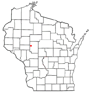
The Town of Marathon is located in Marathon County, Wisconsin, United States. It is part of the Wausau, Wisconsin Metropolitan Statistical Area. The population was 1,048 at the 2010 census. The village of Marathon City was incorporated from a part of the town's original area.

<span class="mw-page-title-main">McMillan, Wisconsin</span> Town in Wisconsin, United States

The Town of McMillan is located in Marathon County, Wisconsin, United States. It is part of the Wausau, Wisconsin Metropolitan Statistical Area. The population was 1,968 at the 2010 census. The unincorporated community of McMillan is located in the town. A section of the Mead Wildlife Area is also located in the town.

<span class="mw-page-title-main">Norrie, Wisconsin</span> Town in Wisconsin, United States

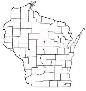
The Town of Norrie is located in Marathon County, Wisconsin, United States. It is part of the Wausau, Wisconsin Metropolitan Statistical Area. The population was 976 at the 2010 census.

<span class="mw-page-title-main">Reid, Wisconsin</span> Town in Marathon County, Wisconsin, United States

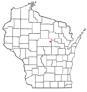
The Town of Reid is located in Marathon County, Wisconsin, United States. It is part of the Wausau, WI Metropolitan Statistical Area. The population was 1,215 at the 2010 census. The unincorporated communities of Little Eau Claire and Pike Lake are located in the town. The unincorporated community of Bevent is located partially in the town.

<span class="mw-page-title-main">Rothschild, Wisconsin</span> Village in Wisconsin, United States

Rothschild is a village in Marathon County, Wisconsin, United States. It is part of the Wausau, Wisconsin Metropolitan Statistical Area. The population was 5,567 at the 2020 census. Rothschild is the northern terminus of Interstate 39, which starts in Normal, Illinois.

<span class="mw-page-title-main">Junction City, Wisconsin</span> Village in Wisconsin, United States

Junction City is a village in Portage County, Wisconsin, United States. The population was 439 at the 2010 census.

<span class="mw-page-title-main">Spring Valley, Wisconsin</span> Village in Wisconsin, United States

Spring Valley is a village in Pierce and St. Croix counties in Wisconsin, United States. The population was 1,401 at the 2020 census. Of those, 1,390 were in Pierce County and 11 in St. Croix County. The village is mostly within the Town of Spring Lake in Pierce County. Small parts also lie in the Town of Gilman, also in Pierce County, and the Town of Cady in St. Croix County.

<span class="mw-page-title-main">Wausau (town), Wisconsin</span> Town in Wisconsin, United States

The Town of Wausau is located in Marathon County, Wisconsin, United States. It is part of the Wausau, Wisconsin Metropolitan Statistical Area. The population was 2,229 at the 2010 census. The city of Wausau is located adjacent to and partially within the town. The unincorporated community of Nutterville is located in the town and the unincorporated community of Sunset is partially in the town.

References

  1. "2019 U.S. Gazetteer Files". United States Census Bureau. Retrieved August 7, 2020.
  2. 1 2 U.S. Geological Survey Geographic Names Information System: Schofield, Wisconsin
  3. 1 2 "U.S. Census website". United States Census Bureau . Retrieved 2008-01-31.
  4. "United States Census 2020". United States Census Bureau . Retrieved March 3, 2023.
  5. "Scholfield, William B. (15 November 1855 – 19??), Marathon County, Wisconsin Biographical Records, Clark County, Wisconsin History & Genealogy Records". www.wiclarkcountyhistory.org. Retrieved 2020-07-30.
  6. Gard, Robert (2015-09-09). The Romance of Wisconsin Place Names (2nd ed.). Madison, WI: University of Wisconsin Press. p. 295. ISBN   978-0-870-20707-5.
  7. "US Gazetteer files: 2010, 2000, and 1990". United States Census Bureau. 2011-02-12. Retrieved 2011-04-23.
  8. "US Gazetteer files 2010". United States Census Bureau. Archived from the original on 2012-01-25. Retrieved 2012-11-18.
  9. "Census of Population and Housing". Census.gov. Retrieved March 3, 2023.
  10. "U.S. Census website". United States Census Bureau . Retrieved 2012-11-18.