Location served Region/State ICAO IATA Airport name Coordinates International airports Mandalay / Tada-U Mandalay Region VYMD MDL Mandalay International Airport 21°42′07″N 095°58′40″E / 21.70194°N 95.97778°E / 21.70194; 95.97778 (Mandalay International Airport ) Yangon (Rangoon) Yangon Region VYYY RGN Yangon International Airport 16°54′26″N 096°07′59″E / 16.90722°N 96.13306°E / 16.90722; 96.13306 (Yangon International Airport ) Naypyidaw (Naypyitaw) Mandalay Region VYNT NYT Nay Pyi Taw International Airport (Ela Airport) 19°37′24″N 096°12′03″E / 19.62333°N 96.20083°E / 19.62333; 96.20083 (Naypyidaw Airport ) Bago (Bago) Bago Region Hanthawaddy International Airport (Under Construction) 17°18′4″N 096°25′41″E / 17.30111°N 96.42806°E / 17.30111; 96.42806 (Hanthawaddy Airport ) Mawlamyine (Mawlamyine) Mon State Mawlamyine International Airport (Planned) Unknown Domestic airports Anisakan Mandalay Region VYAS Anisakan Airport 21°57′19″N 096°24′21″E / 21.95528°N 96.40583°E / 21.95528; 96.40583 (Anisakan Airport ) Ann Rakhine State VYAN VBA Ann Airport 19°46′08″N 094°01′34″E / 19.76889°N 94.02611°E / 19.76889; 94.02611 (Ann Airport ) Bagan / Nyaung-U Mandalay Region VYBG NYU Nyaung U Airport 21°10′43″N 094°55′48″E / 21.17861°N 94.93000°E / 21.17861; 94.93000 (Nyaung U Airport ) Bhamo (Banmaw) Kachin State VYBM BMO Bhamo Airport (Banmaw Airport) 24°16′15″N 097°14′49″E / 24.27083°N 97.24694°E / 24.27083; 97.24694 (Bhamo Airport ) Nogmung (Nogmung) Kachin State VYNM N0M Nogmung Airport (Nogmung Airport) 27°30′00″N 097°49′00″E / 27.50000°N 97.81667°E / 27.50000; 97.81667 (Nogmung Airport ) Bokpyin (Bokepyin) Tanintharyi Region VYBP Bokpyin Airport 11°16′N 098°46′E / 11.267°N 98.767°E / 11.267; 98.767 (Bokpyin Airport ) Coco Islands (Great Coco Island) Yangon Region VYCI Coco Island Airport 14°08′29″N 093°22′06″E / 14.14139°N 93.36833°E / 14.14139; 93.36833 (Coco Island Airport ) Dawei (Tavoy) Tanintharyi Region VYDW TVY Dawei Airport 14°06′13″N 098°12′13″E / 14.10361°N 98.20361°E / 14.10361; 98.20361 (Dawei Airport ) Gangaw Magway Region VYGG GAW Gangaw Airport 22°10′29″N 094°08′04″E / 22.17472°N 94.13444°E / 22.17472; 94.13444 (Gangaw Airport ) Gwa Rakhine State VYGW GWA Gwa Airport 17°36′N 094°35′E / 17.600°N 94.583°E / 17.600; 94.583 (Gwa Airport ) Heho Shan State VYHH HEH Heho Airport 20°44′49″N 096°47′31″E / 20.74694°N 96.79194°E / 20.74694; 96.79194 (Heho Airport ) Homalin (Hommalin) Sagaing Region VYHL HOX Homalin Airport (Hommalin Airport) 24°53′58″N 094°54′50″E / 24.89944°N 94.91389°E / 24.89944; 94.91389 (Homalin Airport ) Hpa-An (Pa-An) Kayin State VYPA PAA Hpa-An Airport 16°53′37″N 097°40′28″E / 16.89361°N 97.67444°E / 16.89361; 97.67444 (Hpa-An Airport ) Hpapun (Papun) Kayin State VYPP PPU Hpapun Airport 18°04′N 097°27′E / 18.067°N 97.450°E / 18.067; 97.450 (Hpapun Airport ) Kalaymyo (Kalemyo) Sagaing Region VYKL KMV Kalaymyo Airport 23°11′19″N 094°03′03″E / 23.18861°N 94.05083°E / 23.18861; 94.05083 (Kalaymyo Airport ) Kawthaung (Kawthoung) Tanintharyi Region VYKT KAW Kawthaung Airport 10°02′57″N 098°32′16″E / 10.04917°N 98.53778°E / 10.04917; 98.53778 (Kawthaung Airport ) Kengtung (Kengtong, Kyaingtong) Shan State VYKG KET Kengtung Airport 21°18′05″N 099°38′09″E / 21.30139°N 99.63583°E / 21.30139; 99.63583 (Kengtung Airport ) Khamti Sagaing Region VYKI KHM Khamti Airport 25°59′18″N 095°40′28″E / 25.98833°N 95.67444°E / 25.98833; 95.67444 (Khamti Airport ) Kyaukpyu (Kyauk Pyu) Rakhine State VYKP KYP Kyaukpyu Airport 19°25′35″N 093°32′05″E / 19.42639°N 93.53472°E / 19.42639; 93.53472 (Kyaukpyu Airport ) Kyauktu (Kyaukhtu) Magway Region VYKU KYT Kyauktu Airport 21°24′45″N 094°08′31″E / 21.41250°N 94.14194°E / 21.41250; 94.14194 (Kyauktu Airport ) Kyauktu (Kyaukhtu) Magway Region VYXG Kyauktu South Airport 21°24′26″N 094°07′31″E / 21.40722°N 94.12528°E / 21.40722; 94.12528 (Kyauktu South Airport ) Lanywa Magway Region VYLY Lanywa Airport 20°56′25″N 094°49′21″E / 20.94028°N 94.82250°E / 20.94028; 94.82250 (Lanywa Airport ) Lashio Shan State VYLS LSH Lashio Airport 22°58′40″N 097°45′07″E / 22.97778°N 97.75194°E / 22.97778; 97.75194 (Lashio Airport ) Loikaw Kayah State VYLK LIW Loikaw Airport 19°41′29″N 097°12′53″E / 19.69139°N 97.21472°E / 19.69139; 97.21472 (Loikaw Airport ) Magwe Magway Region VYMW MWQ Magwe Airport 20°09′56″N 094°56′28″E / 20.16556°N 94.94111°E / 20.16556; 94.94111 (Magwe Airport ) Manaung Rakhine State VYMN MGU Manaung Airport 18°50′45″N 093°41′20″E / 18.84583°N 93.68889°E / 18.84583; 93.68889 (Manaung Airport ) Mandalay Mandalay Region VYCZ VBC Mandalay Chanmyathazi Airport 21°56′25″N 096°05′22″E / 21.94028°N 96.08944°E / 21.94028; 96.08944 (Mandalay Chanmyathazi Airport ) Mawlamyine (Mawlamyaing) Mon State VYMM MNU Mawlamyaing Airport (Mawlamyine Airport) 16°26′41″N 097°39′38″E / 16.44472°N 97.66056°E / 16.44472; 97.66056 (Mawlamyaing Airport ) Momeik Shan State VYMO MOE Momeik Airport 23°05′33″N 096°38′42″E / 23.09250°N 96.64500°E / 23.09250; 96.64500 (Momeik Airport ) Mong Ton (Mong-Tong) Shan State VYMT MGK Mong Ton Airport 20°17′48″N 098°53′56″E / 20.29667°N 98.89889°E / 20.29667; 98.89889 (Mong Ton Airport ) Mong Hsat (Monghsat) Shan State VYMS MOG Monghsat Airport (Mong Hsat Airport) 20°31′00″N 099°15′24″E / 20.51667°N 99.25667°E / 20.51667; 99.25667 (Monghsat Airport ) Monywa (Monywar) Sagaing Region VYMY NYW Monywa Airport (Monywar Airport) 22°14′N 095°07′E / 22.233°N 95.117°E / 22.233; 95.117 (Monywa Airport ) Myeik (Mergui) Tanintharyi Region VYME MGZ Myeik Airport 12°26′23″N 098°37′17″E / 12.43972°N 98.62139°E / 12.43972; 98.62139 (Myeik Airport ) Myitkyina Kachin State VYMK MYT Myitkyina Airport 25°23′01″N 097°21′06″E / 25.38361°N 97.35167°E / 25.38361; 97.35167 (Myitkyina Airport ) Namsang Shan State VYNS NMS Namsang Airport 20°53′25″N 097°44′09″E / 20.89028°N 97.73583°E / 20.89028; 97.73583 (Namsang Airport ) Namtu Shan State VYNU NMT Namtu Airport 23°05′N 097°23′E / 23.083°N 97.383°E / 23.083; 97.383 (Namtu Airport ) Pakokku Magway Region VYPU PKK Pakokku Airport 21°24′N 095°06′E / 21.400°N 95.100°E / 21.400; 95.100 (Pakokku Airport ) Pathein (Bassein) Ayeyarwady Region VYPN BSX Pathein Airport 16°48′54″N 094°46′47″E / 16.81500°N 94.77972°E / 16.81500; 94.77972 (Pathein Airport ) Pauk Magway Region VYPK PAU Pauk Airport 21°26′57″N 094°29′13″E / 21.44917°N 94.48694°E / 21.44917; 94.48694 (Pauk Airport ) Putao Kachin State VYPT PBU Putao Airport 27°19′47″N 097°25′34″E / 27.32972°N 97.42611°E / 27.32972; 97.42611 (Putao Airport ) Pyay (Prome) Bago Region VYPY PRU Pyay Airport 18°49′28″N 095°15′57″E / 18.82444°N 95.26583°E / 18.82444; 95.26583 (Pyay Airport ) Sittwe (Akyab) Rakhine State VYSW AKY Sittwe Airport 20°07′57″N 092°52′21″E / 20.13250°N 92.87250°E / 20.13250; 92.87250 (Sittwe Airport ) Falam (Surbung) Rakhine State VYFS SUR Surbung Airport 22°56′21″N 93°36′55″E / 22.939167°N 93.615333°E / 22.939167; 93.615333 (Surbung Airport ) Tachileik (Tachilek) Shan State VYTL THL Tachilek Airport 20°29′01″N 099°56′07″E / 20.48361°N 99.93528°E / 20.48361; 99.93528 (Tachilek Airport ) Thandwe (Sandoway) Rakhine State VYTD SNW Thandwe Airport 18°27′38″N 094°18′00″E / 18.46056°N 94.30000°E / 18.46056; 94.30000 (Thandwe Airport ) Tilin Magway Region VYHN TIO Tilin Airport 21°42′N 094°06′E / 21.700°N 94.100°E / 21.700; 94.100 (Tilin Airport ) Ye Mon State VYYE XYE Ye Airport 15°18′N 097°52′E / 15.300°N 97.867°E / 15.300; 97.867 (Ye Airport ) 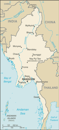
 Mandalay Airport
 Yangon Airport
