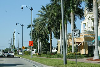
State Road 5 is a mostly-unsigned state highway in the state of Florida. It is mainly signed as US 1 from its south end in Key West, Florida to Jacksonville, Florida, and US 17 from Jacksonville to the Georgia state line at the Saint Marys River. US 1 is SR 15 northwest from Jacksonville.
State Road 5A (SR 5A), also known as Nova Road, is a north–south highway that begins and ends at U.S. Highway 1 or US 1, in Port Orange and Ormond Beach, respectively. It is noted that when 5A was built, it was used more as a bypass or beltway, but in recent years with growth reaching far beyond SR 5A, it sees more use as a major thoroughfare that passes through the heart of the region.
State Road 924 is a 8.5 miles (13.7 km) east–west highway connecting Interstate 75 and the Palmetto Expressway in Hialeah and SR 909 in North Miami. The westernmost 4.85 miles, named the Gratigny Parkway, is a limited access all-electronic toll road maintained by the Miami-Dade Expressway Authority ; the easternmost 3.6 miles (5.8 km) is a surface street also known as Gratigny Road. Despite its relatively short length, SR 924 is a major east–west artery in northern Miami-Dade County.
State Road 909 is a 3.77-mile-long (6.07 km) state highway in northern Miami-Dade County, Florida, United States. It runs along West Dixie Highway, the original alignment of the Dixie Highway, from the east end of Gratigny Drive in North Miami northeast to North Miami Beach Boulevard in North Miami Beach, just across the Florida East Coast Railway from Biscayne Boulevard. State Road 909 is actually in two pieces as motorists traveling the route in North Miami encounter signs on North Miami Boulevard saying "TO 909" and "To W Dixie Hwy" and guiding them along a two-block "detour" to the other section.
Dixie Highway in Palm Beach and Broward counties carries two segments of the State Road 811 designation by Florida Department of Transportation, as well as the local County Road 811 in southeast Florida. The entire road comprises a section of the Dixie Highway, a National Auto Trail which eventually became a former routing of U.S. Route 1 after the route was shifted east to Federal Highway. One segment of SR 811 is in Broward County and the other is in Palm Beach County, Florida. The segments of SR 811 are supplemented by three shorter segments of CR 811, one of which is unsigned.
County Road 854, locally known as Ives Dairy Road, Dan Marino Boulevard, and Honey Hill Drive, is the unsigned designation for an east–west commuter road spanning 8.7 miles (14.0 km) across northern Miami-Dade County, which encompasses sections of North 199th Street, North 202nd Street, North 203rd Street, and North 205th Terrace. Its western terminus is an intersection with Red Road/Northwest 57th Avenue near Miami Lakes and Carol City, the eastern terminus is an intersection with Biscayne Boulevard in Aventura, a half block east of an overpass over West Dixie Highway that once served as part of the Dixie Highway and US 1.
County Road 707 (CR 707) is a designation applied to two segments of road across three counties on Florida's Treasure Coast. The entire road was formerly designated State Road 707 (SR 707) and has been gradually transferred to county jurisdiction.
Sunset Drive, also known as Southwest 72nd Street is a 12.5-mile-long (20.1 km) east–west arterial road traversing the southwestern suburbs of Miami, Florida, from the northwestern portions of the Kendall area to Coral Gables. A central portion of Sunset Drive is maintained by the Florida Department of Transportation as State Road 986, which runs from the Homestead Extension (HEFT) underpass to Southwest 69th Avenue and is signed through South Miami to US 1.
State Road 13 (SR 13) is a 28.25-mile-long (45.46 km) state highway in the U.S. state of Florida, running north from SR 16 near Green Cove Springs, through Switzerland to Jacksonville on the east shore of the St. Johns River.
Atlantic Boulevard, consisting mostly of State Road 814, is a major commercial and commuter highway in northern Broward County, Florida. The 13-mile-long (21 km) divided highway extends from the Sawgrass Expressway in Coral Springs to State Road A1A in Pompano Beach. It serves as the latitudinal baseline for the street grid for the city of Pompano Beach. The portion of the boulevard west of U.S. Route 441 is locally maintained as County Road 814.
State Road 998 is an east–west road in Homestead, Florida, connecting the southern terminus of SR 997 with U.S. Route 1 (US 1). The road, known locally as Campbell Drive, North 8th Street and Southwest 312th Street runs just over 3⁄4 mile (1.2 km) and serves as a truck bypass around downtown Homestead. It is the highest numbered three-digit state highway in Florida.
