Greece has many islands,[Note 1] with estimates ranging from somewhere around 1,200[1] to 6,000,[2] depending on the minimum size to take into account. The number of inhabited islands is variously cited as between 166[3] and 227.[2]
The largest Greek island by both area and population is Crete, located at the southern edge of the Aegean Sea. The second largest island in area is Euboea or Evvia, which is separated from the mainland by the 60m-wide Euripus Strait, and is administered as part of the Central Greece region. After the third and fourth largest Greek islands, Lesbos and Rhodes, the rest of the islands are two-thirds of the area of Rhodes, or smaller.
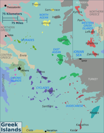
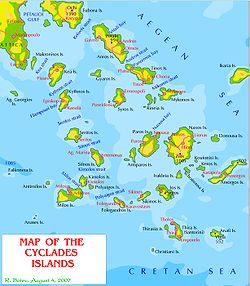
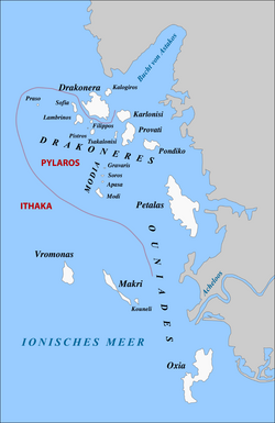
The Greek islands are traditionally grouped into the following clusters: the Argo-Saronic Islands in the Saronic Gulf near Athens; the Cyclades, a large but dense collection occupying the central part of the Aegean Sea; the North Aegean islands, a loose grouping off the west coast of Turkey; the Dodecanese, another loose collection in the southeast between Crete and Turkey; the Sporades, a small tight group off the coast of Euboea; and the Ionian Islands, chiefly located to the west of the mainland in the Ionian Sea. Crete with its surrounding islets and Euboea are traditionally excluded from this grouping.
This article excludes the Peloponnese, which has technically been an island since the construction of the Corinth Canal in 1893, but is rarely considered to be an island due to its artificial origins.
Islands of Greece by size
NASA image of CreteNASA image of RhodesIthaca is to the upper right of the larger Kefalonia island in this picture. The small island in the top-right corner is the uninhabited Atokos island (NASA World Wind satellite picture).
The following are the 40 largest Greek islands listed by surface area.
Aerial view of the port city of Hydra on Hydra Island
This list includes Argo-Saronic islands, which are located in the Saronic Gulf. The largest Argo-Saronic island is Salamis. The main islands are in bold. Uninhabited islands are indicated, including those that may have been inhabited in the past:
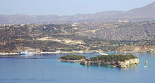
The islet of Leon, on the left, next to the larger islet of Souda, within Souda baySpinalonga (Kalydon)The islet of Pontikonisi (mouse island) which has the shape of a mouse.
↑ In Greek: Island-Νησί (Nisi), Islet-Νησάκι (Nisáki)
Related Research Articles
The geography of Malta is dominated by water. Malta is an archipelago of coralline limestone, located in Europe, in the Mediterranean Sea, 81 kilometres south of Sicily, Italy, and nearly 300 km north (Libya) and northeast (Tunisia) of Africa. Although Malta is situated in Southern Europe, it is located farther south than Tunis, capital of Tunisia, Algiers, capital of Algeria, Tangier in Morocco and also Aleppo in Syria, and Mosul in Iraq in the Middle East. Only the three largest islands – Malta, Gozo and Comino – are inhabited. Other (uninhabited) islands are: Cominotto, Filfla and the St.Paul's Islands. The country is approximately 316 km2 in area. Numerous bays along the indented coastline of the islands provide harbours. The landscape of the islands is characterised by high hills with terraced fields. The highest point, at 253 metres, Ta' Zuta on mainland Malta. The capital is Valletta.
The Arctic Archipelago, also known as the Canadian Arctic Archipelago, is an archipelago lying to the north of the Canadian continental mainland, excluding Greenland and Iceland.
The Queen Elizabeth Islands are the northernmost cluster of islands in Canada's Arctic Archipelago, split between Nunavut and the Northwest Territories in Northern Canada. The Queen Elizabeth Islands contain approximately 14% of the global glacier and ice cap area. The southern islands are called the Parry Islands or Parry Archipelago.
This is a list of the extreme points of the European Union — the points that are farther north, south, east or west than any other location.
The Penguin Islands are a historical group of mostly scattered islands and rocks situated along a stretch of 355 kilometres (221 mi) along the coastline of Namibia. Not forming a geographic whole, the Namibian government formally lists them as the Off-Shore islands. Their name comes from the presence of African penguins which inhabit the coastal region surrounding Namibia and South Africa.
Akça is a Turkish island shaped like a shellfish near the biggest city of the Turkish Aegean coast Izmir. It is an uninhabited island and there are only bushes on the island. It is situated between Arap Islands, Yassıca Island, Çiçek Islands, Körtaş Islands and İncirli Island. It is off the coast of Port of Urla. It is a small island surrounded with turquoise waters, thus it is a swimming spot for the residents of Izmir in summertime.
References
↑ John S. Bowman; Sherry Marker; Peter Keraislands siotis; Heidi Sarna (2010). "Greece in depth". Frommer's Greece (7thed.). Hoboken, NJ: Wiley Publishing. p.12. ISBN978-0-470-52663-7.
1 2 "Islands". Visit Greece - Official website of the Greek National Tourism Organisation. Hellenic Organization of Tourism (EOT; Ελληνικός Οργανισμός Τουρισμού). Retrieved 7 February 2022.
This page is based on this Wikipedia article Text is available under the CC BY-SA 4.0 license; additional terms may apply. Images, videos and audio are available under their respective licenses.