List of territories of the Democratic Republic of the Congo

Last updated

Territoires of the Democratic Republic of Congo Territoires du Republique Democratique du Congo.png
Territoires of the Democratic Republic of Congo
Territoires of the Democratic Republic of Congo by Province Provinces et Territoires du Republique Democratique du Congo.png
Territoires of the Democratic Republic of Congo by Province

The provinces of the Democratic Republic of the Congo are divided into territories (fr. territoires, sing. territoire) and cities (fr. villes, sing. ville). The 145 territories are listed below, in alphabetical order, along with the provinces after and before the 2015 reorganization:

Contents

Territories

TerritoryProvincePre-2015 Province
Aketi Bas-Uele Orientale
Ango Bas-Uele Orientale
Aru Ituri Orientale
Bafwasende Tshopo Orientale
Bagata Kwilu Bandundu
Bambesa Bas-Uele Orientale
Banalia Tshopo Orientale
Basankusu Équateur Équateur (old)
Basoko Tshopo Orientale
Befale Tshuapa Équateur (old)
Beni North Kivu North Kivu
Bikoro Équateur Équateur (old)
Boende Tshuapa Équateur (old)
Bokungu Tshuapa Équateur (old)
Bolobo Mai-Ndombe Bandundu
Bolomba Équateur Équateur (old)
Bomongo Équateur Équateur (old)
Bondo Bas-Uele Orientale
Bongandanga Mongala Équateur (old)
Bosobolo Nord-Ubangi Équateur (old)
Budjala Sud-Ubangi Équateur (old)
Bukama Haut-Lomami Katanga
Bulungu Kwilu Bandundu
Bumba Mongala Équateur (old)
Businga Nord-Ubangi Équateur (old)
Buta Bas-Uele Orientale
Dekese Kasaï Kasaï-Occidental
Demba Kasaï-Central Kasaï-Occidental
Dibaya Kasaï-Central Kasaï-Occidental
Dilolo Lualaba Katanga
Dimbelenge Kasaï-Central Kasaï-Occidental
Djolu Tshuapa Équateur (old)
Djugu Ituri Orientale
Dungu Haut-Uele Orientale
Faradje Haut-Uele Orientale
Feshi Kwango Bandundu
Fizi South Kivu South Kivu
Gandajika or Ngandajika Lomami Kasaï-Oriental (old)
Gemena Sud-Ubangi Équateur (old)
Gungu Kwilu Bandundu
Idiofa Kwilu Bandundu
Idjwi South Kivu South Kivu
Ikela Tshuapa Équateur (old)
Ilebo Kasaï Kasaï-Occidental
Ingende Équateur Équateur (old)
Inongo Mai-Ndombe Bandundu
Irumu Ituri Orientale
Isangi Tshopo Orientale
Kabalo Tanganyika Katanga
Kabambare Maniema Maniema
Kabare South Kivu South Kivu
Kabeya-Kamwanga Kasaï-Oriental Kasaï-Oriental (old)
Kabinda Lomami Kasaï-Oriental (old)
Kabongo Haut-Lomami Katanga
Kahemba Kwango Bandundu
Kailo Maniema Maniema
Kalehe South Kivu South Kivu
Kalemie Tanganyika Katanga
Kambove Haut-Katanga Katanga
Kamiji Lomami Kasaï-Oriental (old)
Kamina Haut-Lomami Katanga
Kamonia or Tshikapa Kasaï Kasaï-Occidental
Kanyama or Kaniama Haut-Lomami Katanga
Kapanga Lualaba Katanga
Kasangulu Kongo Central Bas-Congo
Kasenga Haut-Katanga Katanga
Kasongo Maniema Maniema
Kasongo-Lunda Kwango Bandundu
Katako-Kombe Sankuru Kasaï-Oriental (old)
Katanda Kasaï-Oriental Kasaï-Oriental (old)
Kazumba Kasaï-Central Kasaï-Occidental
Kenge Kwango Bandundu
Kibombo Maniema Maniema
Kimvula Kongo Central Bas-Congo
Kipushi Haut-Katanga Katanga
Kiri Mai-Ndombe Bandundu
Kole Sankuru Kasaï-Oriental (old)
Kongolo Tanganyika Katanga
Kungu Sud-Ubangi Équateur (old)
Kutu Mai-Ndombe Bandundu
Kwamouth Mai-Ndombe Bandundu
Libenge Sud-Ubangi Équateur (old)
Lisala Mongala Équateur (old)
Lodja Sankuru Kasaï-Oriental (old)
Lomela Sankuru Kasaï-Oriental (old)
Lubao Lomami Kasaï-Oriental (old)
Lubefu Sankuru Kasaï-Oriental (old)
Lubero North Kivu North Kivu
Lubudi Lualaba Katanga
Lubutu Maniema Maniema
Luebo Kasaï Kasaï-Occidental
Luilu Lomami Kasaï-Oriental (old)
Luiza Kasaï-Central Kasaï-Occidental
Lukolela Équateur Équateur (old)
Lukula Kongo Central Bas-Congo
Luozi Kongo Central Bas-Congo
Lupatapata or Luhatahata Kasaï-Oriental Kasaï-Oriental (old)
Lusambo Sankuru Kasaï-Oriental (old)
Madimba Kongo Central Bas-Congo
Mahagi Ituri Orientale
Makanza or Mankanza Équateur Équateur (old)
Malemba-Nkulu Haut-Lomami Katanga
Mambasa Ituri Orientale
Manono Tanganyika Katanga
Masi-Manimba Kwilu Bandundu
Masisi North Kivu North Kivu
Mbanza-Ngungu Kongo Central Bas-Congo
Miabi Kasaï-Oriental Kasaï-Oriental (old)
Mitwaba Haut-Katanga Katanga
Moanda Kongo Central Bas-Congo
Moba Tanganyika Katanga
Mobayi-Mbongo Nord-Ubangi Équateur (old)
Monkoto Tshuapa Équateur (old)
Mushie Mai-Ndombe Bandundu
Mutshatsha Lualaba Katanga
Mweka Kasaï Kasaï-Occidental
Mwenga South Kivu South Kivu
Niangara Haut-Uele Orientale
Nyiragongo North Kivu North Kivu
Nyunzu Tanganyika Katanga
Opala Tshopo Orientale
Oshwe Mai-Ndombe Bandundu
Pangi Maniema Maniema
Poko Bas-Uele Orientale
Popokabaka Kwango Bandundu
Punia Maniema Maniema
Pweto Haut-Katanga Katanga
Rungu Haut-Uele Orientale
Rutshuru North Kivu North Kivu
Sakania Haut-Katanga Katanga
Sandoa Lualaba Katanga
Seke-Banza Kongo Central Bas-Congo
Shabunda South Kivu South Kivu
Songololo Kongo Central Bas-Congo
Tshela Kongo Central Bas-Congo
Tshilenge Kasaï-Oriental Kasaï-Oriental (old)
Ubundu Tshopo Orientale
Uvira South Kivu South Kivu
Walikale North Kivu North Kivu
Walungu South Kivu South Kivu
Wamba Haut-Uele Orientale
Watsa Haut-Uele Orientale
Yahuma Tshopo Orientale
Yakoma Nord-Ubangi Équateur (old)
Yumbi Mai-Ndombe Bandundu
Main Source: Independent National Electoral Commission [1]

See also

Related Research Articles

<span class="mw-page-title-main">Departments of France</span> Administrative subdivision in France

In the administrative divisions of France, the department is one of the three levels of government under the national level, between the administrative regions and the communes. Ninety-six departments are in metropolitan France, and five are overseas departments, which are also classified as overseas regions. Departments are further subdivided into 332 arrondissements, and these are divided into cantons. The last two levels of government have no autonomy, instead serving as the basis of local organisation of police, fire departments and, sometimes, administration of elections.

<span class="mw-page-title-main">South Kivu</span> Province of the Democratic Republic of the Congo

South Kivu is one of 26 provinces of the Democratic Republic of the Congo. Its capital is Bukavu.

<span class="mw-page-title-main">Subdivisions of the Democratic Republic of the Congo</span> Territorial organization of the DR Congo

The Third Republic of the Democratic Republic of the Congo is a unitary state with a five-level hierarchy of types of administrative division. There are nine different types of country subdivision in a new hierarchy with no new types but with two from the previous one abolished.

<span class="mw-page-title-main">Rutshuru</span>

Rutshuru is a town located in the North Kivu province of the eastern Democratic Republic of the Congo, and is headquarters of an administrative district, the Rutshuru Territory. The town lies in the western branch of the Albertine Rift between Lakes Edward and Kivu. The Ugandan border is 15 km east and the Rwandan border is 30 km south-east. Lava flows from the Nyamuragira volcano, 40 km south-west, have come within 7 km of the town in recent years.

<span class="mw-page-title-main">Province of Équateur</span> Province of the Democratic Republic of the Congo

Équateur is one of the 21 new provinces of the Democratic Republic of the Congo created in the 2015 repartitioning. Équateur, Mongala, Nord-Ubangi, Sud-Ubangi, and Tshuapa provinces are the result of the dismemberment of the former Équateur province. The new province was formed from the Équateur district and the independently administered city of Mbandaka which retained its status as a provincial capital.

<span class="mw-page-title-main">Provinces of the Democratic Republic of the Congo</span> First-level administrative division of the Democratic Republic of the Congo

Article 2 of the Constitution of the Democratic Republic of the Congo divides the country into the capital city of Kinshasa and 25 named provinces. It also gives the capital the status of a province. Therefore, in many contexts Kinshasa is regarded as the 26th province.

<span class="mw-page-title-main">Districts of the Democratic Republic of the Congo</span>

The provinces of the Democratic Republic of the Congo were divided into 26 districts. Those in turn were divided into territories or communes.

<span class="mw-page-title-main">Tshopo</span> Province of the Democratic Republic of the Congo

Tshopo is one of the 21 new provinces of the Democratic Republic of the Congo created in the 2015 repartitioning. It is situated in the north central part of the country on the Tshopo River, for which it is named.

<span class="mw-page-title-main">Lulua District</span> District in Kasai-Occidental, Democratic Republic of the Congo

Lulua District was a district of the Belgian Congo and the Democratic Republic of the Congo. The city of Kananga was at the center of the district, but had a separate administration. In 2015 Lulua District became the province of Kasaï-Central.

<span class="mw-page-title-main">Équateur District</span> District in Équateur Province, Democratic Republic of the Congo

Équateur District was a former district of the Congo Free State, Belgian Congo and Democratic Republic of the Congo. In 1914 it became part of former Équateur Province. The district went through various changes of extent and name over the years. The original district roughly corresponds to the current provinces of Équateur and Tshuapa.

<span class="mw-page-title-main">Kwilu Province</span> Province of the Democratic Republic of the Congo

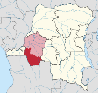
Kwilu is a province of the Democratic Republic of the Congo. It's one of the 21 provinces created in the 2015 repartitioning. Kwilu, Kwango, and Mai-Ndombe provinces are the result of the dismemberment of the former Bandundu province. Kwilu was formed from the Kwilu district and the independently administered cities of Bandundu and Kikwit. Bandundu is the provincial capital.

<span class="mw-page-title-main">Kasai District</span> District in Kasaï, Democratic Republic of the Congo

Kasai District was a district of the Congo Free State, Belgian Congo and the Democratic Republic of the Congo, named after the Kasai River. It was formed around 1885 and went through several large changes in extent in the years that followed. The 1933 version of the district roughly corresponded to the former Kasai-Occidental province and the present Kasaï and Kasaï-Central provinces.

Inongo Territory is a second-level administrative area (territory) in Maï-Ndombe Province in the Democratic Republic of the Congo. Its headquarters is in the provincial capital of Inongo.

<span class="mw-page-title-main">Kwango District</span> District in Bandundu, Democratic Republic of the Congo

Kwango District was a district of the Congo Free State, Belgian Congo and the Democratic Republic of the Congo. It went through various changes in extent. It roughly corresponded to the present provinces of Kwilu and Kwango.

<span class="mw-page-title-main">Kwilu District</span> District in Bandundu, Democratic Republic of the Congo

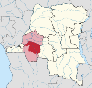
Kwilu District was a district of the Belgian Congo and the Democratic Republic of the Congo. It roughly corresponded to the present province of Kwilu.

Ingende Territory is a second-level administrative area (territory) in Équateur Province in the Democratic Republic of the Congo. Its headquarters is the town of Ingende.

<span class="mw-page-title-main">Districts of the Belgian Congo</span>

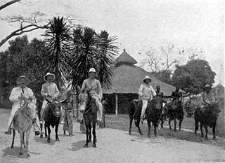
The Districts of the Belgian Congo were the primary administrative divisions when Belgium annexed the Congo Free State in 1908, each administered by a district commissioner. In 1914 they were distributed among four large provinces, with some boundary changes. In 1933 the provinces were restructured into six, again with boundary changes. The number of districts fluctuated between 12 and 26 through splits and consolidations, first rising, then falling, then rising again.

Ubangi District was a district of the Congo Free State, Belgian Congo and Democratic Republic of the Congo. It went through various significant changes in extent.

The cities of the Democratic Republic of the Congo are administrative divisions of provinces with the exception of Kinshasa which itself has the status of a province. Cities are further divided into communes. They are led by mayors except for Kinshasa which is led by a governor.

References

  1. "La Cartographie Electorale des 26 Provinces". www.ceni.cd (in French). Retrieved 25 February 2019.