Interstate 72 (I-72) is an Interstate Highway in the midwestern United States. Its western terminus is in Hannibal, Missouri, at an intersection with U.S. Route 61 (US 61); its eastern terminus is at Country Fair Drive in Champaign, Illinois. The route runs through the major cities of Decatur, Illinois, and Springfield, Illinois. In 2006, the Illinois General Assembly dedicated all of I-72 as Purple Heart Memorial Highway. The stretch between Springfield and Decatur is also called Penny Severns Memorial Expressway, and the section between mile 35 and the Mississippi River is known as the Free Frank McWorter Historic Highway.

Winnebago County is a county located in the U.S. state of Illinois. According to the 2020 census, it had a population of 285,350 making it the seventh most populous county in Illinois behind Cook County and its five surrounding collar counties. Its county seat is Rockford. Winnebago County is the central county of the Rockford Metropolitan Statistical Area.

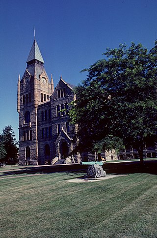
Vermilion County is a county in the eastern part of the U.S. state of Illinois, between the Indiana border and Champaign County. It was established in 1826 and was the 45th of Illinois' 102 counties. According to the 2010 United States Census, it had a population of 81,625, a decrease of 2.7% in 2000. It contains 21 incorporated settlements; the county seat and largest city is Danville.

Monroe County is a county located in the U.S. state of Illinois. According to the 2020 census, it had a population of 34,962. Its county seat and largest city is Waterloo.
Knox County is a county in the U.S. state of Illinois. According to the 2020 census, it had a population of 49,967. Its county seat is Galesburg.

U.S. Route 67 is a major north–south U.S. highway which extends for 1,560 miles (2,511 km) in the Central United States. The southern terminus of the route is at the United States-Mexico border in Presidio, Texas, where it continues south as Mexican Federal Highway 16 upon crossing the Rio Grande. The northern terminus is at U.S. Route 52 in Sabula, Iowa. US 67 crosses the Mississippi River twice along its routing. The first crossing is at West Alton, Missouri, where US 67 uses the Clark Bridge to reach Alton, Illinois. About 240 miles (390 km) to the north, US 67 crosses the river again at the Rock Island Centennial Bridge between Rock Island, Illinois, and Davenport, Iowa. Additionally, the route crosses the Missouri River via the Lewis Bridge a few miles southwest of the Clark Bridge.

Illinois Route 71 is a 66-mile-long (106 km) southwest-to-northeast state highway in north central Illinois. It runs from the end of Interstate 180 in Hennepin to U.S. Route 34 in Oswego. This is a distance of 69.37 miles (111.64 km).

Interstate 155 (I-155) is a north–south spur of I-55 that provides an Interstate connection for the Illinois cities of Peoria and Lincoln. The northern terminus is just east of Peoria, at I-74 exit 101 in Morton. The southern terminus, which is northwest of Lincoln, is located on I-55 at exit 127. The highway is 32.13 miles (51.71 km) long.

U.S. Route 66 was a United States Numbered Highway in Illinois that connected St. Louis, Missouri, and Chicago, Illinois. The historic Route 66, the Mother Road or Main Street of America, took long distance automobile travelers from Chicago to Southern California. The highway had previously been Illinois Route 4 and the road has now been largely replaced with Interstate 55 (I-55). Parts of the road still carry traffic and six separate portions of the roadbed have been listed on the National Register of Historic Places.

Barrington Township is one of 29 townships in Cook County, Illinois, USA. As of the 2010 census, its population was 15,636. The northwestern corner of the Cook County panhandle, it is the county's northwesternmost township. It is also by far the least densely populated township in the county, with less than half the population density of the next least Lemont Township.

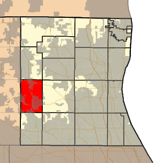
Palos Township is one of 29 townships in Cook County, Illinois. As of the 2010 census, its population was 54,615, with its most populous municipality being Palos Hills. The vast majority of the township's population resides in its eastern half; the half west of La Grange Road consists mainly of facilities in the Cook County Forest Preserves. In 1850 the small town of Trenton, Illinois changed its name to Palos; this recommendation was made by M.S. Powell, the local postmaster, whose ancestor supposedly sailed with Christopher Columbus from Palos de la Frontera. When it incorporated as a village in 1914, Palos officially became Palos Park. The neighboring communities of Palos Hills and Palos Heights incorporated at later points. All three municipalities lie completely or substantially within Palos Township.

Schaumburg Township is one of 29 townships in Cook County, Illinois, USA. As of the 2010 census, its population was 131,288. It is in the north west corner of Cook County.

Ela Township is a township in Lake County, Illinois, USA. As of the 2010 census, its population was 42,654.

Warren Township is a township in Lake County, Illinois, USA. As of the 2020 census, its population was 65,883. The cities of Gurnee, Park City, and Grayslake lie within its borders. The township was established in 1850 by settlers who came from the town of Warren, New York. Both were named in honor of Major General Joseph Warren, killed at the Battle of Bunker Hill.
Wauconda Township is a township in Lake County, Illinois, USA. As of the 2010 census, its population was 21,730.
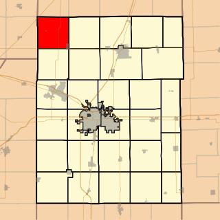
Brown Township is a township in Champaign County, Illinois, USA. As of the 2010 census, its population was 1,995 and it contained 816 housing units.
Allen's Corners is an unincorporated community in Kane County, Illinois, United States. Allen's Corner is a landmark of the Allen family, the first settlers of Kane County in 1836. First known as blacksmiths and farmers, the towing business was started in 1937. The community is located at the intersection of U.S. Route 20 and Allen and Brier Hill roads.
Millburn is a former unincorporated community in Lake Villa Township and Newport Township, Lake County, Illinois, United States. Millburn is located at the junction of U.S. Route 45 and County Routes A10 and A14; it lies within the village of Old Mill Creek and borders Lindenhurst to the west. It is 5 miles (8 km) south of the Illinois-Wisconsin state border and 10 miles (16 km) west of Waukegan.
Twelvemile Corner is an unincorporated community in Lee County, Illinois, United States. Twelvemile Corner is located at the intersection of U.S. Route 30 and Illinois Route 251, north of Compton.
Welco Corners is a populated place in northern Will County, Illinois. It is at the junction of Interstate 55 and Joliet Road, and is within the city limits and postal delivery zone of Bolingbrook, Illinois, though it existed before the founding of Bolingbrook.


