Lysander, New York

Last updated
Lysander, New York
Onondaga County New York incorporated and unincorporated areas Lysander highlighted.svg
Location in Onondaga County and the state of New York.
Coordinates: 43°10′22″N76°21′17″W / 43.17278°N 76.35472°W / 43.17278; -76.35472 Coordinates: 43°10′22″N76°21′17″W / 43.17278°N 76.35472°W / 43.17278; -76.35472
Country United States
State New York
County Onondaga
Government
  Type Town Council
   Town Supervisor Joseph Saraceni (R)
   Town Council
Members' List
Area
[1]
  Total64.61 sq mi (167.34 km2)
  Land61.71 sq mi (159.84 km2)
  Water2.89 sq mi (7.50 km2)
Elevation
436 ft (133 m)
Population
 (2020)
  Total23,074
  Density360/sq mi (140/km2)
Time zone UTC-5 (Eastern (EST))
  Summer (DST) UTC-4 (EDT)
ZIP code
13027
Area code 315
FIPS code 36-44039
GNIS feature ID0979177
Website www.townoflysander.org

Lysander is a town in Onondaga County, New York, United States. As of the 2020 Census, the population was 23,074. The town was named after Lysander, [2] a Spartan military leader, by a clerk interested in the classics. Lying to the northwest of Syracuse, much of the town is suburban in character.

Contents

History

Upscale homes like this one in Lysander are becoming common. Upscalelysanderhome.JPG
Upscale homes like this one in Lysander are becoming common.
The rolling hills of Lysander between Baldwinsville and Syracuse Countrysidelysander.JPG
The rolling hills of Lysander between Baldwinsville and Syracuse

The town was part of the former Central New York Military Tract. It was first settled by outsiders circa 1797.

The Town of Lysander was formed in 1794 from the northern townships of the Military Tract. Lysander was later reduced by the creation of the Towns of Hannibal (1806) and Cicero (1807). Lysander was reduced again on the formation of Oswego County in 1816.

Geography

According to the United States Census Bureau, the town has a total area of 64.6 square miles (167 km2), of which 61.9 square miles (160 km2) is land and 2.7 square miles (7.0 km2) (4.18%) is water.

The northern town line is the border of Oswego County and the western town boundary is the border of Cayuga County. The southern town line is defined by the Erie Canal-Seneca River complex. Cross Lake is located on the western border of Lysander. The Oswego River marks part of the eastern town line. The Oswego, Seneca, and Oneida Rivers join at the eastern town line.

New York State Route 370, West Genesee Road, is an east-west highway in the southern part of Lysander. New York State Route 48 is a highway in the center of the town. New York State Route 31 intersects NY-370 in the southeastern part of Lysander. New York State Route 690 is a major highway leading out of the southern part of Lysander.

Demographics

Historical population
CensusPop.Note
1820 1,723
1830 3,22887.3%
1840 4,30633.4%
1850 5,83335.5%
1860 4,741−18.7%
1870 4,9444.3%
1880 4,903−0.8%
1890 5,1635.3%
1900 4,838−6.3%
1910 4,509−6.8%
1920 4,7254.8%
1930 4,8492.6%
1940 5,2077.4%
1950 6,79830.6%
1960 10,22550.4%
1970 11,96817.0%
1980 13,89716.1%
1990 16,34617.6%
2000 19,28518.0%
2010 21,75912.8%
2020 23,0746.0%
U.S. Decennial Census [3]

As of the census [4] of 2000, there were 19,285 people, 7,139 households, and 5,404 families residing in the town. The population density was 311.5 people per square mile (120.3/km2). There were 7,448 housing units at an average density of 120.3 per square mile (46.4/km2). The racial makeup of the town was 96.89% White, 0.73% African American, 0.29% Native American, 1.00% Asian, 0.02% Pacific Islander, 0.24% from other races, and 0.82% from two or more races. Hispanic or Latino of any race were 0.78% of the population.

There were 7,139 households, out of which 39.8% had children under the age of 18 living with them, 64.5% were married couples living together, 7.9% had a female householder with no husband present, and 24.3% were non-families. 19.9% of all households were made up of individuals, and 7.7% had someone living alone who was 65 years of age or older. The average household size was 2.70 and the average family size was 3.12.

In the town, the population was spread out, with 28.8% under the age of 18, 5.5% from 18 to 24, 30.0% from 25 to 44, 25.4% from 45 to 64, and 10.3% who were 65 years of age or older. The median age was 38 years. For every 100 females, there were 97.7 males. For every 100 females age 18 and over, there were 93.3 males.

The median income for a household in the town was $59,128, and the median income for a family was $67,539. Males had a median income of $47,057 versus $29,164 for females. The per capita income for the town was $26,187. About 2.5% of families and 3.8% of the population were below the poverty line, including 3.5% of those under age 18 and 5.2% of those age 65 or over.

Communities and locations in the Town of Lysander

A typical neighborhood in the planned community of Radisson within Lysander Radisson neighborhood, Lysander, NY.jpg
A typical neighborhood in the planned community of Radisson within Lysander

Notable people

Related Research Articles

<span class="mw-page-title-main">Conquest, New York</span> Town in New York, United States

Conquest is a town in Cayuga County, New York, United States. The population was 1,796 at the 2020 census. The name was chosen to mark the victory of those who wished to form the town. Conquest is on the western border of Cayuga County and is west of Syracuse.

<span class="mw-page-title-main">Mentz, New York</span> Town in New York, United States

Mentz is a town in Cayuga County, New York, United States. The population was 2,114 at the 2020 census. The town is in the central part of the county, north of Auburn.The town's name is derived from Mainz, in Germany.

<span class="mw-page-title-main">Montezuma, New York</span> Town in New York, United States

Montezuma is a town in Cayuga County, New York, United States. The population was 1,277 at the 2010 census.

<span class="mw-page-title-main">Vienna, New York</span> Town in New York, United States

Vienna is a town in Oneida County, New York, United States. The population was 5,440 at the 2010 census. The town is named after the capital of Austria.

<span class="mw-page-title-main">Baldwinsville, New York</span> Village in New York, United States

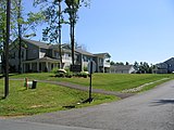
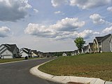
Baldwinsville is a village in Onondaga County, New York, United States. The population was 7,898 at the 2020 census. It is part of the Syracuse Metropolitan Statistical Area.

<span class="mw-page-title-main">Cicero, New York</span> Town in New York, United States

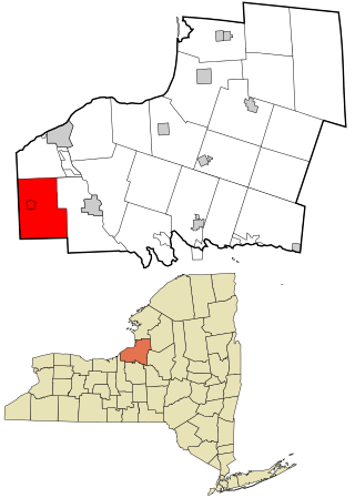
Cicero is a town in northern Onondaga County, New York, United States. As of the 2020 Census, the population was 31,435. The name of the town was assigned by a clerk interested in the classics, honoring Cicero, a Roman statesman.

<span class="mw-page-title-main">Clay, New York</span> Town in New York, United States

Clay is a town in Onondaga County, New York, United States. As of the 2020 Census, the population was 60,527, making it Syracuse's most populous suburb. The town was named after American attorney and statesman Henry Clay.

<span class="mw-page-title-main">Van Buren, New York</span> Town in New York, United States

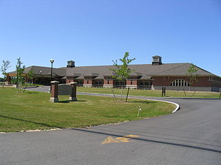
Van Buren is a town located in Onondaga County, New York, United States. As of the 2020 Census, the population was 14,367. The town is named after then-Senator Martin Van Buren, who would later become the eighth president of the United States.

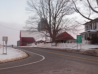
Seneca is a town in Ontario County, New York, United States. The population was 2,658 at the 2020 census. The town is named after a group of local natives.

<span class="mw-page-title-main">Ridgeway, New York</span> Town in New York, United States

Ridgeway is a town in Orleans County, New York, United States. The population was 6,886 at the 2000 census. The name of the town is derived from "Ridge Road," an important highway in the 19th century.

<span class="mw-page-title-main">Granby, New York</span> Town in New York, United States

Granby is a town in Oswego County, New York, United States. The population was 6,821 at the 2010 census.

<span class="mw-page-title-main">Schroeppel, New York</span> Town in New York, United States

Schroeppel is a town in Oswego County, New York, United States. The population was 8,501 at the 2010 census. The name derives from the Schroeppel family, early land owners of the area. Schroeppel is located in the southeast part of the county.

<span class="mw-page-title-main">Volney, New York</span> Town in New York, United States

Volney is a town in Oswego County, New York, United States. The population was 5,926 at the 2010 census. The town was named after a French author, Constantin François de Chassebœuf, comte de Volney, who toured the area in 1808.

<span class="mw-page-title-main">Tyre, New York</span> Town in New York, United States

Tyre is a town in Seneca County, New York, United States. The population was 1,002 at the 2020 census. The town is named after the Lebanese city of Tyre.

<span class="mw-page-title-main">Cato (town), New York</span> Town in New York, United States

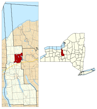
Cato is a town in Cayuga County, New York, United States. The population was 2,443 at the 2020 census. The town is named after Cato the Elder, a Roman statesman. The name was assigned by the surveyors of the Military Tract, and is one of many towns and villages bearing classical place names.

<span class="mw-page-title-main">Camillus, New York</span> Town in New York, United States

Camillus is a town in Onondaga County, New York, United States. As of the 2020 Census, the population was 25,346.

<span class="mw-page-title-main">Hannibal, New York</span> Town in New York, United States

Hannibal is a town in Oswego County, New York, United States. The population was 4,854 at the 2010 census. The name is derived from the hero of ancient Carthage, Hannibal.

<span class="mw-page-title-main">Avoca, New York</span> Town in New York, United States

Avoca is a town in Steuben County, New York, United States. The population was 1,996 at the 2020 census.

<span class="mw-page-title-main">New York State Route 48</span> State highway in Central New York, US

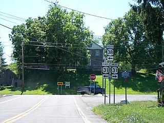
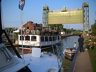
New York State Route 48 (NY 48) is a 28.20-mile (45.38 km) north–south state highway in Central New York in the United States. The southern terminus of the route is located at Interstate 690 (I-690) exit 3 near the interchange between I-690 and the New York State Thruway (I-90) in Van Buren, northwest of Syracuse. The northern terminus is located at an intersection with NY 104 in Oswego. In between, NY 48 passes through the riverside communities of Baldwinsville and Fulton and runs alongside both the Seneca River and Oswego River. For most of its route, NY 48 serves as an alternate route of NY 481. The routes share similar alignments along the Oswego River from the Syracuse area to Oswego, with NY 481 following the eastern riverbank between the two locations.

<span class="mw-page-title-main">New York State Route 370</span> State highway in central New York, US

New York State Route 370 (NY 370) is an east–west state highway in Central New York in the United States. It extends for about 35 miles (56.33 km) from an intersection with NY 104 and NY 104A south of the Wayne County village of Red Creek to a junction with U.S. Route 11 (US 11) in the Onondaga County city of Syracuse. The western and central portions of the route pass through mostly rural areas; however, the eastern section serves densely populated areas of Onondaga County, including the villages of Baldwinsville and Liverpool. NY 370 also passes through Cayuga County, where it connects to NY 34, a major north–south highway in Central New York.

References

  1. "2016 U.S. Gazetteer Files". United States Census Bureau. Retrieved Jul 5, 2017.
  2. Gannett, Henry (1905). The Origin of Certain Place Names in the United States. U.S. Government Printing Office. p.  193.
  3. "Census of Population and Housing". Census.gov. Retrieved June 4, 2015.
  4. "U.S. Census website". United States Census Bureau . Retrieved 2008-01-31.
  5. "ELMIRA LOSES A BENEFACTOR IN THE DEATH OF MRS. STEELE". Star-Gazette. 23 November 1911. p. 10. Retrieved 25 December 2021 via Newspapers.com.PD-icon.svg This article incorporates text from this source, which is in the public domain .