M-96 (Michigan highway)

Last updated

M-96.svg

M-96

M-96 (Michigan highway)
M-96 highlighted in red
Route information
Maintained by MDOT
Length33.379 mi [1]  (53.718 km)
Existed1926 [2] [3] –present
Major junctions
West endBusiness Spur 94.svg BS I-94 at Kalamazoo
Major intersections
East endI-69.svgBusiness Loop 94.svg I-69  / BL I-94 at Marshall
Location
Country United States
State Michigan
Counties Kalamazoo, Calhoun
Highway system
Business Loop 96.svg BL I-96 M-97.svg M-97

M-96 is a state trunkline highway in the US state of Michigan that runs between Kalamazoo and Marshall. Its termini are both on business routes of Interstate 94 (I-94); the eastern one coincides with an intersection with I-69. Between Kalamazoo and Marshall it passes through Comstock, Galesburg, Augusta, and Battle Creek intersecting I-194/M-66 in Battle Creek and I-94 in Emmett Township.

Contents

The highway now known as M-96 was originally part of M-17. Parts of M-17 that were not used for US Highway 12 (US 12) in 1926 were given the M-96 number. Additional segments of trunkline were added to M-96, one of which was an Alternate US 12 in the years afterwards. Later, US 12 was moved after the completion of I-94 in southern Michigan. Additional US 12 segments were added to M-96 at that time. The last major changes to M-96 rerouted the highway through the Battle Creek area in late 1998.

Route description

M-96 starts at an intersection between King Highway and Business Spur I-94 (BS I-94) east of downtown Kalamazoo. From this point, it follows King Highway over and then along the Kalamazoo River through a suburban residential area. The highway then follows Michigan Avenue east through Comstock and north of Morrow Lake. At Galesburg, M-96 turns northeast along Augusta Drive to Augusta, running through rural farmland. It turns eastward again, skirting the Fort Custer State Recreation Area and the Fort Custer National Cemetery. In Augusta, M-96 turns to follow Dickman Road to Battle Creek, passing north and east of the W. K. Kellogg Airport on Dickman and Helmer roads. [4] [5]

On the north side of the airport, M-96 runs concurrently with both Business Loop I-94 (BL I-94) and M-37. M-96 turns south on Helmer Road, separating from the other two trunklines, and then turns east crossing along Columbia Avenue. Here the highway runs along the edge of the city of Battle Creek through more residential areas and crosses the I-194/M-66 freeway next to the Riverside County Club. Near Brownlee Park, M-96 (Columbia Avenue) merges with BL I-94 (Michigan Avenue). Together BL I-94/M-96 continues along Michigan Avenue to I-94 where BL I-94 ends. M-96 passes the FireKeepers Casino Hotel, which is located just east of the ending of BL I-94, between 11 and 12 Mile Roads. M-96 continues along Michigan Avenue through farmland from Emmett to Marshall ending at an interchange with I-69/BL I-94. [4] [5]

M-96 is maintained by the Michigan Department of Transportation (MDOT) like other state highways in Michigan. As a part of these maintenance responsibilities, the department tracks the volume of traffic that uses the roadways under its jurisdiction. These volumes are expressed using a metric called annual average daily traffic, which is a statistical calculation of the average daily number of vehicles on a segment of roadway. MDOT's surveys in 2010 showed that the highest traffic levels along M-96 were the 22,953 vehicles daily between Capitol Avenue and I-194 in Battle Creek; the lowest counts were the 5,167 vehicles per day at the western terminus in Kalamazoo. [6] The only section of M-96 that has been listed on the National Highway System (NHS), is in the Battle Creek area between the western BL I-94/M-37 junction and the I-94 interchange. [7] The NHS is a network of roads important to the country's economy, defense, and mobility. [8]

History

M-96 was formed as a state trunkline in late 1926 from parts of M-17. The section of M-17 between Galesberg and Battle Creek was not utilized for US 12 and became M-96. [2] [3] In 1936, the Alternate US 12 trunkline was designated through the Battle Creek area along a section of highway that had previously been part of US 12. [9] [10] This highway was added to M-96 three years later in 1939. [11] [12]

A rerouting of trunklines in 1941 lead to the creation of a Business US 12 (Bus. US 12). M-96 ran concurrently with Bus. US 12 and M-37 was truncated to end at M-96. [13] [14] US 12 was rerouted between Galesburg and Kalamazoo in 1954, and M-96 was extended along the former US 12 routing to end in Kalamazoo. [15] [16] M-96 was rerouted in downtown Battle Creek to one-way streets in 1958, [17] [18] and Bus. US 12/M-96 was extended by the end of the decade when the I-94/US 12 freeway was completed in the area. Bus. US 12 was redesignated as BL I-94 in 1960 and M-96 was shortened to end at BL I-94/M-78 running on Capital Avenue. [19] M-37 was reextended in 1961 in Battle Creek to a concurrent routing with M-96 in 1961. [20]

M-89 was extended along the roadway used by M-96 west of Battle Creek to M-37 in 1965, truncating M-96 in the process. [21] [22] M-96 was reextended back to Battle Creek along Dickman Road and Fort Custer Highway from Augusta east in 1971. [23] [24] Several changes in Battle Creek were made to the area trunklines in 1998. M-96 was extended along BL I-94 (Dickman Road) to M-37 (Helmer Road) and along M-37 to Columbia Avenue. At Columbia, M-96 then turned west and M-37 turned east. M-96 rejoined BL I-94 along Michigan Avenue to I-94 and on to Marshall. [25] [26]

Major intersections

CountyLocationmi [1] kmDestinationsNotes
Kalamazoo Comstock Township 0.0000.000Business Spur 94.svg BS I-94  Kalamazoo Western terminus of BS I-94
Calhoun Springfield 17.237–
17.409
27.740–
28.017
West plate green.svg
Business Loop 94.svg
South plate.svg
M-37.svg
BL I-94 west (Martin Luther King, Jr. Memorial Highway) / M-37 south (Skyline Drive)
Western end of BL I-94/M-37 concurrency
18.25129.372North plate.svg
M-37.svg
M-37 north (Helmer Road)
Eastern end of M-37 concurrency
18.35429.538East plate green.svg
Business Loop 94.svg
BL I-94 east (Dickman Road)
Eastern end of BL I-94 concurrency
Emmett Township 22.77636.654I-194.svgM-66.svg I-194  / M-66 Exit 2 on I-194/M-66
23.34637.572South plate.svg
M-294 rectangle.svg
M-294 south (Main Street, Beadle Lake Road)
25.12940.441West plate green.svg
Business Loop 94.svg
BL I-94 west (East Michigan Avenue)
Western end of BL I-94 concurrency
28.26445.486East plate green.svg
Business Loop 94.svg
To plate blue.svg
I-94.svg
BL I-94 east (11 Mile Road) to I-94
South plate.svg
M-311 rectangle.svg
M-311 south (11 Mile Road)
Eastern end of BL I-94 concurrency
Marshall Township 33.37953.718I-69.svg I-69  Lansing, Fort Wayne
Business Loop 94.svg BL I-94  Marshall
Roadway continues as BL I-94 at exit 36 on I-69
1.000 mi = 1.609 km; 1.000 km = 0.621 mi

See also

Related Research Articles

<span class="mw-page-title-main">M-37 (Michigan highway)</span> State highway in Michigan, United States

M-37 is a north–south state trunkline highway in the US state of Michigan. The southern terminus is near the border between Kalamazoo and Calhoun counties at exit 92 of Interstate 94 (I-94) southwest of Battle Creek. The northern terminus is at the Mission Point Light on Old Mission Point in Grand Traverse County. In between, the highway connects Battle Creek, Grand Rapids and Traverse City. Motorists will travel through agricultural land, forests, suburbs and large cities along the way. The section of M-37 on the Old Mission Peninsula was designated what is now a Pure Michigan Scenic Byway in 2008.

<span class="mw-page-title-main">M-60 (Michigan highway)</span> State highway in Michigan, United States

M-60 is an east–west state trunkline highway in the US state of Michigan. It runs from the Niles area at a junction with US Highway 12 (US 12) to the Jackson area where it ends at Interstate 94 (I-94). The trunkline passes through a mix of farm fields and woodlands, crosses or runs along several rivers and connects several small towns of the southern area of the state. The westernmost segment runs along divided highway while the easternmost section is a full freeway bypass of Jackson.

<span class="mw-page-title-main">M-66 (Michigan highway)</span> State highway in Michigan, United States

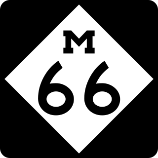
M-66 is a north–south state trunkline highway on the Lower Peninsula (LP) of the US state of Michigan. It runs from the Indiana state line in the south to Charlevoix in the north. M-66 is the only state highway to run the north–south distance of the LP. It starts as a continuation of State Road 9 (SR 9) which provides access to the Indiana Toll Road. The total length is approximately 272.9 miles (439.2 km), which includes almost 3.4 miles (5.5 km) of freeway between Interstate 94 (I-94) and downtown Battle Creek designated as I-194. A section of the highway immediately south of I-94 is an expressway, a type of divided limited-access highway, while the section along I-194 is a full freeway; otherwise M-66 is a two-lane rural highway. Two sections are listed on the National Highway System.

<span class="mw-page-title-main">M-78 (Michigan highway)</span> State highway in Michigan, United States

M-78 is a state trunkline highway in the US state of Michigan. The western terminus is the intersection with M-66 north of Battle Creek in Pennfield Township. The roadway runs 10.744 miles (17.291 km) through rural farmland and the community of Bellevue as it approaches its eastern terminus at an interchange with Interstate 69 (I-69) near Olivet. The highway is used by between 3,100 and 5,300 vehicles on a daily basis.

<span class="mw-page-title-main">M-89 (Michigan highway)</span> State highway in Michigan, United States

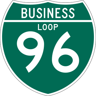
M-89 is an east–west state trunkline highway in the US state of Michigan that runs from near Ganges to Battle Creek. M-89 starts at an interchange with Interstate 196/US Highway 31 (I-196/US 31) and passes through Allegan, Kalamazoo County, Michigan, and Calhoun counties. The highway also briefly crosses the southwest corner of Barry County before it terminates an at intersection with Business Loop I-94 on the northwestern side of downtown Battle Creek. In between the trunkline runs parallel to the Kalamazoo River through rural southwestern Michigan farmlands while also running through the middle of several smaller towns in the area.

<span class="mw-page-title-main">Interstate 196</span> Interstate Highway in Michigan

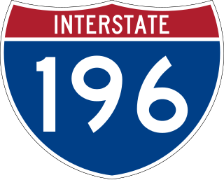
Interstate 196 (I-196) is an auxiliary Interstate Highway that runs for 80.6 miles (129.7 km) in the US state of Michigan. It is a state trunkline highway that links Benton Harbor, South Haven, Holland, and Grand Rapids. In Kent, Ottawa, and Allegan counties, I-196 is known as the Gerald R. Ford Freeway, or simply the Ford Freeway, after President Gerald Ford, who was raised in Grand Rapids and served Michigan in the House of Representatives for 25 years. This name generally refers only to the section between Holland and Grand Rapids. I-196 changes direction; it is signed as a north–south highway from its southern terminus to the junction with US Highway 31 (US 31) just south of Holland, and as an east–west trunkline from this point to its eastern terminus at an interchange with I-96, its parent highway. There are three business routes related to the main freeway. There are two business loops and one business spur that serve South Haven, Holland and the Grand Rapids areas. Another business spur for Muskegon had been designated relative to the I-196 number.

<span class="mw-page-title-main">M-99 (Michigan highway)</span> State highway in Michigan, United States

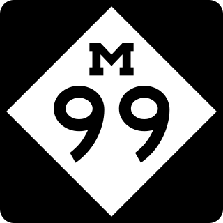
M-99 is a north–south state trunkline highway in the Lower Peninsula of the US state of Michigan. It runs from the Ohio state border, where it connects to State Route 15 (SR 15), north to Lansing, where it terminates at a junction with Interstate 496 (I-496) and the Capitol Loop. The highway mainly serves local communities along the route as it passes through farm lands in the southern part of the state. One short segment, in Jonesville, is routed concurrently with US Highway 12 (US 12). The segment within Lansing follows Martin Luther King Jr. Boulevard.

<span class="mw-page-title-main">M-43 (Michigan highway)</span> State highway in Michigan, United States

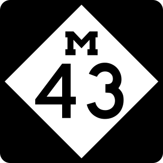
M-43 is a state trunkline highway in the southwestern and central parts of the US state of Michigan. The highway runs from South Haven to Webberville along an indirect path through both rural areas and larger cities. The trunkline follows five overall segments: a southeasterly track from South Haven to Oshtemo Township, a northerly path to Plainwell, a southeasterly route to Richland, a northeasterly course to the Hastings area and an easterly route through the Lansing area.

<span class="mw-page-title-main">M-79 (Michigan highway)</span> State highway in Michigan, United States

M-79 is an east–west state trunkline highway in the central portion of Lower Peninsula of the U.S. state of Michigan. The western terminus is about three miles (4.8 km) southeast of Hastings at the junction with M-37 and the eastern terminus is in downtown Charlotte at the junction with M-50 and Business Loop Interstate 69 (BL I-69). It passes through Quimby and Nashville, where there is a junction with M-66. The entire highway is undivided surface road. It has no direct access with Interstate 69 (I-69), although a sign for the highway is located on southbound I-69 at exit 61.

<span class="mw-page-title-main">M-59 (Michigan highway)</span> State highway in Michigan, United States

M-59 is an east–west state trunkline highway that crosses the northern part of Metropolitan Detroit in the US state of Michigan. It runs between Howell at Interstate 96 (I-96) and I-94 on the Chesterfield–Harrison township line near the Selfridge Air National Guard Base. While primarily a multi-lane surface highway, it is a full freeway from just east of downtown Pontiac near Opdyke Road to just east of the Mound Road/Merrill Road exit in Utica. The various surface highway segments are named either Highland Road, Huron Street or Hall Road, with the latter known as an area for shopping and dining. The rural sections west of Pontiac pass through Oakland County lake country, passing through two state recreational areas.

<span class="mw-page-title-main">M-11 (Michigan highway)</span> State highway in Ottawa and Kent counties in Michigan, United States

M-11 is a state trunkline highway in the US state of Michigan in the Grand Rapids metropolitan area. The highway runs through the western and southern sides of the metro area, starting over the border in Ottawa County at an interchange with Interstate 96 (I-96). It runs through both rural woodlands and busy commercial areas before it terminates at another interchange with I-96 in Cascade Township. Locally known as Wilson Avenue and 28th Street, the trunkline is listed on the National Highway System. M-11 carries between 8,000 and 42,000 vehicles on average each day.

<span class="mw-page-title-main">U.S. Route 27 in Michigan</span> Former U.S. Highway in Michigan

US Highway 27 (US 27) is a part of the US Highway System that now runs from Miami, Florida, to Fort Wayne, Indiana. In the US state of Michigan, it was a north–south state trunkline highway that entered the state south of Kinderhook and ended south of Grayling. Its route consisted of a freeway concurrency with Interstate 69 (I-69) from the state line north to the Lansing area before it followed its own freeway facility northward to St. Johns. From there north to Ithaca, US 27 was an expressway before continuing as a freeway to a terminus south of Grayling.

<span class="mw-page-title-main">M-218 (Michigan highway)</span> Former state highway in Oakland County, Michigan, United States

M-218 was a state trunkline highway in the US state of Michigan that served as a connector route from Interstate 96 in Wixom through Oakland County's lake country area to Business US 10 in Pontiac. M-218 was originally designated by 1936 and extended into Pontiac in 1938. The highway was decommissioned in 1963.

<span class="mw-page-title-main">Interstate 94 in Michigan</span> Interstate Highway in Michigan, United States

Interstate 94 (I-94) is a part of the Interstate Highway System that runs from Billings, Montana, to the Lower Peninsula of the US state of Michigan. In Michigan, it is a state trunkline highway that enters the state south of New Buffalo and runs eastward through several metropolitan areas in the southern section of the state. The highway serves Benton Harbor–St. Joseph near Lake Michigan before turning inland toward Kalamazoo and Battle Creek on the west side of the peninsula. Heading farther east, I-94 passes through rural areas in the middle of the southern Lower Peninsula, crossing I-69 in the process. I-94 then runs through Jackson, Ann Arbor, and portions of Metro Detroit, connecting Michigan's largest city to its main airport. Past the east side of Detroit, the Interstate angles northeasterly through farmlands in The Thumb to Port Huron, where the designation terminates on the Blue Water Bridge at the Canadian border.

<span class="mw-page-title-main">U.S. Route 12 in Michigan</span> U.S. Highway in Michigan

US Highway 12 (US 12) is an east–west US Highway that runs from Aberdeen, Washington, to Detroit, Michigan. In Michigan it runs for 210 miles (338 km) between New Buffalo and Detroit as a state trunkline highway and Pure Michigan Byway. On its western end, the highway is mostly a two-lane road that runs through the southern tier of counties roughly parallel to the Indiana state line. It forms part of the Niles Bypass, a four-lane expressway south of Niles in the southwestern part of the state, and it runs concurrently with the Interstate 94 (I-94) freeway around the south side of Ypsilanti in the southeastern. In between Coldwater and the Ann Arbor area, the highway angles northeasterly and passes the Michigan International Speedway. East of Ypsilanti, US 12 follows a divided highway routing on Michigan Avenue into Detroit, where it terminates at an intersection with Cass Avenue.

<span class="mw-page-title-main">Business routes of Interstate 94 in Michigan</span> List of business route highways in Michigan

There are currently eight business routes of Interstate 94 (I-94) in the US state of Michigan. These business routes connect I-94 to the downtown business districts of neighboring cities. Seven of the eight routes are business loops which bear the Business Loop I-94 designation while one is a business spur that bears the Business Spur I-94. These loops are former routings of I-94's two predecessors in Michigan: US Highway 12 (US 12) or US 25. The westernmost BL I-94 runs through the twin cities of Benton Harbor and St. Joseph along the former routing of US 12 and US 31/US 33 that now includes a section of the Lake Michigan Circle Tour in the state. The loops in Kalamazoo, Battle Creek, Marshall, Albion, and Jackson were also formerly segments of US 12 which were later designated as separate version of Business US Highway 12 through their respective cities before becoming BL I-94s in 1960. The BL I-94 in Kalamazoo was converted into BS I-94 in 2019. The route of the business loop through Ann Arbor was previously US 12 and then later M-14 before receiving its current moniker. The BL I-94 through Port Huron was previously US 25 and then Business US Highway 25.

<span class="mw-page-title-main">Business routes of Interstate 69 in Michigan</span> List of highways in Michigan

There are currently four business routes of Interstate 69 (I-69) in the US state of Michigan. Designated Business Loop Interstate 69, they are all former routings of I-69's predecessor highways, US Highway 27 (US 27), M-78 or M-21, in whole or in part. The BL I-69 in Coldwater and the one in Charlotte were both parts of US 27 before the freeway bypassed those two cities in 1967 and the early 1970s, respectively. The BL I-69 through Lansing and East Lansing was previously part of M-78 and Temporary I-69 until it was redesignated in 1987. Before 1984, the loop in Port Huron was originally part of M-21 and was initially a business spur numbered Business Spur Interstate 69. It was later redesignated when it was extended to run concurrently with that city's BL I-94 which was originally part of I-94's predecessor, US 25. Each business loop follows streets through each city's downtown areas and connects to I-69 on both ends, giving traffic a route through the downtown and back to the freeway.

<span class="mw-page-title-main">Business routes of Interstate 96</span> List of highways in Michigan

There have been six business routes of Interstate 96 (I-96) in the US state of Michigan. There are two business loops designated Business Loop Interstate 96 : one through Lansing and one through Howell. Both follow the old route of US Highway 16 (US 16), with appropriate connections to I-96. There are three former business spurs that were designated Business Spur Interstate 96. One connected to the carferry docks in Muskegon, running concurrently with part of Business US 31 along former US 16, but it has been eliminated. The second spur ran into downtown Portland until it was decommissioned in 2007. Two routes in the Detroit area—a loop through Farmington and a spur into Detroit—both using Grand River Avenue, and meeting at the temporary end of I-96 near Purdue Avenue, were eliminated when I-96 was moved to the completed Jeffries Freeway in 1977. The Farmington business route is still state-maintained as an unsigned highway, while the Detroit business route remained unsigned until it was decommissioned in 2016 and replaced by an extension of M-5.

<span class="mw-page-title-main">Business routes of U.S. Route 23 in Michigan</span> Routes of a highway in Michigan

There have been five different business routes of US Highway 23 in the state of Michigan. These business routes were designated along former sections of US Highway 23 (US 23) to provide signed access from the main highway to the downtowns of cities bypassed by new routings of US 23. Two are still extant, connecting through downtown Ann Arbor and Rogers City. Three others have been decommissioned. The former Business US 23 in Fenton was split in half during the 1970s and later completely turned back to local control in 2006. The former business loops through Saginaw and Bay City were renumbered as business loops of Interstate 75 in the 1960s.

References

  1. 1 2 Michigan Department of Transportation (2021). Next Generation PR Finder (Map). Michigan Department of Transportation. Retrieved October 11, 2021.
  2. 1 2 Michigan State Highway Department (November 1, 1926). Official Highway Condition Map (Map). [c. 1:823,680]. Lansing: Michigan State Highway Department.
  3. 1 2 Michigan State Highway Department (December 1, 1926). Official Highway Condition Map (Map). [c. 1:823,680]. Lansing: Michigan State Highway Department.
  4. 1 2 Michigan Department of Transportation (2011). Pure Michigan: State Transportation Map (Map). c. 1:975,000. Lansing: Michigan Department of Transportation. § M9. OCLC   42778335, 786008212.
  5. 1 2 Google (September 1, 2011). "Overview Map of M-96" (Map). Google Maps . Google. Retrieved September 1, 2011.
  6. Bureau of Transportation Planning (2008). "Traffic Monitoring Information System". Michigan Department of Transportation. Retrieved August 27, 2011.
  7. Michigan Department of Transportation (2005). National Highway System: Battle Creek Urbanized Area (PDF) (Map). Scale not given. Lansing: Michigan Department of Transportation. Retrieved January 1, 2011.
  8. Natzke, Stefan; Neathery, Mike & Adderly, Kevin (June 20, 2012). "What is the National Highway System?". National Highway System. Federal Highway Administration . Retrieved July 1, 2012.
  9. Michigan State Highway Department & Rand McNally (June 1, 1936). Official Michigan Highway Map (Map). Scale not given. Lansing: Michigan State Highway Department. Battle Creek inset. OCLC   12701143.
  10. Michigan State Highway Department & Rand McNally (December 15, 1936). Official Michigan Highway Map (Map) (Winter ed.). Scale not given. Lansing: Michigan State Highway Department. Battle Creek. inset. OCLC   12701143, 317396365 . Retrieved October 17, 2019 via Michigan History Center.
  11. Michigan State Highway Department & Rand McNally (April 15, 1939). Official Michigan Highway Map (Map) (Summer ed.). Scale not given. Lansing: Michigan State Highway Department. Battle Creek inset. OCLC   12701143.
  12. Michigan State Highway Department & Rand McNally (December 1, 1939). Official Michigan Highway Map (Map) (Winter ed.). Scale not given. Lansing: Michigan State Highway Department. Battle Creek inset. OCLC   12701143 . Retrieved October 17, 2019 via Michigan History Center.
  13. Michigan State Highway Department & Rand McNally (March 21, 1941). Official Michigan Highway Map (Map) (Spring ed.). Scale not given. Lansing: Michigan State Highway Department. Battle Creek inset. OCLC   12701143.
  14. Michigan State Highway Department & Rand McNally (July 1, 1941). Official Michigan Highway Map (Map) (Summer ed.). Scale not given. Lansing: Michigan State Highway Department. Battle Creek inset. OCLC   12701143. Archived from the original on April 22, 2017. Retrieved January 2, 2017 via Archives of Michigan.
  15. Michigan State Highway Department (April 15, 1954). Michigan Water Wonderland: Official Highway Map (Map). [c. 1:918,720]. Lansing: Michigan State Highway Department. § M9. OCLC   12701120 . Retrieved October 17, 2019 via Michigan History Center.
  16. Michigan State Highway Department (October 1, 1954). Official Highway Map (Map). [c. 1:918,720]. Lansing: Michigan State Highway Department. § M9. OCLC   12701120.
  17. Michigan State Highway Department (October 1, 1957). Official Highway Map (Map). Scale not given. Lansing: Michigan State Highway Department. Battle Creek inset. OCLC   12701120, 367386492.
  18. Michigan State Highway Department (1958). Official Highway Map (Map). Scale not given. Lansing: Michigan State Highway Department. Battle Creek inset. OCLC   12701120, 51856742 . Retrieved October 17, 2019 via Michigan History Center. (Includes all changes through July 1, 1958)
  19. Michigan State Highway Department (1960). Official Highway Map (Map). Scale not given. Lansing: Michigan State Highway Department. Battle Creek inset. OCLC   12701120, 81552576 . Retrieved October 17, 2019 via Michigan History Center. (Includes all changes through July 1, 1960)
  20. Michigan State Highway Department (1961). Official Highway Map (Map). Scale not given. Lansing: Michigan State Highway Department. Battle Creek inset. OCLC   12701120, 51857665 . Retrieved October 17, 2019 via Michigan History Center. (Includes all changes through July 1, 1961)
  21. Michigan State Highway Department (1965). Official Highway Map (Map). [c. 1:918,720]. Lansing: Michigan State Highway Department. § M9. OCLC   12701120 . Retrieved October 17, 2019 via Michigan History Center.
  22. Michigan Department of State Highways (1966). Official Highway Map (Map). [c. 1:918,720]. Lansing: Michigan Department of State Highways. § M9. OCLC   12701120 . Retrieved October 17, 2019 via Michigan History Center.
  23. Michigan Department of State Highways (1971). Michigan, Great Lake State: Official Highway Map (Map). c. 1:918,720. Lansing: Michigan Department of State Highways. § M9. OCLC   12701120, 77960415.
  24. Michigan Department of State Highways (1972). Michigan, Great Lake State: Official Highway Map (Map). c. 1:918,720. Lansing: Michigan Department of State Highways. § M9. OCLC   12701120.
  25. Michigan Department of Transportation (1998). Michigan Department of Transportation Map (Map). c. 1:190,080. Lansing: Michigan Department of Transportation. Battle Creek inset. OCLC   42778335.
  26. Michigan Department of Transportation (1999). Michigan Department of Transportation Map (Map). c. 1:190,080. Lansing: Michigan Department of Transportation. Battle Creek inset. OCLC   42778335, 55974644 . Retrieved October 17, 2019 via Michigan History Center.

Route map:

Template:Attached KML/M-96 (Michigan highway)
KML is from Wikidata